


- Brief description
-
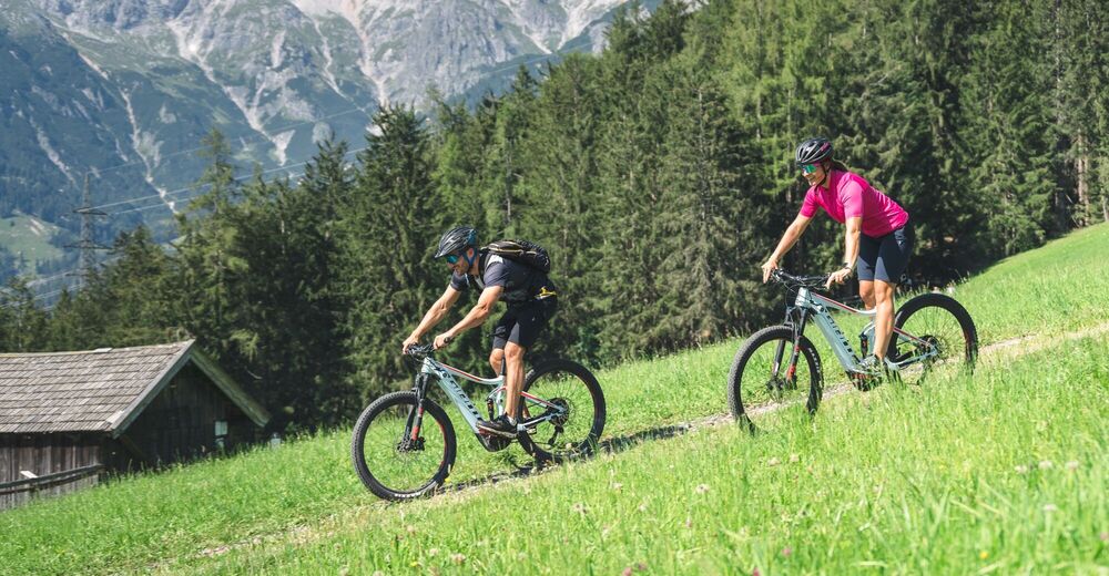
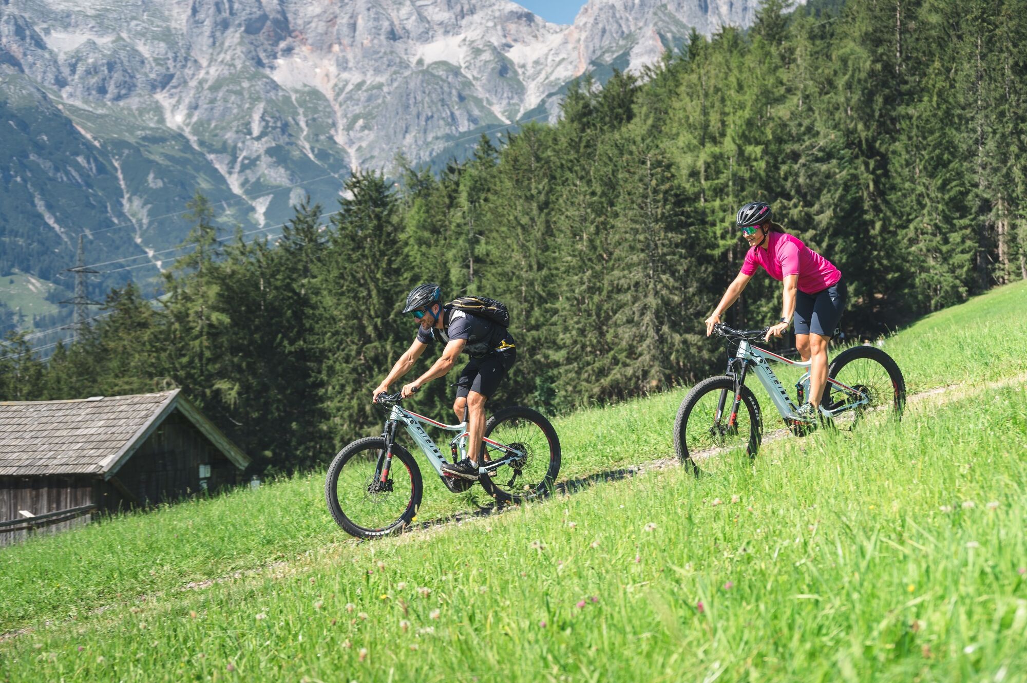
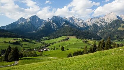
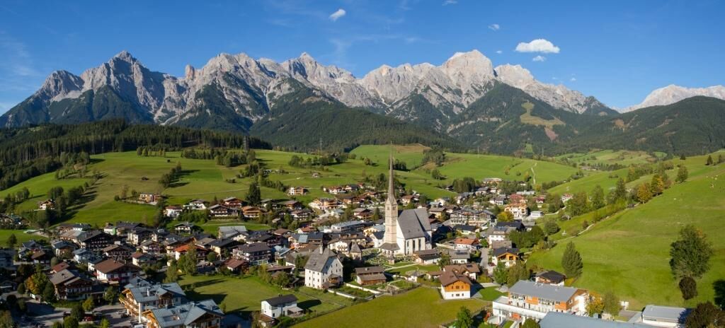
Beautiful eBike tour with start and finish in Maria Alm.
- Difficulty
-
medium
- Rating
-
- Starting point
-
Maria Alm Tourist Office
- Route
-
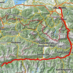
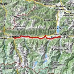
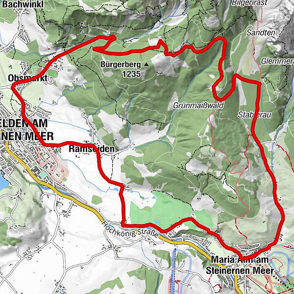
Wallfahrtskirche Maria AlmMaria Alm am Steinernen Meer0.0 kmGriesbachwinkl1.5 kmRiemannshöhe7.2 kmObsmarkt11.1 kmSerbisch-orthodoxe Kirche11.6 kmSaalfelden am Steinernen Meer (748 m)11.9 kmRamseiden13.5 kmFeichtenkapelle13.7 kmRain15.2 kmSchinking16.5 kmKapelle17.2 kmMaria Alm am Steinernen Meer17.8 kmWallfahrtskirche Maria Alm17.9 kmGriesbachwinkl19.4 km
- Best season
-
JanFebMarAprMayJunJulAugSepOctNovDec
- Description
-
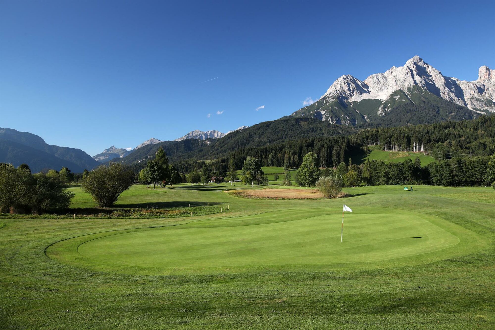
The Ramseiderrounde eBike tour is a beautiful and scenic tour. It leads from Maria Alm via Sandten in the direction of Saalfelden and via the Urslautal golf course back to Maria Alm. If you run out of battery power along the way, you have the option of making a stop at Gasthof Theurerhof to replenish your own power reserves and those of your eBike.
- Directions
-
Start at the Maria Alm tourist office and from here drive approx. 500 m in the direction of Grießbachwinkl until you reach the Grießbach bridge. Here you turn left at the fork over the bridge, then immediately right again and follow the road to the Kronreith turn-off. Here you turn right and drive over the Stablerau in the direction of Riemannhaus - after approx. 1km continue left along the forest road in the direction of Fürstenbründl and from here continue to Saalfelden and via Ramseiden and Rain back to Maria Alm.
- Highest point
- 1,282 m
- Endpoint
-
Maria Alm Tourist Office
- Height profile
-

- Equipment
-
Controlled bike equipment with helmet
Sunglasses
Sun protection
Rain protection
Drinks and a snack
Necessary medication
First aid kit
Bike map - Safety instructions
-
Fair play!
Drive only on marked paths! Close all gates, barriers and pasture gates! Observe the road traffic regulations! Overtake only at walking pace! Behave respectfully towards other nature users! and the forestry and hunting staff! Be considerate of animals! Do not leave waste in nature! Act responsibly! Check the weather forecast. Fog and bad weather can come surprisingly quickly.Emergency numbers: Alpine emergency call: 140
International emergency call: 122 - Tips
-
A delicious snack at Gasthof Theurerhof
- Additional information
- Directions
-
Coming from Salzburg: Take the A10 motorway to the Bischofshofen exit, then take the B311 towards Bischofshofen. Follow the Hochkönig Bundesstraße/B164 to Maria Alm.
Coming from Innsbruck/ Kufstein: Take the Loferer Straße/B178 in the direction of St. Johann i.T., then follow the Hochkönig Bundesstraße/B164 via Saalfelden to Maria Alm.
A valid vignette is required to use the Austrian motorway and motorway network. It is also compulsory to carry a first-aid kit, warning triangle and high-visibility waistcoat. Further information can be found under Asfinag. - Public transportation
- Parking
-
Free parking at the beginning of the village and in the center of Maria Alm

- Author
-
The tour e-Bike Tour - Ramseidenrounde is used by outdooractive.com provided.


General info
-
Saalfelden - Leogang
157
-
Maria Alm
58