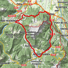
Hellbrunn - Anif - Eichet - Gneis - Thumegg - Nonntal

Logo Hellbrunn - Anif - Eichet - Gneis - Thumegg - Nonntal
Tour data
15.19km
420 - 440m
Distance
13hm
14hm
Ascent
02:00h
 
Duration
Brief description

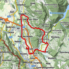
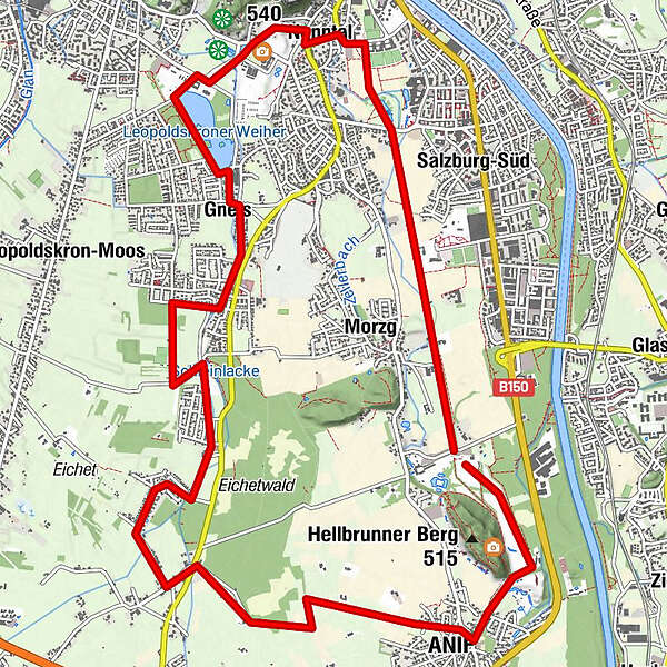
Roundtour through Southern City and residential areas
Hellbrunn - Anif - Eichet - Gneis - Thumegg - Nonntal

Difficulty
easy
Rating
Technique
Fitness
Landscape
Experience
Starting point

Parkplatz Hellbrunn

Route
Anif
1.6 km
Mostwastl
4.4 km
Gneis
8.5 km
Salzburg (424 m)
10.7 km
Nonntal
11.4 km

Best season
Jan
Feb
Mar
Apr
May
Jun
Jul
Aug
Sep
Oct
Nov
Dec
Highest point
440 m
Endpoint

Parkplatz Hellbrunn


Source
Xxlstier

Overall rating

5

0

%

4

0

%

3

0

%

2

0

%

1

0

%

Error
An error has occurred. Please try again.
Thank you for your review

Rating has been deleted

GPS Downloads
  • GPX GPS Exchange Format (XML)
  • KML Google Earth, Google Maps
QR Download Codes for Mobile Phones

Surfaces

Asphalt (90)
Gravel (10)
Forest
Mountain paths
Single trails
Trial
Traffic
Other tours in the regions

Popular tours in the area

Rund um den Untersberg

medium Cycling
43.11km | 696hm | 04:00h

Natur Erlebnis-Tour Tennengau

easy Cycling
20.65km | 228hm | 02:00h

Rad: Rund um den Untersberg

medium Cycling
52.11km | 290hm | 04:30h

Salzburg: zum Königssee

medium Cycling
26.85km | 151hm | 06:00h