
- Brief description
-
A more demanding pilgrimage with bathing facilities.
- Difficulty
-
difficult
- Rating
-
- Starting point
-
Lend
- Route
-
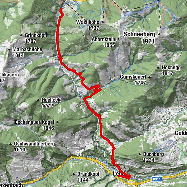
Lend0.0 kmHandlwirt0.1 kmBruderau1.2 kmBoden3.5 kmOberdorfkapelle3.8 kmSonnberg11.3 kmSchattberg11.5 kmDienten am Hochkönig15.3 km
- Best season
-
JanFebMarAprMayJunJulAugSepOctNovDec
- Description
-
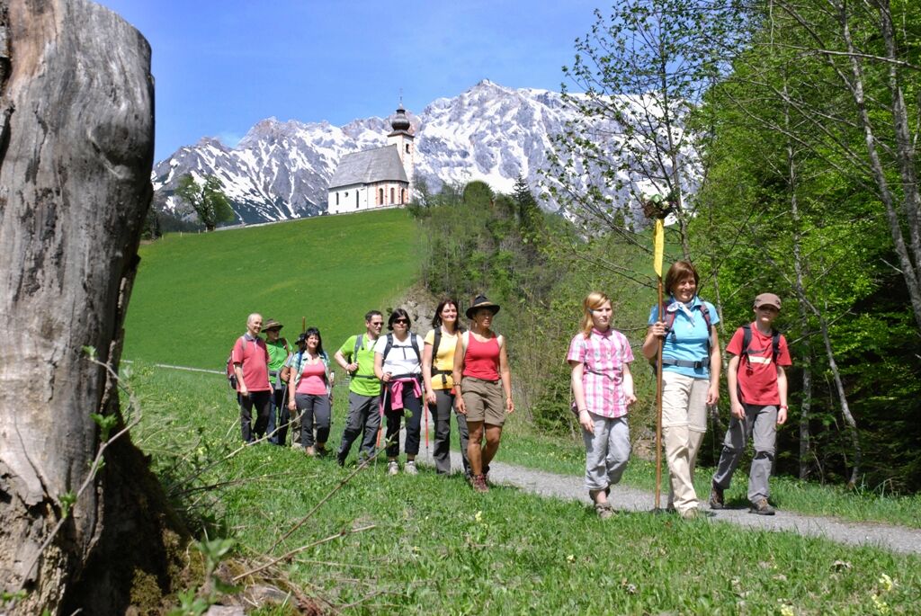
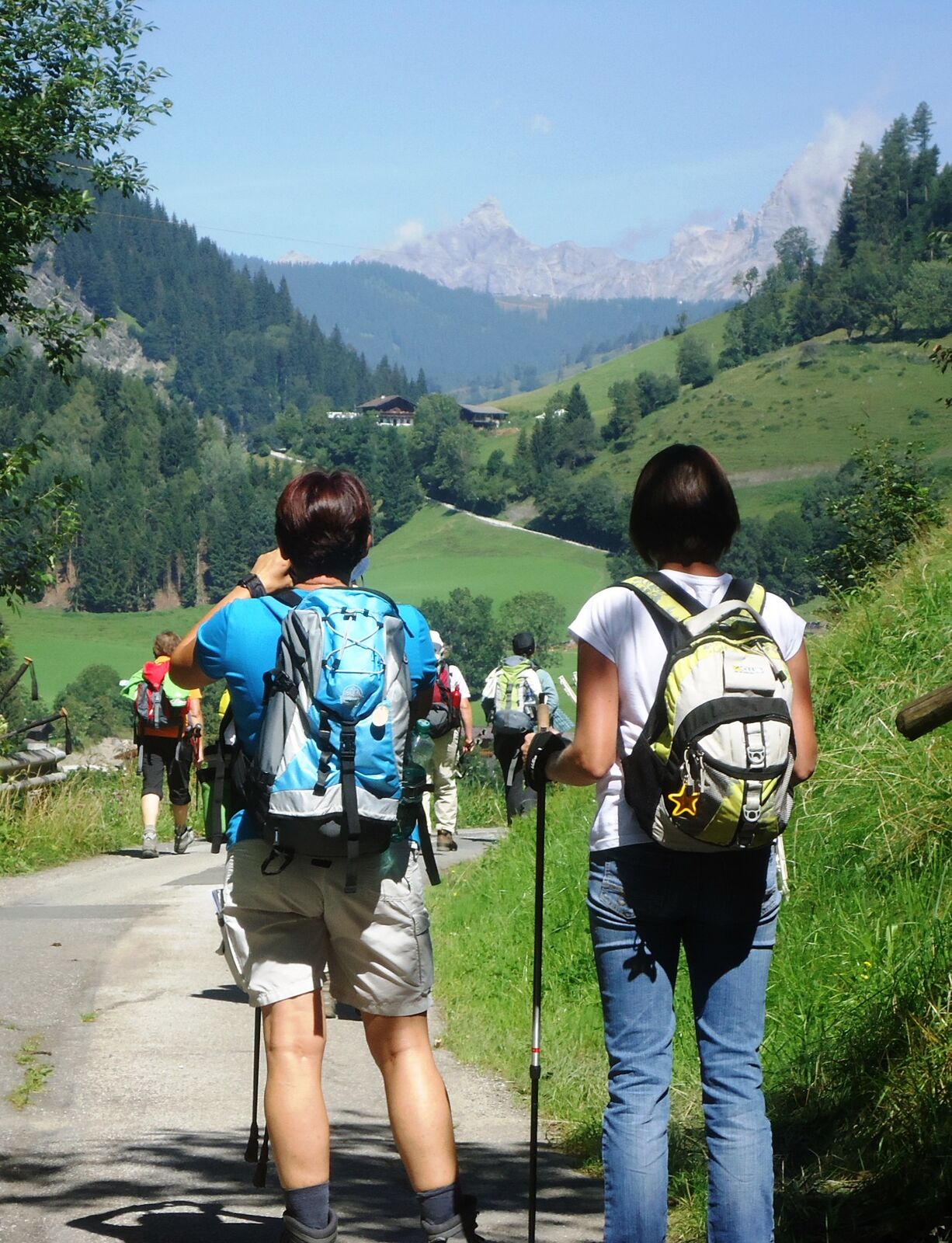
This somewhat demanding route takes you into the Dientner Valley. After a steep ascent you will pass the beautiful Böndlsee lake (swimming possibility). Now you enter the valley rather comfortably, before you have to master another steep ascent at the Schwarzenbach. After the (asphalt) path over the Dientner Sonnerberg (beautiful vantage points) you walk the last part leisurely along the brook to Dienten.
- Directions
-
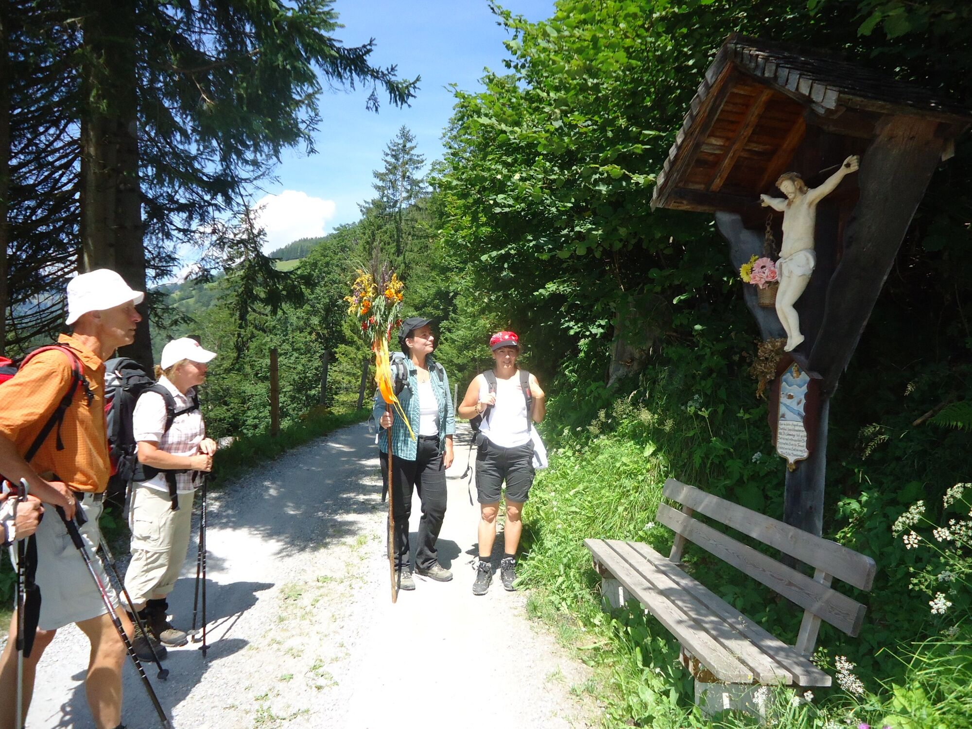
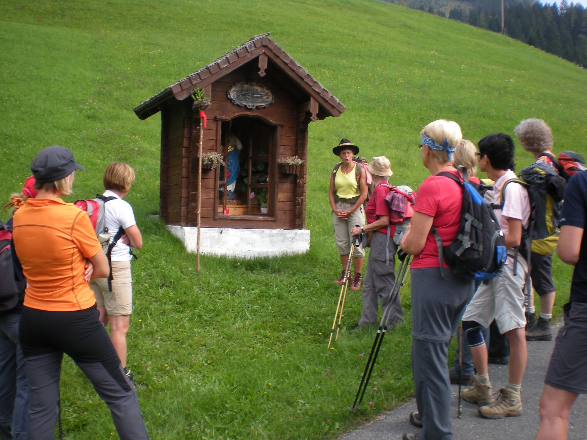
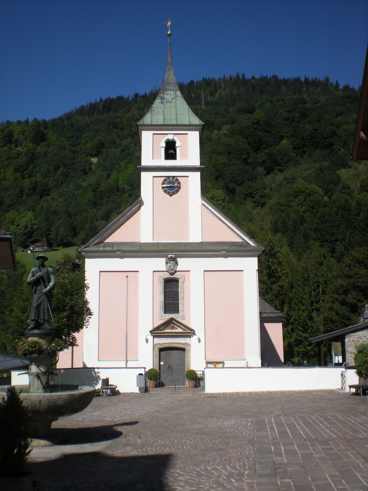
The start is at the Lend parish church, which is dedicated to St. Rupert. From the castle opposite, the road leads over the bridge down to the main road (100m), which you follow down the Salzach for another 200m. Cross the bridge to the left and follow the road over the railway tracks. After the railway tracks, turn left immediately and take the right-hand path after about 100m. This leads steeply uphill for about 2.5 km, just before the Böndlsee lake it goes slightly downhill.
Before the Böndlsee lake, turn left and hike along the Böndlsee lake in the direction of Dienten, always staying on a straight path for 1 km; at the end, the path leads to the left and past the Oberdorf chapel uphill until you reach a cross with a wayside shrine after 1.7 km. Here you continue along the hiking trail, which descends slightly into the Dientner Tal valley (do not turn uphill!) and joins the main road after 2 km. Follow the main road for 500 m before turning right into the Schwarzenbachtal valley (Güterweg Schwarzenbach). After 1.2 km, turn left into Güterweg Lindl. The trail continues steeply uphill for another 1.2 km, then straight ahead (towards Fischerstüberl - closed!, trail 56) and slightly downhill for 2 km along the Sonnberg to the junction with Hauptstraße. Turn right here and follow the footpath along the Dienter Bach stream for 3km to Dienten. The Dient church greets you from afar, standing picturesquely on a hill and looking down on the village and the Hochkönig. You can reach the parish church of "St. Nicholas" via the small road that leads steeply over the Kirchbühel between the vicarage and the Hochkönig Hotel.
- Highest point
- 1,109 m
- Endpoint
-
Dienten
- Height profile
-

- Equipment
-
Sturdy, ankle-high footwear
Walking sticks
Headgear
Sun protection
Sunglasses
Rain protectin
Drinks and a snack
Necessary medication
First aid kit
Hiking map - Safety instructions
-
Self-assessment Check your physical fitness before every mountain tour and correctly assess your strength as well as that of your companions - especially those of your children! Surefootedness and a head for heights are often very important!
Planning and preparation Plan each intended mountain tour in detail beforehand. Hiking maps and guides as well as information from alpine associations and local experts such as mountain guides and mountain hut keepers can be helpful.
Equipment On the mountain, you will need appropriate equipment and clothing, especially sturdy, high shoes with good grip soles. Weather and cold protection are essential, as the weather can often change unexpectedly.
Weather forecasts Take note of the current weather conditions at: www.zamg.at
Together Follow the 10 rules for the correct handling of grazing animals and do not leave any waste in nature!
Do not kick stones Do not kick stones as this can seriously endanger other hikers. Marked places with a danger of falling rocks should be crossed as quickly as possible and with attention and caution.
Turn back in good time This is not a disgrace, but a sign of common sense. It becomes necessary when the weather changes, fog rolls in, and also when the path is too difficult or not in good condition.Emergency numbers: Alpine emergency call: 140
International emergency call: 122 - Tips
-
Bathing possibility at Böndlsee
- Additional information
- Directions
-
Coming from Salzburg: Take the A10 freeway to the Bischofshofen exit, then take the B311 in the direction of Bischofshofen. Follow the Hochkönig Bundesstraße/B164 to Mühlbach and further to Dienten and to Lend
Coming from Innsbruck/ Kufstein: On the Loferer Straße/B178 in the direction of St. Johann i.T., then on the Hochkönig Bundesstraße/B164 via Saalfelden and Maria Alm to Dienten or to the Filzensattel and to Lend
A valid vignette is required to use the Austrian motorway and motorway network. It is also compulsory to carry a first-aid kit, warning triangle and high-visibility waistcoat. Further information can be found under Asfinag. - Public transportation
- Parking
-
Free parking at Lend railway station

- Author
-
The tour Pilgrim walk "Pinzgauer Marienweg" stage 10: Lend - Dienten is used by outdooractive.com provided.


General info
-
Hochkönig
2016
-
Embach - Lend
551