
- Brief description
-
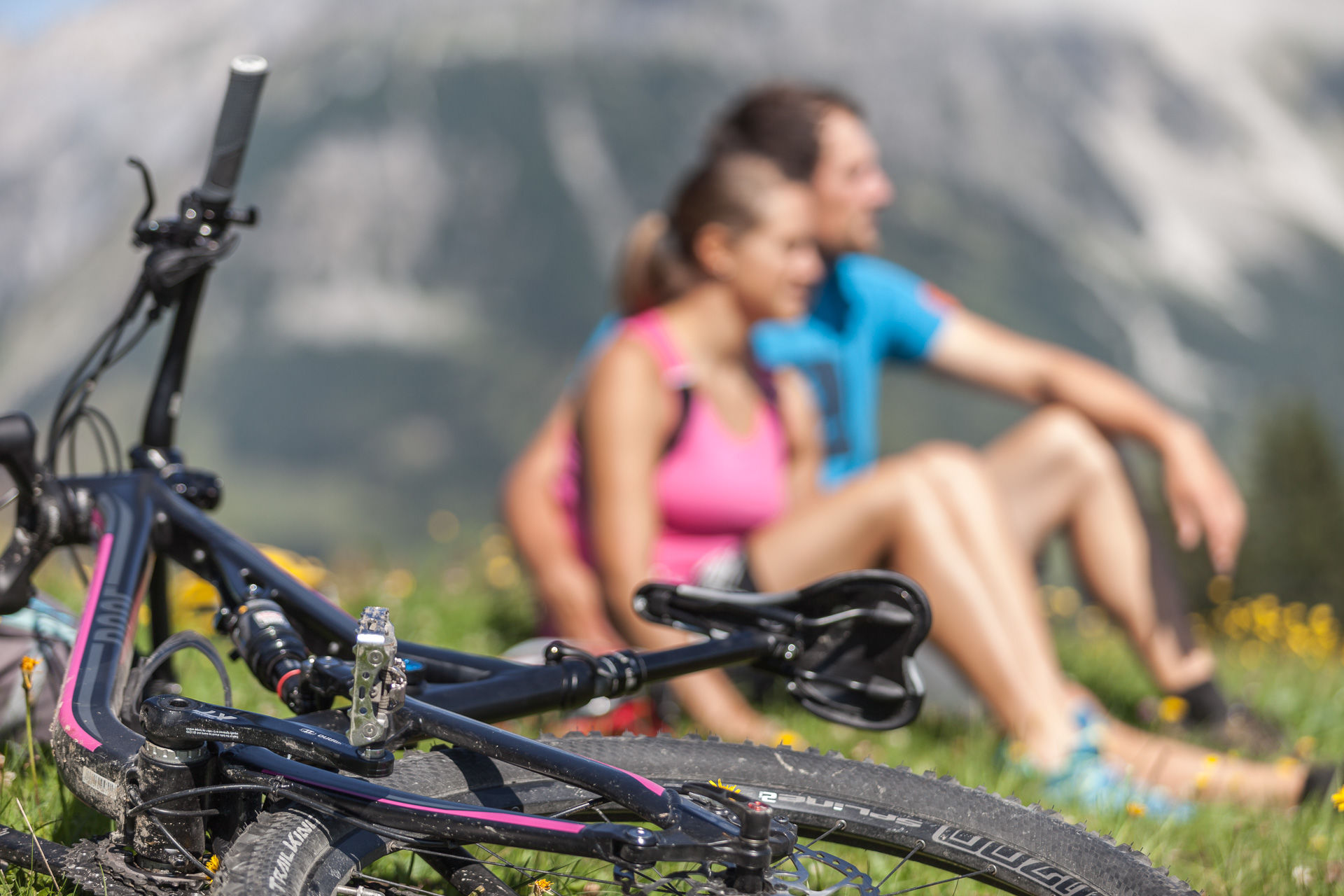
A pleasure round in the easy difficulty level, which is suitable for all mountain bikers.
A comfortable and enjoyable round in the heart of Maria Alm awaits you. - Difficulty
-
easy
- Rating
-
- Starting point
-
Tourist office Maria Alm
- Route
-
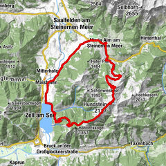
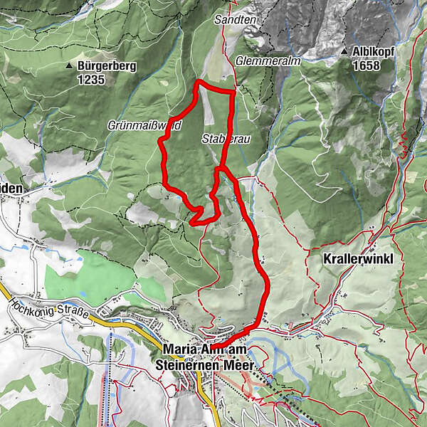
Maria Alm am Steinernen MeerGriesbachwinkl1.3 kmHochreitshöhe5.7 kmKronreithhof6.8 kmGriesbachwinkl8.7 kmMaria Alm am Steinernen Meer10.3 km
- Best season
-
JanFebMarAprMayJunJulAugSepOctNovDec
- Description
-
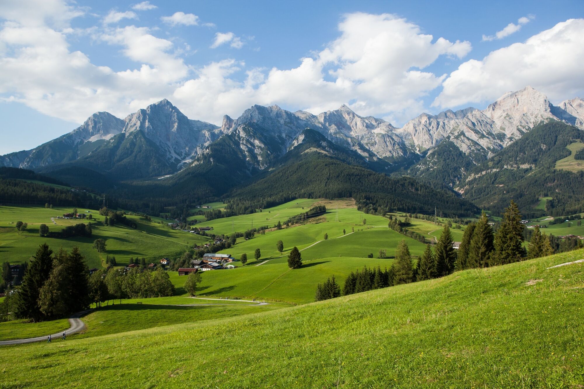
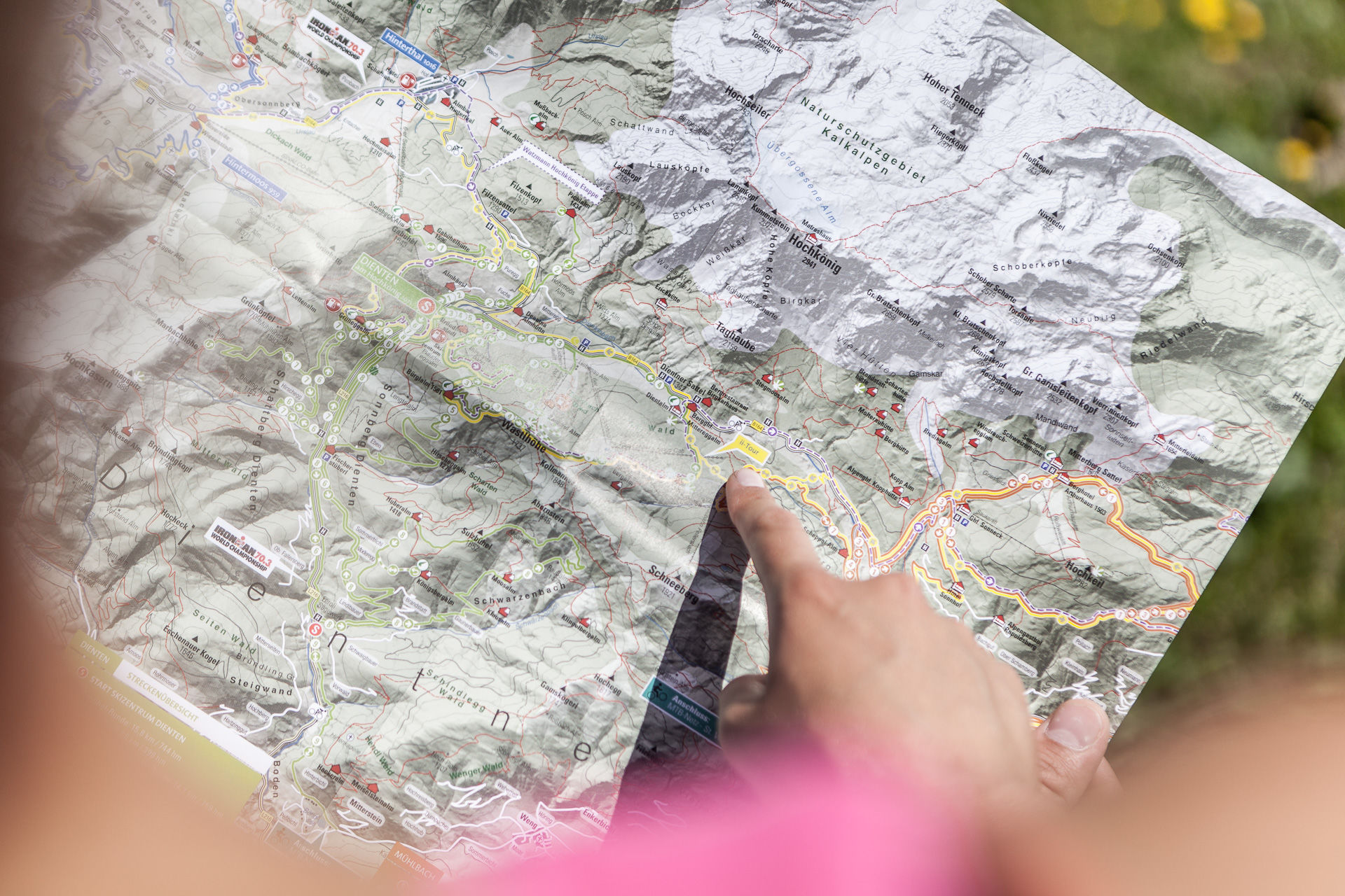
Our tour starts at the tourist office in Maria Alm, heading towards Krallerwinkel, passing by the Natrun cable car and the three local sports shops until we reach the Griesbach bridge. We cross this bridge and then follow the road slightly uphill into the Griesbachwinkel. For 2 km, we continue on asphalt past quaint farms, always with the Steinerne Meer (Rocky Sea) in sight, heading towards Sandten, before proceeding straight at the intersection "Liebmannhof" and leaving the road onto a gravel forestry road. From here, the path steadily ascends. Passing through sparse forests, we gradually approach the steep rock walls of Breithorn and Sommerstein. Those who look closely can spot the last support of the material cable car to the Riemannhaus. By the way, a great Bike & Hike tip for experienced mountaineers (Attention: The bike route ends at the Riemannhaus parking lot!).
At the intersection "Riemannhaus Parking Lot," we turn left. The steepest section is behind us. After another 1.5 km of gentle ascent, we reconnect with Route 1 and thus reach the highest point of the tour. Snap a quick photo with the breathtaking backdrop of the Pinzgauer Grass Mountains and the High Tauern in the background, and then it's time for the descent. Passing by the Gasthof Kronreith, we head back to the starting point of the tour."
- Directions
-
Follow the signage for "MA 02 Kronreith Loop".
From the Maria Alm tourist office, turn right towards Grießbachwinkl / Krallerwinkl. After about 500m, take a left over a bridge and follow along the Grießbach until you reach the Kronreith / Riemannshaus parking lot junction. From there, follow the path over the Güßgraben and Hochreith until you reach the Gasthof Kronreith.
To return to Maria Alm, follow the Grießbach again.
Route: Maria Alm - Grießbachwinkel - Riemannhaus Parking Lot - Hochreith - Gasthof Kronreith - Maria Alm Starting Point: Maria Alm Tourist Information (Direction: Krallerwinkel)
- Highest point
- 1,150 m
- Endpoint
-
Tourist office Maria Alm
- Height profile
-

- Equipment
-
Controlled bike equipment with helmet
Sunglasses
Sun protection
Rain protection
Drinks and a snack
Necessary medication
First aid kit
Bike map - Safety instructions
-
Fair play!
Drive only on marked paths! Close all gates, barriers and pasture gates! Observe the road traffic regulations! Overtake only at walking pace! Behave respectfully towards other nature users! and the forestry and hunting staff! Be considerate of animals! Do not leave waste in nature! Act responsibly! Check the weather forecast . Fog and bad weather can come surprisingly quickly.Emergency numbers: Alpine emergency call: 140
International emergency call: 122 - Tips
-
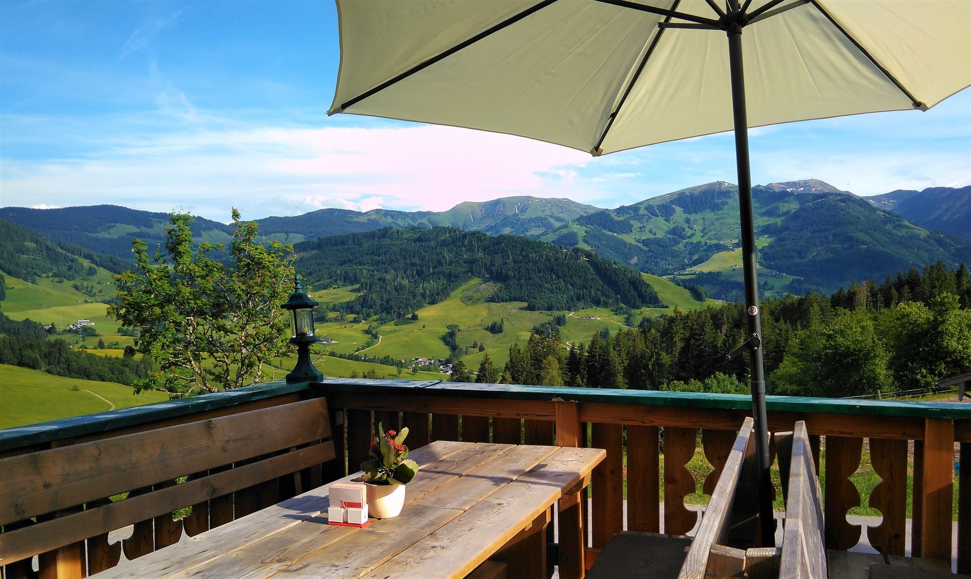
Enjoy the excellent cuisine of Gasthof Kronreith and the magnificent view of Maria Alm on the panoramic terrace.
- Additional information
- Directions
-
Coming from Salzburg: Take the A10 motorway to the Bischofshofen exit, then take the B311 towards Bischofshofen. Follow the Hochkönig Bundesstraße/B164 to Maria Alm.
Coming from Innsbruck/ Kufstein: Take the Loferer Straße/B178 in the direction of St. Johann i.T., then follow the Hochkönig Bundesstraße/B164 via Saalfelden to Maria Alm.
A valid vignette is required to use the Austrian motorway and motorway network. It is also compulsory to carry a first-aid kit, warning triangle and high-visibility waistcoat. Further information can be found under Asfinag. - Public transportation
- Parking
-
Free parking at the beginning of the village and in the centre of Maria Alm

- Author
-
The tour MTB Tour Kronreith-Runde (Tour 2) is used by outdooractive.com provided.


General info
-
Saalfelden - Leogang
384
-
Maria Alm
93