- Brief description
-
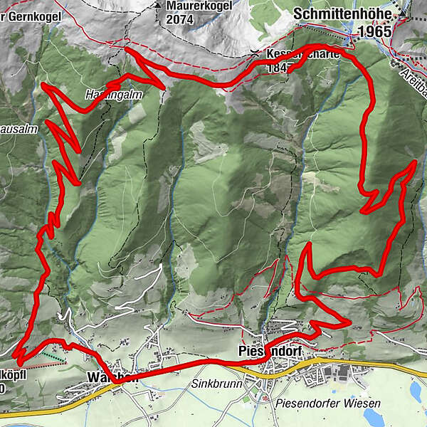
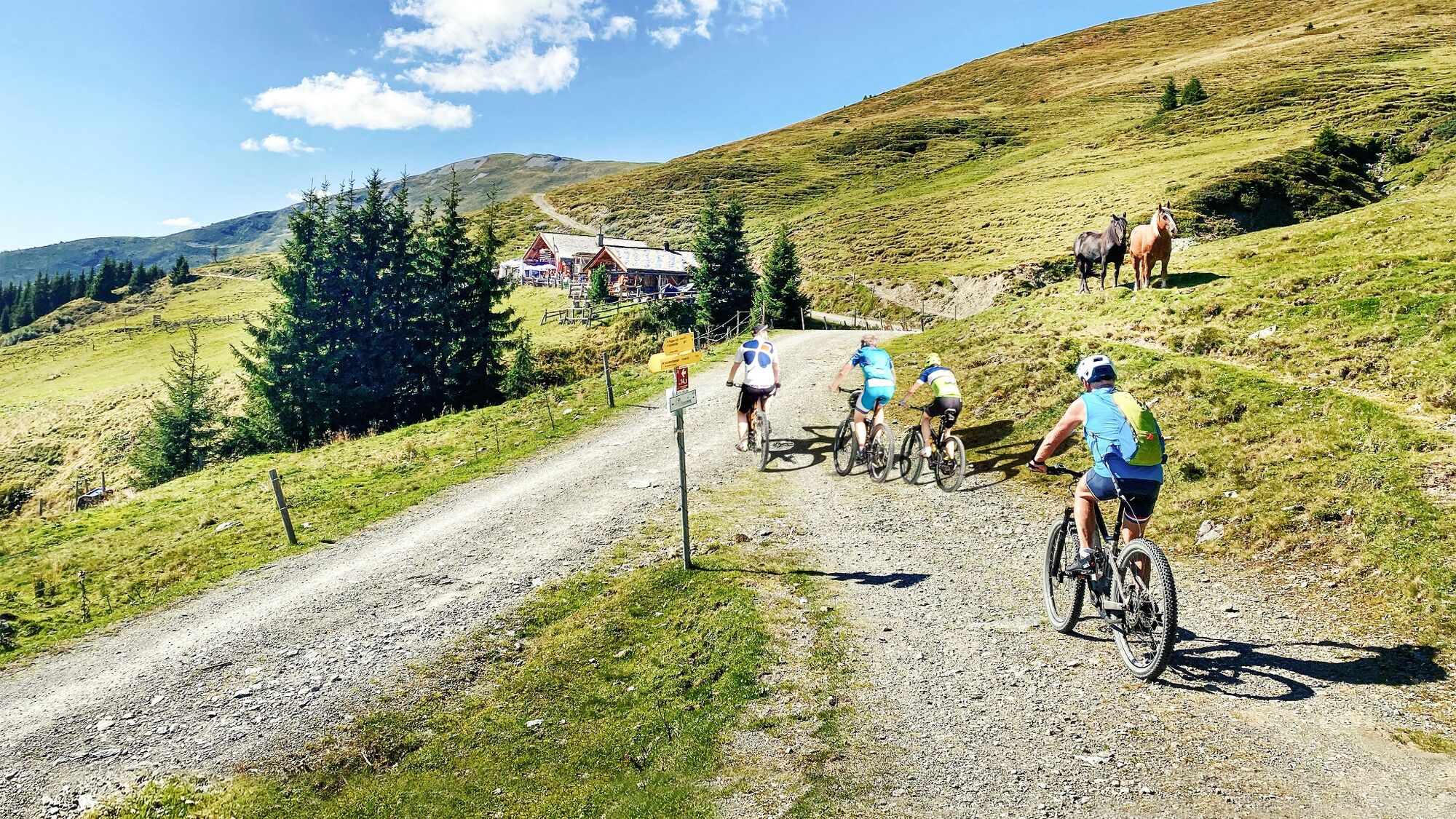
Scenic "Hochsonnbergrunde" tour from Piesendorf: Enjoy panoramic views and culinary highlights on this unforgettable beautiful tour.
- Difficulty
-
medium
- Rating
-
- Starting point
-
Piesendorf
- Route
-
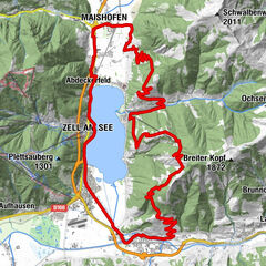
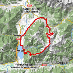
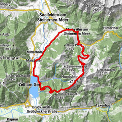
Il CapriccioPiesendorfWalchen1.5 kmSt. Ulrich1.9 kmBubenreuther Hütte (950 m)3.1 kmHochsonnbergalm12.8 kmKesselscharte (1,847 m)14.7 kmPinzgauer Hütte16.1 kmPfarrkirche St. Laurentius26.2 kmGasthof Neuwirt26.3 kmIl Capriccio26.3 kmPiesendorf26.3 km
- Best season
-
JanFebMarAprMayJunJulAugSepOctNovDec
- Description
-
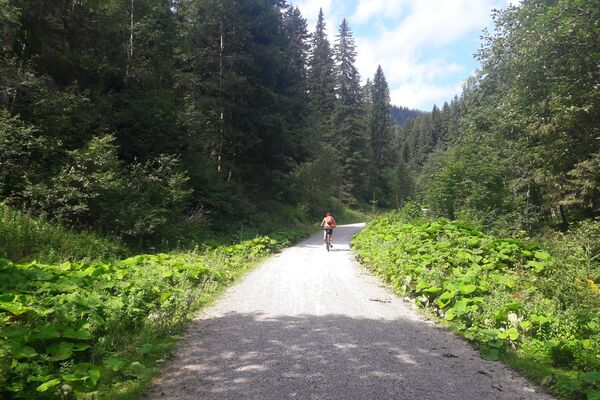
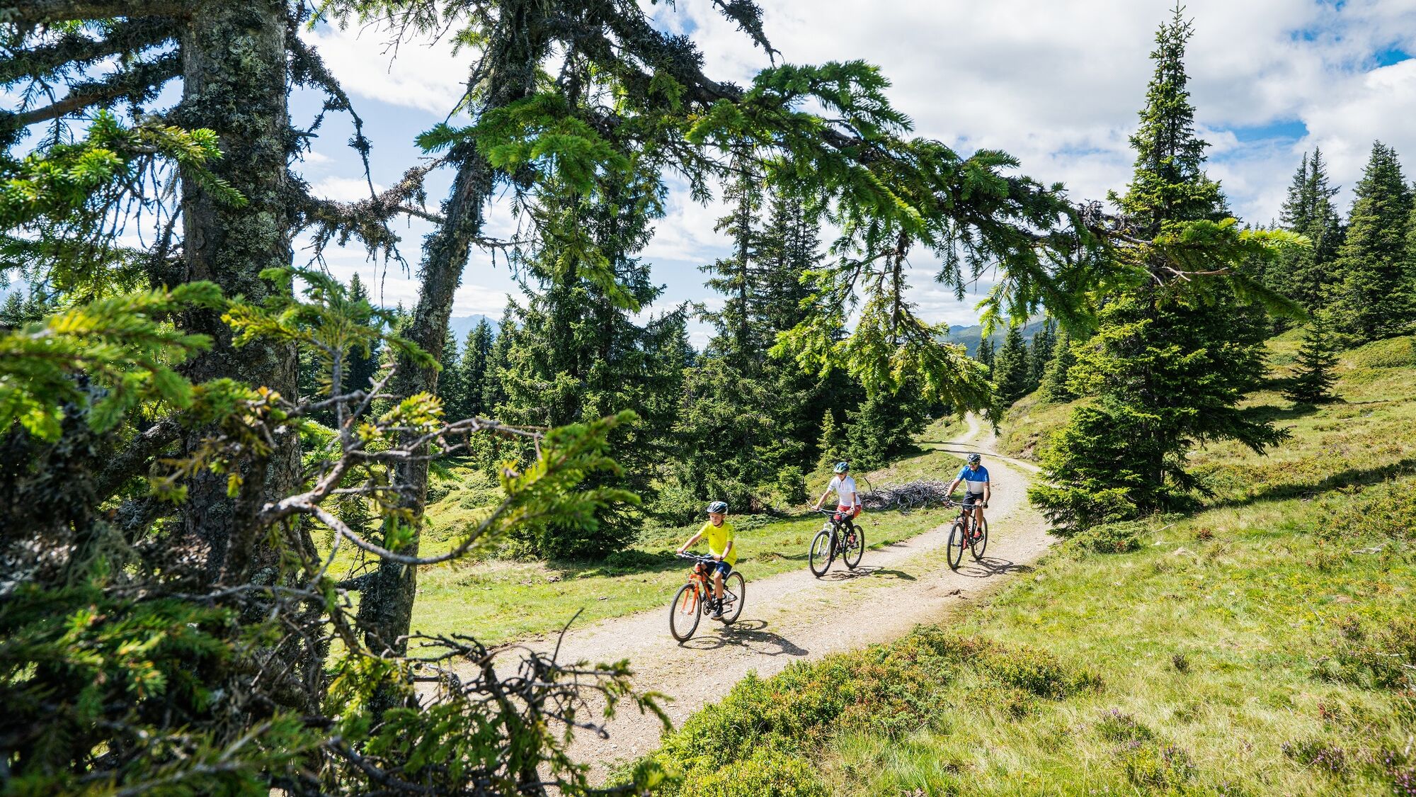
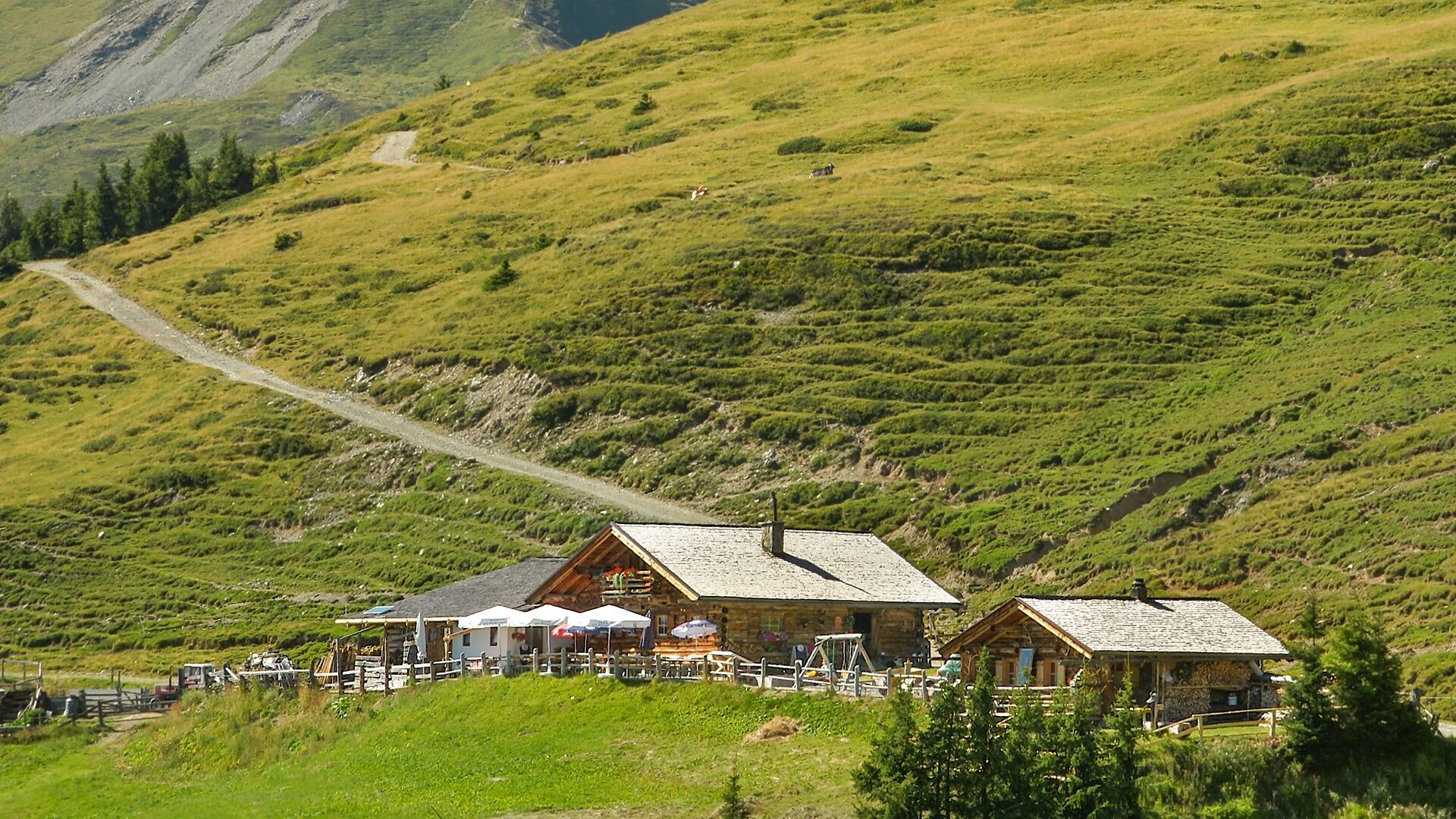
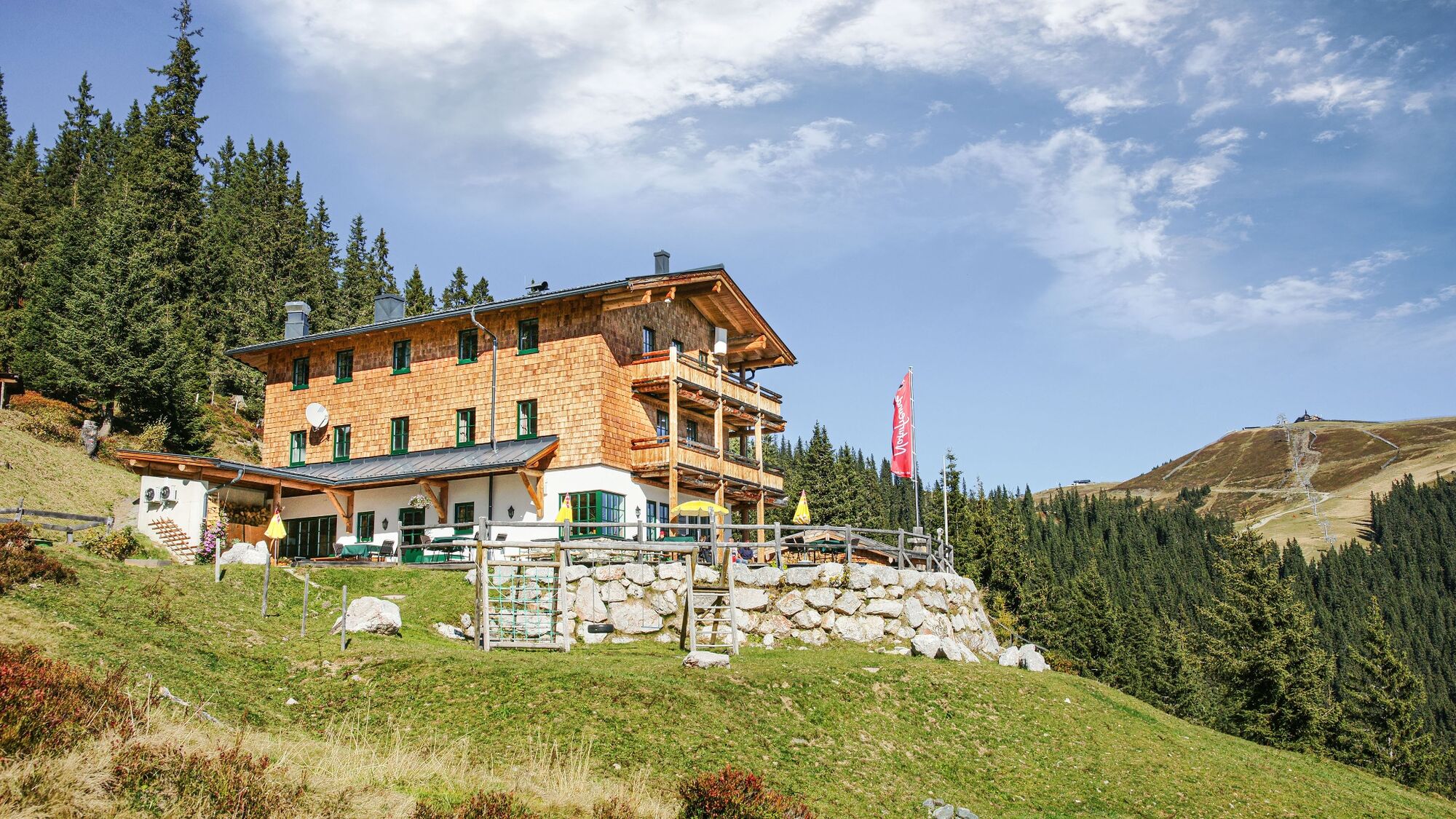
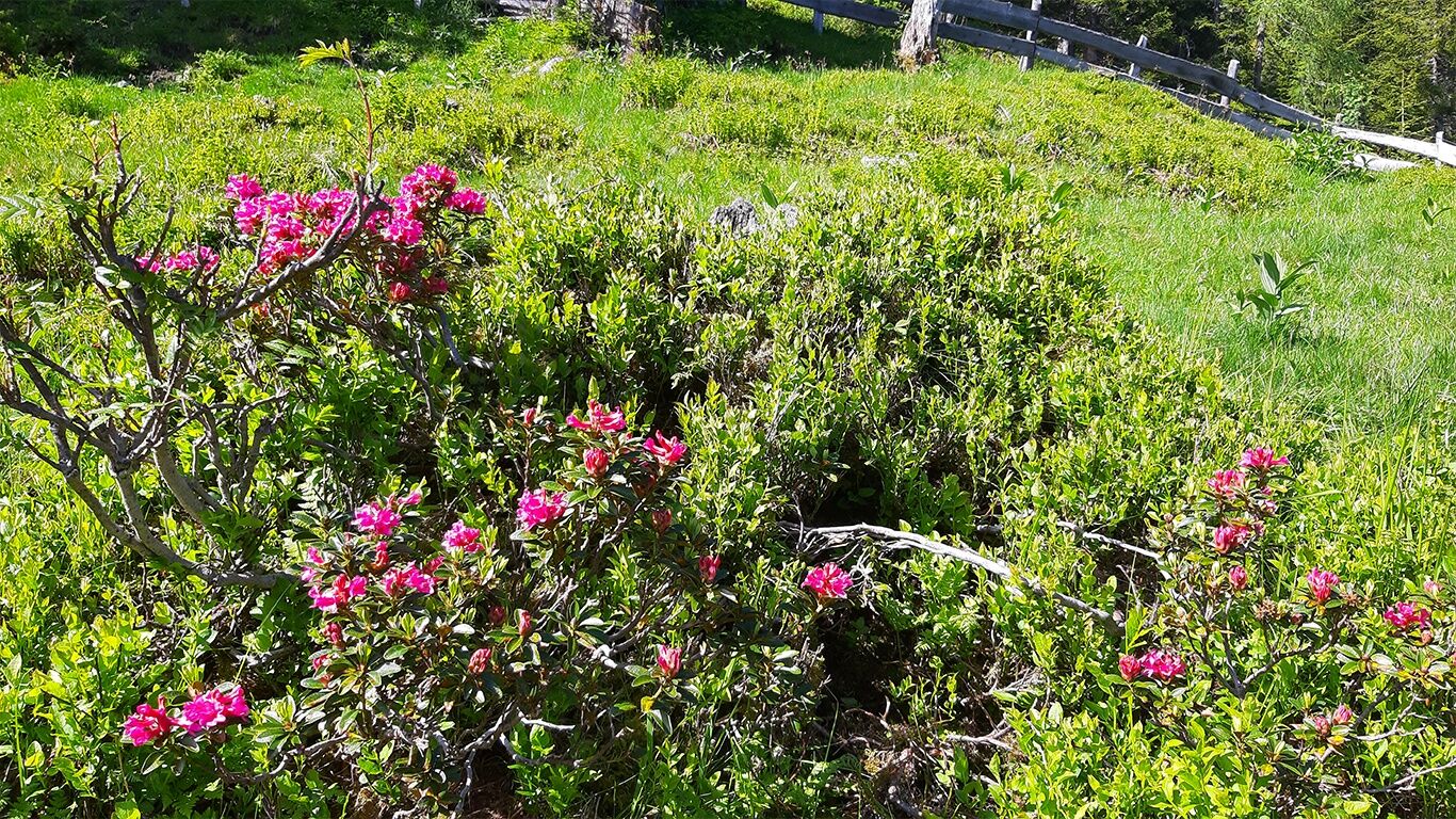
The tour spans a diverse route of over 26 km along the sunny side of Piesendorf, renowned for hiking, mountain biking, and its rich flora featuring numerous alpine flowers such as alpine roses, arnica and gentian. The path from Hochsonnbergalm to Pinzgauer Hütte offers magnificent views with old forest stands and lush alpine meadows. Special highlights include the dining options at both huts, serving homemade specialties. From their sun terraces, you can enjoy breathtaking panoramas of the Hohe Tauern. From Pinzgauer Hütte, you might catch a glimpse of the impressive Grossglockner ;)
- Directions
-
Start in the town center and follow the road and bike path westward until you reach the church in Walchen. Turn right and ride uphill on the Skiliftstraße and Rohrerberg towards Naglbauer. Stay to the right at the last hairpin turn before Naglbauer and continue cycling until you reach the barrier at Mittereckbauer. Here, the forest road (MTB 10B) begins, leading in hairpin turns to Hochsonnbergalm. Just before the alpine hut, turn right and follow the high-altitude cycle path to Pinzgauer Hütte. Then, proceed along the forest road (MTB 10C) and Wengerberg back to the starting point in the village.
- Highest point
- 1,842 m
- Endpoint
-
Piesendorf
- Height profile
-

- Safety instructions
- Tips
-
Enjoy breathtaking views, regional specialties, and take a detour to Schmittenhöhe for an unforgettable MTB adventure.
- Additional information
- Public transportation
- Parking
-
At the town center and at the parking lot near the eastern entrance to the village, there are sufficient parking facilities available.
-

-
AuthorThe tour 10D Hochsonnbergrunde is used by outdooractive.com provided.