- Brief description
-
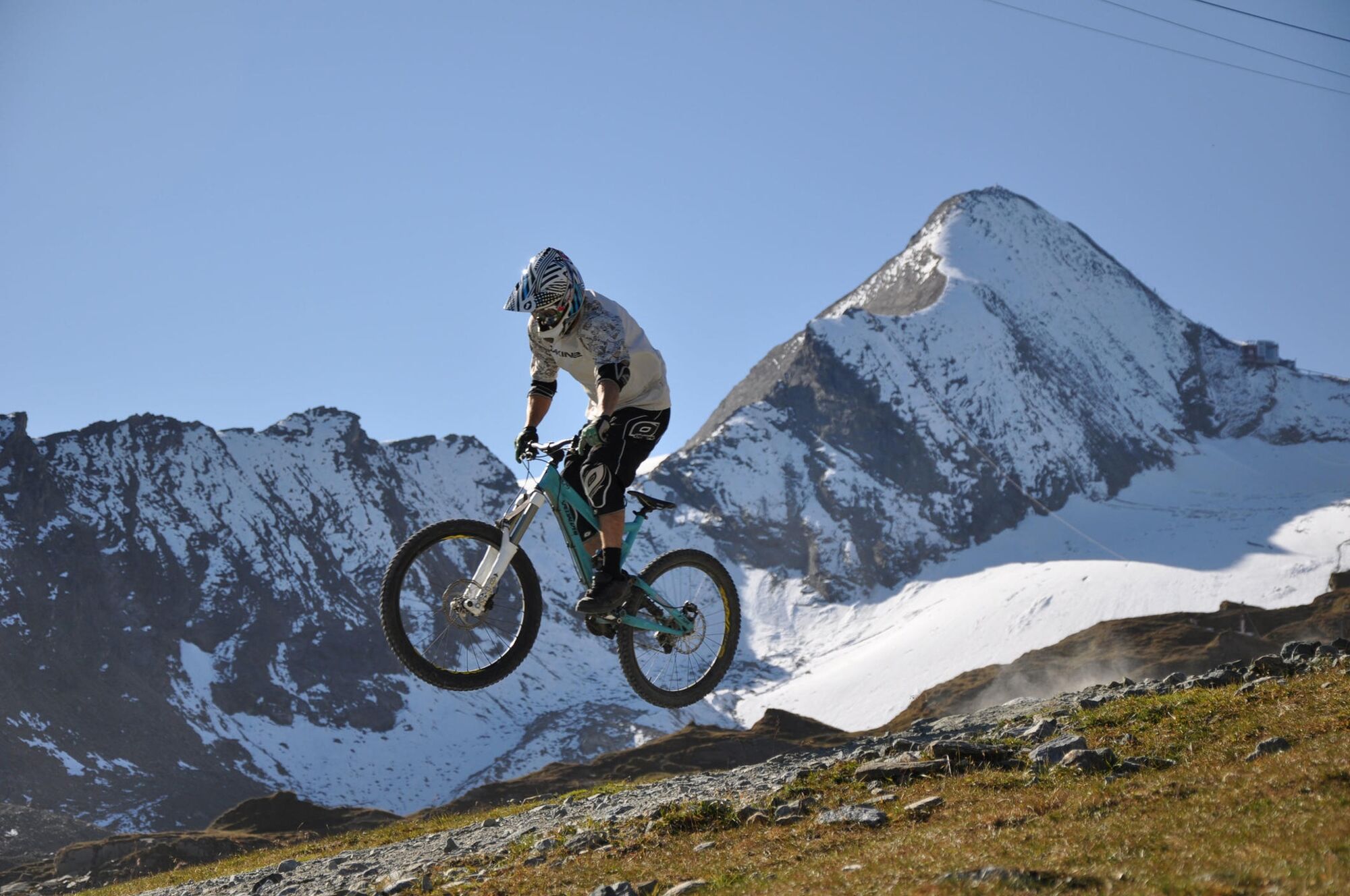
A challenging, high-alpine downhill trail with breathtaking panoramas, speed sections, berms, and small jumps - perfect for experienced riders.
- Difficulty
-
medium
- Rating
-
- Starting point
-
Alpincenter
- Route
-
Gletschermühle0.0 kmLangwiedbahn (1,976 m)3.4 km
- Best season
-
JanFebMarAprMayJunJulAugSepOctNovDec
- Description
-
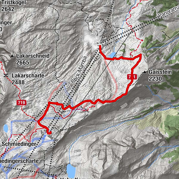
The Geissstein Trail is the perfect starting point for downhill enthusiasts seeking the thrill of high-alpine routes. Starting at the Alpincenter at 2,450 meters above sea level, the trail offers and inviting yet challenging entry with its long curves, natural elements, and the impressive glacier panorama at your back.
- Directions
-
The trail entrance is easily accessible by gondola. Spanning over 3 kilometers, this high-alpine trail covers a vertical drop of 492 meters and challenges the skills of experienced riders with speed, berms, and small jumps. The route concludes at Langwiedboden at 1,976 meters above sea level, seamlessly merging into the Wüstlau Trail, providing an impressive downhill experience.
- Highest point
- 2,445 m
- Endpoint
-
Langwiedboden
- Height profile
-

- Safety instructions
-
The signposted route regulations are to be followed when riding the mountain bike trails. The routes range from technically difficult to used trails, which means that control over one's bike and technical ability are required. Apart from the joy of mountain biking, one should not forget the dangers present in alpine terrain.
An appeal for personal responsibility:
Mutual consideration between bikers and hikers Give hikers the right of way on narrow paths. Protect and respect plants and animals Please do not leave any litter behind in Mother Nature Avoid noise and unnecessary skid marks Always expect to meet agricultural and forest motor vehicles Only ride as fast as it is possible to stop at any time Expect wild animals, domestic animals or livestock to be on the trails Respect prohibitive signs and information boards Only ride with technically sound bikes Ride according to your ability and the condition of the trail Don't forget bad weather gear, tools and a reserve tubeYour behaviour influences public opinion and tolerance.
- Tips
-
Master your skills because the Geissstein Trail offers top speed and challenges - for experienced riders, it's an unparalleled adventure.
- Additional information
- Directions
-
The cable cars allow for the transportation of bicycles, offering a convenient ascent to the mountain station.
- Public transportation
- Parking
-
Sufficient parking available at the valley station of the cable car.
-

-
AuthorThe tour F5 Geissstein Trail is used by outdooractive.com provided.