© Piesendorf Niedernsill - Tourismusverband Piesendorf Niedernsill

© Piesendorf Niedernsill - Tourismusverband Piesendorf Niedernsill

© Piesendorf Niedernsill - Tourismusverband Piesendorf Niedernsill
- Brief description
-
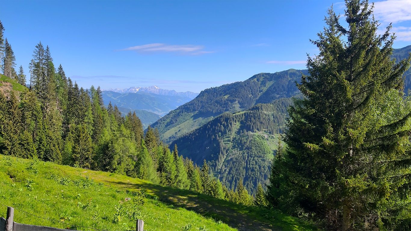
A mountain bike tour through the former mountain health resort "Bad Fusch" with stunning view of the Fusch valley.
- Difficulty
-
medium
- Rating
-
- Starting point
-
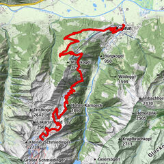
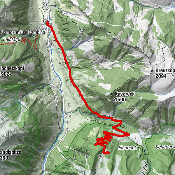
Fusch
- Route
-
Pfarrkirche hll. Ägidius und MartinFusch an der Großglocknerstraße0.1 kmBad Fusch4.1 kmAugenheilquelle4.1 kmSt. Wolfgang4.2 kmEmbach Hochalm8.2 km
- Best season
-
JanFebMarAprMayJunJulAugSepOctNovDec
- Description
-
This tour is a real challenge - you cycle leisurely past the romantic Kneipp facility and the mineral springs in Bad Fusch, which invites one to linger awhile before taking on the challenge of the wide forest road to the Embach Hochalm at 1,649 m.
- Directions
-
From the starting point, follow the main road towards Ferleiten for a short distance and then turn left into the road Bad Fuscher Straße. Follow the road uphill to Bad Fusch (1,140 m). From here continue along the forest road through a gate and turn right after the left-hand bend after about 500 m. Continue along the challenging forest road in serpentines to the Embach Hochalm (not managed!).
The way back is via the same route.
- Highest point
- 1,644 m
- Endpoint
-
Embach Hochalm
- Height profile
-

- Safety instructions
- Tips
-
A Kneipp session on the way back will refresh your tired legs, and a stop at the Bad Fusch snack station is a welcome refreshment.
- Additional information
- Directions
-
By mountain bike: From Piesendorf Niedernsill follow the well-marked Tauern Cycle Path to Bruck and from there in the Fusch valley until Fusch.
- Public transportation


-

-
AuthorThe tour 13C Bad Fusch - Embach Hochalm is used by outdooractive.com provided.
GPS Downloads


Other tours in the regions