
- Brief description
-
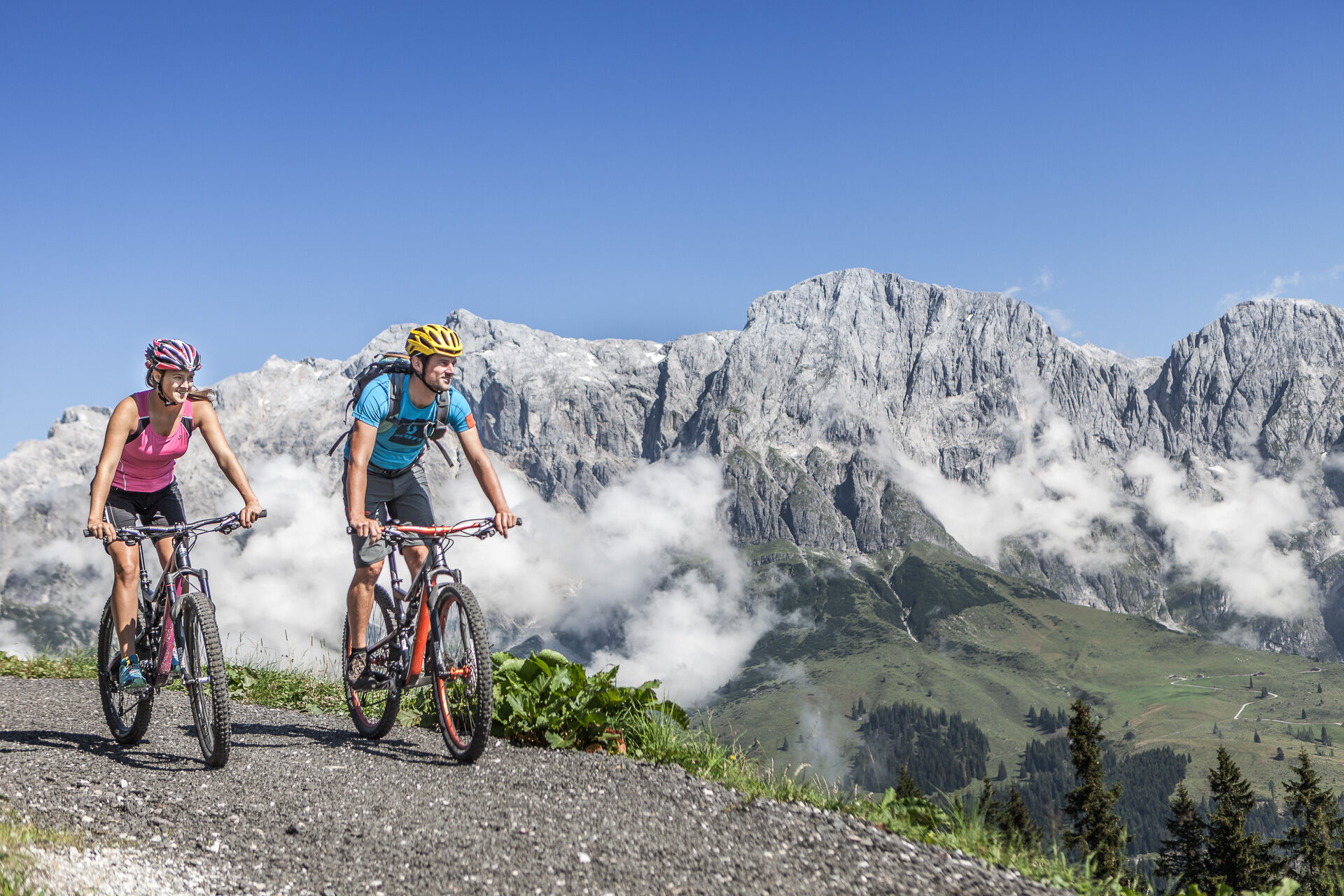
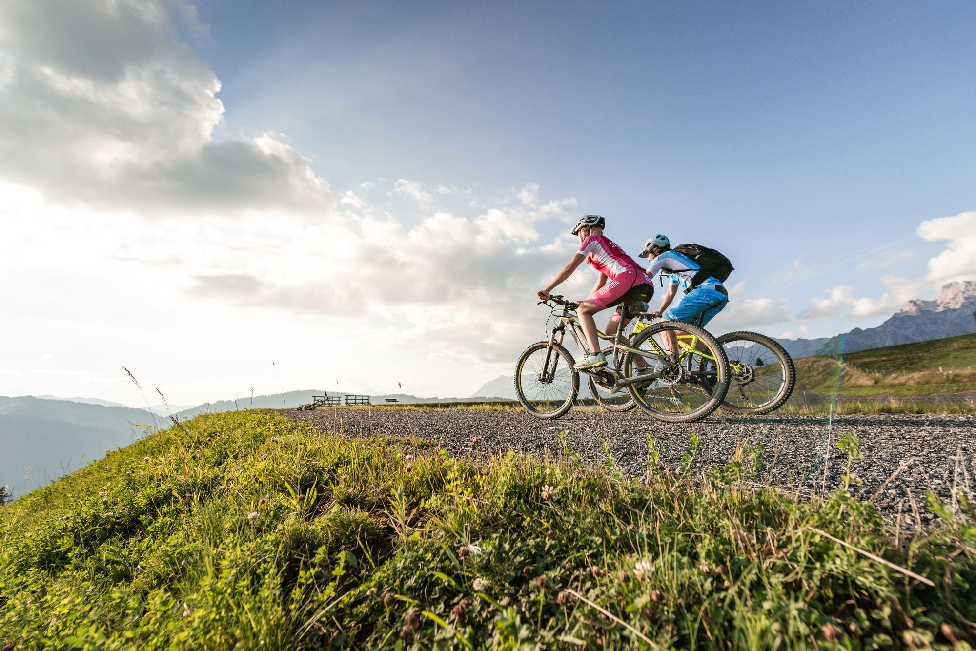
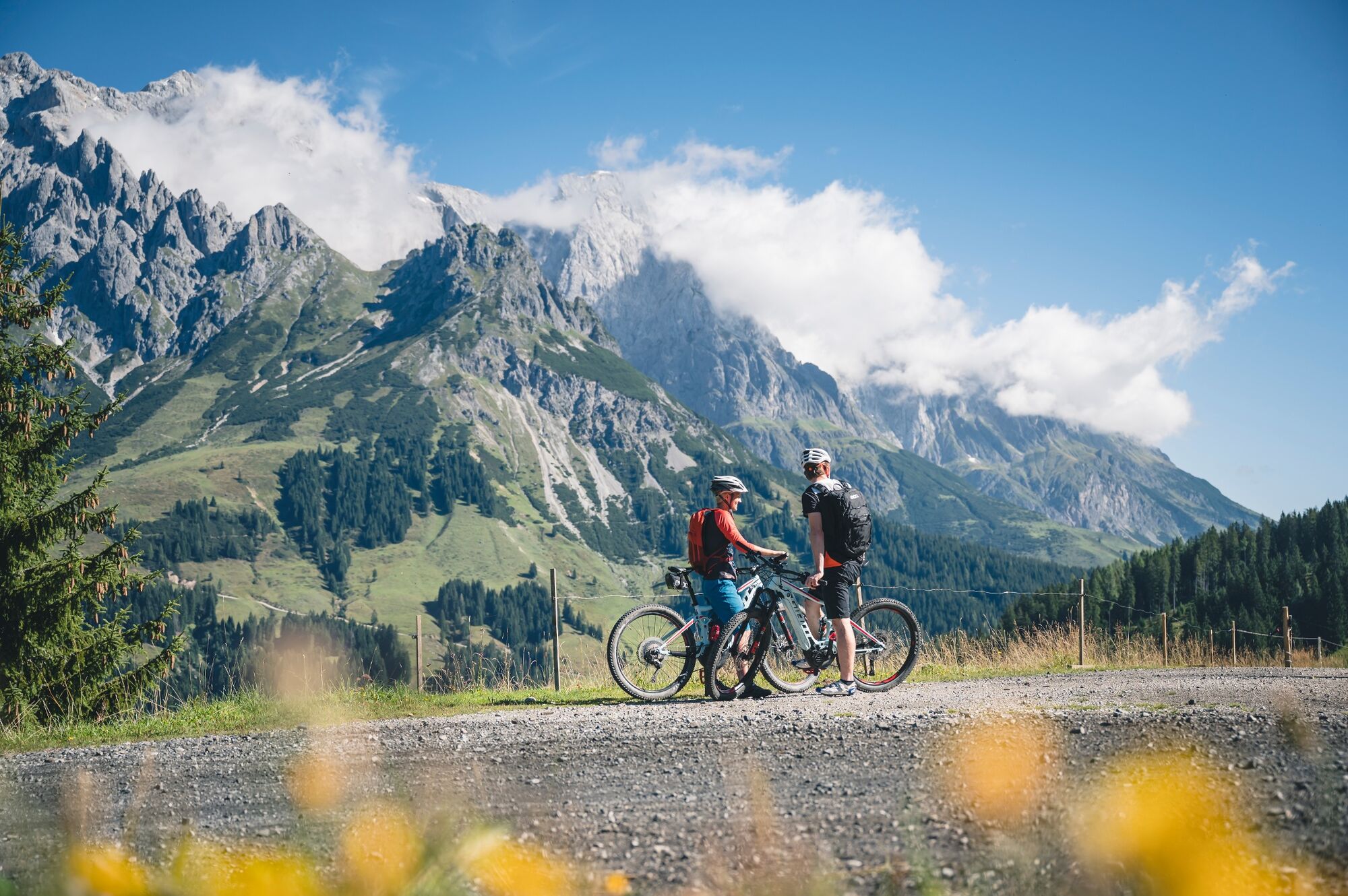
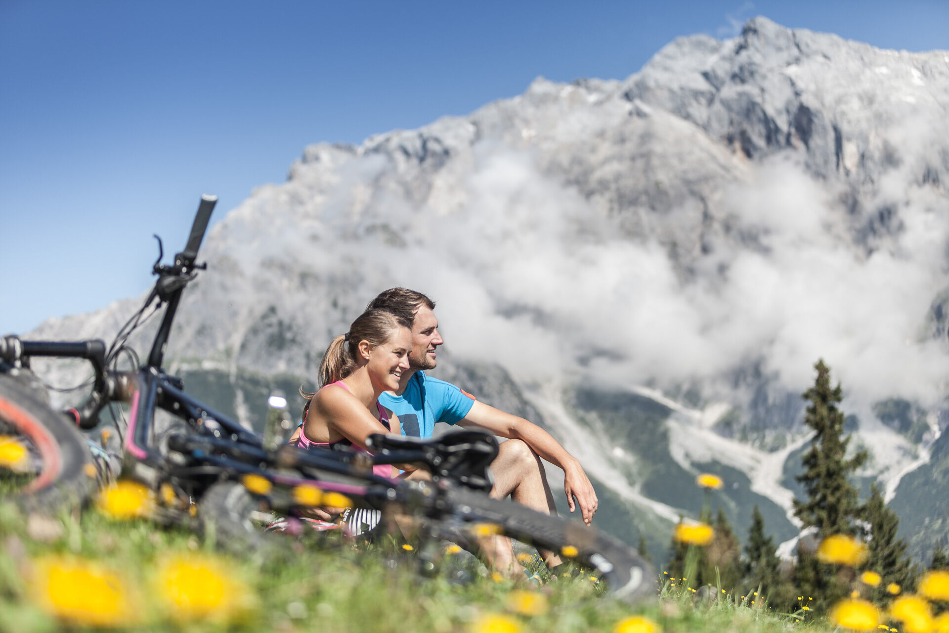
Discover the Hochkönig region by mountain bike or e-bike in four day stages.
Magnificent views await you in an impressive landscape. We will take care of the luggage transfer! - Difficulty
-
medium
- Rating
-
- Starting point
-
Tourist office Maria Alm
- Route
-
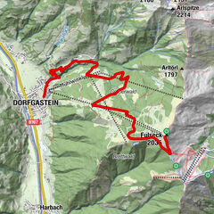
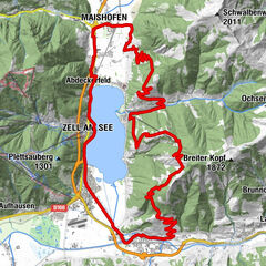
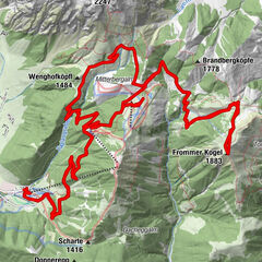
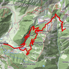
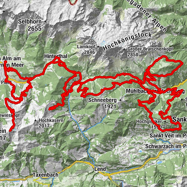
Wallfahrtskirche Maria Alm0.2 kmRaum der Stille0.3 kmMaria Alm am Steinernen Meer0.3 kmTom Almhütte4.0 kmSchlosspielplatz4.6 kmGrammlergut4.6 kmSonnberg5.3 kmBirnbach9.3 kmHinterthal10.6 kmKath. Pfarrkirche hl. Dreifaltigkeit10.8 kmGrünegg Alm26.5 kmDienten am Hochkönig28.7 kmBürglalm29.2 kmHöfl-Zachhof29.7 kmKönig & Kuh31.4 kmMittereggalm33.3 kmBirgkarhaus33.4 kmMitterbergalm41.7 kmArthurhaus42.2 kmMitterbergsattel (1,515 m)42.7 kmKnie54.1 kmPfarrkirche zum hl. Sebastian57.2 kmMesnerhaus, Café, Bar & Restaurant57.2 kmAnderlwirt57.3 kmMühlbach am Hochkönig57.3 kmHöring57.3 kmSchlöglberg59.1 kmAlthausalm66.2 kmAlthaussattel66.5 kmHubertuskapelle67.1 kmKreisten67.1 kmFadlsteinkapelle67.8 kmOberlehen68.0 kmPfarrkirche zum hl. Sebastian87.2 kmMesnerhaus, Café, Bar & Restaurant87.2 kmMühlbach am Hochkönig87.3 kmAnderlwirt87.3 kmHöring87.3 kmKarbachalm88.5 kmSchepperlalm89.5 kmTiergartenalm94.1 kmWastlhöhe (1,737 m)97.0 kmZachhofalm97.0 kmBürglalm98.6 kmHöfl-Zachhof103.0 kmDienten am Hochkönig103.5 kmBürglalm103.5 kmBirnbach110.4 kmHintermoos114.3 kmHandlerkapelle114.9 kmBachwinkl115.2 kmAbergalm119.1 kmHundstein (2,117 m)126.6 kmStatzerhaus126.6 kmAbergalm133.9 kmKröllalm135.2 kmAbergalm136.3 kmAberg139.0 kmRaum der Stille142.0 kmMaria Alm am Steinernen Meer142.1 kmWallfahrtskirche Maria Alm142.2 km
- Best season
-
JanFebMarAprMayJunJulAugSepOctNovDec
- Description
-
The tour takes you through unspoilt nature and enchanting forests, across meadows and alpine pastures, through valleys and over mountain passes. From Maria Alm via Dienten to Mühlbach, along the majestic Hochkönig massif. From Mühlbach over the Grasberge to Dienten and back to Maria Alm.
- Directions
-
The first stage takes you over the Natrun to Hintermoos and further to Hinterthal (e-Bike charging station Landhotel Schafhuber). From here, follow the "old Filzenweg" and the Hochkönig Landesstraße to the Filzensattel. Turn right here and take the service road towards Grünegg. Just before the Grünegg snack station (e-Bike charging station), those still feeling strong and willing can turn off towards the Reicheralm. This detour rewards you with a magnificent view. From the Grünegg snack station, enjoy a leisurely descent to the Dientner Landesstraße. Turn left here and, after a few hundred meters, you'll reach your stage destination, Dienten (e-Bike charging station Skizentrum).
Stage two starts at the Skizentrum Dienten (e-Bike charging station). Follow a narrow road slightly uphill until you reach the Hochkönig Bundesstraße. This will lead you to the Dientner Sattel, where you turn right at the highest point towards the Dientalm. Follow the forest road uphill for about 500 meters, then turn towards the Zapferlalm, and finally downhill until you reach the Hochkönig Bundesstraße again. After passing the Elmaugut, turn left and follow the signs for the "Watzmann-Hochkönig Round" until you reach the Mandlwandstraße. This road leads you to the Berghotel Arthurhaus (e-Bike charging station). After a cozy break with a magnificent view at the foot of the Hochkönig, continue your tour around the Hochkeil until you reach the Mandlwandstraße again. The last kilometers descend on the Mandelwandstraße until you reach your stage destination, Mühlbach (e-Bike charging station Bäckerei Bauer).
For the third stage, start from the center of Mühlbach along the Bundesstraße (B164) towards Dienten. After about 900 meters, you'll reach the junction towards Schlöglberg. The service road winds past the Reithgut and leads you to the "Brennerlehen". Just before reaching the farm, the path turns right towards Brennerköpfl. A wide forest road now leads you to the Althaus Sattel. Here, a short but intense climb awaits you to the Hubertuskapelle. At the fork, continue straight towards St. Veit and treat yourself to a brisk descent. At the intersection with the impressive wayside cross, turn left and follow the path to the Kinderalm. The uphill climb is sweetened by the prospect of a well-deserved break at the Pronebenalm. From the Pronebenalm, continue your journey along the service road "Bliem" until you finally reach the Bundesstraße (B164) again. This road will lead you back to the starting point.
The fourth stage starts at the Tourist Office in Mühlbach on the Hochkönig Bundesstraße towards Dienten. At the Karbachalm cable car, turn left into the parking lot and cycle slightly uphill past the Scheppalalm towards the Zapferlalm. Continue until you reach a junction where you turn left and ride uphill towards Tiergartenalm and further to Sunn Hüttl (not serviced). After a cozy break at one of the two huts, the path continues over the Wastlhöhe with a summit cross and magnificent views. The path descends to the Bürglalm and further to Dienten.
From the Tourist Office Dienten, the fifth stage leads via the Hochkönig Bundesstraße over the Filzensattel to Hintermoos. Here, turn left into the Bachwinkel district and pass the valley station of the Schwarzeckbahn. Past the Hüttendorf and the Melchamalm, cycle uphill to the Thoraualm. At the fork after the Thoraualm, continue straight with some flat sections and magnificent views of the Steinernes Meer, through the Abergalm area. After a small ridge, a gentle descent follows to the Grießbachalm (e-Bike charging station). Then continue via the Lohningalm to the summit of Hundstein (2,117m). Enjoy a well-deserved rest at the Statzerhaus and the magnificent panoramic view from the summit. After replenishing your energy, descend to Maria Alm. Until the Schwarzeckalmbahn mountain station, take the same route as uphill. At the fork, keep left to reach Unterberg via the Kröllalm, the Bärmoosalm, and the Gasthof Christernreith. From here, the last stretch leads back to the center of Maria Alm on small side streets.
- Highest point
- 2,113 m
- Endpoint
-
Tourist office Maria Alm
- Height profile
-

- Equipment
-
Controlled bike equipment with helmet
Sunglasses
Sun protection
Rain protection
Drinks and a snack
Necessary medication
First aid kit
Bike map - Safety instructions
-
Fair play!
Drive only on marked paths! Close all gates, barriers and pasture gates! Observe the road traffic regulations! Overtake only at walking pace! Behave respectfully towards other nature users! and the forestry and hunting staff! Be considerate of animals! Do not leave waste in nature! Act responsibly! Check the weather forecast. Fog and bad weather can come surprisingly quickly.Emergency numbers: Alpine emergency call: 140
International emergency call: 122 - Tips
-
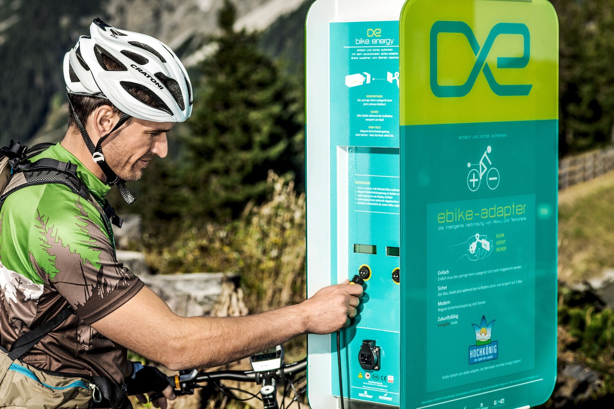
Charging stations for e-bikes are marked in the cycling map.
- Additional information
- Directions
-
Coming from Salzburg: Take the A10 motorway to the Bischofshofen exit, then take the B311 towards Bischofshofen. Follow the Hochkönig Bundesstraße/B164 to Maria Alm.
Coming from Innsbruck/ Kufstein: Take the Loferer Straße/B178 in the direction of St. Johann i.T., then follow the Hochkönig Bundesstraße/B164 via Saalfelden to Maria Alm.
A valid vignette is required to use the Austrian motorway and motorway network. It is also compulsory to carry a first-aid kit, warning triangle and high-visibility waistcoat. Further information can be found under Asfinag. - Public transportation
- Parking
-
Free parking at the beginning of the village and in the centre of Maria Alm or the first landlord
- Author
-
The tour KÖNIGSTOUR – BIKING WITHOUT LUGGAGE is used by outdooractive.com provided.


General info
-
Hochkönig
357
-
Dienten am Hochkönig
88