Watzmann-Hochkönig South-Loop: Stage 5: Variant via St. Veit im Pongau


- Brief description
-
This alternative branches, shortly before Dienten, away from the original route (stage 5a South) and has around 200 meters less to climb. Especially the idyllic Böndlsee, the ride along the so-called 'Sun Terrace of Salzburg' to St. Veit im Pongau and the subsequent climb to the Pronebenalm have their special charm.
- Difficulty
-
difficult
- Rating
-
- Starting point
-
Maria Alm
- Route
-
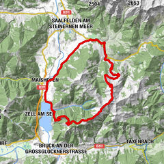
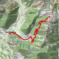
Gasthaus Waldhaus0.7 kmEnterwinkl0.8 kmJufenalm3.0 kmBirnbach7.9 kmHinterthal9.2 kmKath. Pfarrkirche hl. Dreifaltigkeit9.4 kmFischerstüberl21.0 kmSchattberg21.7 kmSonnberg21.9 kmOberdorfkapelle26.6 kmBoden27.1 kmMitterstein28.7 kmAnnakirche31.1 kmWeng31.1 kmUrpaß34.6 kmWegscheid34.6 kmStein35.0 kmFeldmair35.6 kmPichl36.3 kmOberlehen40.2 kmFadlsteinkapelle40.3 kmKreisten41.1 kmHubertuskapelle41.1 kmMitterberghütten54.3 kmPizzeria55.4 kmPfarrkirche St. Maximillian58.3 kmBischofshofen58.4 kmLiebfrauenkirche58.6 km
- Best season
-
JanFebMarAprMayJunJulAugSepOctNovDec
- Description
-
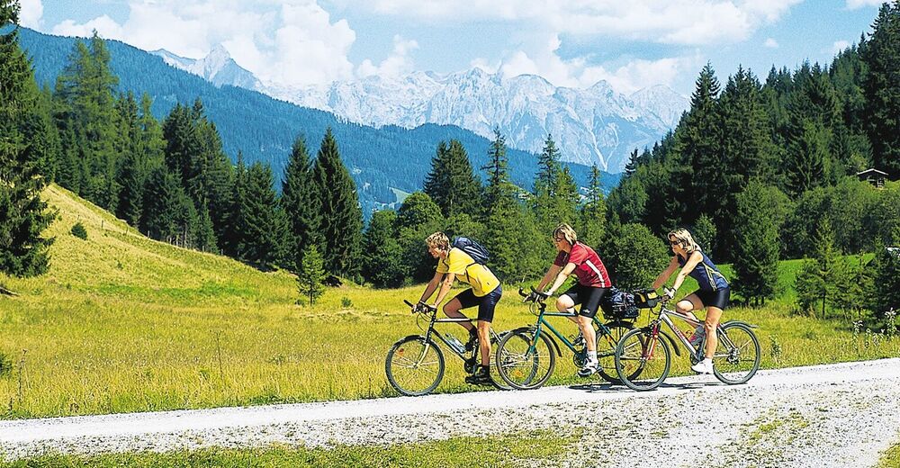
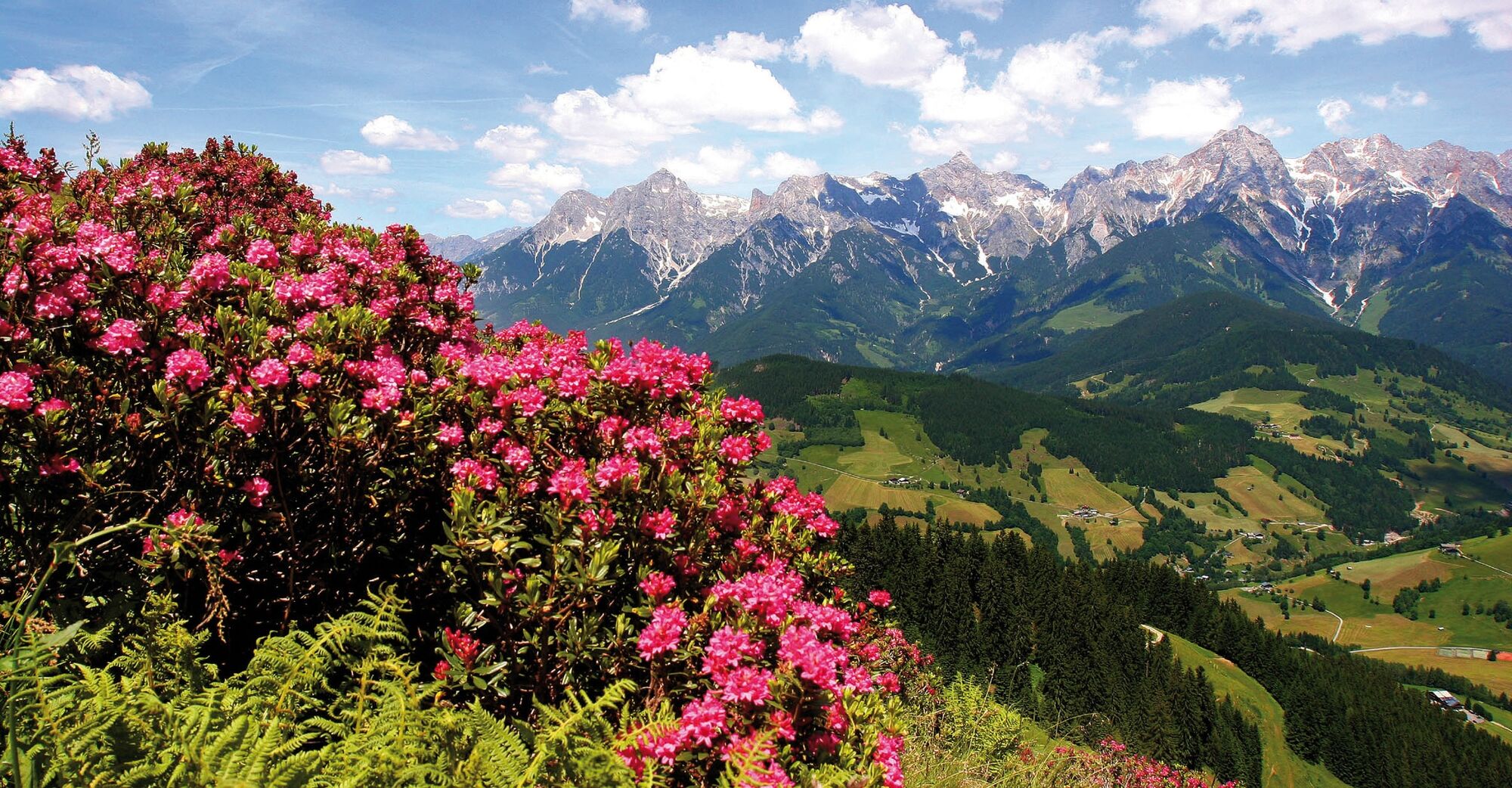
Our route crosses the Griessbach (stream) at the entrance to Maria Alm and leads towards Krallerwinkl. After about 2.5 km, the trail branches off to the right. The paved road ends after the last farm. The following forest road leaves the forest after 2 km, where in a game reserve deer can be seen. Immediately afterwards, we have reached our next destination, the Gasthof Jufen (1,100 m). Just above the Inn is a crossing point to numerous other hiking trails and the Weitwanderweges (long-distance hiking trail) 01A. Here is the actual parking lot of the Inn, and where the paved road begins again. Alternatively, you can take the new Natrunbahn cable car up (taking your bikes along) from the Maria Alm town centre east of the Natrun to connect back onto the main route. Trail Tip: The 3.3km long Trail Flow One from the Natrunbahn Mountain Station to the Valley Station! At this point, one has to ride down 100 m into the valley and then onto the main road (Caution: traffic) to be able to climb the Hinterthal. From there, we cycle into the village to the church, turn to the right and continue upwards, and at the end of the village turn right again. Here an unpaved path begins, initially down to the creek, before it rises quite steeply. The surface is not the best. In the last bend before Filzensattel, we reach the federal road (1,200 m). For the last 90m altitude, we must endure the heavily trafficked road. 50 m in front of the Filzensattel (1,290 m) we turn right and leave the main road again. At this point, we still haven't reached the highest point of the route. Our trail climbs to a wide forest track again (approx. 100 m). What follows are only a few light ascents and descents, where throughout one can see the final destination, Dienten am Hochkönig. From the turn off before the Grüneggbach stream, where the main route bears left down towards the Jausenstation Grünegg, we cycle almost parallel on until we reach the paved road at Hof Scheibegg. We follow this down via Hirschegg into the valley. We stay on the main road for about 3.5km until we bear left 500m after the Feroli. A moderate climb takes us up to Böndlsee Lake with several refreshment opportunities. On the following section of road to St. Veit there are no major ascents or descents. At the district of Urpass we stay left until above St. Veit where we turn sharply left. From here it is about 20.8km to Bischofshofen merging onto the main route. Here, the trail goes steeply uphill and only flattens out after Pointleiten towards the Hubertuskapelle Chapel. Here, the paved road also finishes. We switch onto the forest road with a steep incline for next few kilometres (the highest point of this section at around 1,400m altitude). Thereafter, it gets easier. We cycle along flat and a little downhill past the Pronebenalm (a beautiful view of the Hochkönig and Mühlbach) and through the Hengstbachwald forest. At the next fork in the trail, we stay left until we reach the fork after Mühlbach where we bear right. After a short climb (around 200m), it is flatter and a little downhill until we finally feel the ascent again just below the Kohlmaißhöhe. After conquering this last climb, it goes steeply downhill (Caution – deep water channels cross the trail, risk of falling!). The paved road starts again above Englmair (stunning view of the Salzach Valley), but still goes steeply downhill. At the crossing in Mitterberghütten (Lutz-Halle) we bear right, ride down to and across the main road. Now, we continue on to the left and then right through the underpass at the train station. Thereafter, we take the gravel path left along the Salzach River, past the dam until we merge again onto the paved road and arrive in the centre of Bischofshofen (main route connection).
- Highest point
- 1,405 m
- Endpoint
-
Bischofshofen
- Height profile
-

- Additional information


- Author
-
The tour Watzmann-Hochkönig South-Loop: Stage 5: Variant via St. Veit im Pongau is used by outdooractive.com provided.


General info
-
Hochkönig
357
-
Goldegg am See
106