
- Brief description
-
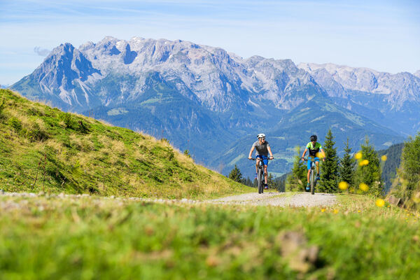
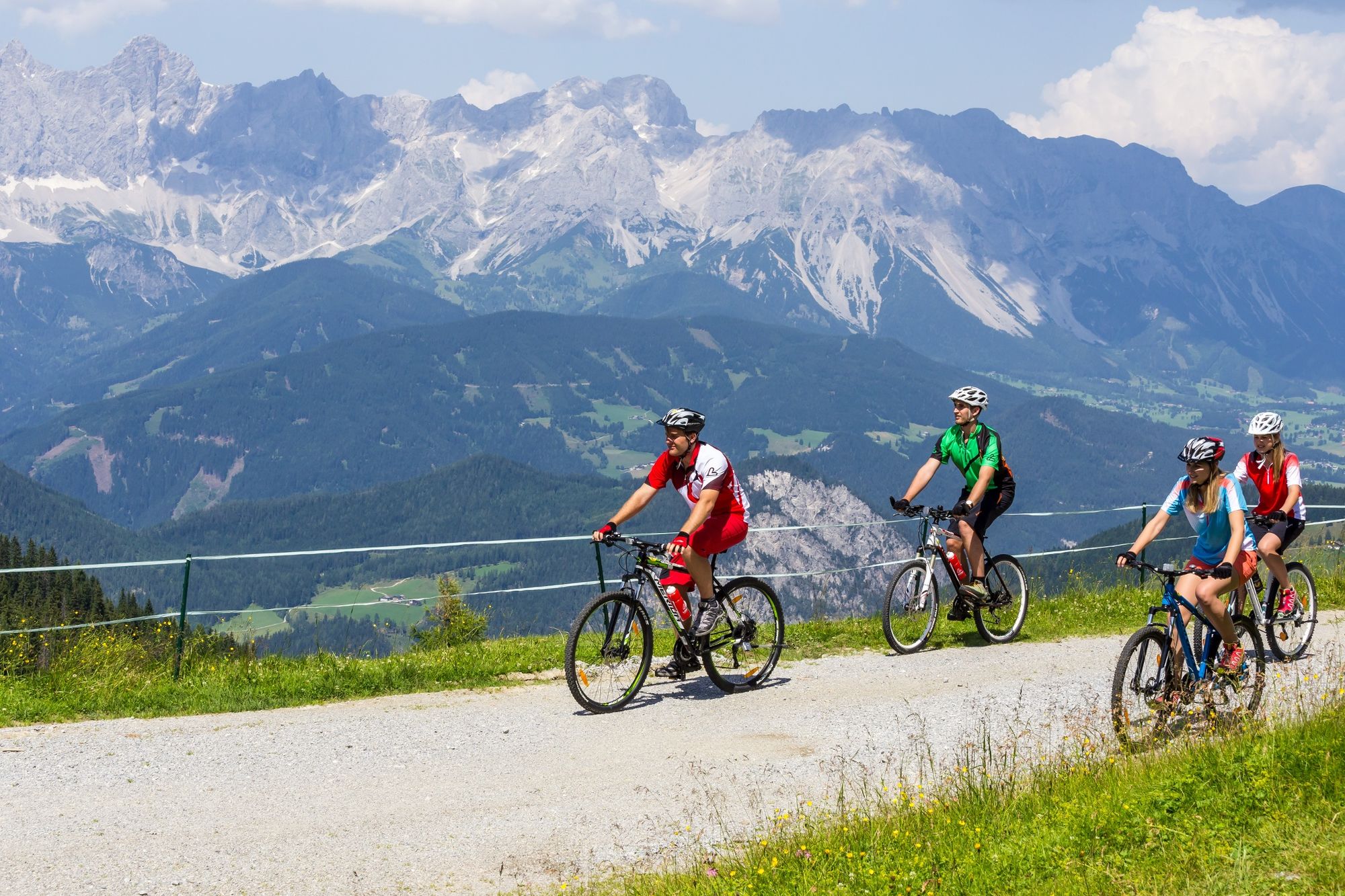
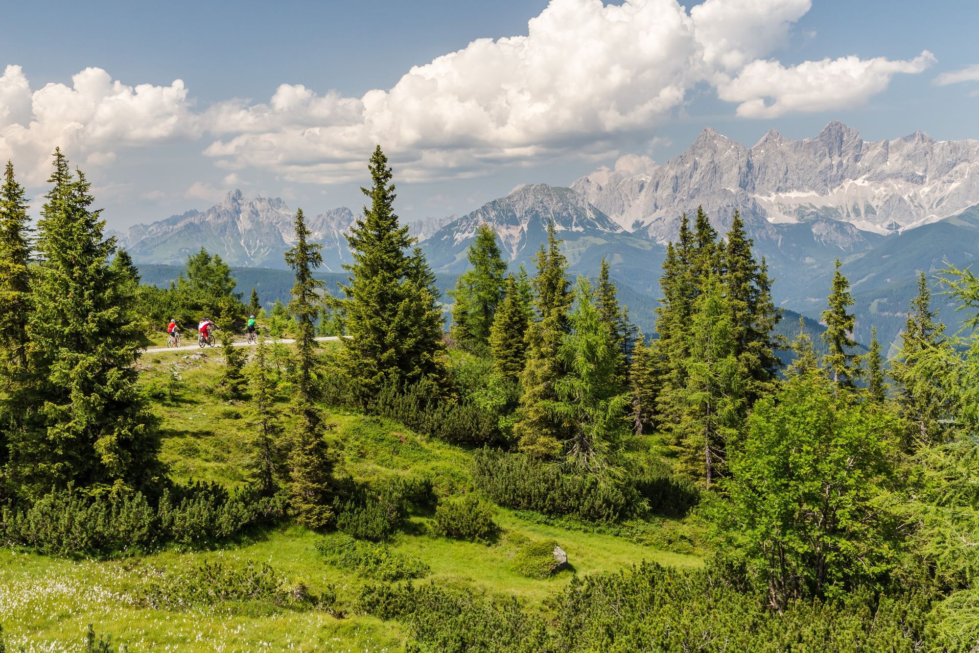
Classic mountain bike tour to the beautifully situated ski area.
- Difficulty
-
difficult
- Rating
-
- Starting point
-
Tourist office Flachau
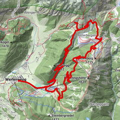
- Route
-
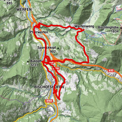
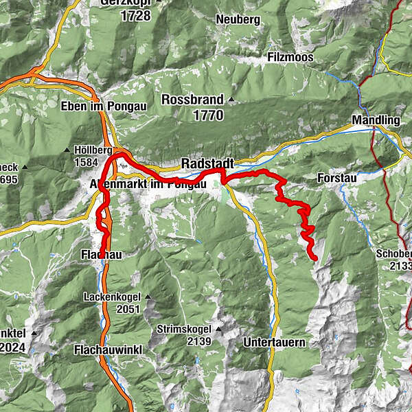
FlachauSinnhub7.4 kmAltenmarkt im Pongau8.5 kmKrallinger9.0 kmRadstadt (858 m)11.8 kmUnterbergalm22.2 kmLechneralm22.5 kmPremhütte22.7 kmTrinkeralm24.7 kmZeffereralm24.7 kmPremhütte26.8 kmLechneralm27.0 kmUnterbergalm27.3 kmRadstadt (858 m)37.7 kmKrallinger40.4 kmAltenmarkt im Pongau40.9 kmSinnhub41.9 kmFlachau49.5 km
- Best season
-
JanFebMarAprMayJunJulAugSepOctNovDec
- Description
-
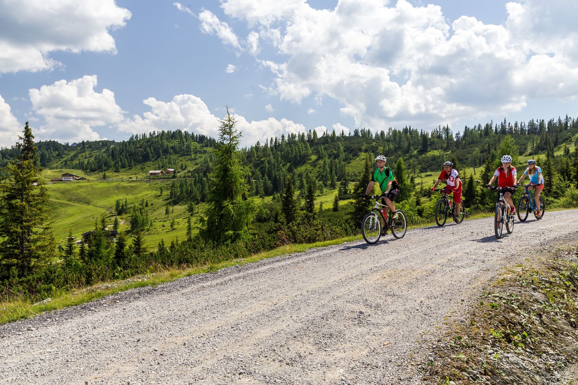
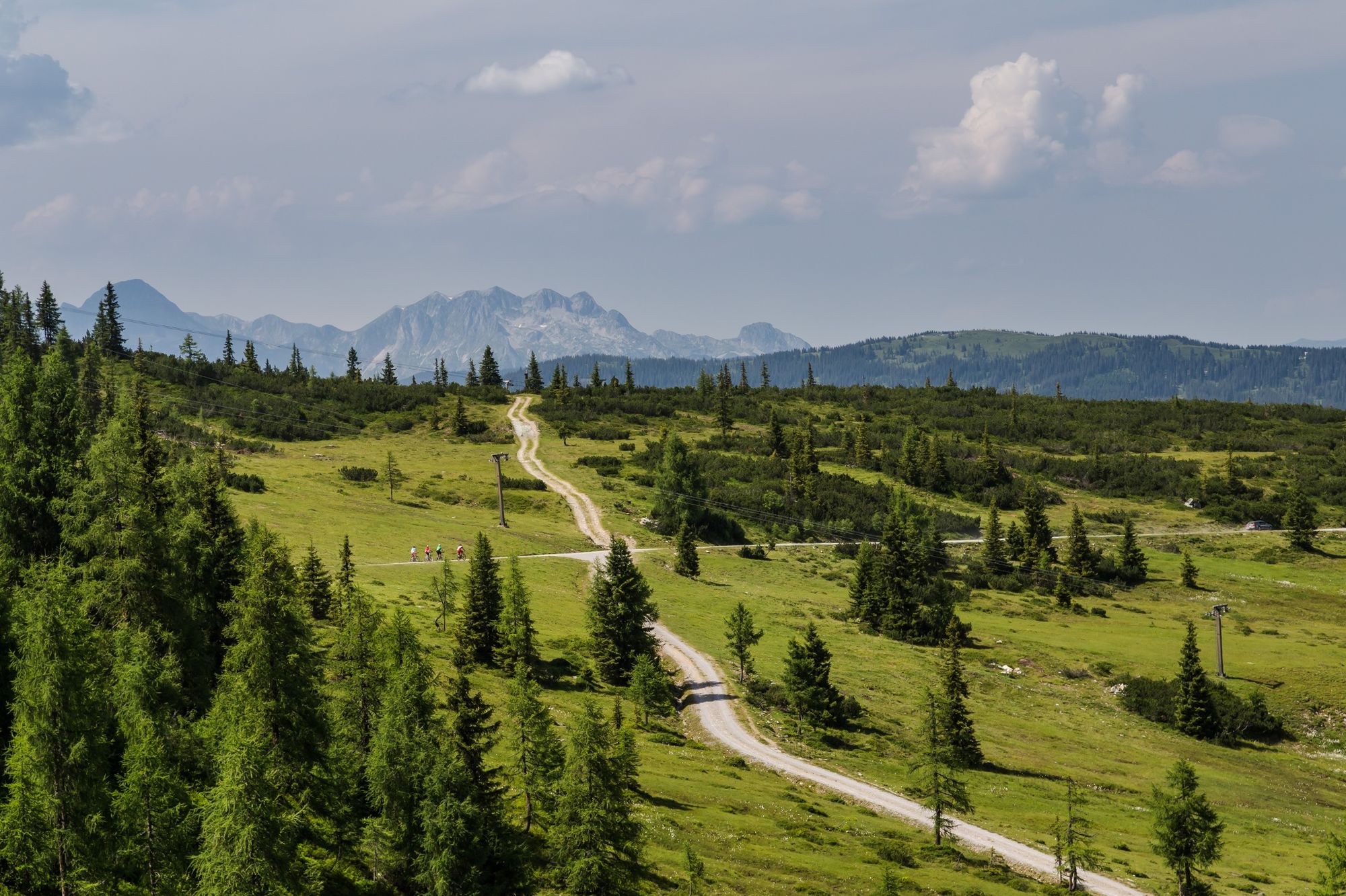
We cover more than 900 meters of altitude difference until we can enjoy the view and a cool drink on the terrace of the Trinkeralm. Via the Ennsradweg we start from Flachau in the direction of Radstadt, where we then start the tour. We continue on the road towards Forstau, which we leave after a little more than 5km. After another kilometre on an asphalt side road, the forest path begins, which takes us in many bends and hairpin bends in a fairly constant gradient through the forest up to the extensive alpine pasture region of the Fageralm, which is used as a ski area in winter. The higher you get, the fewer the trees, the better the view. From the guesthouse at the end of the tour you have a wonderful, unobstructed view of the whole region and over to the mighty Dachstein Mountains. Here, one gets real anticipation and the desire for the next ski winter. The way back to Radstadt is the same as the ascent. From there it goes over the Ennsradweg back to Flachau.
- Directions
-
Start at Flachau Tourismus - over the bridge and then left in the direction of the miniature golf course - follow the signposted Ennsradweg in the direction of Altenmarkt and further in the direction of Radstadt - in Radstadt, pass the grammar school - turn right at the sawmill - pass the Pirnbacher car dealership and Billa supermarket - turn left at the following roundabout (3rd exit on the right) - turn right at the roundabout (3rd exit on the right). At the following roundabout turn left (3rd exit) in the direction of Forstau - approx. 4 km moderately rising on country road in the direction of Forstau - at km 16.9 turn right in the direction of Fageralm / Trinkeralm - at km 17.9 the asphalt road changes into a gravel path - at km 25.1 the turning point and highest point of the tour is reached - the same route takes you back to the starting point in Flachau
- Highest point
- 1,747 m
- Endpoint
-
Tourist office Flachau
- Height profile
-

- Equipment
-
A mountainbiker's basic equipment:
protective gear enough to drink and eat for inbetween sunglasses, optionally sun cream or rain cover mobile phone - Safety instructions
-
Check the functionality of your mountain bike before each ride and inform yourself in about the current weather on site. For your own safety, we recommend to wear a helmet.
- Tips
-
At the tourist info Flachau you get a bike map with information to this tour.
- Additional information
-
This mountain bike tour is also suitable for e-bikes! Charging stations are available in the village center at Flachau.
Here you'll find more about mountainbiking in Flachau: https://www.flachau.com/en/sport/hiking-biking/mountain-bike.html
Info on the current weather on site: https://www.flachau.com/en
- Directions
-
to Flachau Center / Tourist office Flachau
- Public transportation
-
From June to September, the Sportweltbus is the ideal shuttle service for your bike tours in the entire region (Flachau, Wagrain-Kleinarl, St. Johann-Alpendorf, Radstadt, Altenmarkt-Zauchensee, Eben, Filzmoos, Obertauern, Großarl & Hüttschlag).
With the Flachau Summer Card you can use the Sportweltbus for only Euro 1,00 per person and route. Children under 6 years travel free!
More information at: https://www.flachau.com/en/more/information/sportweltbus.html
- Parking
-
Parking space near the starting point.
-

-
AuthorThe tour Fageralm-Tour (SW 15) is used by outdooractive.com provided.


General info
-
Schladming - Dachstein
405
-
Salzburger Sportwelt
338
-
Radstadt
134