BIG-5 Bike Challenge in Saalbach Hinterglemm Leogang (2020)


- Brief description
-
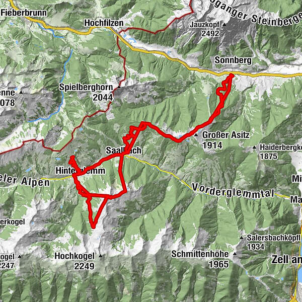
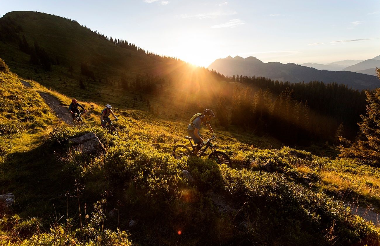
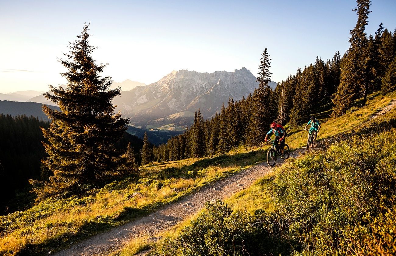
The BIG-5 Bike Challenge covers the 5 cable cars and 5 mountains around Saalbach Hinterglemm and Leogang, combining them into a XXL tour that guarantees you the absolute maximum enduro pleasure in one day.
- Difficulty
-
difficult
- Rating
-
- Starting point
-
Valley station ot the Leogang Bergbahn cable car
- Route
-
SaalbachKohlmaisbahn Talstation0.0 kmMontelino's Wildfütterung1.9 kmKohlmaiskopf (1,794 m)2.3 kmMontelino's Erlebnisweg2.3 kmKohlmaisbahn Bergstation2.3 kmAlte Schmiede8.0 kmhendl fischerei8.1 kmKraller Alm15.9 kmSteinbergbahn I16.2 kmRain16.8 kmKniestichkogel (1,570 m)17.0 kmSteinbergbahn II18.0 kmhendl fischerei18.0 kmSteinbergbahn Mittelstation18.5 kmAlte Schmiede18.6 kmPanoramaalm26.9 kmEdel Weiss27.0 kmHl. Nikolaus und Hl. Bartholomäus32.0 kmSaalbach32.1 kmSchattberg X-press Talstation32.3 kmSchattberg X-press Mittelstation33.5 kmSkyRest33.6 kmSchattberg-Ost (2,018 m)33.9 kmSchattberg X-press Bergstation33.9 kmWestgipfelhütte36.4 kmSchattberg West (2,096 m)36.5 kmWestgipfelbahn Bergstation36.6 kmHacklbergalm39.3 kmOberschwarzachlifte45.2 kmHinterglemm46.4 kmReiterkogelbahn46.5 kmReiterkogelbahn47.6 kmHasenau50.2 kmWestgipfelbahn Talstation51.4 kmWestgipfelbahn Mittelstation52.7 kmSchattberg West (2,096 m)52.8 kmWestgipfelbahn Bergstation52.8 kmHacklbergalm56.8 kmOberschwarzachlifte62.7 kmHinterglemm63.9 kmWieshoflift64.5 kmMitteregglift64.8 kmAchrain65.4 kmEibing65.9 kmSaalbach67.8 kmHl. Nikolaus und Hl. Bartholomäus67.8 km
- Best season
-
JanFebMarAprMayJunJulAugSepOctNovDec
- Description
-
The BIG-5 Bike Challenge covers 6 cable cars and 5 mountains around Saalbach Hinterglemm and Leogang, combining 5.000 downhill meters into a XXL tour that guarantees you the absolute maximum enduro pleasure in one day.
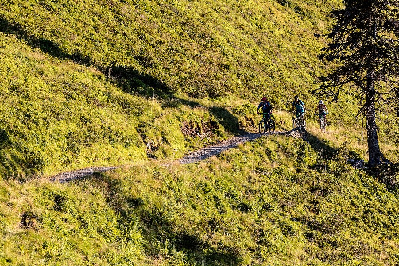
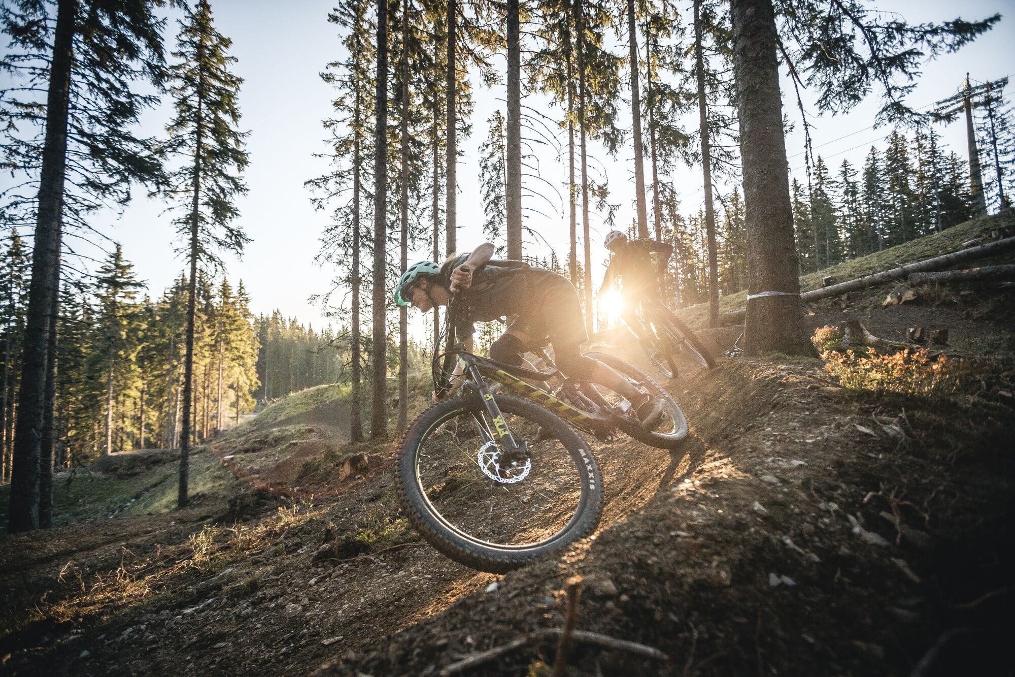
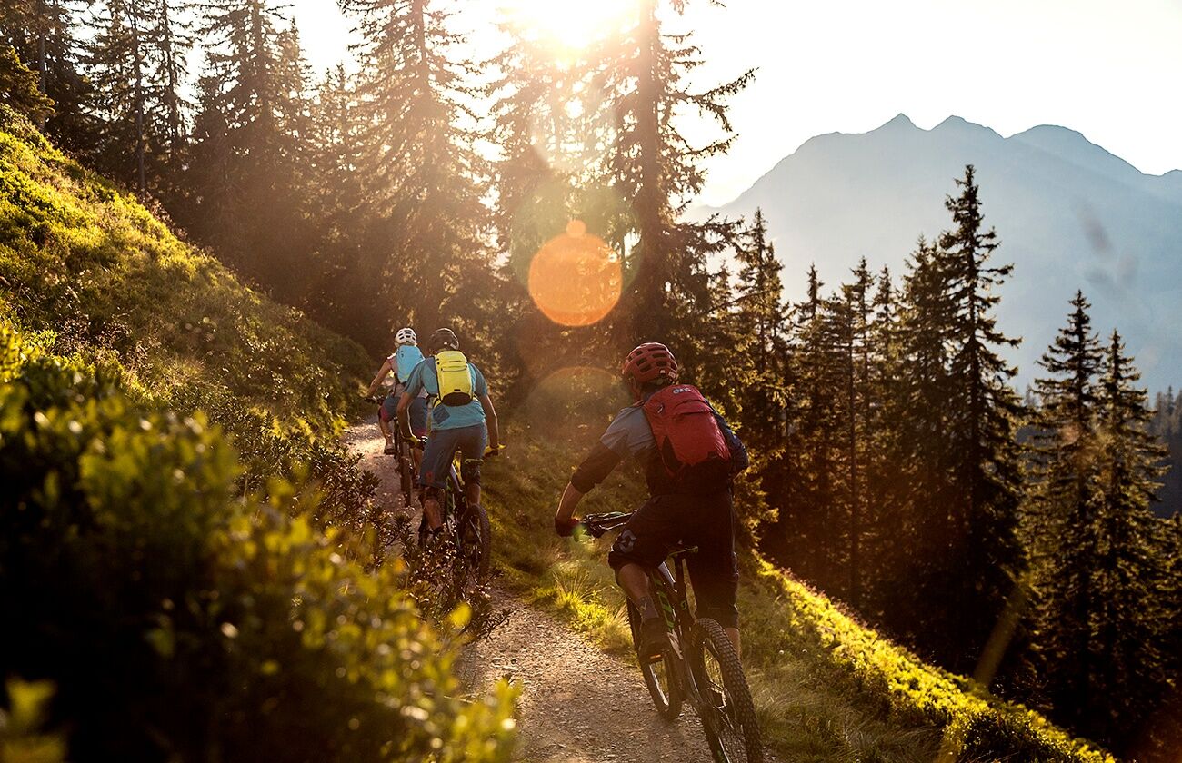
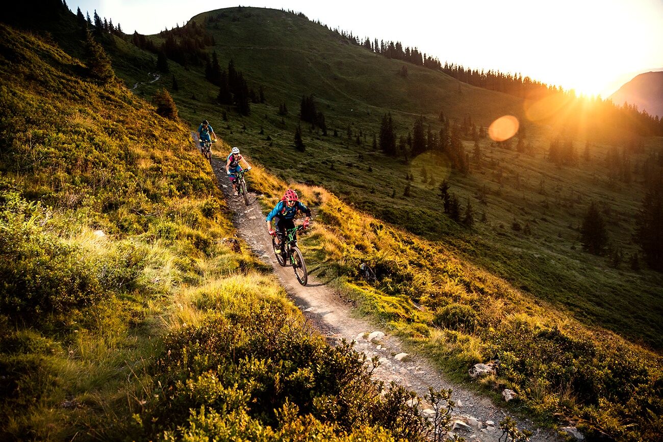
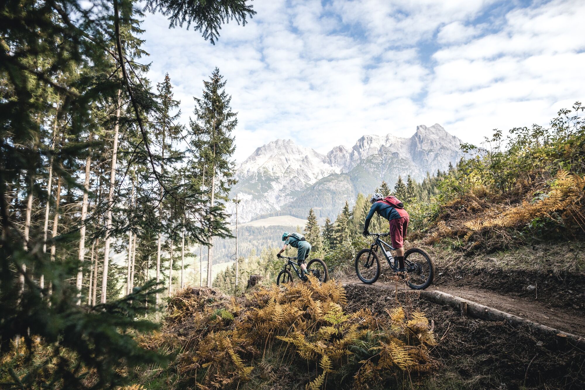
The BIG-5 Bike Challenge combines six cable cars and five mountains around Saalbach Hinterglemm and Leogang in one big XXL tour to experience the absolute maximum of bike pleasure in one day. Each mountain is covered with exciting trails for maximum biking pleasure. During the BIG-5 Bike Challenge, you will get to experience the best bike trails in the region within a single day.
The given route already guarantees you the first around 5,000 vertical meters, of which you only have to conquer a few vertical meters on your own steam, because the rest is covered by cable cars. During the challenge, however, everyone is free to take one or the other extra round on their favorite mountain to catch up some additional vertical meters. But be careful: don't take too much time, because the BIG-5 tour itself takes almost the whole day. What counts at the end of the day is not just the descent of all five mountains, but the experience itself and the fantastic memory of this impressive tour.
Trailstatus: bikepark-leogang.com/en
- Directions
-
Turn-by-turn directions
Note: The following route description is just a recommendation. The BIG-5 Bike Challenge can of course be started and finished at any of the lifts.
KOHLMAISBAHN - Saalbach
The Kohlmaisbahn valley station is just a few metres from the centre of Saalbach. The Kohlmaisbahn lift takes you up to the peak of the Kohlmais at approximately 1.790 m above sea level. The Kohlmais is home to the beginnerfriendly Monti-Trail and the Panorama-Trail, always great for a relaxing warmup lap. Attention: Owners of BIG-5 tickets can use each of the six cable cars only one time, so no reruns are possible!
Once at the summit, take a right and you will find the start of the Panorama-Trail. You then head off for the first 300 m along the Panorama-Trail. At the first fork, leave the Panorama-Trail and ride a little bit behind the top station of the Panorama 6-seater chair lift, and then continue along the Wurzel-Trail (rooty trail) towards the Schönleitenhütte, then along the Asitz-Trail to the top station of the Asitzbahn and Steinbergbahn lift in Leogang. Note: The Wurzel-Trail is used by hikers as well as bikers and in both directions, please be sure to observe FAIR PLAY.
STEINBERGBAHN / ASITZBAHN – Leogang
Follow the flowing Steinberg Line by FOX as far as the valley station of the Steinbergbahn lift. Experienced bikers can also try the technically demanding Hangman I variation or the fast-paced Hot Shots. From the mid station, you can choose from the simple Hangman II, the moderately difficult Flying Gangster, or the difficult Speedster World Cup route.
After this varied descent, take the Steinbergbahn or Asitzbahn back to the top of the mountain. From the top station, you head off a little way towards the Asitzkopf peak, then after a few metres you turn right into the wood on the Asitz-Trail back to the Schönleitenhütte. If you want, you can of course also choose the steep ramp to the Asitzkopf summit with a wonderful panoramic view and descend from here to the Schönleitenhütte. Then either take the Wurzel-Trail (caution oncoming traffic!) back to Kohlmais and then take the Panorama-Trail towards to the Monti-Trail. Or alternatively follow the forest path down the Schönleitenhütte and after a few bends take the first turning off to the right in a section of woodland. A bit further on you pass the Thurneralm, then after the barrier a short trail the start of the Egger-Trail which heads over to the Panorama-Trail. Once in Saalbach, ride through the centre straight to the Schattberg X-press lift. Important: Only ride at walking speed in pedestrianized zones.
SCHATTBERG X-PRESS - Saalbach
The Schattberg X-press lift takes you up to 2.020 m above sea level where the X-Line starts, one of the longest and most varied downhill stretches in Europe. For those who want to, and have the time available, it’s possible to add an extra lap in here. And if you want to continue the BIG-5 just follow the X-Line for a few hundred metres and branch off at the Schattberg Sprinter valley station and take it up to the Schattberg Westgipfel summit, the highest point of the tour.
SCHATTBERG SPRINTER - Saalbach Hinterglemm
Thanks to the Schattberg Sprinter, you save yourself the tedious uphill climb to the Westgipfel summit. Once there, the easy Hacklberg-Trail and the challenging Bergstadl-Trail are already waiting for you. You can decide! Both trails take you to the mid station of the Westgipfelbahn lift. You can choose! From there, the Buchegg-Trail takes you down to Hinterglemm.
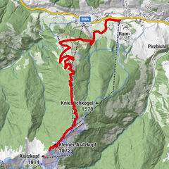
12ER KOGEL BAHN - Hinterglemm
The 12er KOGEL Bahn lift is located near to the Westgipfelbahn valley station and takes you to the mid station of the Zwölferkogel at almost 1,500 m above sea level and the start of the Z-Line. Note: The mid station is also the end station for bikers with their mountain bikes! Right next to the exit of the mid station is the start of the Z-Line, which will lead you back into the valley.
REITERKOGELBAHN - Hinterglemm
The Reiterkogelbahn valley station is in the centre of Hinterglemm. This lift takes you to approximately 1.500 m above sea level, where the next stage of your BIG-5 Bike Challenge begins. You have a difficult decision to make: Either you go for the fun Blue-Line, or you try out the somewhat more demanding Pro-Line to get back to Hinterglemm.
>> Depending on where you began the BIG-5 Bike Challenge, you should now find yourself either at the end of your XXL tour, or right in the middle of it.
- Highest point
- 2,086 m
- Endpoint
-
Valley station of the Leogang Bergbahn cable car
- Height profile
-

- Equipment
-
In addition to repair tools and extra tubes, it is essential to pack enough water and clothes for this day trip.
- Safety instructions
-
What sort of bike you are best to use depends on the type of rider you are; it could be a cross-country, all mountain, enduro or freeride bike. In the uphill sections, cross-country bikers will clearly have an advantage, but then on the single trails, a enduro bike would clearly be better. In the end, it’s a matter of taste which bike you want to use for the tour. Why not complete the tour more than once so that you can find out your own best “setup” and thus take the enjoyment factor to its maximum.
- Directions
-
when you come from Saalfelden : about 4 km after the village entrance Leogang - turn left to the Leogang cable car.
when you come from Tyrol : about 9 km after the village entrance Hochfilzen - turn right to the Leogang cable car.
- Parking
-
directly at the valley station of the Leogang Bergbahn cable car


-

-
AuthorThe tour BIG-5 Bike Challenge in Saalbach Hinterglemm Leogang (2020) is used by outdooractive.com provided.


-
Saalbach Hinterglemm
434
-
Hochfilzen
141