© Hotel Alpendorf - Aktivhotel Alpendorf
© Hotel Alpendorf - Aktivhotel Alpendorf
© Hotel Alpendorf - Aktivhotel Alpendorf
© Hotel Alpendorf - Aktivhotel Alpendorf
© Hotel Alpendorf **** ☀️

- Brief description
- Difficulty
-
medium
- Rating
-
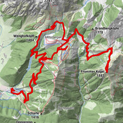
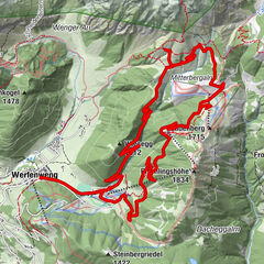
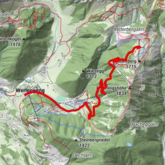
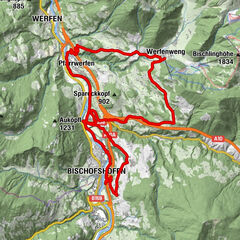
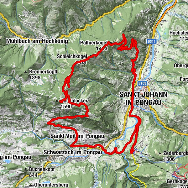
- Route
-
Alpendorf0.1 kmReitlehen1.1 kmSankt Johann im Pongau3.7 kmSt. Johann im Pongau3.8 kmSankt Johann im Pongau3.9 kmPalfnerdörfl4.8 kmPalfner Dörfl5.1 kmEinöden6.6 kmPalfnerkogel (1,413 m)13.2 kmSchleichkogel (1,421 m)14.6 kmSankt Veit im Pongau28.6 kmHotel Metzgerwirt28.8 kmSchwarzach im Pongau29.4 kmGrafenhof31.2 kmOka-Bichl32.8 kmPlankenau33.7 kmSankt Johann im Pongau35.3 kmReitlehen36.7 kmAlpendorf37.7 km
- Best season
-
JanFebMarAprMayJunJulAugSepOctNovDec
- Highest point
- 1,578 m
- Endpoint
-
Alpendorf, St. Johann im Pongau
- Height profile
-


-

-
AuthorThe tour Mountainbiketour zum Hochglocker is used by outdooractive.com provided.
GPS Downloads


General info
Refreshment stop
Other tours in the regions