© Wanderhotel Kirchner - Christian Kirchner

© Wanderhotel Kirchner - Christian Kirchner

- Brief description
-
Moutainbiketour abseits von touristischen Pfaden
- Difficulty
-
difficult
- Rating
-
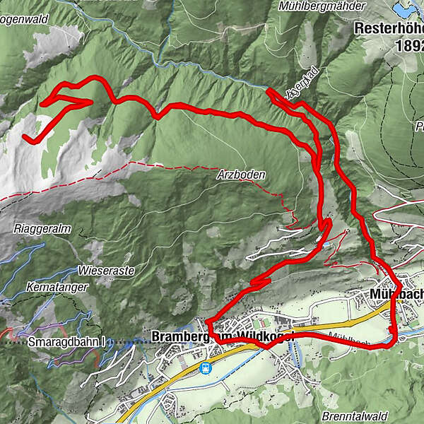
- Route
-
Mühlbach0.0 kmBramberg am Wildkogel2.3 kmSonnberg4.9 kmGeislhof5.0 kmBergkristall5.4 kmMühlbach23.6 km
- Best season
-
JanFebMarAprMayJunJulAugSepOctNovDec
- Highest point
- 1,776 m
- Endpoint
-
Wander & Bikehotel Kirchner
- Height profile
-


-
-
AuthorThe tour Bramberg - Entscharrn Hochalm is used by outdooractive.com provided.
GPS Downloads


Other tours in the regions