Hüttschlag: Kreealmen - Murtörl - Schmalscharte - Schwarzseen


- Brief description
-
Wonderful mountain tour to the Schwarzseen, but which requires stamina, surefootedness and you have to be free of dizziness.
- Difficulty
-
difficult
- Rating
-
- Starting point
-
Parking lot Hüttschlag valley end
- Route
-
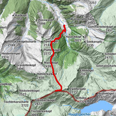
Kreealm-Wasserfall0.5 kmKreealm Kreehüte2.1 kmKreealm2.7 kmKreealm Bichlhütte2.7 kmKreealm Bichlhütte17.0 kmKreealm17.1 kmKreealm-Wasserfall18.7 km
- Best season
-
JanFebMarAprMayJunJulAugSepOctNovDec
- Description
-
This mountain tour starts at the parking space at Gasthof Talwirt. Here you will find local delicacies and you can buy smoked bacon. On the first floor of the Talwirt is the Bergwaldausstellung and an information point from the Hohe Tauern national park. The Hüttschlager Bauernladenstüberl is nearby, where you can also buy products from their own production.
Right next door is the valley museum of the Grossarltal.
You hike past the Stockham farm in the direction to the Kreealmen. Right at the beginning of the path there is a cascade. On the way up, you have the choice whether you prefer the forestry road or the short-cuts through the forest. Shortly before the mountain huts you reach a small chapel. This is a place to stop and should encourage every hiker to say thank you.
There are two mountain huts on the Kreealm, the Kreealm-Kreehütte is the lower one, the upper one is the Kreealm-Bichlhütte. On both huts, you will be spoiled with delicacies from your their own production (cheese, butter, bread, bacon or sausages).
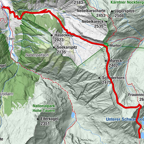
After a short rest, you continue upwards through meadows to the Murtörl. Here it is often very windy, so it can happen that you hike everywhere with short sleeves and that on the Murtörl it is rather cold.
You hike to the Schmalzscharte. A little below the Schmalzscharte is the "Albert-Bivouac", which is a sleeping place for hikers in need. The "Albert-Bivouac" is a small, lovingly designed cottage.
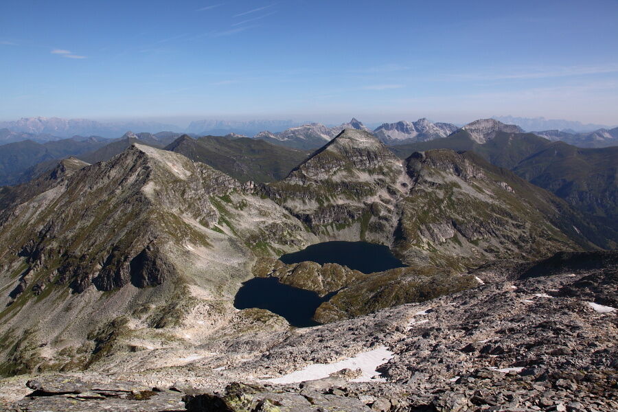
From Schmalzscharte you can already see the lower Schwarzsee. The piece along the "Tauern-Höhenweg" between the "Schmalzscharte" and the upper "Schwarzsee" is demanding. There is a short climbing passage between the upper and lower Schwarzsee. You have to be free of dizziness and surefootedness is requrired there.
The landscape at the Schwarzseen is unique and invites you to linger, but be careful: you have to go back the same way. That means, that you have to hike the same time back.
Attention: There is no possibility to eat (except of the Kreealmen) on the whole route, so enough food and beverages with you!
- Directions
-
You hike from the parking space at the valley end of Hüttschlag - past the Stockham farm - after the first bridge turn left. You hike up the path no. 724, 51 in serpentines to a small chapel (or alternatively: ascent along the forestry road) - from here onwards to the two Kreealmen (Kreehütte, 1,483 m and Bichlhütte, 1,570 m - approx 1 1/2 h). From here, you contine along the marked path (no. 724, 51) to the Murtörl, 2,260 m (approx. 2 h). You hike further on the path no. 702 to the Schmalzscharte, 2,244 m (approx. 2 h). You hike along the "Tauern-Höhenweg" to the both Schwarseen, 2,221 m (approx. 1 h). There is a climbing passage between the lower and the upper Schwarzsee. Back on the same route.
- Highest point
- 2,406 m
- Endpoint
-
Schwarzseen
- Height profile
-

- Equipment
-
hiking boots with grip sole, hiking map, food and beverages
- Safety instructions
-
Surefootedness, good stamina and experience on the mountains are required. You have to be free of dizziness.
Take enough food and beverages with you.
- Tips
-
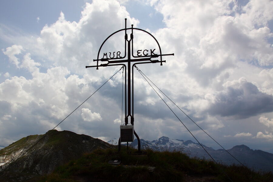
You could hike up from the Murtörl to the Mureck, 2,402 m (approx. 20 min. in one direction). Up there is a beautiful summit cross.
- Additional information
- Arrival
-
You go by car or public bus no. 540 to Hüttschlag and further into the valley end to the Gasthof Talwirt.
- Public transportation
- Parking
-
Parking lot Hüttschlag valley end

- Author
-
The tour Hüttschlag: Kreealmen - Murtörl - Schmalscharte - Schwarzseen is used by outdooractive.com provided.