- Brief description
-
The Keeskogel (2,884 m) is the hightest mountain in Grossarltal and the only glaciert. It is a challenge for all the mountaineers.
- Difficulty
-
difficult
- Rating
-
- Starting point
-
Parking lot Hüttschlag valley end
- Route
-
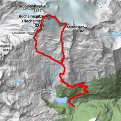
Talwirt0.1 kmBauernladenstüberl0.2 kmPertillkapelle0.3 kmSee0.6 kmModereggalm3.4 kmKeeskogel (2,884 m)8.9 kmModereggalm14.7 kmSee17.5 kmPertillkapelle17.7 kmBauernladenstüberl17.8 kmTalwirt17.9 kmHubertuskapelle18.0 km
- Best season
-
JanFebMarAprMayJunJulAugSepOctNovDec
- Description
-
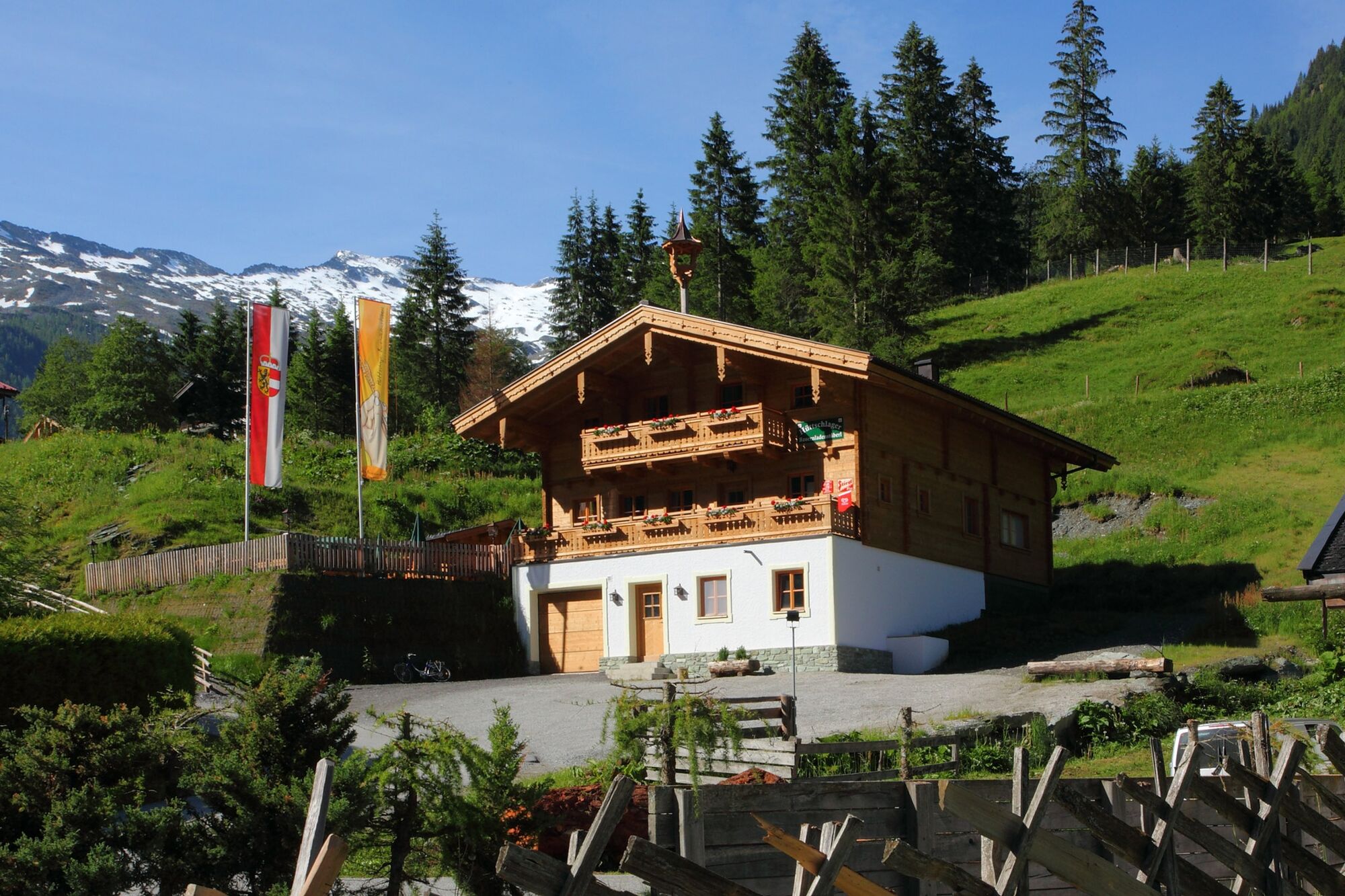
This hike starts at the parking space at the inn Talwirt in Hüttschlag. Here you can enjoy local delicacies and buy home-smoked bacon. Next to it is the Hüttschlager Bauernladenstüberl, where you can also taste and buy products from their own production.
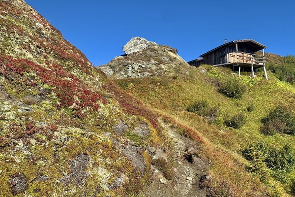
The trail leads past the Pertillbauer farm through meadows until you finally reach the high forest. The hiking trail leads a little steeper in serpentines to the Modereggalm. Shortly before you leave the forest, you pass a small hunting lodge. Once at the top, you will be mesmerised by the panorama. The Keeskogel, the highest mountain and the only glacier in our valley, watches over the Modereggalm area at 2,884 metres.
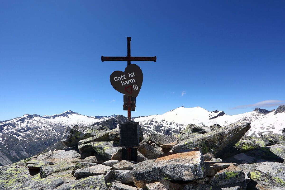
After the steep ascent, everyone has earned a delicious alpine snack at the Modereggalm. But don't forget - there is still a long stretch ahead of you.
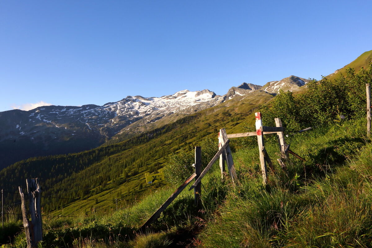
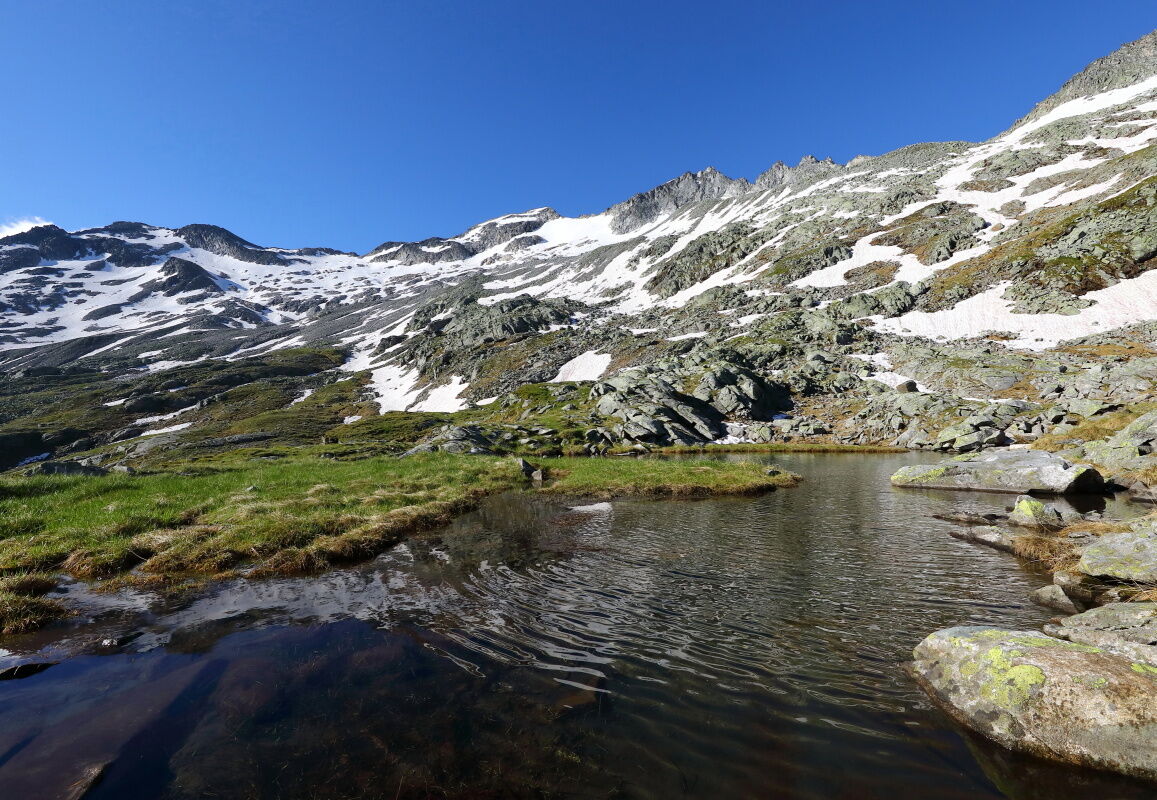
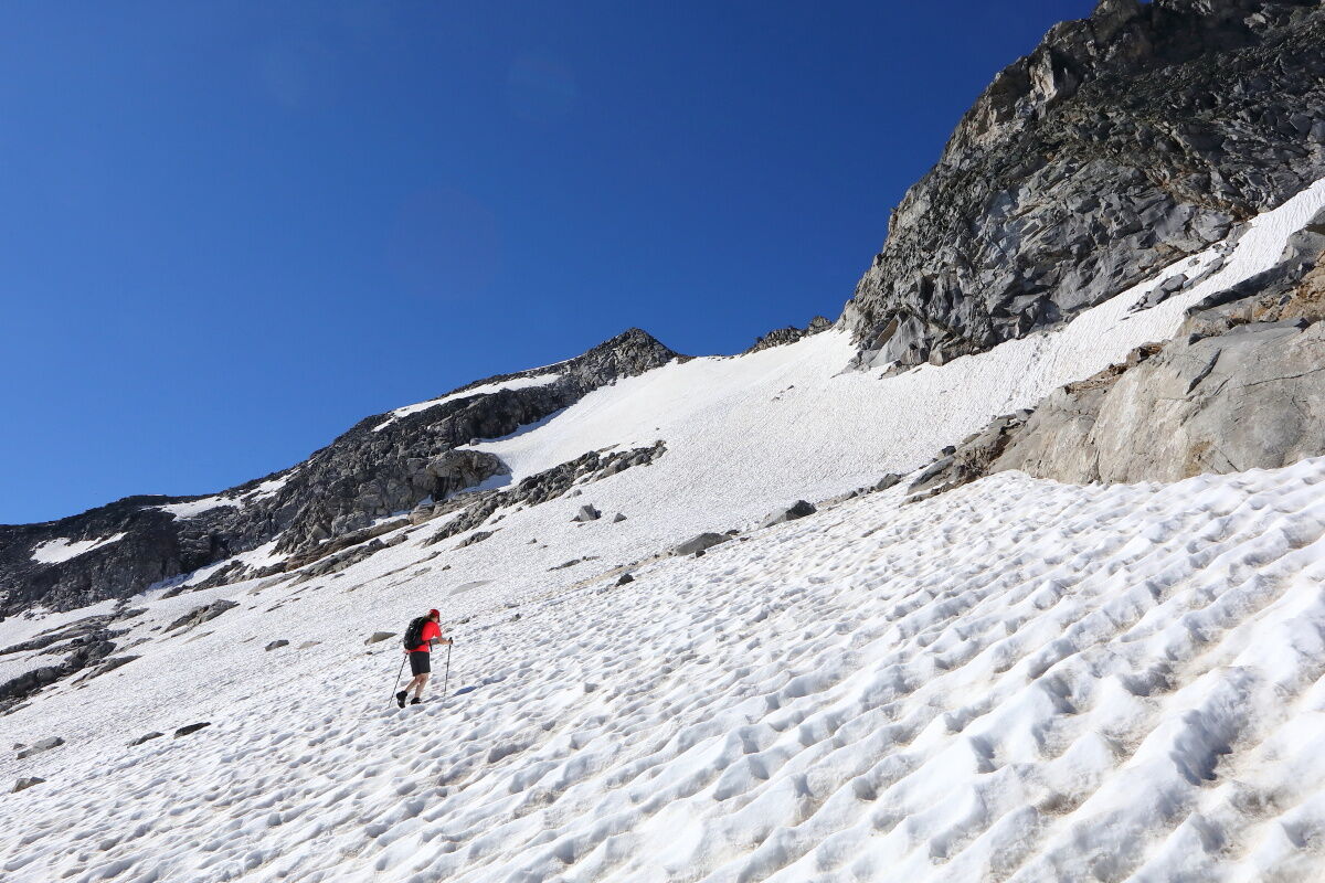
Continue along the marked hiking trail for a short stretch. Then you leave the marked paths and head into open terrain. There are a few footpaths, but otherwise you first have to hike over alpine meadows, then over stone slabs and finally over the glacier. You pass the Lienlacken, idyllic mountain lakes. The area is simply unique. Many sheep spend their summer holidays in this area. Continue to the glacier (the Gstößkees) - glacier experience is essential here!
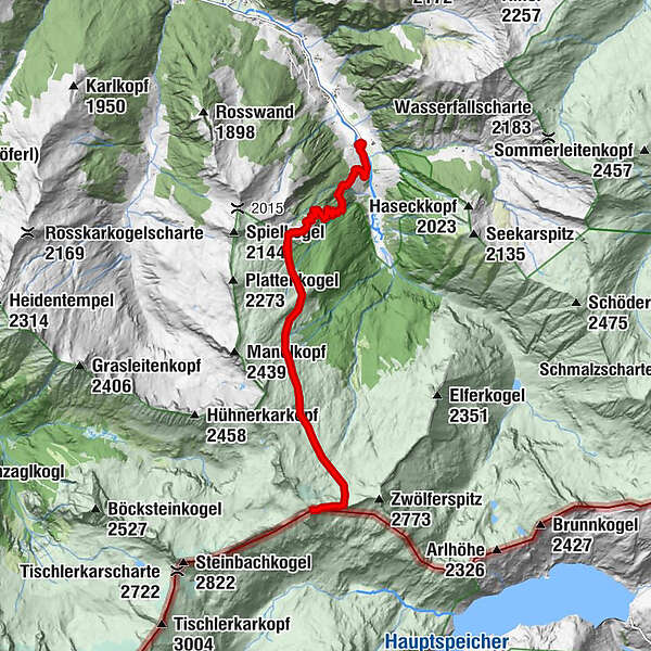
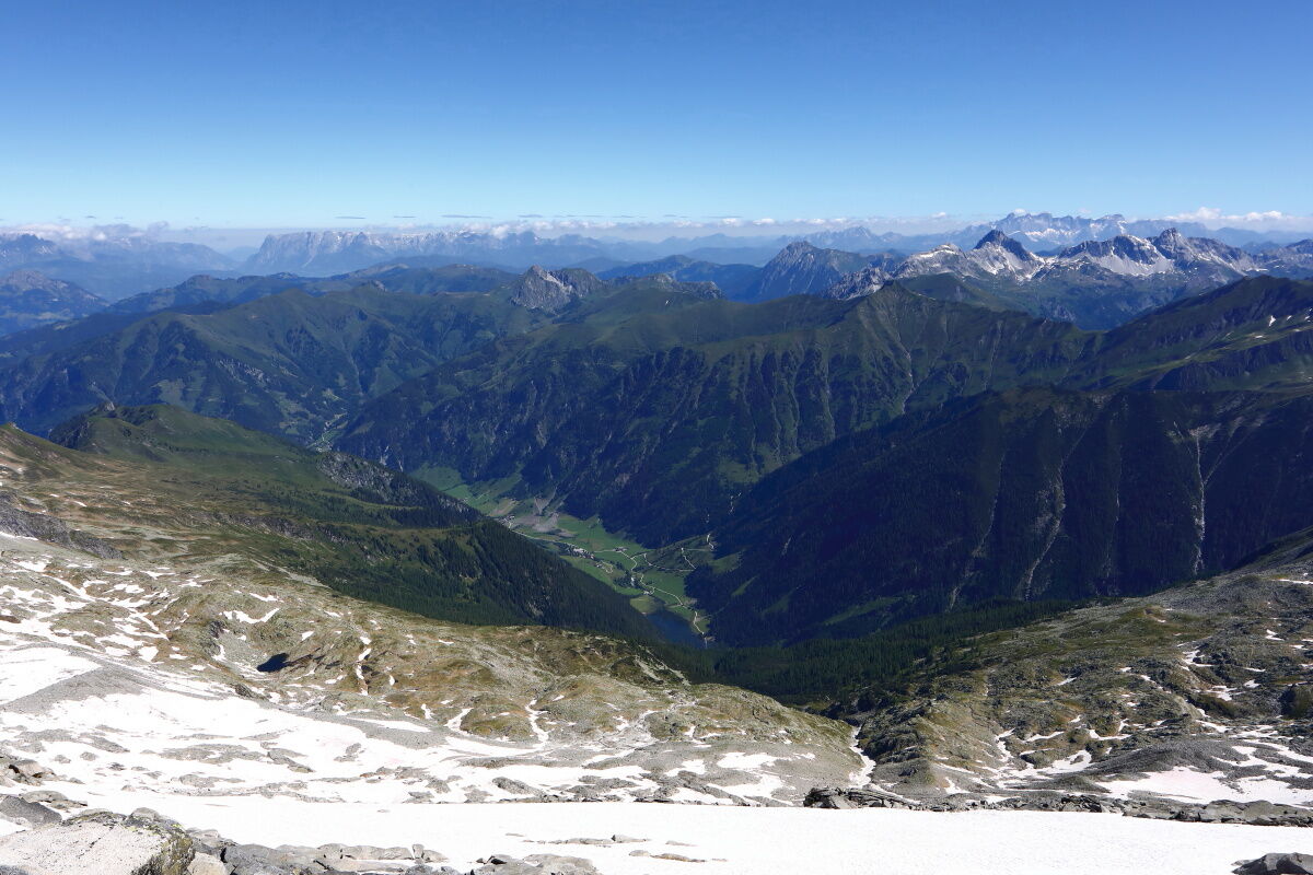
Over snow, ice and stone slabs you reach the Keeskogel, the highest mountain in Grossarltal. The view is simply breathtaking. On the other side of the valley you can see the Kölnbreinspeicher, a huge reservoir. You should not extend your rest at the summit for too long, as you still have at least five hours of descent ahead of you.
ATTENTION: As there is no marked path and you have to hike in open terrain (stone slabs, glaciers), you can ONLY do the tour with a local mountain guide! Make sure the weather is safe, as there is no way to protect yourself from bad weather.
- Directions
-
Travel by car or public bus to the end of the valley in Hüttschlag. From there you hike along the forest path to the Pertillbauer. Then follow the hiking trail (no. 50), first across meadows and finally through the forest over several hairpin bends, a little steeper up to the Modereggalm, 1,720 m (approx. 2 h). Follow the path uphill for a short distance and then across open terrain, first over alpine meadows, then over stone slabs and over the glacier to the Keeskogel, 2,884 m. There are occasional paths. Walking time from the Modereggalm approx. 4 1/2 hours. Ascent is also possible via the Aschlreitalm or the Hirschgrubenalm. Return via the same route.
ASCENT IS ONLY POSSIBLE WITH A LOCAL MOUNTAIN GUIDE!!!
ATTENTION: The variant shown on the map is a possible variant. It may not be possible due to weather, snow conditions or avalanche danger.
- Highest point
- 2,863 m
- Endpoint
-
Keeskogel
- Height profile
-

- Equipment
-
Mountain boots with treaded soles, crampons for the glacier, hiking map, drinks & provisions for the journey, first aid pack
- Safety instructions
-
A sense of orientation and glacier experience are necessary! You will have to climb a total of around 1,800 metres in altitude and you should expect a minimum walking time of 10 hours. Strength and fitness are essential. You will not pass any serviced huts for a long time, so you will need plenty of provisions for this high mountain tour. Be sure to check the weather forecast before starting the tour, as safe weather is essential.
- Tips
-
The best time to climb the Keeskogel is in June and July.
- Additional information
- Directions
-
You go by car or public bus no. 540 to Hüttschlag and further to the valley end to Stockham.
- Public transportation
- Parking
-
parking space at the valley end Hüttschlag - Talwirt
- Author
-
The tour Hüttschlag: Keeskogel is used by outdooractive.com provided.