- Brief description
-
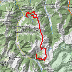
3-days hiking tour along the Salzburger Almenweg from Hüttschlag to Grossarl.
- Difficulty
-
medium
- Rating
-
- Starting point
-
Parking lot Hallmoosalm
- Route
-
Karteistörl (2,146 m)4.6 kmTappenkarseehütte6.0 kmTappenkarsee Alm7.1 kmDraugsteinalm-Schrambachhütte10.0 kmDraugsteinalm-Steinmannhütte10.0 kmDraugsteinalmen10.0 kmLoosbühelalm (Klausalm)15.7 kmWeißalm17.1 kmEllmaualm18.3 kmGerstreitalm25.1 kmHertas Rast27.9 kmGroßarl29.1 km
- Best season
-
JanFebMarAprMayJunJulAugSepOctNovDec
- Description
-
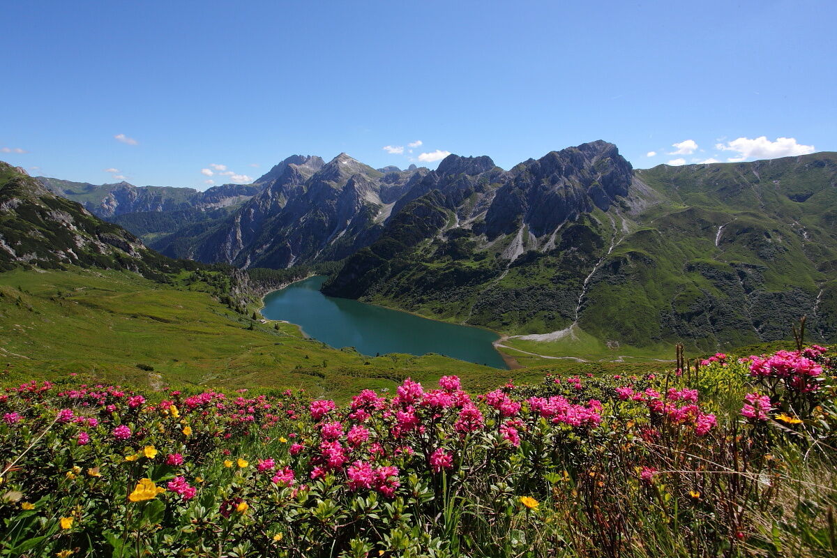
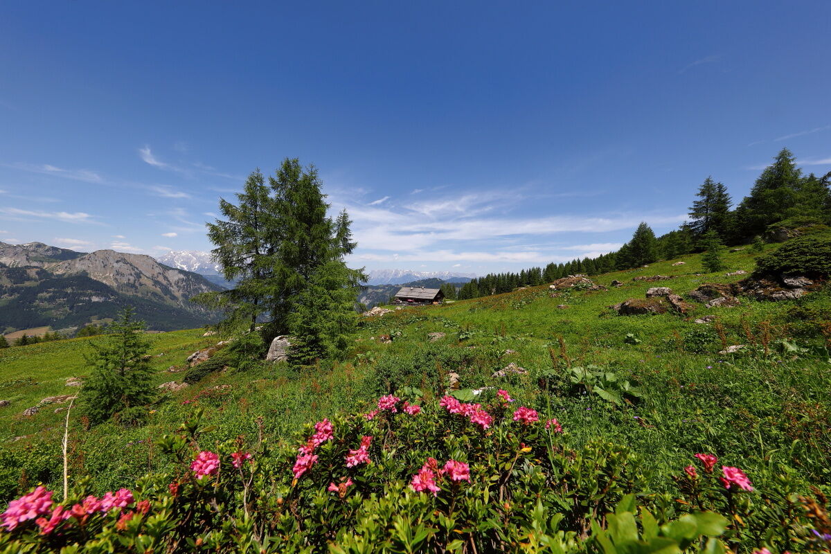
You start this 3-days hiking tour at the Hallmoosalm in Hüttschlag. After a short distance on the forest road you hike along a path to the Karteisalm (closed). Just before the mountain hut, there is an idyllic spring. The water in the mountains in Grossarltal is drinking water. You hike through meadows (very beautiful during the spring when the rhododendrons are there) to the Karteistörl. From here you have a magnific view to the Tappenkarsee, which is the biggest mountain lake in the Eastern Alps.
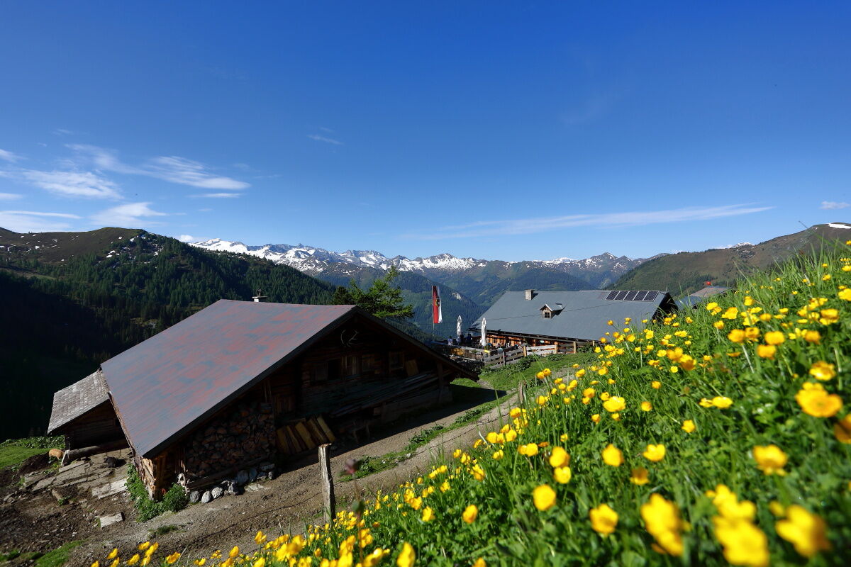
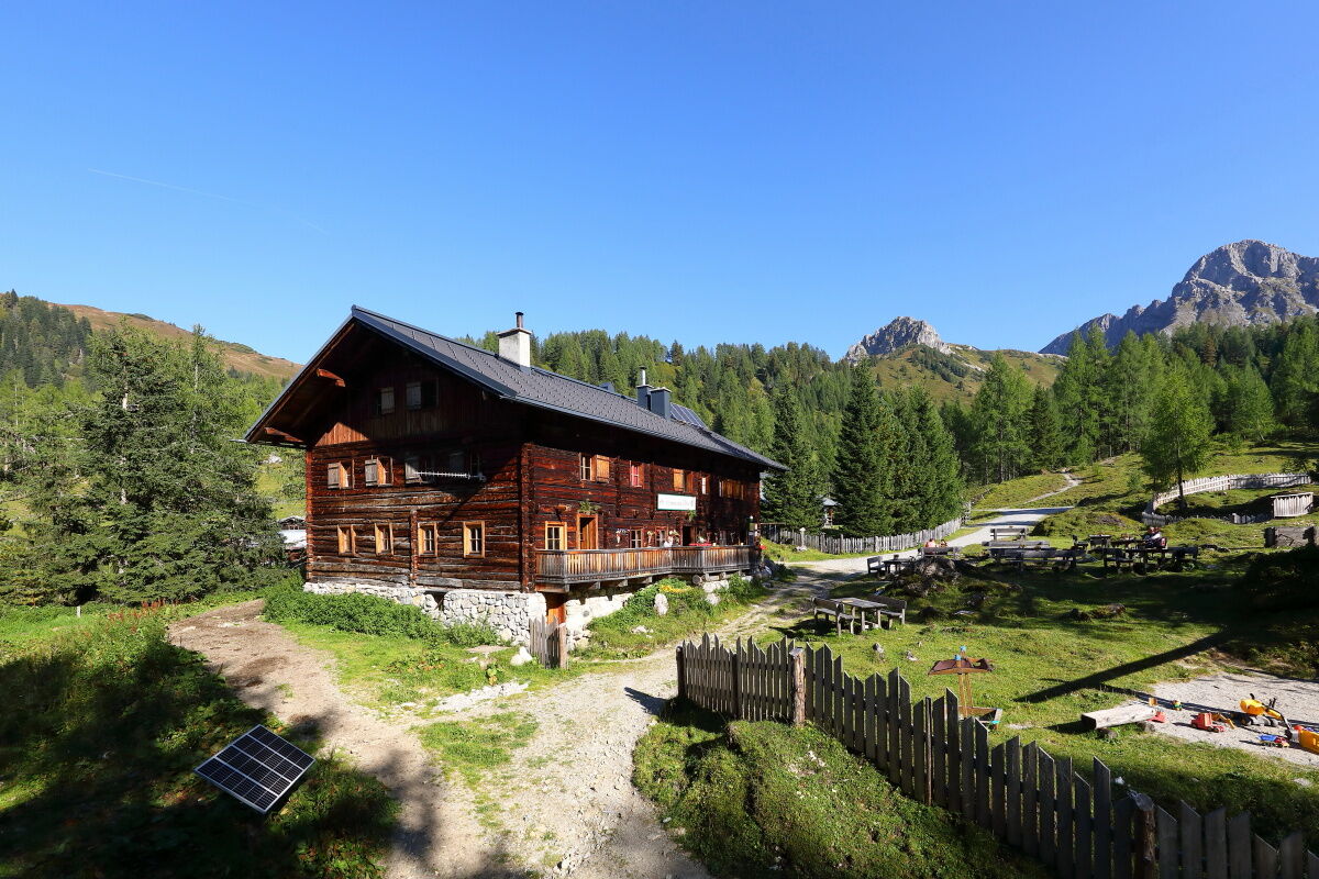
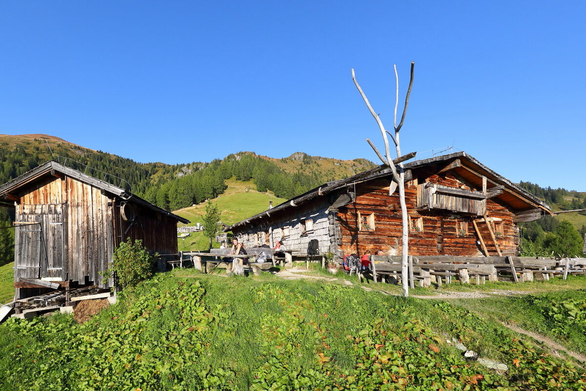
You descend to the Tappenkarsee and can taste delicacies at the Tappenkarseehütte and the Tappenkarseealm. You hike along the Tappenkarsee and hike up to the Draugsteintörl. Then you hike down to the Draugsteinalmen. Here are two mountain huts, the Draugsteinalm-Schrambachhütte and the Draugsteinalm-Steinmannhütte. And the people up there produce self-made delicacies like bread, butter, cheese, bacon or schnaps. And on both you can spend the night.
After a tasty breakfast you hike to the Filzmoossattel. There is a big gentian, which is the symbol of the Salzburger Almenweg, whereof this hiking tour is a part. Just some meters away on the Filzmooshöhe is a unique summit cross. You hike down to the Filzmoosalm. In this area there are lots of Swiss stone pines, which are typical for the Ellmautal. You hike further to the Loosbühelalm, the Weißalm and the Ellmaualm. On every of this mountain huts you can taste self-made delicacies and you can spend your night on these huts.
You hike to the Henerbichlalm (closed). Alternative you can hike up to the Trögseen, which are small mountain lakes. After some hours you reach the Saukaralm, which is the highest mountain hut in Grossarltal. From here you have a picturesque view. Sunsets are amazing up there. Then you descend to the Gerstreitalm, which is a paradise for children because of the play ground there. You come back to Grossarl on the trail "Hertas Rast".
- Directions
-
1st day:
You go by car or hiking taxi to Hüttschlag to the district Karteis and on the Güterweg Seilsitzberg to the Hallmoosalm, 1,350 m (parking possibility). You hike along the way nr. 53, 721 and turn left after approx. 1 km (but you stay on the way nr. 53, 721) until the Karteisalm, 1,661 m (approx. 1 h, closed). Further on the same way to the Karteistörl, 2,145 m (approx. 1 1/2 h). Descent on the way nr. 721 to the Tappenkarseehütte, 1,820 m (approx. 3/4 h). Hiking along the Tappenkarsee to the Tappenkarseealm, 1,768 m (approx. 1/2 h). You hike up on the way nr. 12 to the Draugsteintörl, 2,077 m (approx. 1/2 h). Descent on the way nr. 54 to the Draugsteinalmen, 1,778 m (approx. 1 h, the left mountain hut is the Schrambachhütte, the right mountain hut the Steinmannhütte) - Overnight stay on the Draugsteinalmen.
2nd day:
You hike up the way nr. 54, then 54A to the Filzmoossattel, 2,062 m (approx. 3/4 h). Descent on the way nr. 57, 720 to the Filzmoosalm, 1,710 m (approx. 1 1/4 h). Then you hike along the way nr. 63 to the Loosbühelalm, 1,769 m (approx. 1 h), further on the same way to the Weißalm, 1,723 m (approx. 1/2 h) and to the Ellmaualm, 1,794 m (approx. 1/2 h) - Overnight stay on the Loosbühelalm, the Weißalm or the Ellmaualm. Alternative: You hike on the way nr. 64 and then descend to the mountain huts.
3rd day:
Hike along the way nr. 63, then 64 to the Saukaralm, 1,850 m (approx. 2 h). Descent on the way nr. 65, then 65A to the Gerstreitalm, 1,575 m (approx. 1 h). Then you hike down the way nr. 65A, then 65 to the Vorderstadluck farm (approx. 1 h) and on the way nr. 17 to the village center of Grossarl (approx. 1 h).
- Highest point
- 2,125 m
- Endpoint
-
Grossarl - village
- Height profile
-

- Equipment
-
Hiking boots, fruits, beverages (bottles which you can refill), rain and wind protection, toiletries, warm clothes and clothes for change, flashlight, first-aid kit, hiking map, sun cream, chocolate, grandola bar...
- Tips
-
You should really dry a "Heidelbeerschmarrn" on the Tappenkarseehütte.
- Directions
-
You go by hiking taxi or car to the Hallmoosalm in Hüttschlag.
- Public transportation
- Parking
-
parking possibility at the Hallmoosalm
- Author
-
The tour Hut Adventure Tour I is used by outdooractive.com provided.