Pinzga' Hatscha - Stage 9 (Statzerhaus - Maishofen)


- Brief description
-
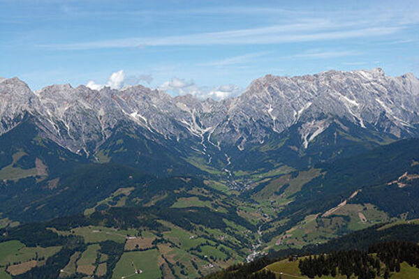
The Salzburg Pinzgau consists of many different regions. Some of them, the Salzburg Saalachtal, the Hochkönig region, Maishofen, Viehhofen, Saalbach Hinterglemm and Saalfelden Leogang have united to create a unique project - the Pinzga' Hatscha.
- Difficulty
-
difficult
- Rating
-
- Starting point
-
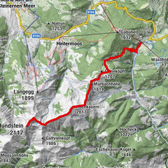
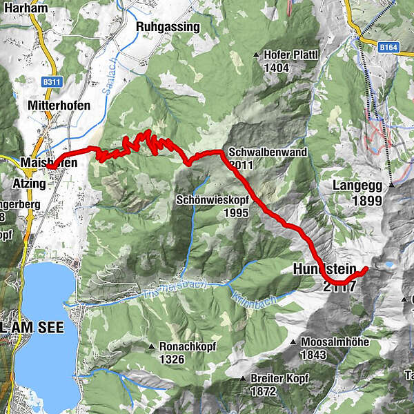
Statzerhaus
- Route
-
Hundstein (2,117 m)0.0 kmQuelle1.0 kmOchsenkopf (1,995 m)1.0 kmSchönwieskopf (1,995 m)4.1 kmSchwalbenwand (2,011 m)5.7 kmKammeregg Alm10.3 kmSchloss Kammer13.6 kmStiegerschlössl14.7 kmMaishofen14.9 km
- Best season
-
JanFebMarAprMayJunJulAugSepOctNovDec
- Description
-
The Pinzga' Hatscha as a long-distance hiking trail can be experienced on foot, with the summer cable cars or public transportation and reveals the hidden treasures of this unique landscape. Large parts of the Pinzga' Hatscha lead through alpine and high alpine landscapes. For this reason, a plant native to this very area, the silver thistle, is the symbol of this long-distance trail. The silver thistle and the Pinzga' Hatscha even have one more thing in common: both can have their pitfalls.
- Directions
-
After a hearty breakfast at the Statzerhaus, you can once again enjoy the wonderful view in the morning before starting the hike into the valley to Maishofen. A beautiful path leads along the ridge of the mountain. To the right, the Hochkönig Masiv towers imposingly, to the left you look down into the valley to Lake Zell. Once you reach the Schwalbenwand, turn left and after a while you reach a forest road that leads to the stage destination in Maishofen.
- Highest point
- 2,104 m
- Endpoint
-
Maishofen
- Height profile
-

- Equipment
-
Sturdy, ankle-high shoes
Hiking poles
Headgear
Sun protection
Sunglasses
Rain protection
Drinks and a small snack
Necessary medication
First aid kit
Hiking map - Safety instructions
-
Self-assessment Check your physical fitness before every mountain tour and correctly assess your strength as well as that of your companions - especially those of your children! Surefootedness and a head for heights are often very important!
Planning and preparation Plan each intended mountain tour in detail beforehand. Hiking maps and guides as well as information from alpine clubs and local experts such as mountain guides and mountain hut keepers can be helpful.
Equipment On the mountain you need appropriate equipment and clothing, especially sturdy, high shoes with a grippy sole. Weather and cold protection are essential, the weather can often change unexpectedly.
Weather forecasts Note the current weather conditions at: www.zamg.at
Togetherness Follow the 10 rules for proper handling of grazing animals and do not leave litter in nature!
Do not kick rocks Do not kick rocks as this can seriously endanger other hikers. Marked places with danger of falling rocks should be crossed as quickly as possible and with attention and caution.
Turn back in time This is not a disgrace, but a sign of common sense. It becomes necessary when the weather changes, fog rolls in, and also when the path is too difficult or not in good condition.
Emergency numbers: Alpine emergency call: 140
International emergency call: 122 - Additional information
- Directions
-
Coming from Salzburg: Take the A10 freeway to the Bischofshofen exit, then take the B311 in the direction of Bischofshofen. Follow the Hochkönig Bundesstraße/B164 to Maria Alm.
Coming from Innsbruck/ Kufstein: On the Loferer Straße/B178 towards St. Johann i.T., then follow the Hochkönig Bundesstraße/B164 via Saalfelden to Maria Alm. - Public transportation
-
With the train you can enjoy your vacation from the beginning.
No traffic jam will stop you from coming to Maria Alm!
The nearest train station is Saalfelden.
You can book your train connection at www.oebb.at or by phone at 051717.
From Saalfelden train station you can get to Maria Alm by bus 620 - bus schedule - Parking
-
Parking spaces at the entrance to Maria Alm

- Author
-
The tour Pinzga' Hatscha - Stage 9 (Statzerhaus - Maishofen) is used by outdooractive.com provided.


General info
-
Zell am See - Kaprun
1504
-
Maishofen
517