Tour data
3.88km
2,209
- 3,302m
1,096hm
1,096hm
00:58h
- Difficulty
-
medium
- Rating
-
- Route
-
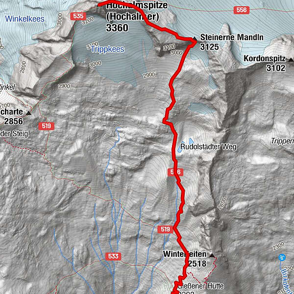
Winterraum0.1 kmSteinerne Mandln (3,158 m)2.7 kmHochalmspitze (3,360 m)3.8 km
- Best season
-
JanFebMarAprMayJunJulAugSepOctNovDec
- Highest point
- 3,302 m
- Endpoint
-
Hochalmspitze
- Source
- Christopher Beck
GPS Downloads


Trail conditions
Asphalt
Gravel
Meadow
Forest
Rock
Exposed
Other tours in the regions
-
Katschberg Lieser-Maltatal
2574
-
Großarltal
2171
-
Obervellach
111