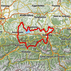
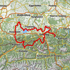
Mozart Cycle Path – Stage 06: Laufen – Waging am See


- Brief description
-
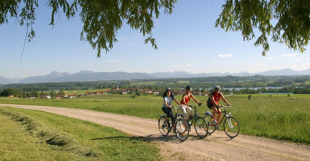
In the sixth stage, we start at Laufen and go to Lake Waginger See. The first half of the route goes in a southerly direction and offers a wonderful mountain panorama. After half of the stretch, we cycle along the Schönramer Filz, one of Bavaria’s biggest upland moors – it is definitely worth a stop! The last stage leads to Lake Waginger See, Upper Bavaria’s warmest lake.
- Difficulty
-
easy
- Rating
-
- Starting point
-
Laufen
- Route
-
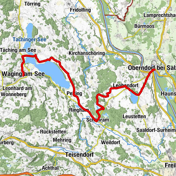
Oberndorf bei SalzburgKapuzinerkirche St. Peter und Paul0.2 kmJesuskirche0.3 kmLaufen (Salzach)0.8 kmWiedmannsfelden1.5 kmKletzing1.5 kmOberhaslach2.0 kmOberheining2.5 kmLandgasthof Hofmann3.0 kmFisching3.5 kmLeobendorf5.4 kmEhemoosen7.7 kmKafling8.2 kmBraustüberl Schönram13.9 kmFilialkirche Sieben Schmerzen Mariä14.0 kmSchönram14.0 kmWasserbrenner15.0 kmNeukrämer15.2 kmNeuhaus15.3 kmHuberhof16.5 kmDornbacher Rundkapelle16.7 kmLindenhub17.2 kmBuon Gusto Due18.0 kmGasthaus Riedler18.1 kmPetting18.3 kmKühnhausen20.9 kmLampoding21.9 kmWolkersdorf24.1 kmHorn25.8 kmTettenhausen26.7 kmZum Boadwirt z'Denhausen27.0 kmKammering30.0 kmSt. Martin30.7 kmWaging am See30.8 km
- Best season
-
JanFebMarAprMayJunJulAugSepOctNovDec
- Description
-
In Laufen at the Marienplatz, the Mozart cycle path bends to the left into Schlossstraße, and leads through the city gate – after the give way sign, take a half-right onto the Tittmoninger road – take the left turning for Waging and left again towards Lake Abtsdorfer See. After the railway underpass, take another left to the Freizeitgelände Abtsdorfer See leisure area. Go through the district of Oberheining – take a right to Leobendorf. In Leobendorf, turn left towards the Sportplatz (sports field). The mountain road takes you half way around the church – over a crest in the direction of Stögen. Keep straight on going to Kalfing. Turn left before the dead-end sign and continue on a gravelled track which goes right. At the give way sign, take another right – past Geisbach, where you will reach the border of the Traunstein district. Here, turn left onto a gravel forest road – pass the Parkplatz Heidewanderung car park and then turn right towards Schönram. At the Bräustüberl Schönram, turn right towards Petting – keep going straight on – at the stop sign at the end of the village, turn right towards the Strandbad Kühnhausen lido. Go along the signposted ‘Seeweg’ cycling route – direction Lampolding – Wolkersdorf – Tettenhausen to Waging.
- Highest point
- 479 m
- Endpoint
-
Waging am See
- Height profile
-

- Additional information


- Author
-
The tour Mozart Cycle Path – Stage 06: Laufen – Waging am See is used by outdooractive.com provided.


General info
-
Waginger See
28
-
Petting
8