- Brief description
-
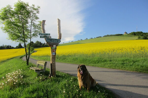
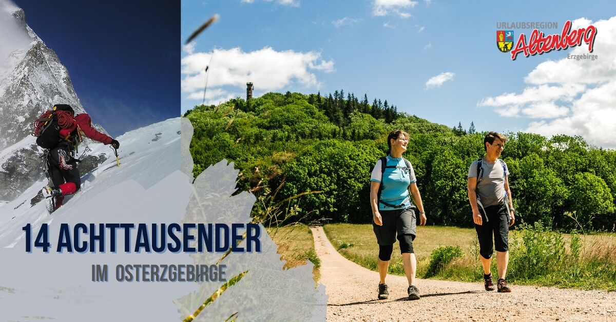
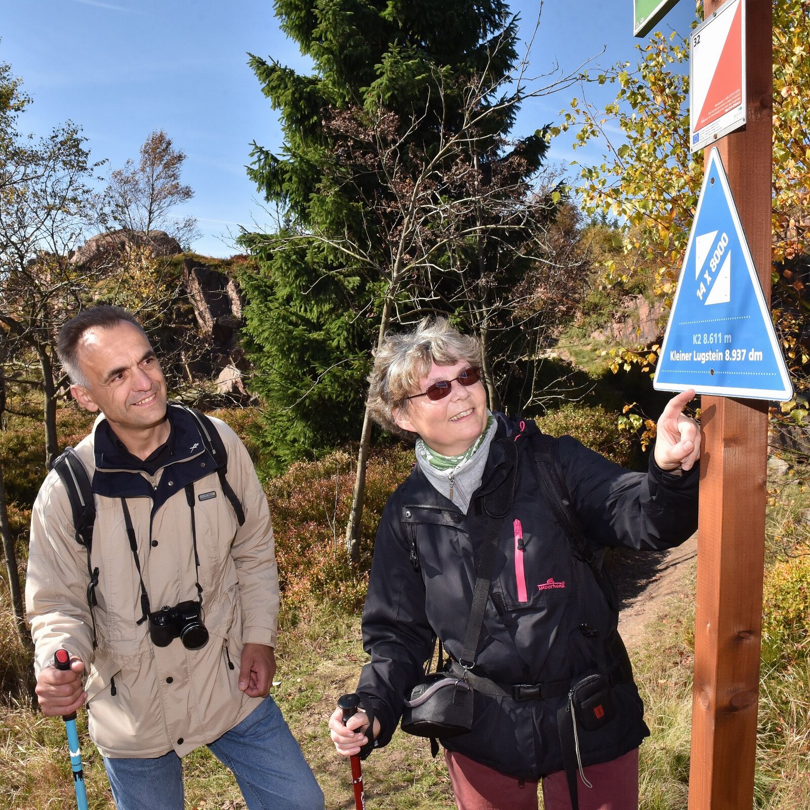
The Himalayas in the Eastern Ore Mountains! The 14 peaks over 8000 dm! Enjoy breathtaking views and hidden secret places on a unique tour.
- Difficulty
-
medium
- Rating
-
- Starting point
-
Altenberg (train station)
- Route
-
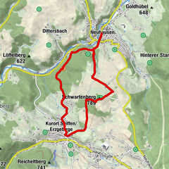
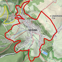
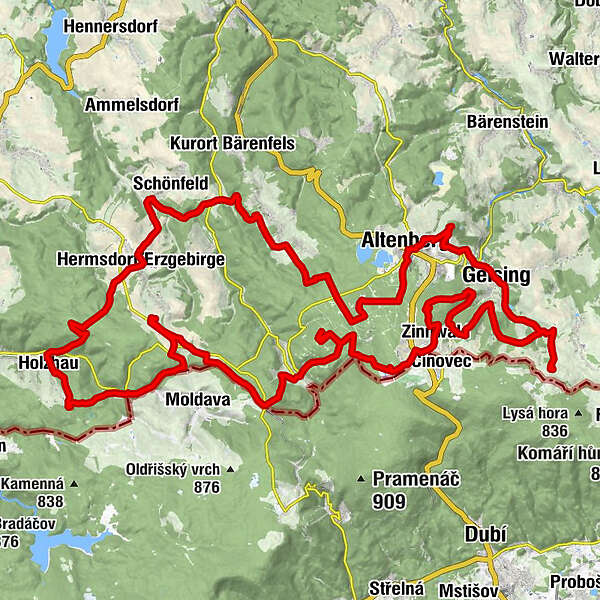
AltenbergBergglöck'l0.0 kmGeisingberg (824 m)2.0 kmBergbaude Geisingberg2.1 kmRatskeller4.9 kmGeising (599 m)5.3 kmCafé & Restaurant Am Schauhübel5.8 kmTraugotthöhe (806 m)9.9 kmKohlhaukuppe (785 m)13.6 kmBergbaude Kohlhaukuppe13.7 kmGeising (599 m)14.6 kmFuchshübel (813 m)15.7 kmKommerzienrat-Zietz-Kurve18.9 kmScharspitze (807 m)19.4 kmBiwak-Kuppe (828 m)20.5 kmZinnwald22.5 kmZinnwald-Georgenfeld22.7 kmExulantenkirche22.9 kmGeorgenfeld23.4 kmKleiner Lugstein (897 m)24.2 kmGroßer Lugstein (899 m)24.8 kmWüste Höhe (826 m)29.3 kmRehefeld-Zaunhaus32.8 kmSkilift Rehefeld - Talstation33.2 kmHemmschuh (846 m)34.0 kmNeu-Rehefeld34.5 kmSWF Sporthotel37.0 kmLandhotel Wettin37.4 kmNeuhermsdorf37.5 kmAltes Zollhaus37.7 kmSchickels Höhe (805 m)39.8 kmTeichhaus45.1 kmSteinkuppe (805 m)47.0 kmHolzhau49.3 kmKannelberg (805 m)52.0 kmHermsdorf/Erzgebirge55.2 kmStephanshöhe (803 m)63.2 kmAussichtspunkt Stephanshöhe (804 m)63.3 kmSchellerhau64.2 kmPöbelknochen (832 m)66.9 kmKahleberg (905 m)69.9 kmBergglöck'l73.5 kmAltenberg73.6 km
- Best season
-
JanFebMarAprMayJunJulAugSepOctNovDec
- Description
-
Frank Meutzner, the Saxony mountaineering guru par excellence, had the crazy idea to bring the Himalayan eight-thousanders to the Eastern Ore Mountains. And he succeeded!
However, the peaks here are measured in decimetres, so we have a great and fascinating hiking trail in the Altenberg recreational area, which connects the Eight Thousanders of the Ore Mountains.
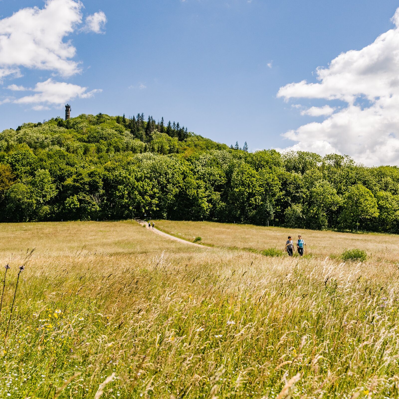
From Geisingberg via Lugsteins to Pöbelknochen. You can climb the 14 different peaks in different ways. On foot, by bike or even on cross-country skis. Very experienced hikers can do it in two days. However, you can also take a more leisurely approach and "climb" the peaks in several stages. On this hike you can fully discover and enjoy the beautiful authentic nature of the Eastern Ore Mountains. After completing the hike, you can also declare that you have climbed several eight-thousanders.
- Directions
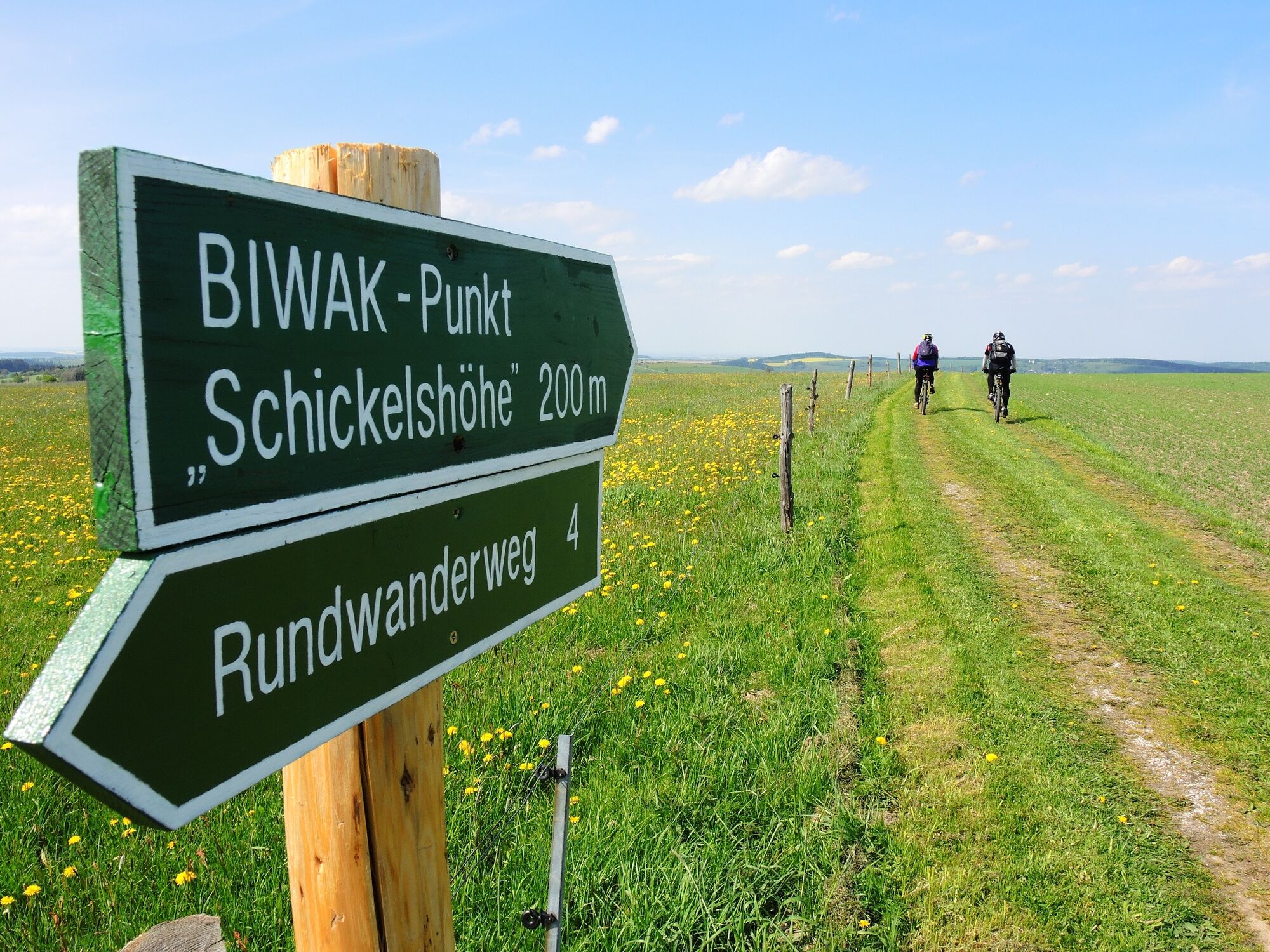
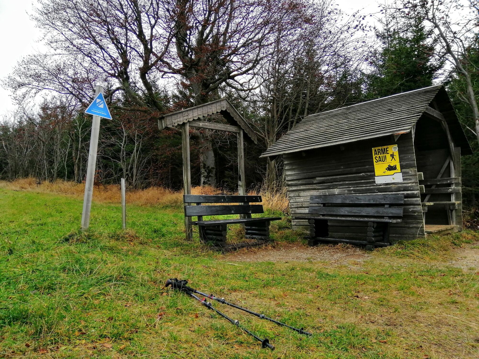
-
The starting point is the railway station in Altenberg. The route first heads to Geisingberg (8238 dm). From this point you go downhill to Geising, following the main road through the whole village. On the road towards Löwenhain you turn right onto Lindenallee to the natural swimming pool Hüttenteich. Passing the Hüttenteich swimming pool, you pass through the Erdbachtal valley, turn left towards Fürstenau and reach the summit of Traugotthöhe (8066 dm). Go back the way you came and then turn left around the Kohlhaukuppe to Zinnwald. Directly on the way towards Zinnwald is the Fuchshübel (8138 dm). The hike then leads through the forests between Altenberg and Zinnwald to Scharspitze (8072 dm) and via Biwak-Kuppe (8285 dm) to Zinnwald-Georgenfeld. The next destination are the two Lugstein peaks ("Big Lugstein" 8992 dm and "Little Lugstein" 8937 dm). From there is a fantastic view of the Bohemian Basin. You will continue your hike around the Biathlon Arena. Behind the arena is the Wüste Höhe (8266 dm - also known as the "Unbenannte Höhe"). Proceed westwards to Rehefeld and the Hemmschuh (8473 dm). Here you will find the stamping point next to the wooden hut by the ski lift. From Hemmschuh, continue along the Kammweg Erzgebirge-Vogtland trail to Schickelshöhe (8049 dm). Afterwards, your route returns back along the Kammweg Erzgebirge-Vogtland to Steinkuppe (8048 dm). Then the "14 eight-thousanders" route continues to Holzhau and through it to Kannelberg (8054 dm, also called Drachenkopf). Further on, it heads to Hermsdorf and then to the small town of Schellerhau. Here is the Stephanshöhe (8040 dm). This peak can be found easily along the hiking trail that runs parallel to the village. If you follow the trail above Schellerhau, you will reach the summit of Pöbelknochen (8328 dm). You are now on your way back to Altenberg. Passing the Gallows Ponds (Galgenteichen), you return to Altenberg railway station, your starting point. At the Tourist Information Office in Altenberg, you can pick up a T-shirt with the route logo after presenting a fully completed stamped card and voucher.
- Highest point
- 905 m
- Endpoint
-
Altenberg (train station)
- Height profile
-
 © outdooractive.com
 - Equipment
-
Solid walking shoes, rain equipment, first aid kit, food and drink, binoculars if needed.
- Safety instructions
-
Enjoy the nature
Allow the inhabitants of the forest to sleep peacefully
Protect plants and animals
Keep escape routes accessible
Use the parking lots
Don't leave trash behind
Be respectful towards other people
Prevent forest fires
Pay attention to the forestry works
Be aware of and accept closures
Be careful and cautious - Tips
-
After completing the route, would you like to receive a T-shirt with the logo as a souvenir?
Purchase a starter backpack for 29,50 € at the Altenberg Tourist Information and collect stamps along the way.
With your completed stamp card and voucher ( included in the starting backpack) you will receive a T-shirt at the Altenberg Tourist Information.
You can also purchase the starter backpack online here.
- Additional information
-
The hike is about 70 km in length and the elevation gain is 3530 metres, so it is not to be underestimated.
- Directions
-
Via BAB17 - Exitt Bad Gottleuba - Lauenstein - Geising - Altenberg
Via B170 - Dresden - Dippoldiswalde - Altenberg / Teplice - Dubi - Zinnwald-Georgenfeld – Altenberg
- Public transportation
-
Train: Dresden - Heidenau – Altenberg
Bus: Linie 360 from Dresden Hbf, Linie 398 from Teplice
- Parking
-
You can park your car in the car park behind the train station.
-

-
AuthorThe tour 14 Eight-thousanders in the Eastern Ore Mountains is used by outdooractive.com provided.


General info
-
Sächsische Schweiz
1404
-
Erzgebirge
628
-
Altenberg
150