- Brief description
-
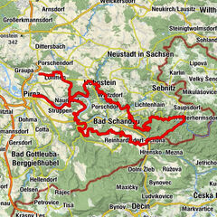
The areas of the Elbe Sandstone Mountains which are located left from the river Elbe are not part of the Saxon Switzerland National Park, yet they are still a popular hiking destinations. Especially the three mesas Papststein, Gohrisch and Kleinhennersdorfer Stein formed in the early development a common large sandstone panel. Over thousands of years it eroded to the aforementioned three mesas. In this area geologically interested hikers will find sandstone, and sporadically basalt and soapstone. From the top of the Gohrisch and the Papststein visitors will enjoy a fantastic view over the whole National Park.
- Difficulty
-
easy
- Rating
-
- Starting point
-
spa town Gohrisch
- Route
-
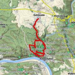
GohrischNarrenkappe1.4 kmAbgetrennte Wand1.4 kmZwerg1.4 kmGohrisch1.6 kmGohrischscheibe1.6 kmWetterfahne (448 m)1.6 kmSchwedenhöhle1.7 kmGohrisch (448 m)1.7 kmPavillon (437 m)1.7 kmGalgenschänke2.1 kmHunskirchenblick2.4 kmPapststein (451 m)2.6 kmPapst2.7 kmBerggaststätte Papststein2.7 kmPapststein2.8 kmEishöhle3.7 kmLichterhöhle3.8 kmHampelhöhle3.8 kmGohrisch5.7 km
- Best season
-
JanFebMarAprMayJunJulAugSepOctNovDec
- Description
-
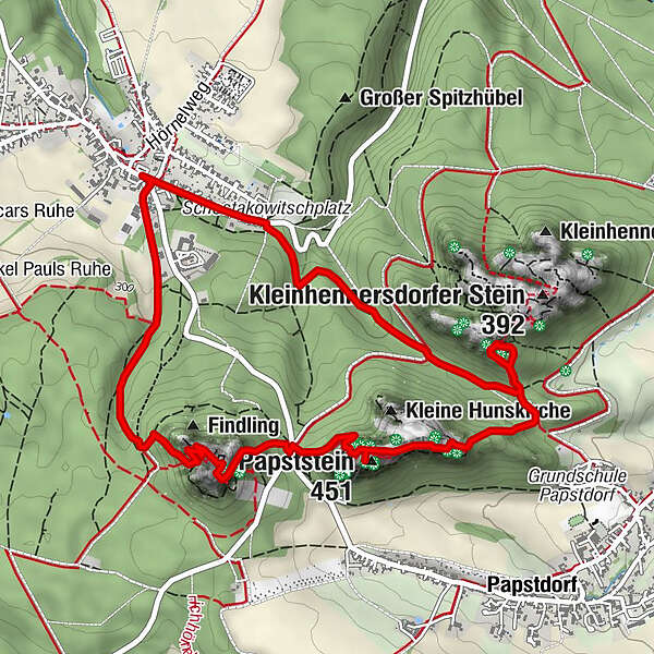
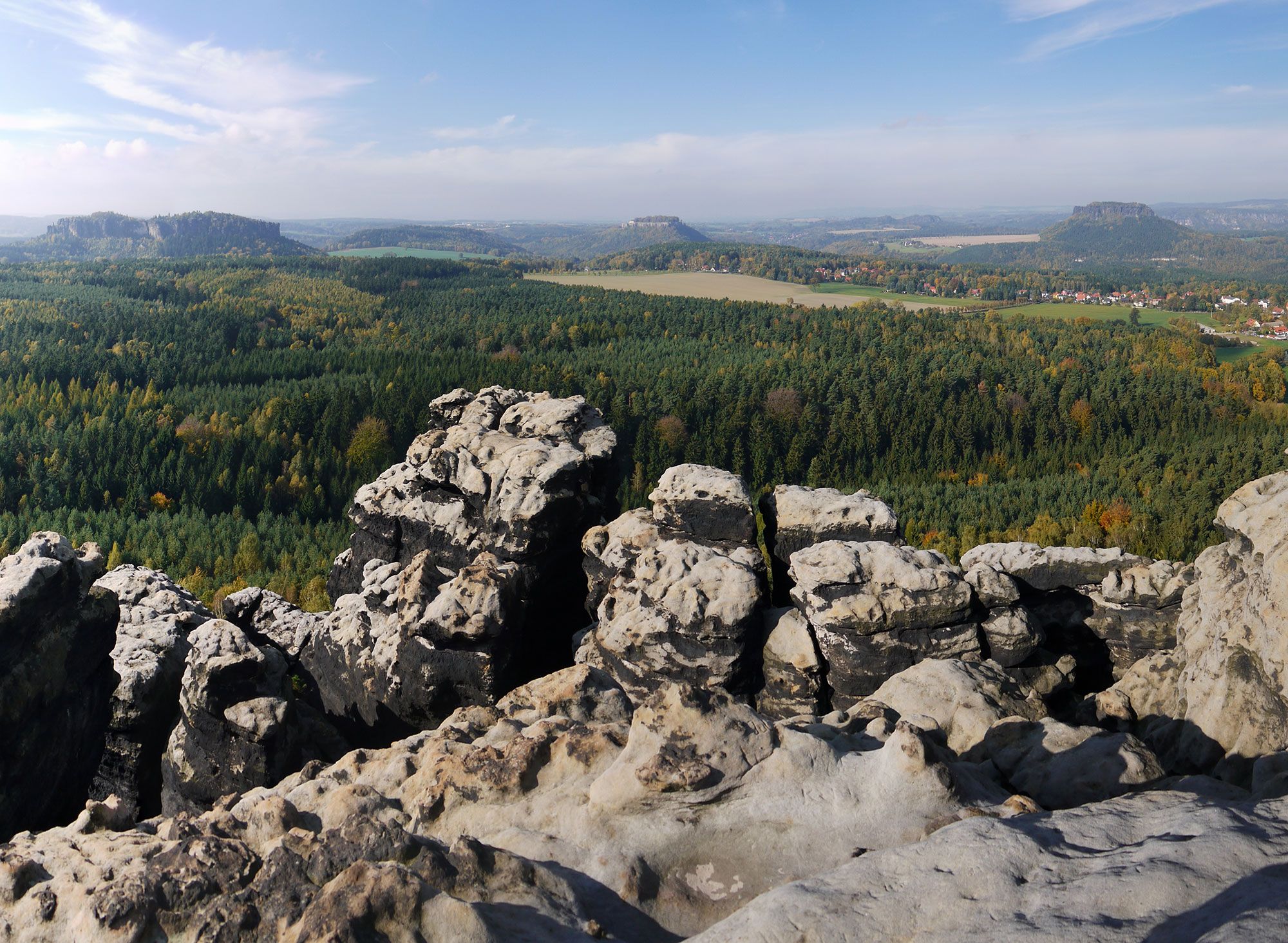
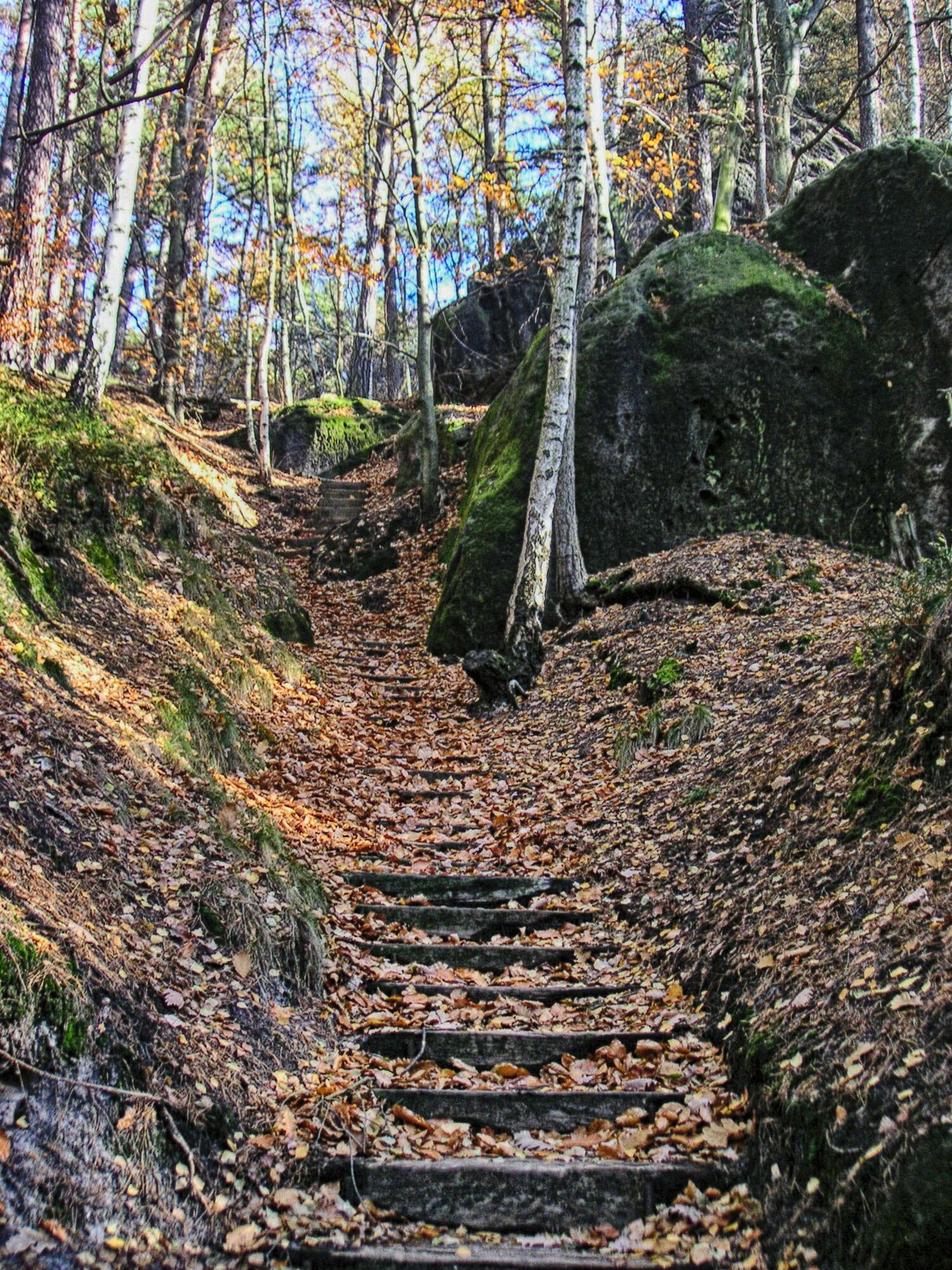
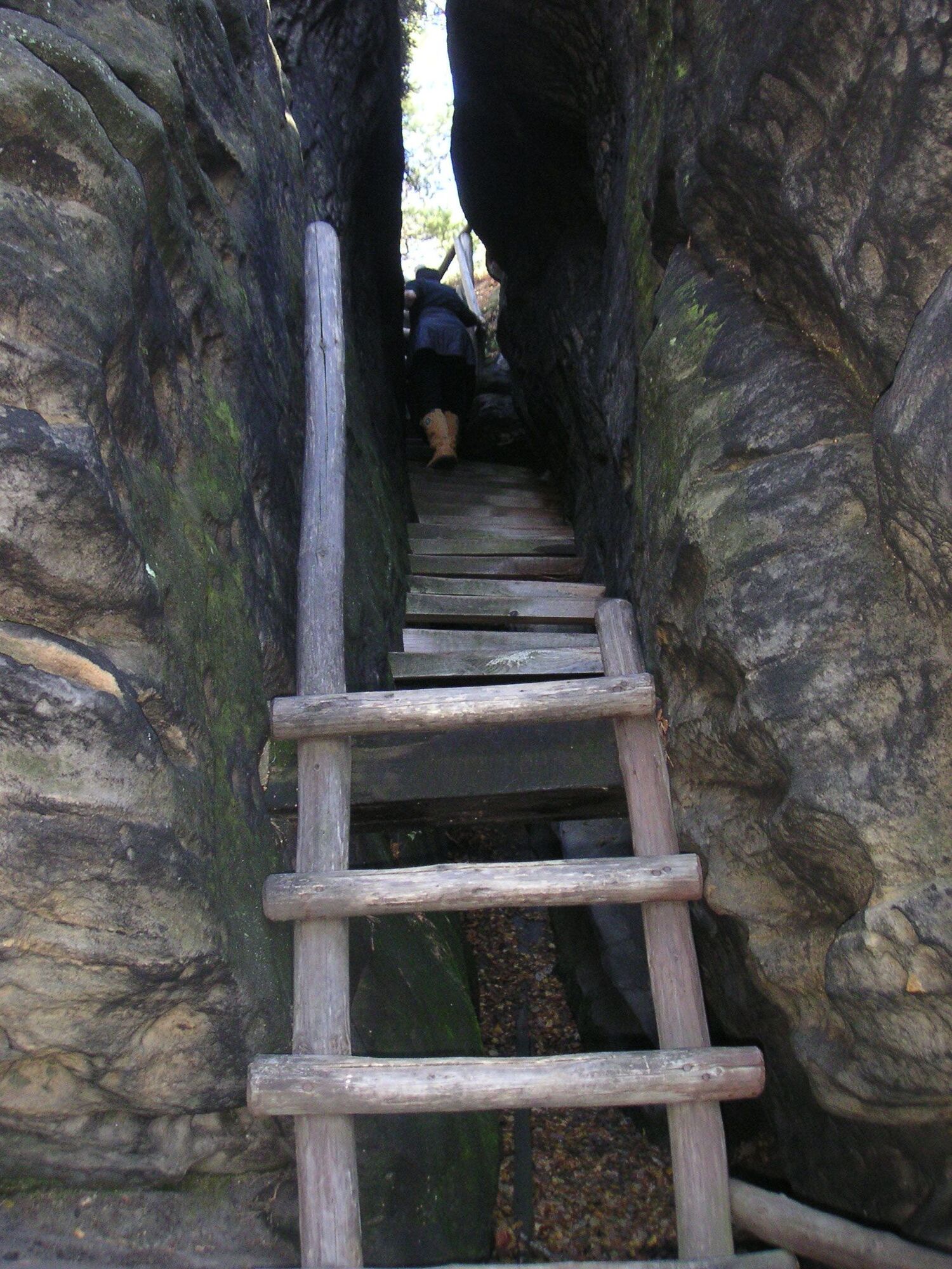
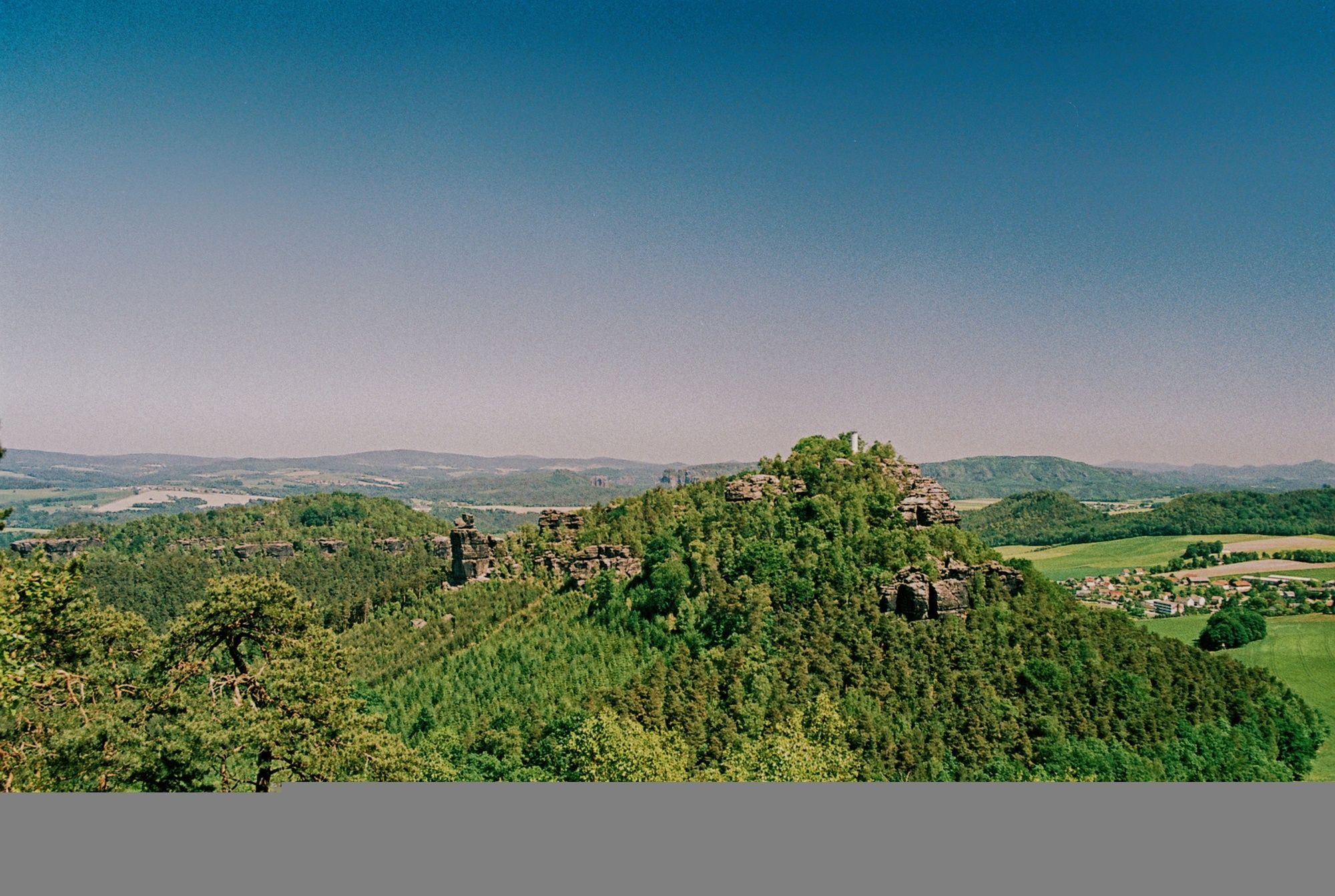
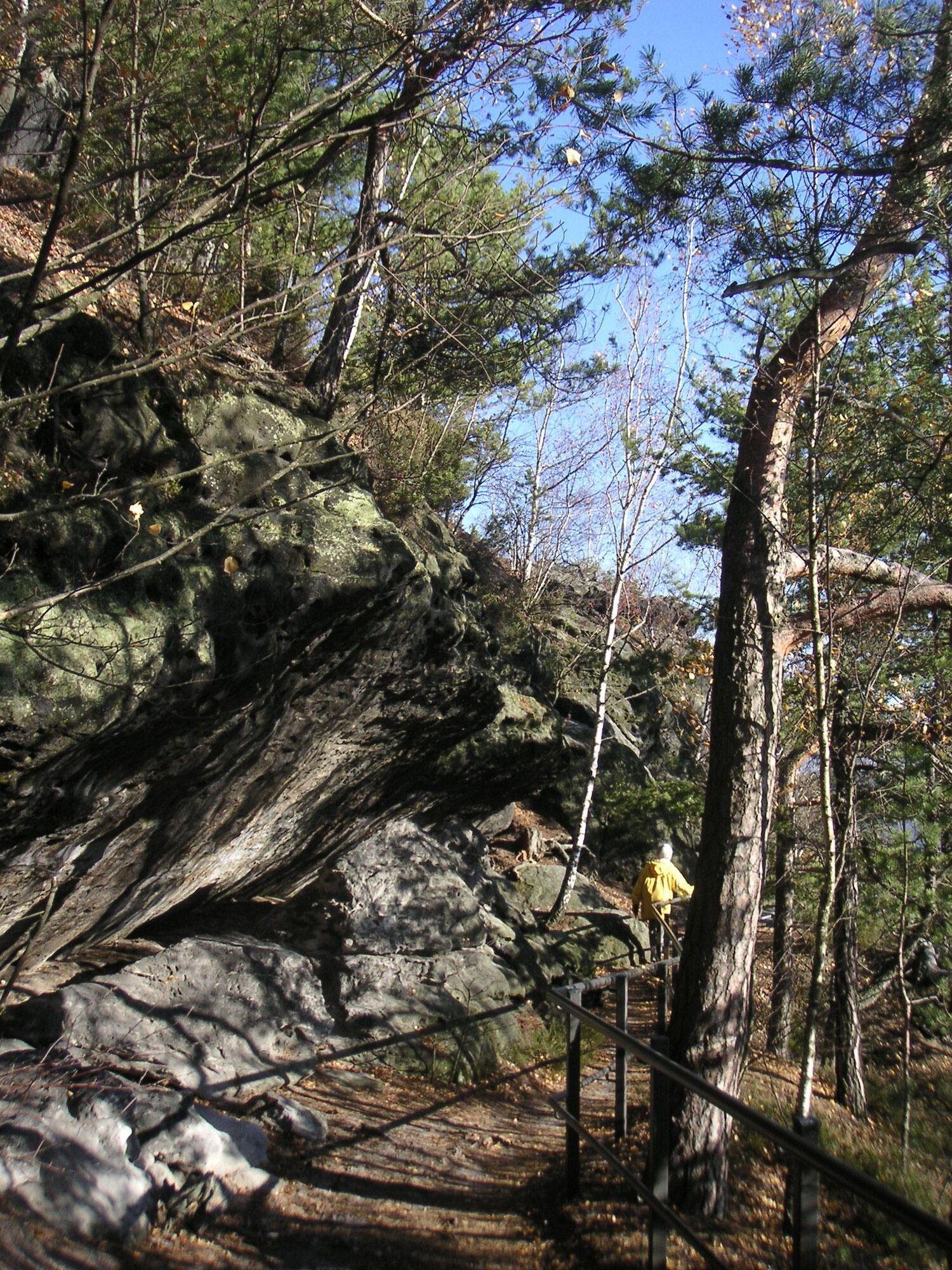
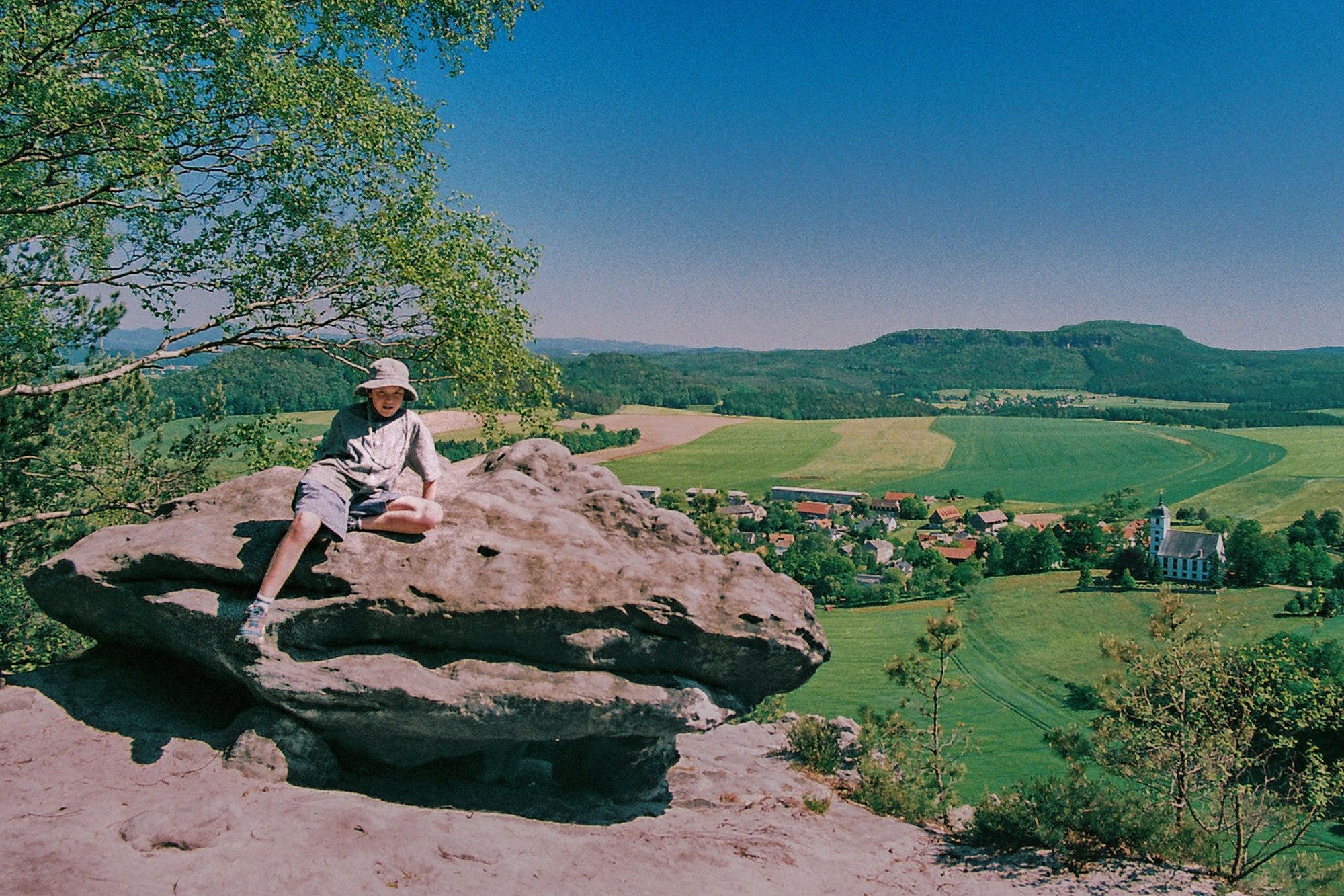
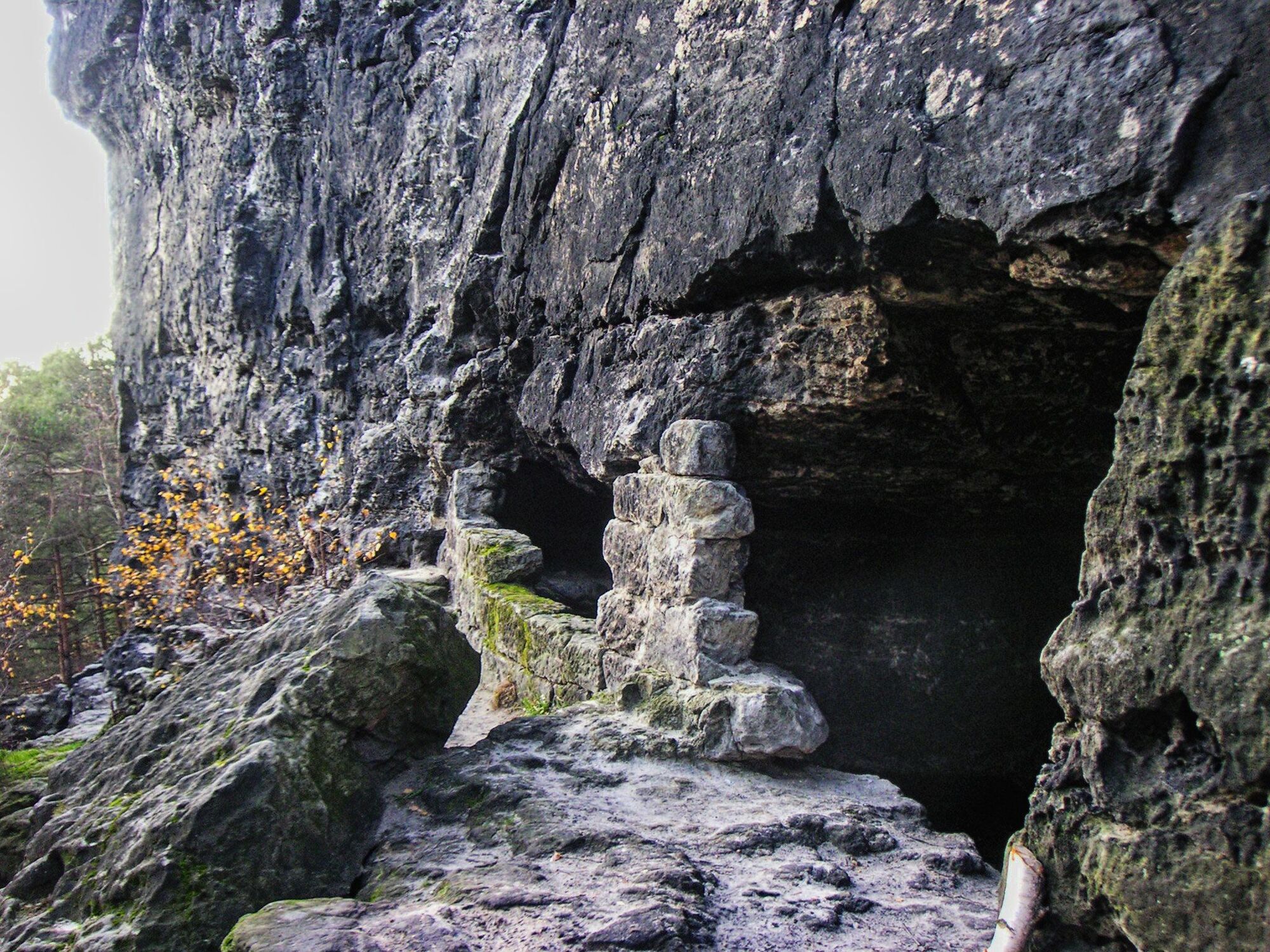
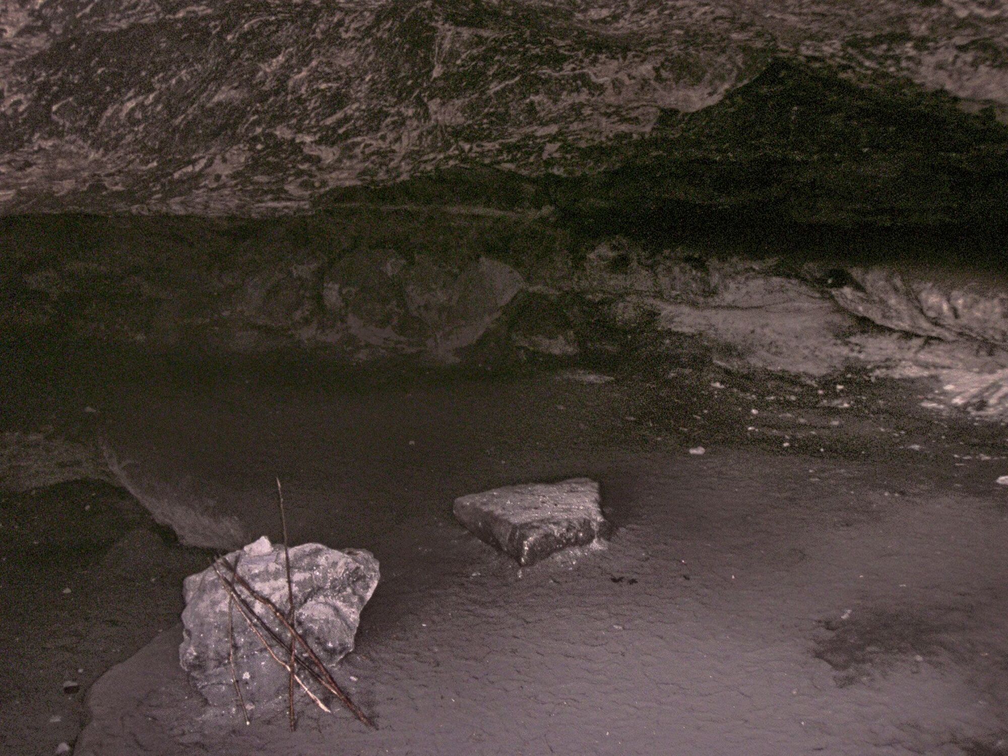
On arrival by car we recognize the exposed location of the spa Gohrisch. Without any further hiking the rock formations Lilienstein and Schrammsteine are already partly visible. At the end of the Neue Hauptstraße street, just before the junction to the Schulstraße street, is located a large parking lot. Following the yellow dot waymark, we start our hike in direction towards the ravine „Stiller Grund". On our right side we see a large meadow area; on the left side the last buildings of Gohrisch are visible in the increasingly deep forest. Among them is also a "jewel" for nostalgics of the former GDR (albeit not visible from the hiking path)! The hotel Albrechtshof was formerly a guest house for Ministers of the GDR. Today the hotel is of course open for hikers and due to its interior design and the furniture a perfect example of the architecture from the 50s. Our trail gets steeper and leads us into a coniferous forest. Our road bends slightly to the left and after about 600 meters from the tree line begins the climb to the Gohrisch (southwest side of the rock). We arrive at the foot of the rock. Since there were no exhausting sections on our hike up to this point, we decide to take the harder climb through the gorge Falkenschlucht (left). The last stage we pass on wooden ladders. On weekends you can watch climbers going up on the adjacent rocks "Abgetrennte Wand" and "Zwerg". Once we stand on the plateau there is a natural urge for taking a picture of the fantastic landscape. the first viewpoint should therefore be the look-out point Wetterfahnenaussicht, which is located on the west side. Especially during the clear morning hours hikers can enjoy the magnificent panorama view on the rocks Lilienstein, Königstein, Quirl and Pfaffenstein. On a clear day, you can look very far to the Eastern Ore Mountains and of course to Dresden. The touristic development of the rock massif was relatively late. The royal forester Emil Grünewald (1842-1892) told the Mountain Club of the Saxon-Bohemian Switzerland to create three paths to the summit. The refuge on the east side was built in 1988, then became run down after the Second World War and was rebuilt in 1998. On the east side visitors have a long-ranging view to the Schrammsteine rock formation and the rock Großer Zschirnstein. Not far from the refuge some steps lead us down to the cave Schwedenhöhle. Centuries ago this small rock basin served as a hiding place in times of war and offered the peasants at that time a safe haven. At the refuge the steep descent begins through a canyon. At the foot of the cliff a path branches off to the left direction from the trail with the red dot waymark. This path leads to the (closed) Soapstone tunnel and is also the shortest way to the car park below the Papststein rock. The Papststein rock is a popular destination for residents and day-trippers due to its easy accessibility by car and the moderate ascent to the restaurant. Already in 1829 the Royal Saxon Forestry Administration ordered to largely cut down the forest covering the plateau in favor of tourism. From the parking east of the Papststein a small canyon can be reached on a wooden-paved dirt road and afterwards stairs. We arrive at mountain inn, which was built in 1862. Despite the easy access of the mountain inn, the place has kept its romance. The seats on the "stone balconies" are very popular. From here you can observe mountaineers in the region of "Hunskirchen". In the evening the sunsets here are very atmospheric. Sometimes visitors spot small colorful dots on the horizon in the northwest direction ... these are balloonists from Dresden. From the restaurant we advance over the stairs in south direction to the lookout point. Unfortunately for decades no observervation tower has existed here. Thus the the white fire watchtower often irritates tourists. But even without the elevated point from a tower, the south view offers a beautiful 180-degree panorama. In the background we can see the high snow mountain (Hoher Schneeberg) with its observation tower on the top, the two Zschirnstein rocks, the lower Lasenstein rocks, the Kohlbornstein rock, Zirkelstein rock, Kaiserkrone rock, the Schrammsteine rock formation, even the basalt cone of the Rosenberg mountain, the Kaltenberg mountain in Bohemia and the Great Winterberg mountain amid the Saxon Switzerland Hinterland. By the way, we denote by "-berg" (mountain) a summit with predominantly volcanic origin. The "-stein" (rock, stone) on the other hand consist entirely of sandstone and most of the time have the shape of a mesa. From the lookout point we look down on the idyllic village Papstdorf. Even in GDR times, this was a well known place for children's camps. Today the "Child and Youth Village ERNA" offers an all-round care for school classes, youth exchanges and also family trips. On the left of the supply building we climb down over stone steps towards west direction. After a short time we reach a ridge trail with iron railings. The road narrows in some cases considerably. This narrowing is the result of a rockfall from 1972. Back then an entire rock wall of about 4000 square meters collapsed. Just until recent years, large parts of the shattered rocks were still recognizable in the valley. In the meantime, the vegetation has already "archived" this geological incident. Comparable rockfalls happened at the Bastei rock and also in the Kirnitzschtal valley. In the border town Herrnskretschen (Hrensko, Bohemian Switzerland) the erosion is prevented by concreting critical areas in the rock. A rockfall is always a spectacular event, but still a normal process in the formation of the Elbe sandstone mountains over thousands of years. Below the hiking path run layers of rocks, which are exposed to strong weathering (due to different hardnesses of the rock layers). As a result eroded sections have probably contributed to the rockfall. We now move on wooden steps down to the valley and arrive after a short time at the Suppelsgrundweg trail. It is possible to make a short detour to the village Papstdorf (right direction). We turn left and shortly follow the path down towards Gohrisch. The Kleinhennersdorfer rock now appears on our right side and we choose the path toward the rock. At the next sandy crossroads is an educational trail about the sand quarrying on the Kleinhennersdorfer rock. At this point also begins the ascent to the main attraction of this rock massif.. the caves. The caves between the rock layers and from former collapses have been used commercially for sandstone mining about 150 years ago. Friedrich Herrmann Hempel from Königstein has mined this stone, crushed it to coarse abrasive powders and sold it as a cleaning agent. In 1918 nature avenged itself on him in its own way, when he died in a rockfall. Especially the cave of lights "Lichterhöhle" is very impressive. The remains of a stone wall at the entrance give us the impression of a historic living place. This applies still today, when hikers and climbers like to bivouac here. Unfortunately open fires are also prohibited in this place. The Ice Cave "Eishöhle" and the cave "Hampelhöhle" are appropriate even for children. Standing on the top of the rock does not give us many new impressions. The rock is about 50 meters lower than the rocks Papststein or the Gohrischstein. The plateau is forested and there are no significant lookout points. Therefore after a last rest we finally descend to Gohrisch. We hike again on the Suppelsgrundweg trail and follow it to the right direction to descend further. After passing the next crossroad (educational trail) we take the next turn-off to the left direction and leave the Suppelsgrundweg trail. After about 300 meters at the next crossroads we turn sharp to the right direction and walk on until reaching the entrance of Gohrisch after a few minutes. The Schandauerstraße street now leads us directly to the parking lot. At the end of the hike our last problem is to decide in which of the numerous taverns we would like to enter ..
- Highest point
- 433 m
- Endpoint
-
spa town Gohrisch
- Height profile
-
 © outdooractive.com
 - Equipment
-
secure hiking boots
- Additional information
- Directions
-
Arrival on the road B172. In Königstein take the junction nearby the Hotel Lindenhof and drive to Gohrisch.
- Public transportation
-
Bus line 244a from Königstein to Gohrisch
Bus line 244b from Bad Schandau to Gohrisch
Arrival with the train "S-Bahn" to Königstein and later by foot / bus to Gohrisch
- Parking
-
Parking lot in the center of Gohrisch.
- Author
-
The tour Table mountains nearby Gohrisch is used by outdooractive.com provided.


General info
-
Sächsische Schweiz
1401
-
Erzgebirge
626
-
Gohrisch
562