© TZS - Manuela Meyer

© TZS - Manuela Meyer

© Saarland - Kolja Koglin

© Gemeinde Schwalbach - Lara Thomé

- Brief description
-
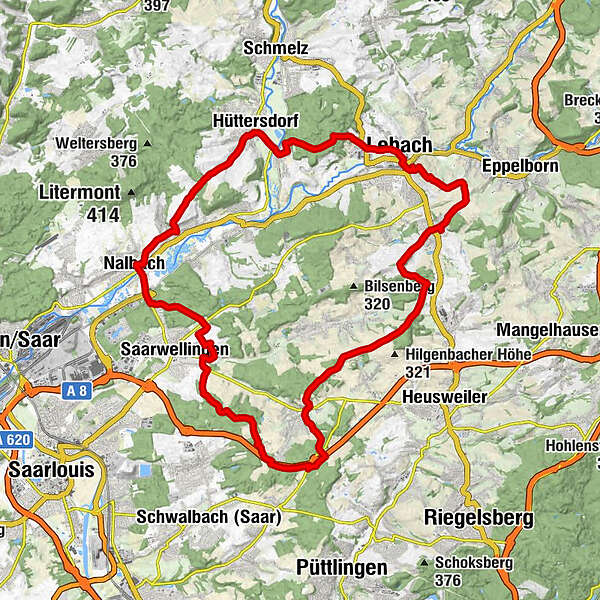
Lebach is called ‘ green centre‘ for two reasons: It’s in the densely forested Saar-Nahe hill region and the official geographical centre of the Saarland is in the town of Lebach.
- Difficulty
-
medium
- Rating
-
- Route
-
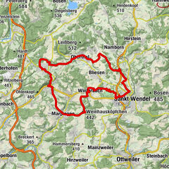
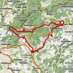
Lebach (275 m)0.4 kmLocanda Grappolo d'oro1.2 kmPrimsweiler4.9 kmBuprich6.2 kmHüttersdorf6.2 kmPfarrkirche St. Johannes der Täufer10.7 kmPiesbach10.8 kmGasthaus Eisenbarth11.1 kmNalbach12.6 kmSt. Peter und Paul12.8 kmPizzaria Da Gino13.0 kmMariengrotte26.8 kmSchwarzenholz27.6 kmKatzenkopf (276 m)28.8 kmSt. Donatus37.0 kmLandsweiler37.2 kmLebach (275 m)42.4 km
- Best season
-
JanFebMarAprMayJunJulAugSepOctNovDec
- Highest point
- 326 m
- Endpoint
-
Marktstraße, 66822 Lebach
- Height profile
-
 © outdooractive.com
- Author
-
The tour Lebacher Loop is used by outdooractive.com provided.
GPS Downloads


Other tours in the regions