


- Brief description
-
Geology, history and panoramic views.
- Difficulty
-
medium
- Rating
-
- Starting point
-
market place, 54332 Wasserliesch
- Route
-
Wasserliesch0.0 kmKonz2.2 kmHalbersborn4.3 kmLöschemer Kapelle5.5 kmAlbacher Stuben14.3 kmRömerstraße15.3 kmWasserliesch16.0 km
- Best season
-
JanFebMarAprMayJunJulAugSepOctNovDec
- Description
-
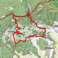
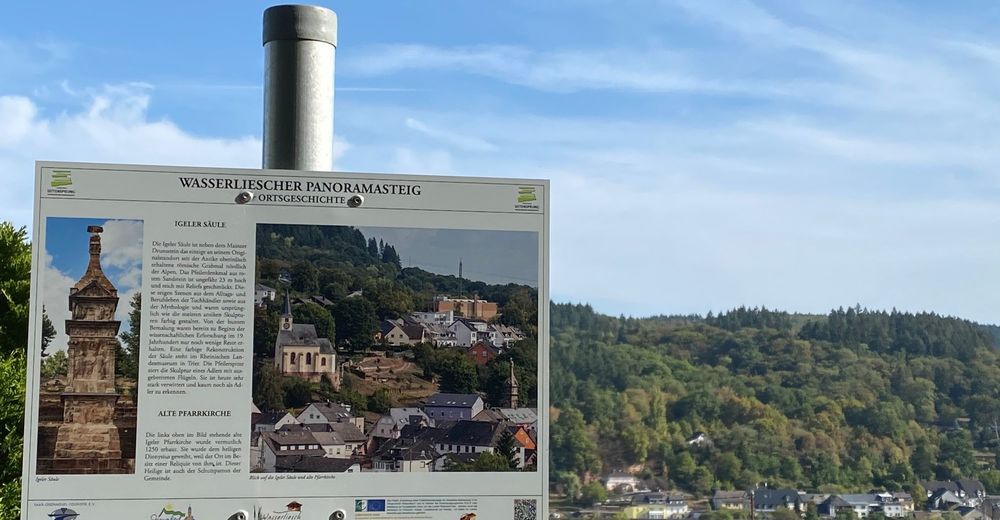
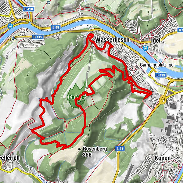
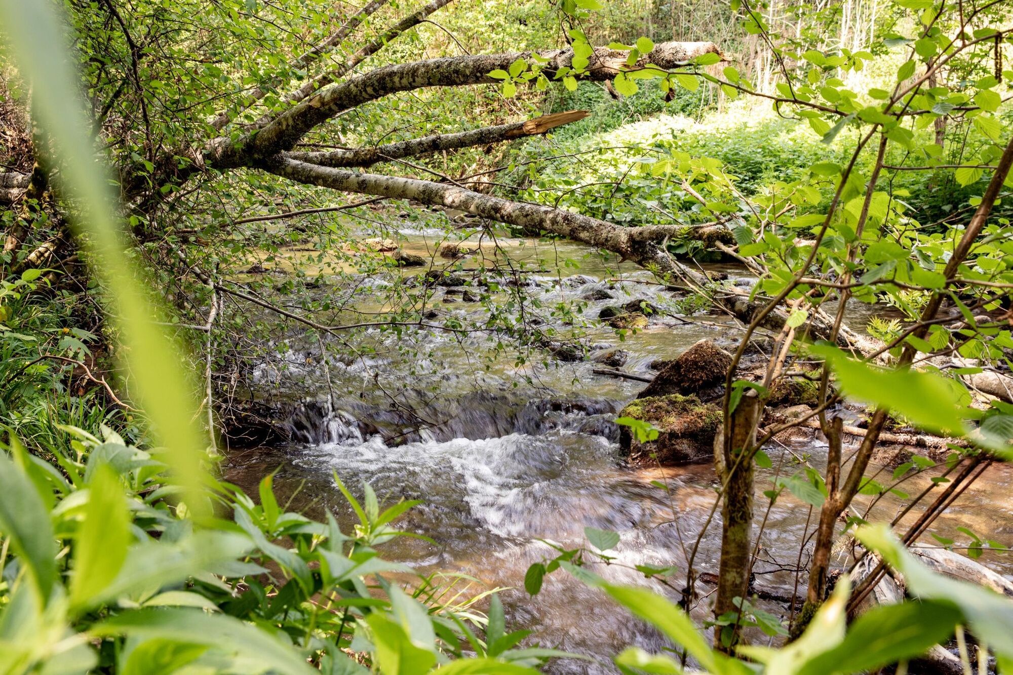
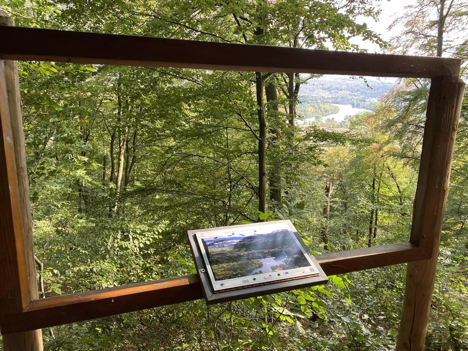
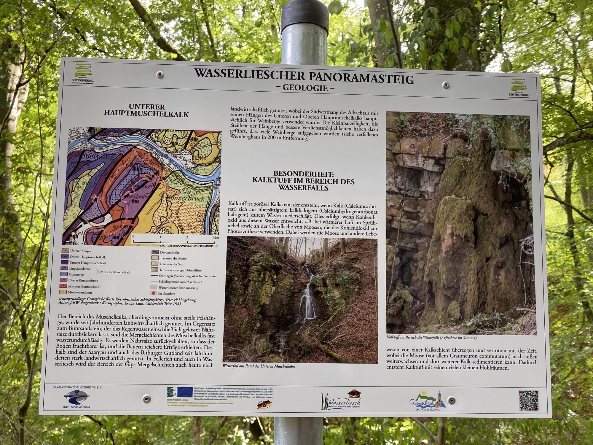
The Moselle leaves the German-French cuesta at Wasserliesch and enters the Rhenish Slate Mountains via the Trier valley basin. This is clear to see with the coloured sandstone and shell limestone strata advancing on the Moselle between Igel and Wasserliesch and the sharp dividing line of the Igel Fault. The market square is start and end point for the hike. From there the trail follows a gently undulating path to the peaks between the Saar and the Moselle. It combines a number of cultural and natural highlights. In the Perfeist natural conservation area, orchid fans will find one of the most species-rich occurrences of these in Germany. The trail continues from the “Altes Lager” down into the Albachtal valley conservation area. Taking in panoramic views of the natural and cultural landscape and a variety of features, the trail follows a picturesque path along the course of the stream before heading back to the starting point via the viewpoint on obere Römerstraße.
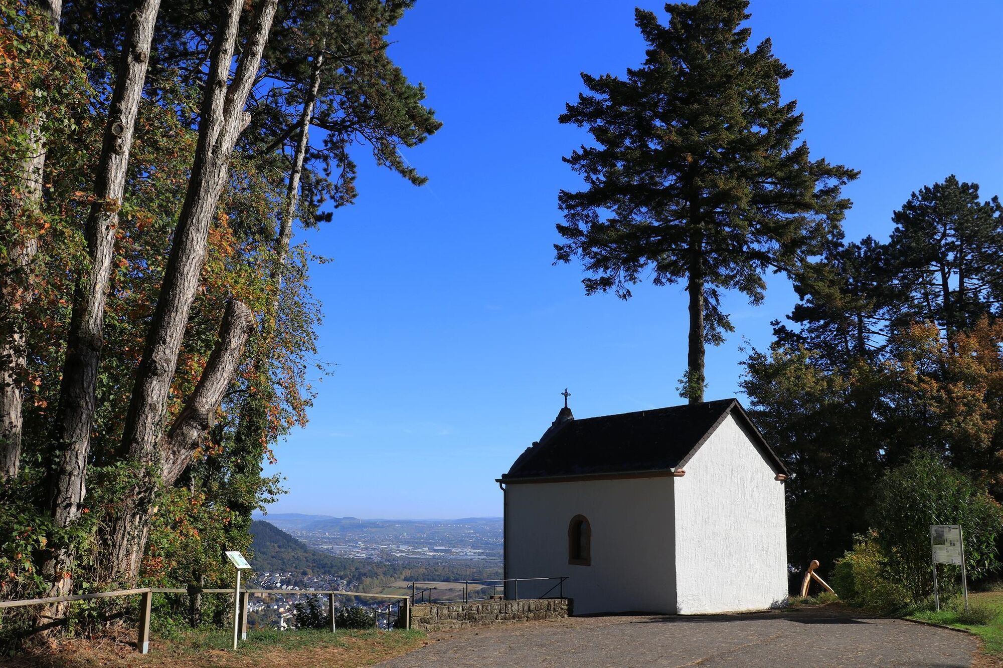
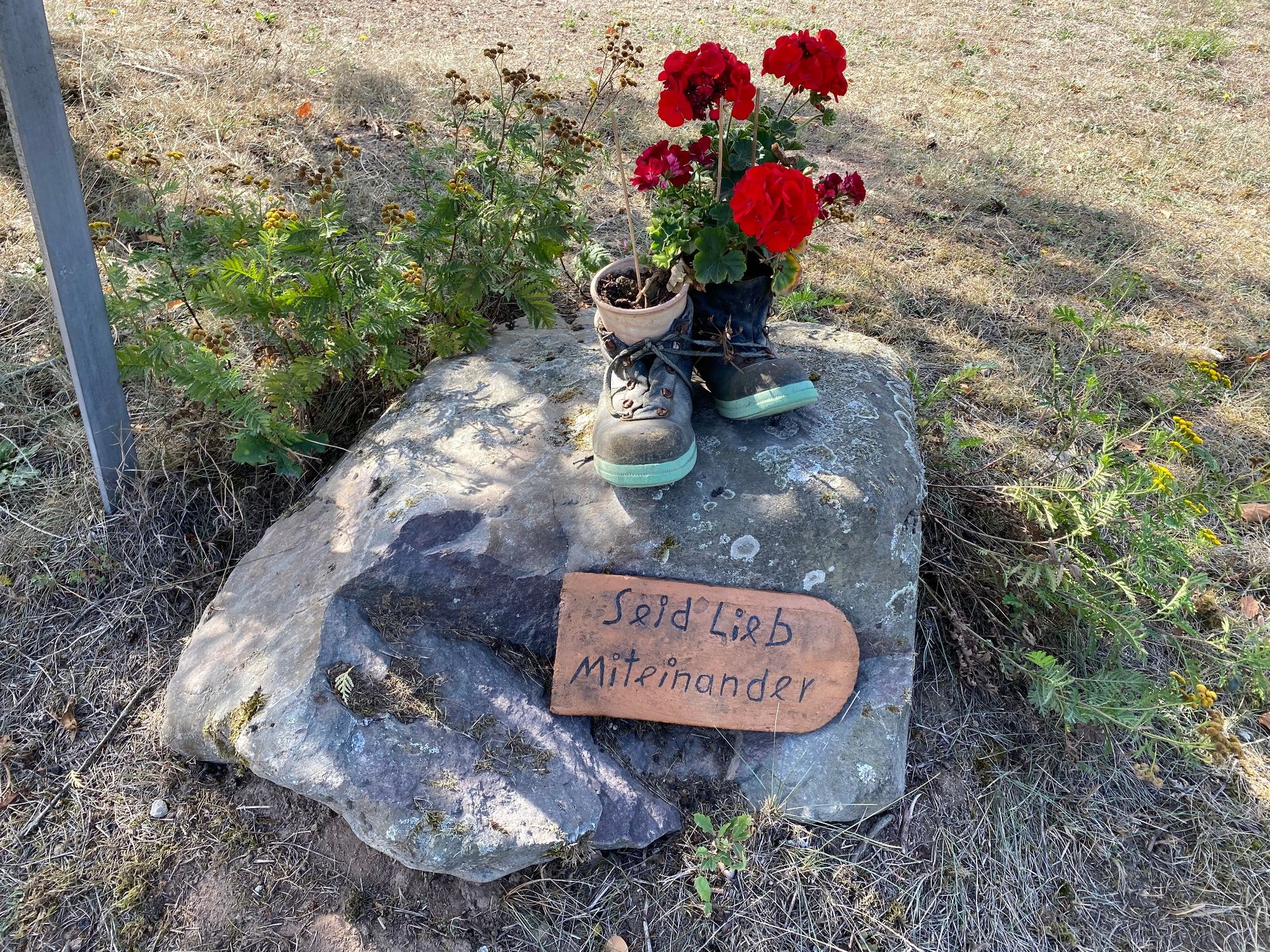
Cultural and natural landscape highlights: the Perfeist natural conservation area with its countless species of orchid, special rock formations, the Grana Memorial, and the Löschem Chapel. - Directions
-
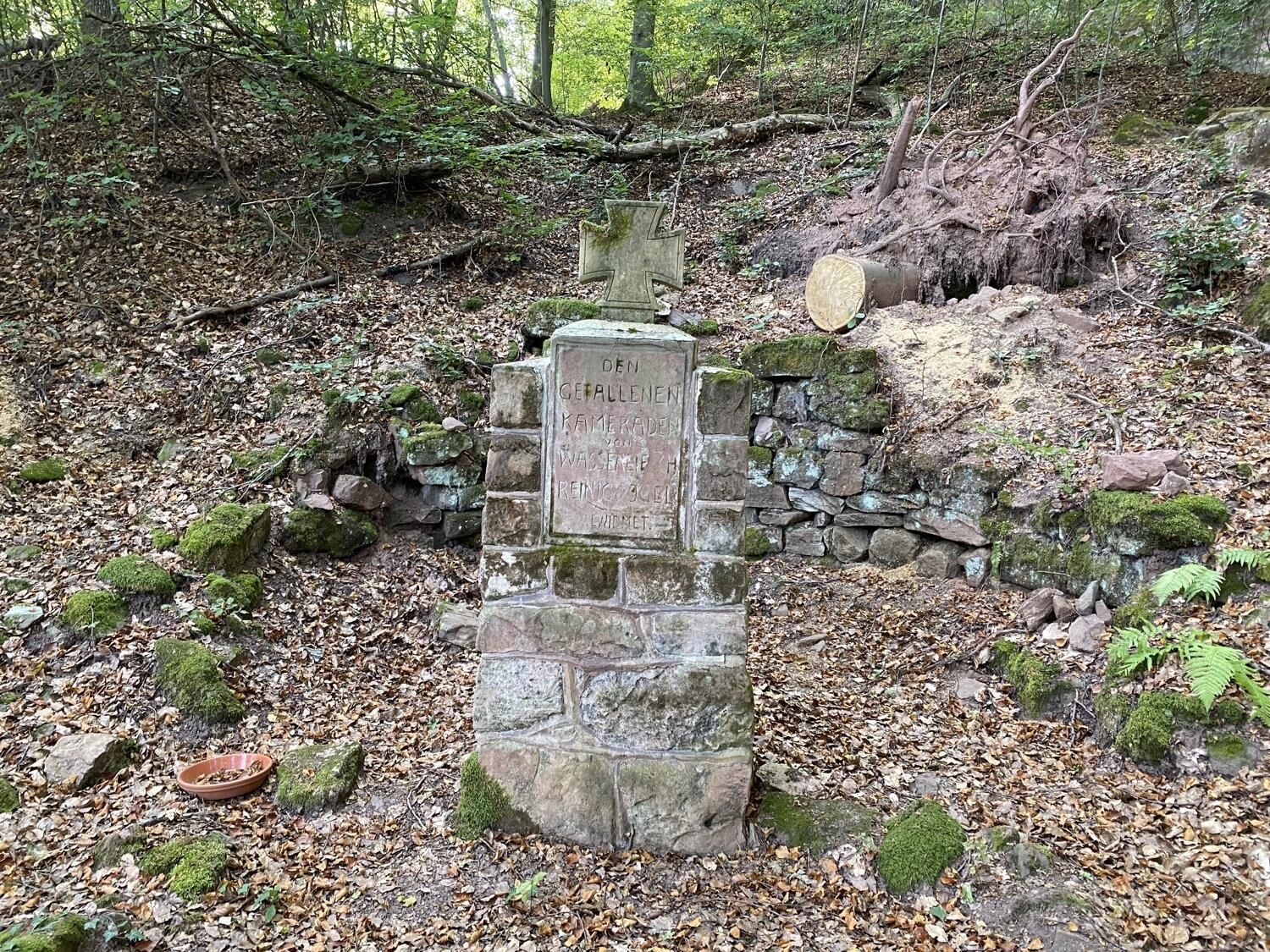
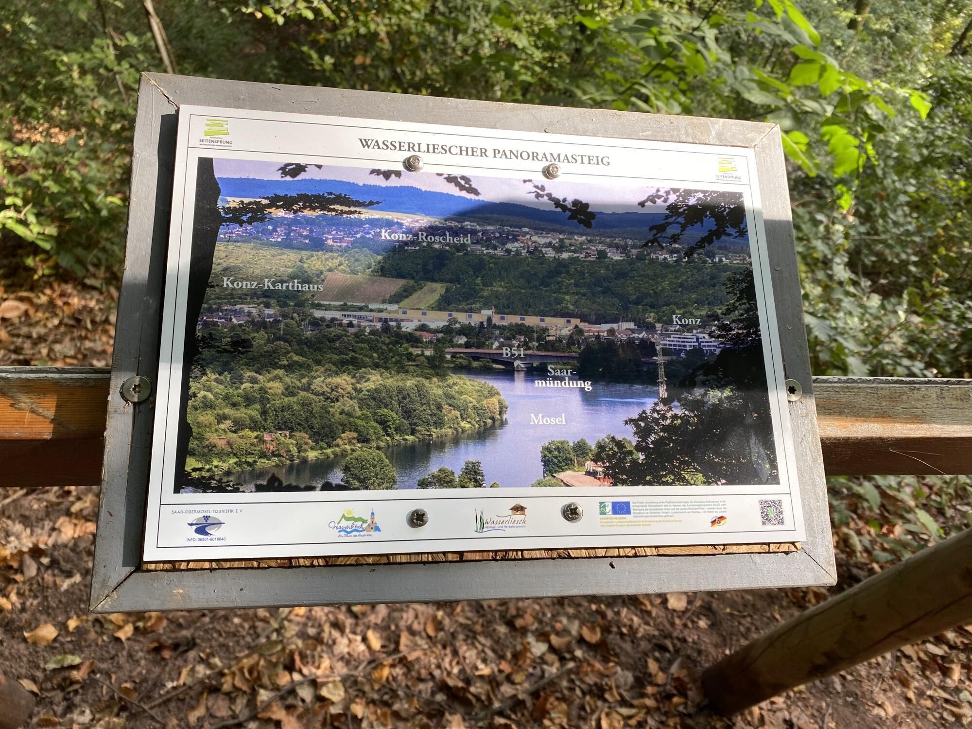
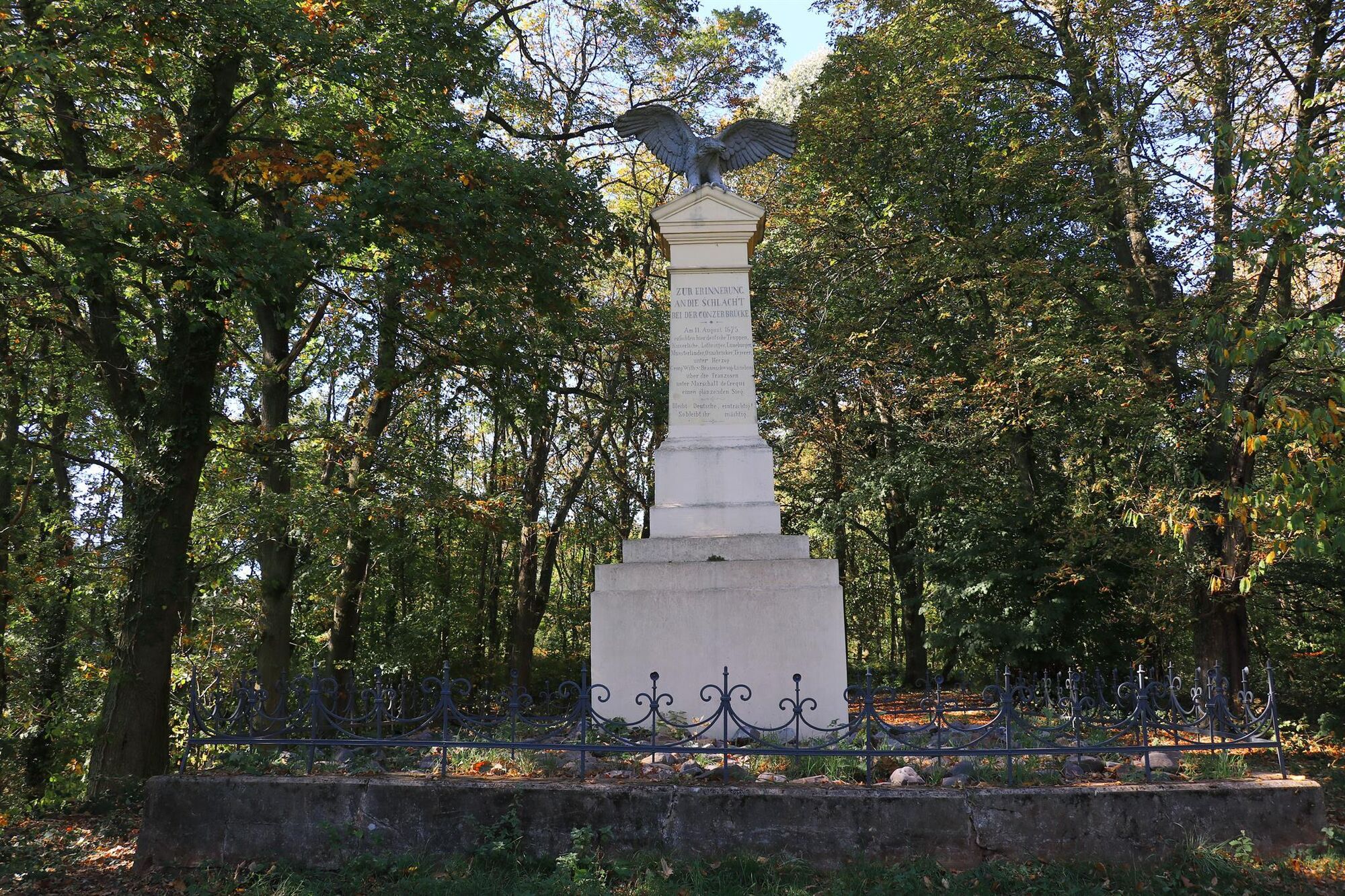
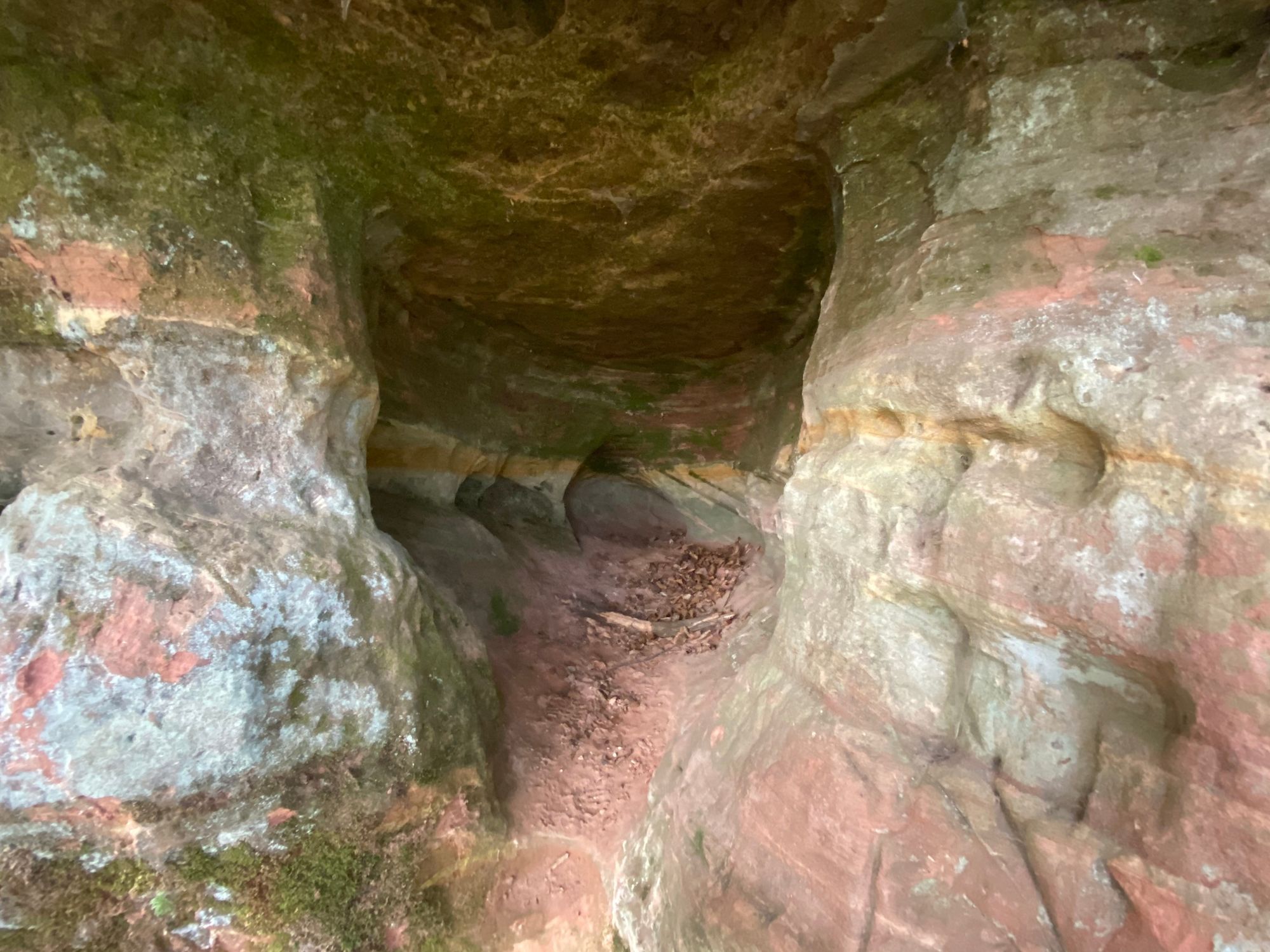
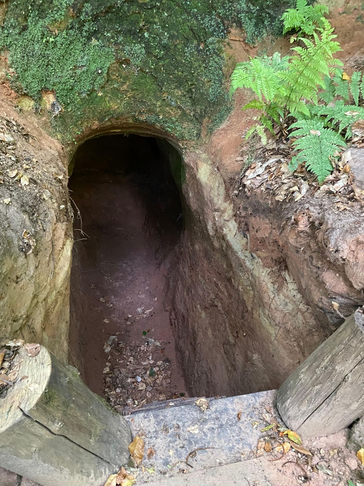
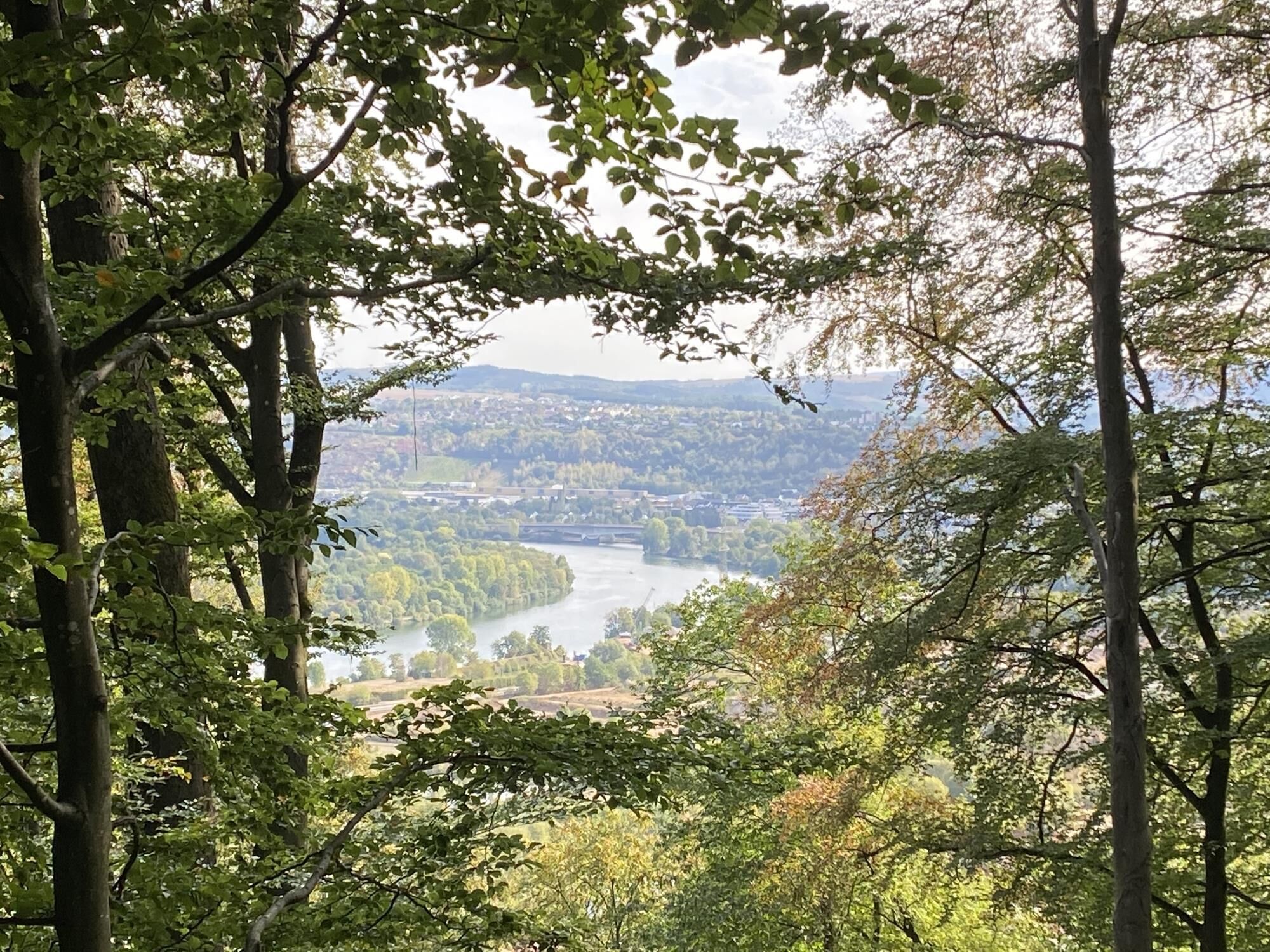
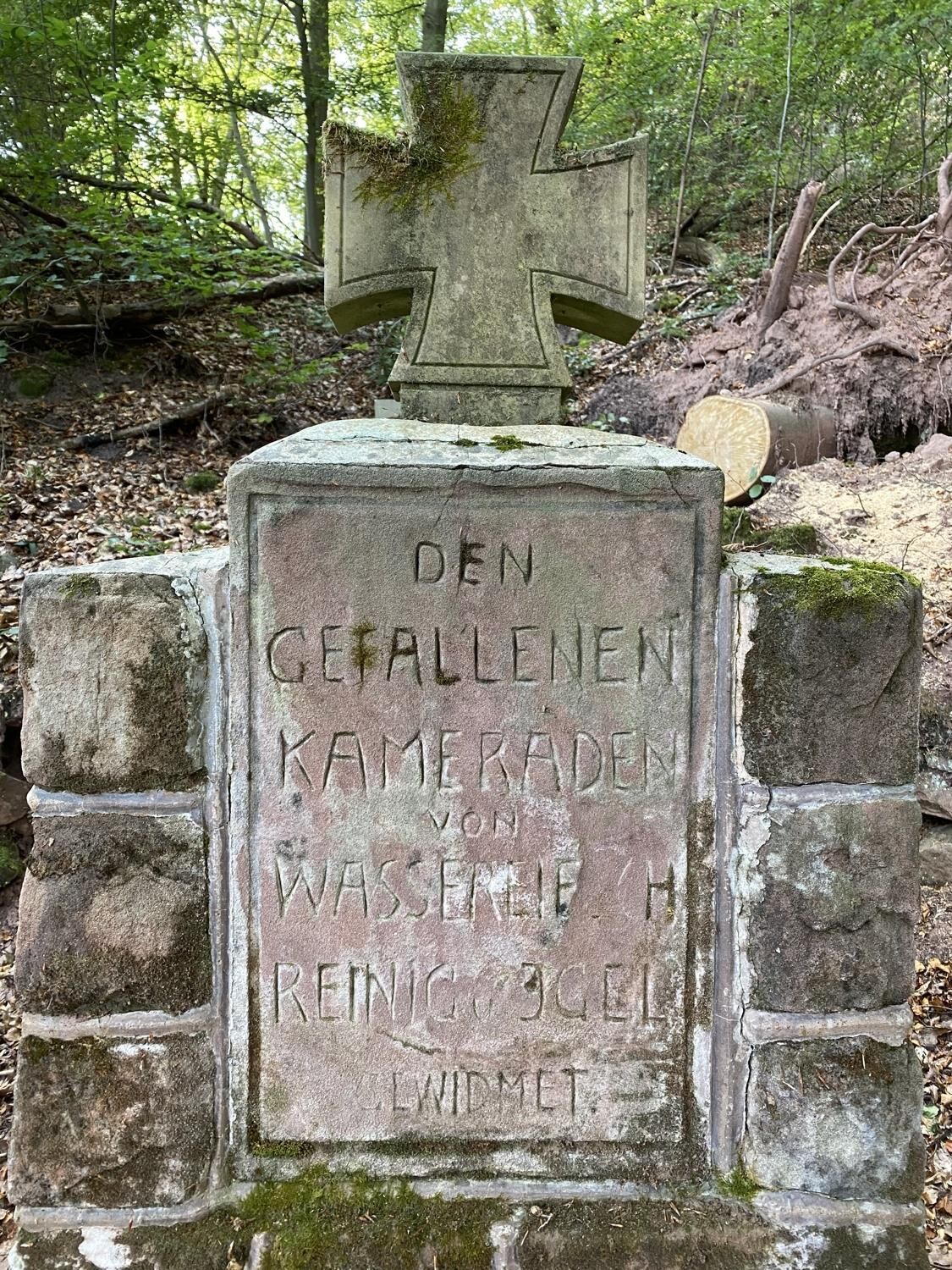
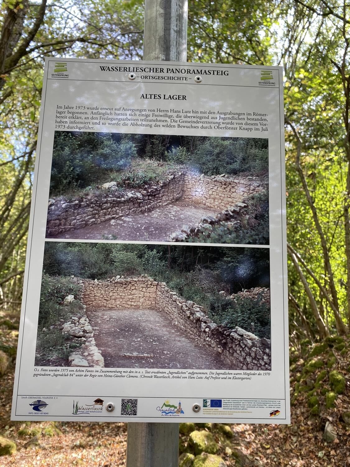
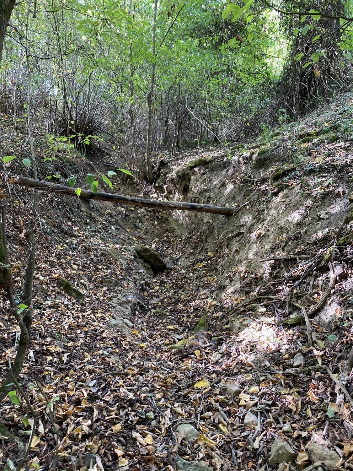
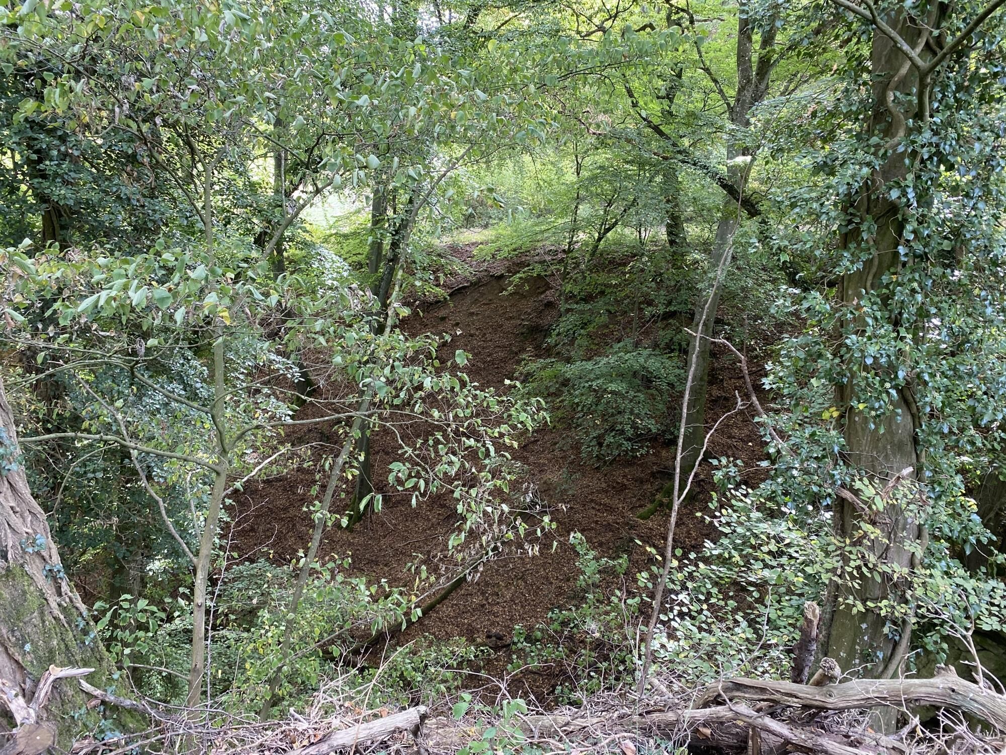
Where the Moselle leaves the border area with Luxembourg and the Saar flows into the Moselle, you will come across Wasserliesch, also referred to as the “Gate to the Upper Moselle”. After starting at the market square with the remains of a Roman Villa Rustica, you continue uphill on the Way of the Cross, which you will come across a number of times. After approx. 500 m you will cross Römerstraße and turn left after the garden after about 40 m. The trail leads slightly downhill along the slope until you turn off to the right into the woods. A short ascent leads you to the Moselsteig, which joins up with your trail for a while. After a ravine, turn off to the right at the first house, following the signposts you will come upon a rock formation with iron ore strata alongside a former French military camp. The trail leads on to the rocky plateau with the Grana Memorial which commemorates the defeat of Conzer Brück in 1675. Go left at the tennis courts , then slightly upwards to the right into a wood full of chestnuts. There the path leads you underneath striking coloured sandstone rocks. You will pass a cave dug out into the rock which was used as a refuge from bomb attacks during the Second World War. After a longer ascent you will rejoin the Moselsteig trail. One point of particular interest is a memorial site in front of an ancient stone bridge. From a resting stop here you can enjoy a distant view of Trier with its cathedral and basilica. Shortly after this you can experience the calming effect of nature under tall beech trees at Germany’s first Shinrin-Yoku forest bathing spot. It is here that the sudden change in vegetation becomes apparent. After crossing a geological fault line, the first calciferous orchid species grow right at the edge of the path. Break up the ascent on the Way of the Cross by taking a relaxing detour to the barbecue hut where you can rest and enjoy the distant view into the Moselle valley and Luxembourg. The Löschem chapel at 343 m altitude is the highest point of the Wasserliesch panoramic trail which really does live up to its name. The distant view into the Trier Moselle valley and beyond to Luxembourg and up to the Ardennes, into the Eifel and Hunsrück mountains will last long in the memory. Once on the high plateau, the trail leads on to the Auf Perfeist nature conservation area with its unique variety of rare orchids. Past the “Altes Lager” - the remains of the walls of a Roman guard post or maybe even traces of an old Celtic keep - the trail leads down towards a rest stop with a view of the wine village of Fellerich. The next few kilometres lead you on a leisurely walk through high forest and coppice forest before looping down several times to the Albach stream which you can cross via a footbridge. Now the Moselsteig trail and Panorama trail join one another for an uphill section before the woods open out onto a beautiful view of Fellerich and the Albachtal valley. Meadows and vineyards line the path up to another rest stop above an old vineyard wall, from where the wooded hilltop with the Altes Lager is clearly visible. Right after this, the path crosses the “Alte Gracht” canal and follows it downhill to the Albach stream, which is crossed at a pump station. Following the slightly undulating path, always accompanied by rushing of the stream, you will come to the Obere Mühle (upper mill) and then, following the old mill brook, the Albachmühle hotel restaurant, a great place for a break! Past old stone bridges, and a steep ascent, the path leads to the Römerstraße viewpoint with a sweeping view over Wasserliesch and the valley floor at the confluence of the Moselle and the Saar to Konz. Across the deeply carved Schlangengracht or winding canal, an old quarry path will take you back to your starting point at the market square, where you will find more places to stop for refreshments before your journey home.
- Highest point
- 337 m
- Endpoint
-
market place, 54332 Wasserliesch
- Height profile
-
 © outdooractive.com
 - Equipment
-
Please ensure you are wearing sturdy shoes and have packed sufficient provisions.
- Tips
-
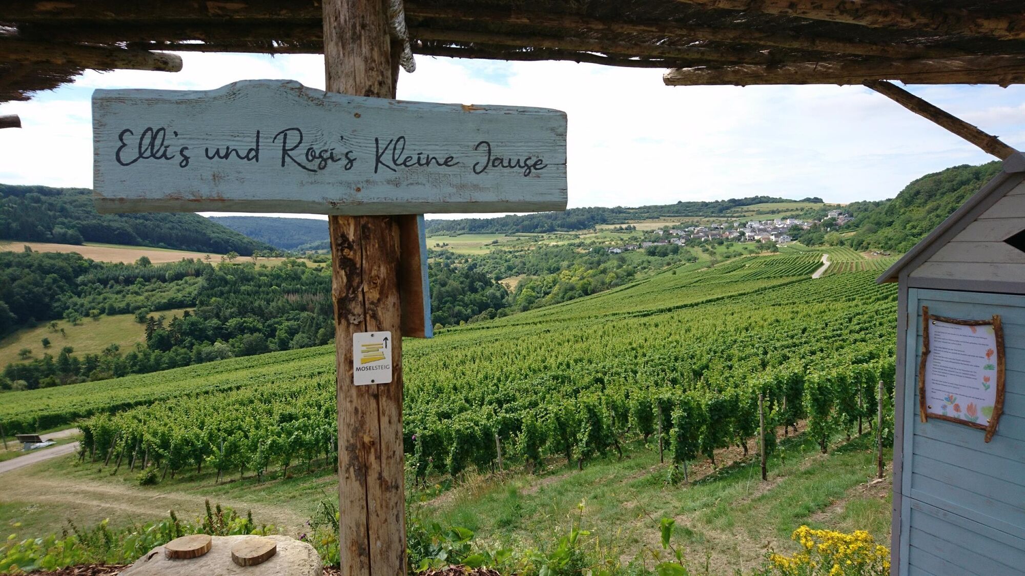
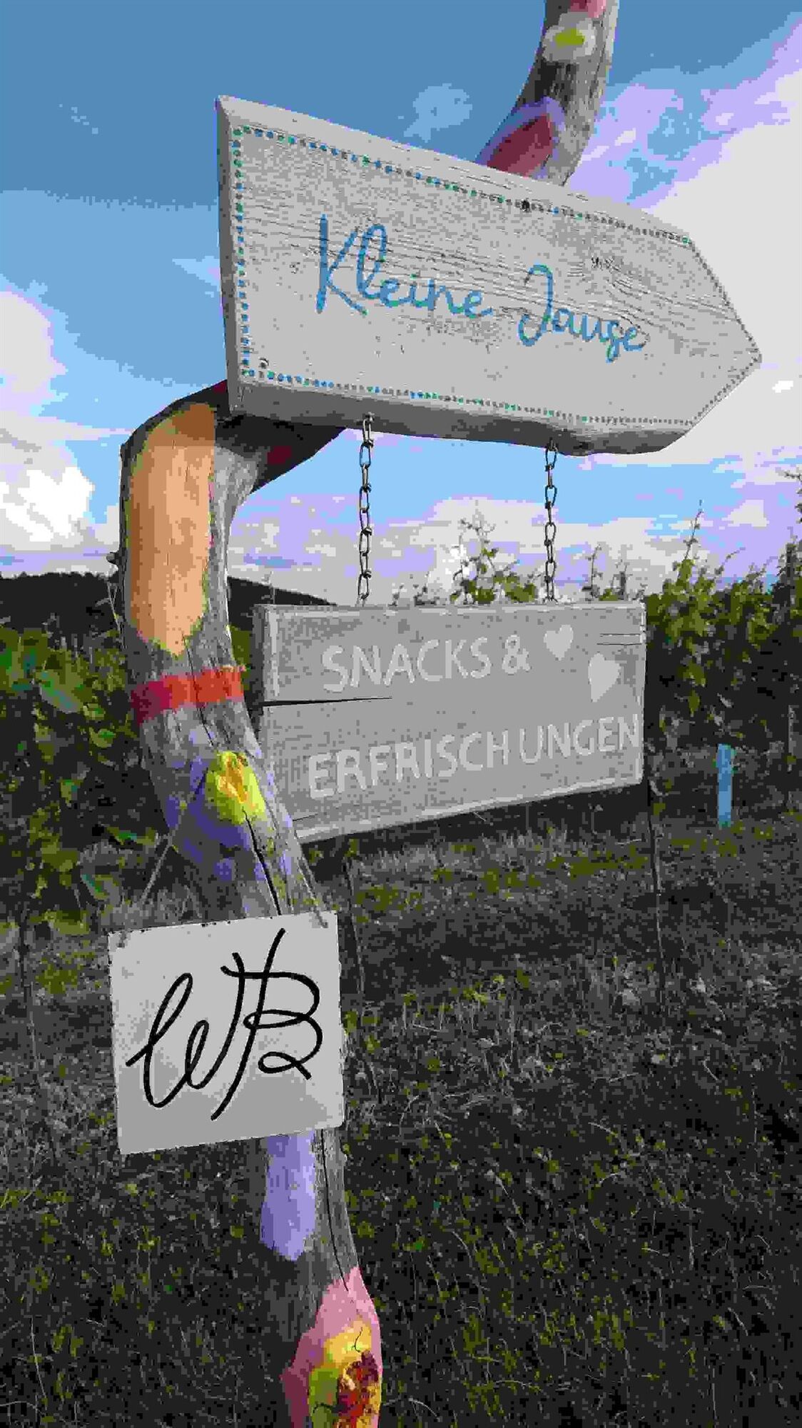
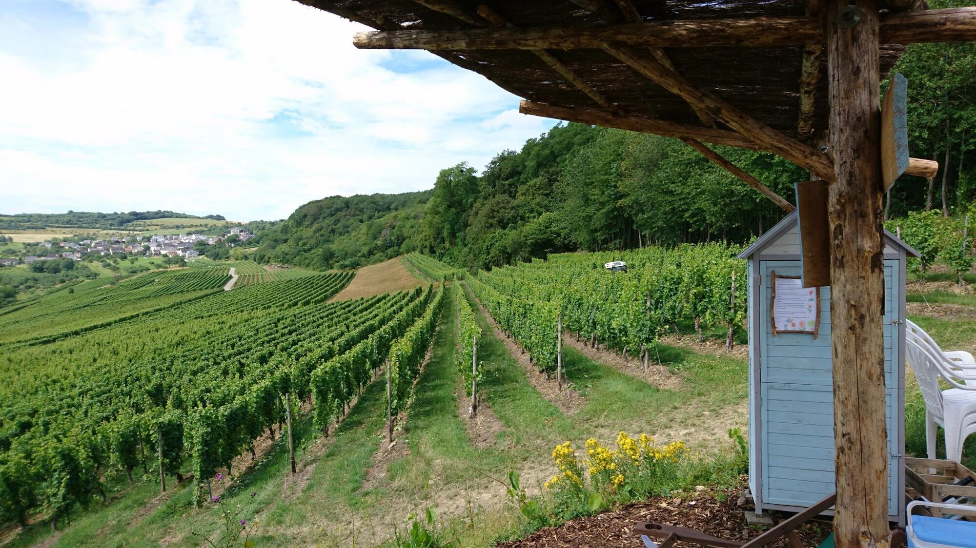
On a hill at the 11-kilometre point in the middle of a vineyard approx. 150 m off the path you will find Elli's und Rosi's Kleine Jause, a rest stop run by the Biewers wine estate. The stop offers snacks, refreshments, top-notch wine and a spectacular view of the vineyards around Fellerich.
- Additional information
-
Saar-Obermosel-Touristik e. V.
Saarstr. 1, 54329 Konz, Tel. +49 (6501) 6018040
Graf-Siegfried-Str. 32, 54439 Saarburg, Tel. +49 (6581) 995980,
www.saar-obermosel.de
Mosellandtouristik GmbH
Kordelweg 1, 54470 Bernkastel-Kues, Tel. +49 (6531) 97330
www.moselsteig.de
- Directions
-
You can reach Wasserliesch via B419.
- Public transportation
-
You can reach Wasserliesch by train via the Wittlich-Trier-Perl line. From there you can reach the hike start and finish point on the market square in just a few minutes.
- Parking
-
Free parking is available on the market square in Wasserliesch.


-

-
AuthorThe tour Moselsteig Side Trail Wasserliescher Panoramasteig is used by outdooractive.com provided.


General info
-
Saar-Obermosel
505
-
Mertert / Wasserbillig
164