- Brief description
-
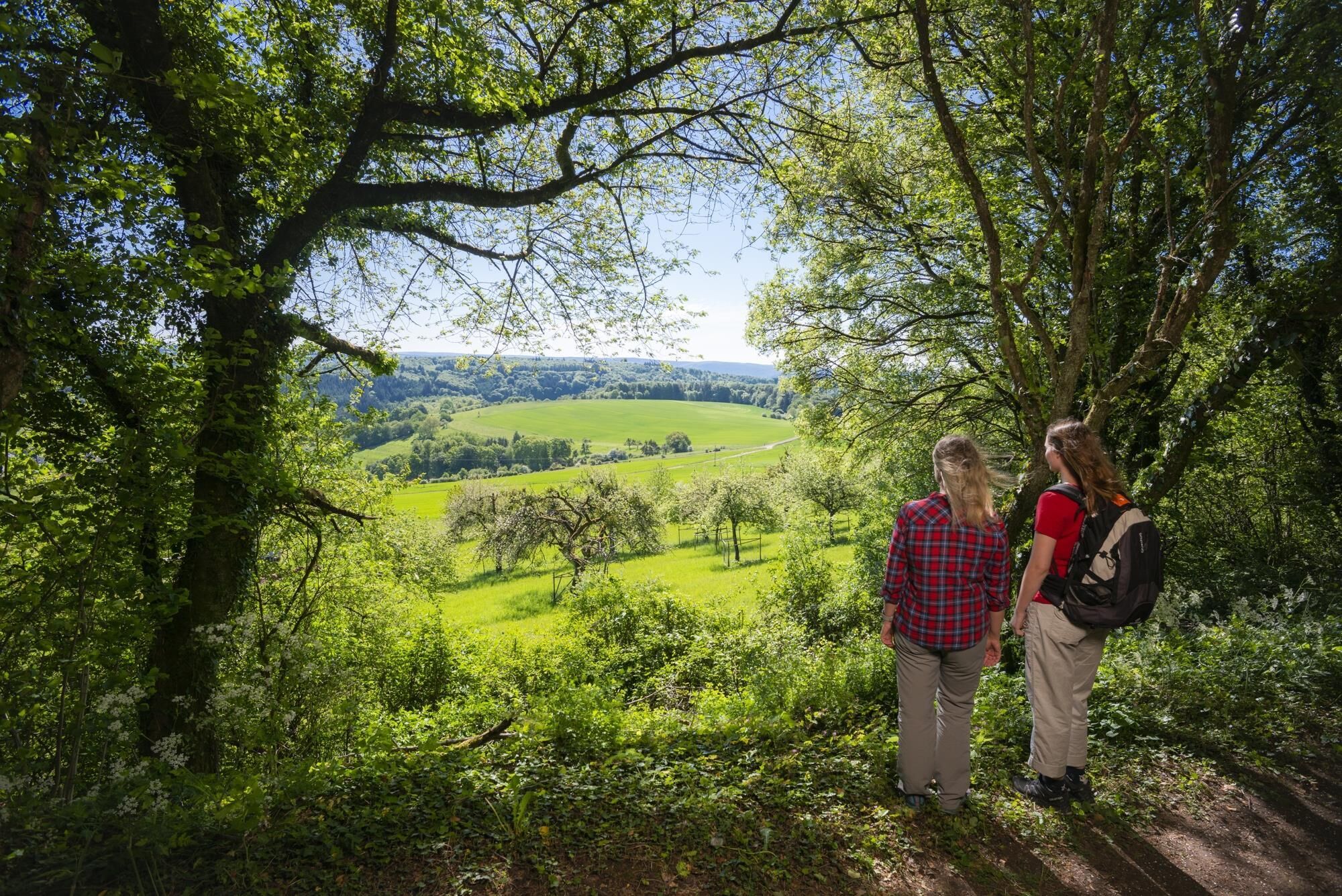
The tour leads along small paths through the Mannebach Valley. Quiet and peaceful stretches alternate with magnificent views. Special highlights are the green tunnel paths and the river of life in Fisch.
- Difficulty
-
medium
- Rating
-
- Starting point
-
Village square at the fire station in Mannebach, car park
- Route
-
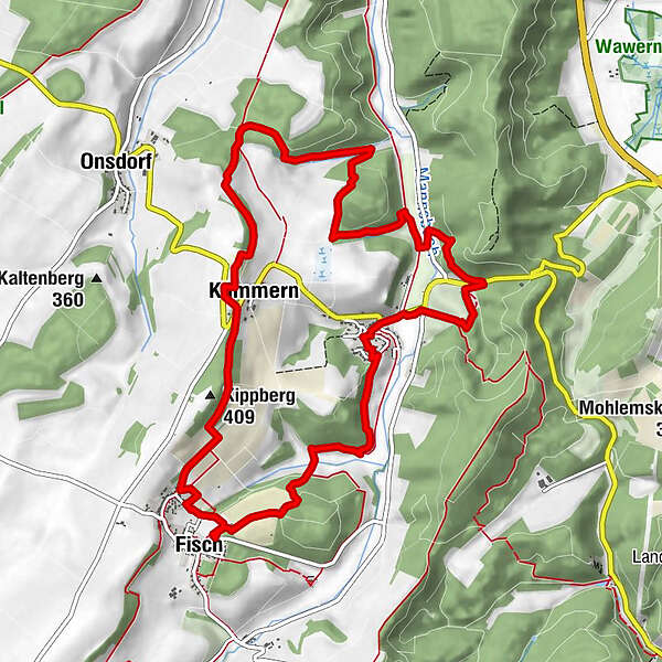
Mannebacher BrauhausMannebach0.1 kmKapellchen0.2 kmHinkelsgret2.9 kmKolmet5.7 kmMoorblick6.1 kmImrother Acker (394 m)6.3 kmKümmern6.9 kmKippberg (409 m)7.6 kmHochwald-Hostebergblick7.8 kmFisch9.2 kmMannebacher Brauhaus12.1 kmMannebach12.2 km
- Best season
-
JanFebMarAprMayJunJulAugSepOctNovDec
- Description
-
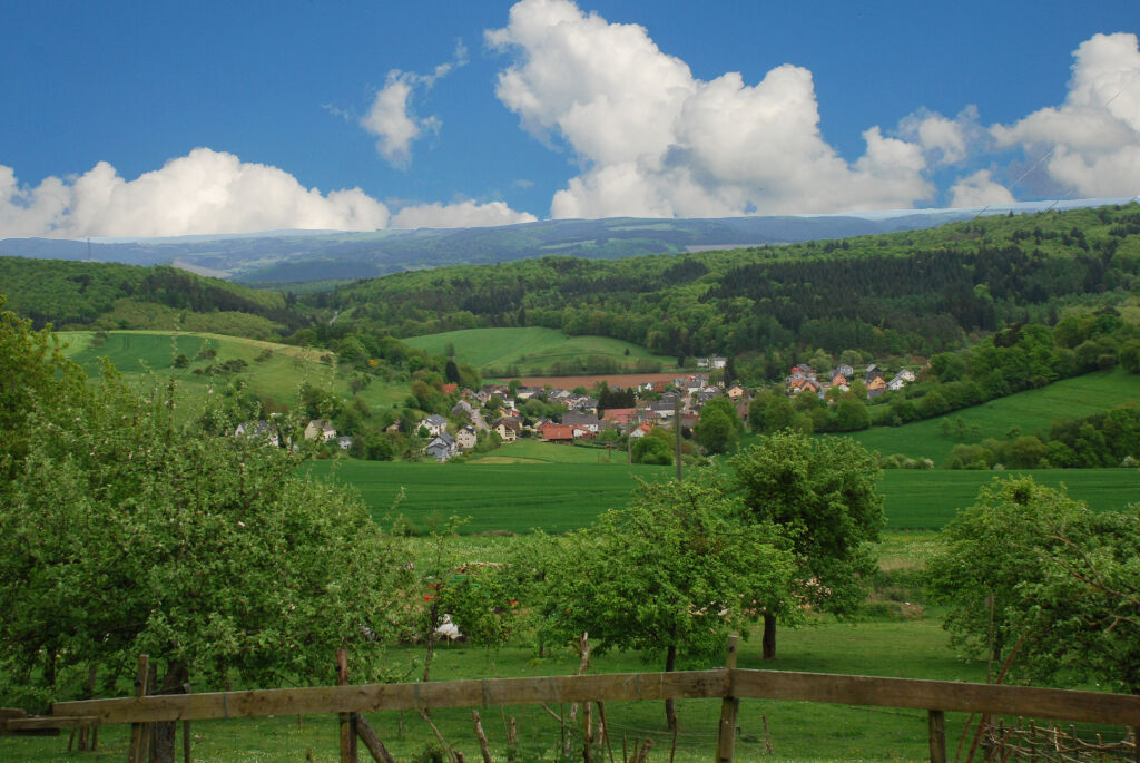
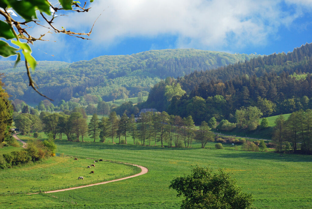
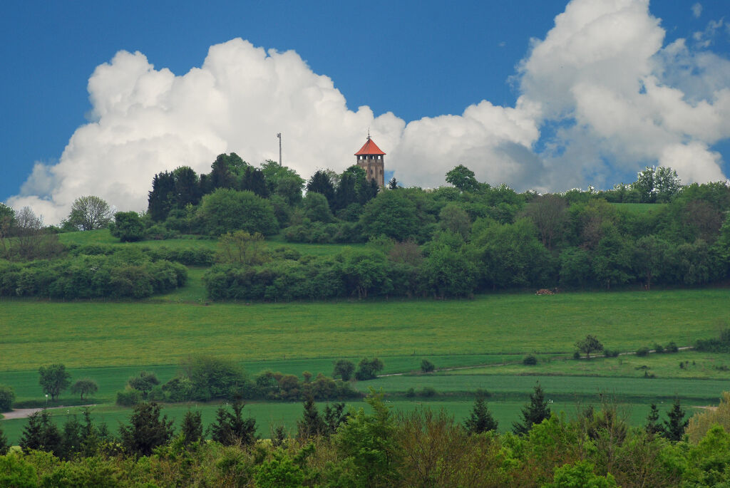
After crossing the Mannebach at the sports and leisure facility, you pass the Hinkelsgret caves. The next highlight is already waiting for you: the descent to the "Schaufelstal", which you hike up the valley to the western ridge of the Mannebach valley. Up here you can enjoy a magnificent view. The next part of the dream loop can be described as a highlight. A 1 km section through a "tunnel path" awaits you, with wonderful views of a high moor and the village of Mannebach again and again. The path leads you on to the river of life to Fisch. Before you get there, enjoy the wide view towards the Hunsrück and the 435 m high Hosteberg with its Geheimrat-Brügman tower. After about 12 kilometres of medium difficulty, you will pass through the orchard meadows on the "Bickel" and reach your starting point again.Further entrances are possible at the Lebensfluss Fisch and the Mannebachtal sports and leisure facility.
- Directions
-
You pass the Mannebachtal sports and leisure facility. After crossing the Mannebach, you pass the Hinkelsgret caves, where the people of Mannebach hid from the Swedes during the 30-year war. The next highlight is already waiting for you: the descent to the "Schaufelstal", a romantic side valley of the Mannebach, which you hike up the valley to the western ridge of the Mannebach valley. Up here, you can enjoy a magnificent view: into the Schaufelstal valley, into the Moselle mountains near Trier, over the Vorderer Hochwald forest with the Saar mountains and to the Hosteberg mountain. The next part of the dream loop can be described as a highlight. A 1 km section through a "tunnel path" awaits you, with wonderful views of a high moor and the village of Mannebach again and again.The trail continues along the path that runs below the ridge of the Saargau to the river of life in Fisch. Here you can trace the different stages of human life from birth to death along a small river. Before you go, enjoy the wide view towards the Hunsrück and the 435 m high Hosteberg with its Geheimrat-Brügman tower. On clear days, you can see the highest elevation in Hunsrück, the 816-metre-high Erbeskopf, in the distance. After about 12 kilometres of medium difficulty, you reach Mannebach again through the orchard meadows on the "Bickel", through the Fischer and adjoining Mannebach valleys via the so-called "Fischer Pfädchen". Around 1800, the fishermen used this path to retrieve their church bells, which they had brought to safety in Mannebach, in a night and fog operation after the people of Mannebach refused to hand them over.Other access points are possible at the Fish River and the Mannebach Valley Sports and Leisure Centre.Texts and pictures with the kind support of Werner Weber, Mannebach!
- Highest point
- 394 m
- Endpoint
-
Village square at the fire station in Mannebach, car park
- Height profile
-
 © outdooractive.com
 - Equipment
-
Please make sure you wear sturdy shoes. The premium hiking trail is not suitable for prams.
- Tips
-
Look forward to fantastic views and breathtaking vistas! A picnic at the Fischer Lebensfluss facility is recommended.
- Additional information
-
Saar-Obermosel-Touristik, Tourist-Information Saarburg, Graf-Siegfried-Str. 32, 54439 Saarburg, Tel. 06581-995980Saar-Obermosel-Touristik, Tourist-Information Konz, Saarstr. 1, 54329 Konz, Tel. 06501-6018040E-mail: info@saar-obermosel.de Visit our website with exclusive tips and information on the Saar-Obermosel holiday region:www.saar-obermosel.de/ www.facebook.com/saarobermosel www.instagram.com/saarobermoselhttps:...
- Directions
-
From Trier via the B 51 towards Saarburg. After Konz-Könen via Tawern to Mannebach.From Saarburg via the L 135 to Mannebach-Ort, Mannebachtal sports and leisure centre or Fisch-Lebensfluss.
- Public transportation
-
Information on current bus schedules is available at: www.vrt-info.de/busnetz

-

-
AuthorThe tour Dream Loop Mannebach 111 is used by outdooractive.com provided.


General info
-
Saar-Obermosel
505
-
Grevenmacher
160
")