
- Brief description
-
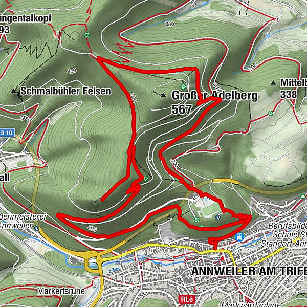
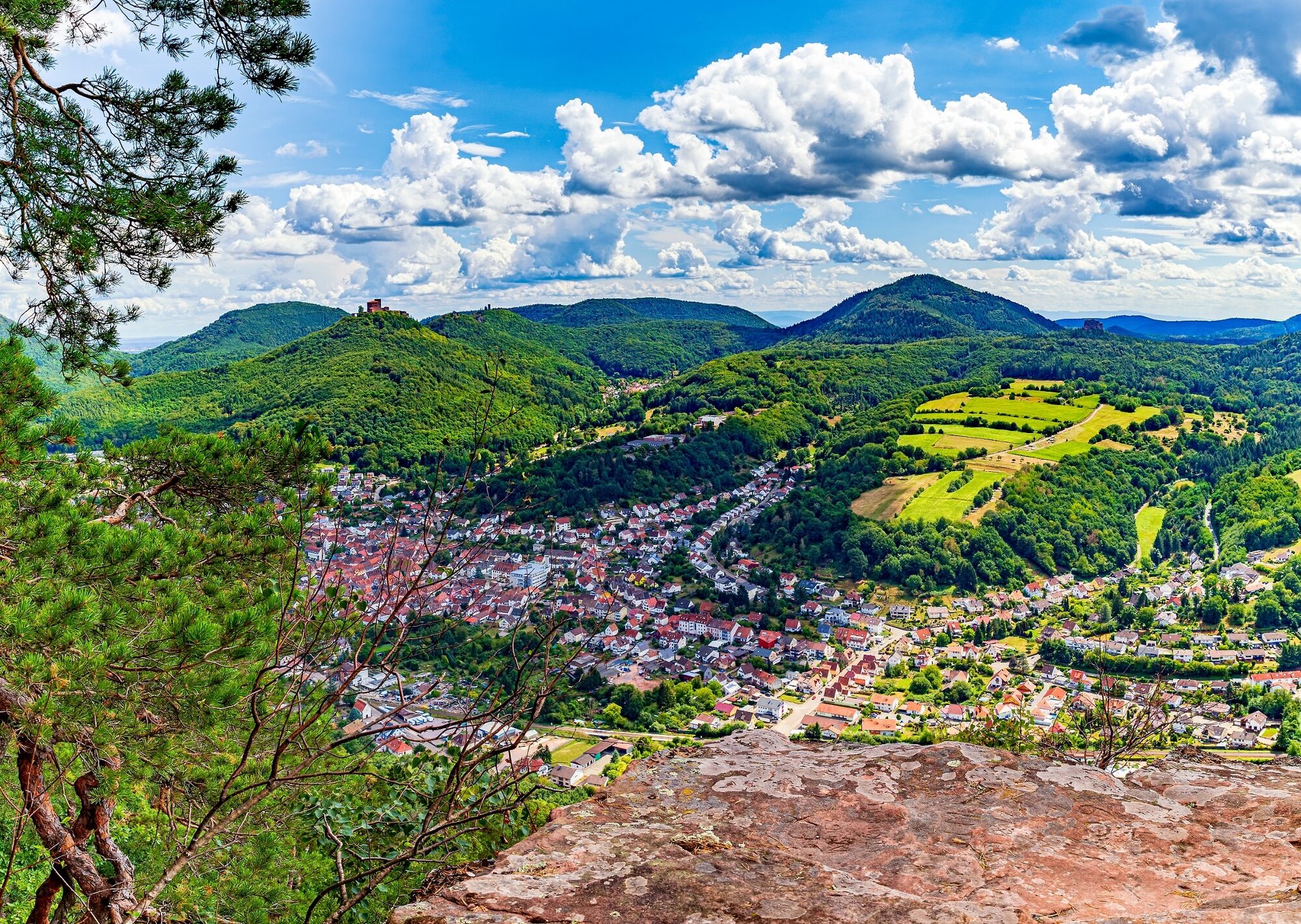
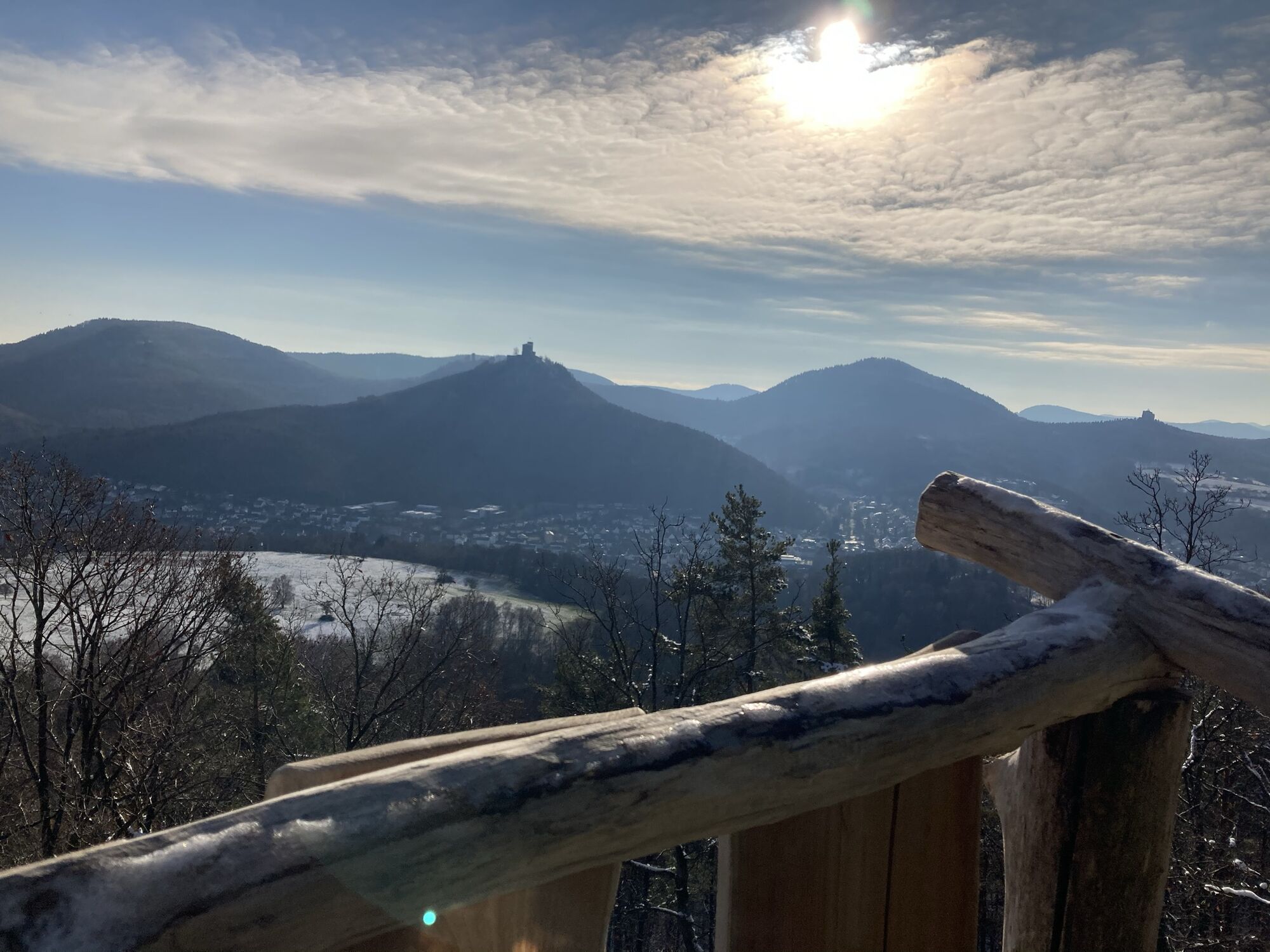
Hiking tour around the Adelberg. Magnificent panorama view of Annweiler and the castle trio Trifels, Anebos and Münz, as well as the rock „Asselstein“.
- Difficulty
-
medium
- Rating
-
- Starting point
-
Catholic Curch in Annweiler
- Route
-
St. JosefAnnweiler am Trifels (179 m)0.3 kmHolderquelle3.4 kmSt. Josef9.5 km
- Best season
-
JanFebMarAprMayJunJulAugSepOctNovDec
- Description
-
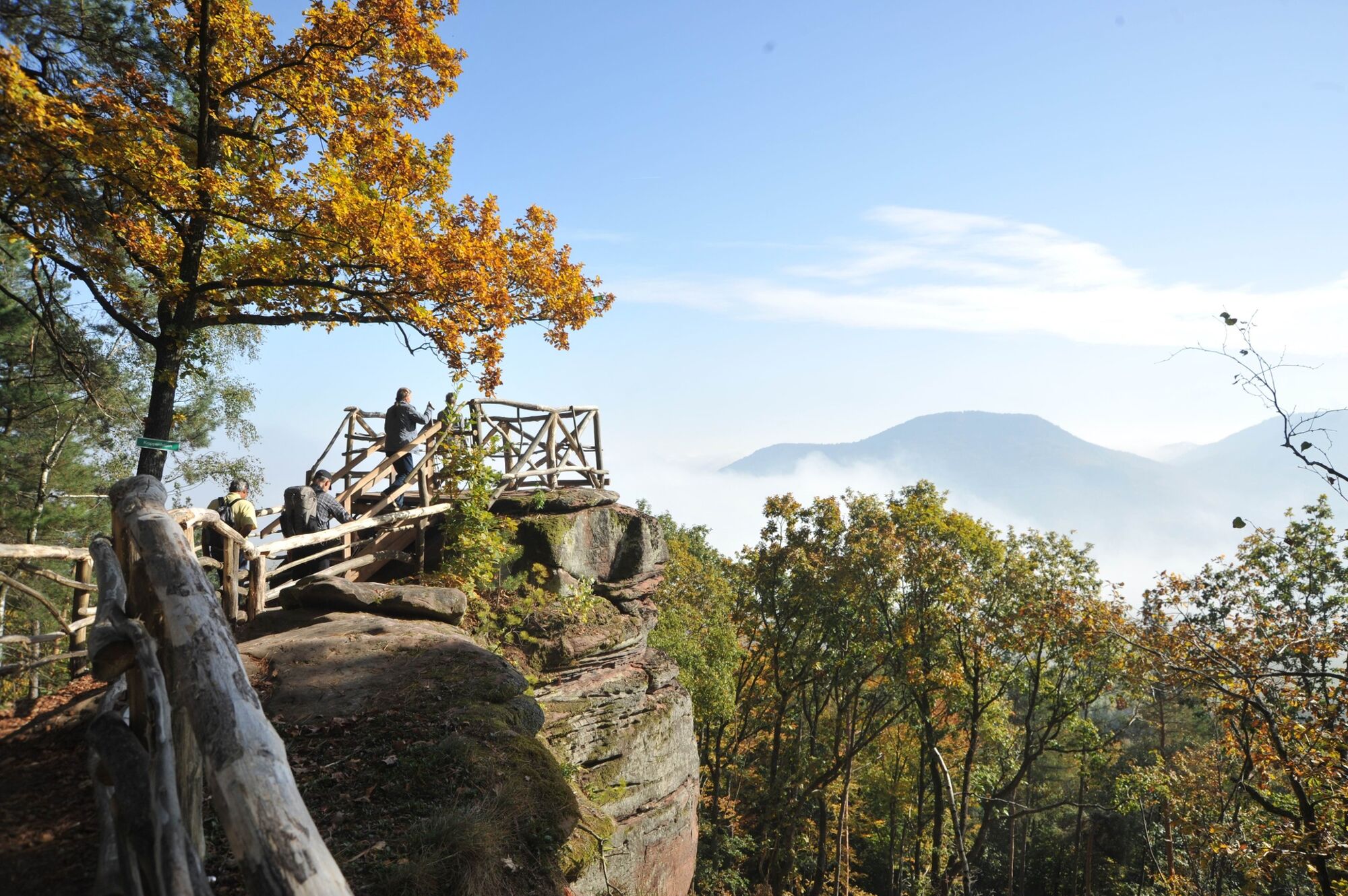
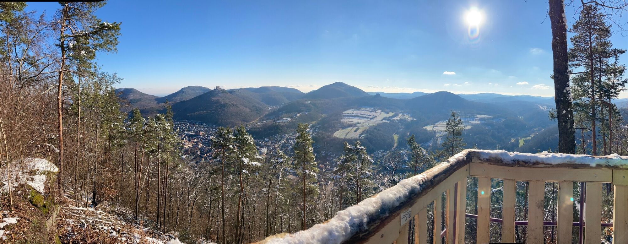
The tour starts at the Catholic Church in Annweiler am Trifels. We cross the railroad tracks and follow the path on the right to get to the Turnerheim. We pass it and follow the crown signs uphill. The first outlook is the rock “Krappenfelsen”. There you have a great view in the Queich valley.
After we enjoyed this view, we cross the driveway and follow the path towards the “Holderquelle”, which is a natural spring. There is a lodge, which is great for a picnic. At the following crossroad, a detour to the hiking lodge “Jungpfalzhütte” is recommended. They offer authentic regional cuisine on the weekends, a playground and an amazing view.
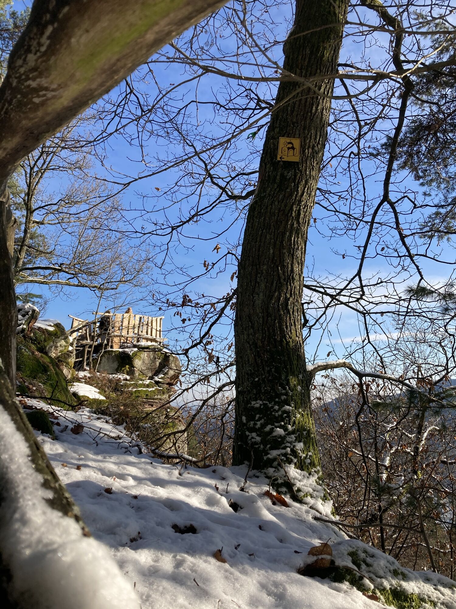
At the cross road we hike stright to the rock „Sommerfelsen“. This is the last gorgeous view on the castle trio. We go back a little and descend back to Annweiler.
- Directions
-
The tour starts at the Catholic Church in Annweiler close to the train station. You walk through the “Turnerweg” and by using a little bridge cross the railroad tracks. Right after the bridge the path turns right. At the following crossroad, we follow the Zigzagging path on the right.
The emperor-Friedrich-path passes the hostel “Turnerheim” and ascends to the rock “Krappenfelsen”, where you have an amazing lookout on the Queich valley. After we enjoyed this view, we cross the driveway and follow the path towards the “Holderquelle”, which is a natural spring. There is a lodge, which is great for a picnic.
The hiking path turns left at the big crossroad to the rock “Sommerfelsen”. The rock can be reached by an approximately 500 m long path. After that the path winds downhill to the Turnerheim street. You follow the street uphill for a little while until you can turn right into the Scheffel-Weg. This street leads you back to the railroad tracks and the starting point.
Refreshment stops:
Near the Turnerheim you can make a small detour to the restaurant Schützenhaus. On weekends, we recommend a detour to the hiking lodge “Jungpfalzhütte”. Both refreshment stops are approximately 500 meters removed from the hiking path. Another option is to stop in in the center of Annweiler at the end of your tour. There are many different restaurants, cafes and wine taverns in Annweiler.
- Highest point
- 471 m
- Endpoint
-
Catholic Curch in Annweiler
- Height profile
-
 © outdooractive.com
 - Equipment
-
For our hiking tours we recommend the following equipment as standard:
Sturdy shoes Clothing suitable for the weather Sun and rain protection Sufficient supplies of food and drinks, as there are not always refreshment stops or shops available or open everywhere. Even though the paths are very well marked throughout, it is always advisable to carry a suitable hiking map for safety reasons, so that you can quickly find your way to a safe area in the event of a thunderstorm or emergency, for example. - Safety instructions
-
In general:
Especially in autumn, also be aware that leaves lying on the ground can hide bumps, roots, stones or holes in the path. After thunderstorms or rainstorms, trees can still fall over or branches can fall down afterwards. Especially in adverse weather conditions, muddy and slippery passages can occur on natural paths. Not all rocks or precipices are secured with ropes or railings. Surefootedness is required in places. You have to expect this type of path impairment when you undertake a hike. If you are of the opinion that certain sections of the trail are not passable for you, you should avoid them.
NOTICE:
We endeavour to announce on this platform any closures that occur due to forestry work or hunting parties. Nevertheless, there are situations where hiking trails are closed and we may not have been informed. If you unexpectedly encounter a trail closure or diversion, please follow the instructions for your own safety.
- Tips
-
If you want to make a detour to visit the castle Trifels just follow the hiking path „Pfälzer Weinsteig“ through Annweiler. One way is approx. 3 km.
- Additional information
- Directions
-
Highway A65 to exit "Landau-Nord", continue on B10 to Annweiler am Trifels, Exit Annweiler-Ost
- Public transportation
- Parking
-
Parking lot 6 (close to the tourist information) or P10 near Villa Gotthold in Zweibrücker Straße


-

-
AuthorThe tour Annweiler - Kaiser-Friedrich-Weg is used by outdooractive.com provided.


General info
-
Pfalz
1517
-
Trifelsland
1063