
- Brief description
-
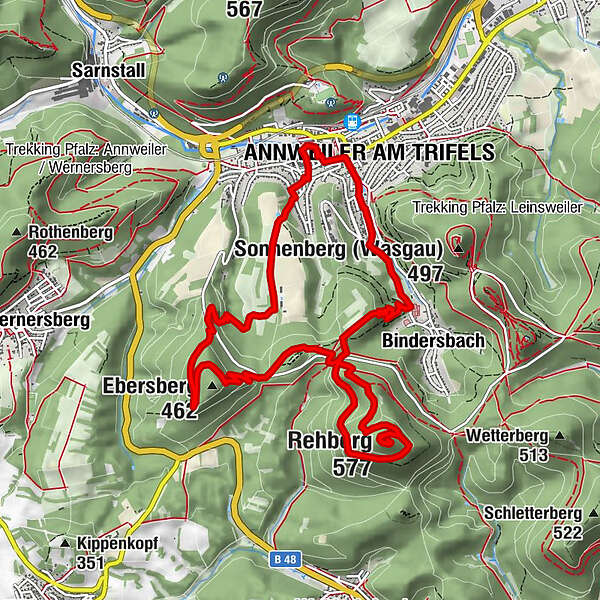
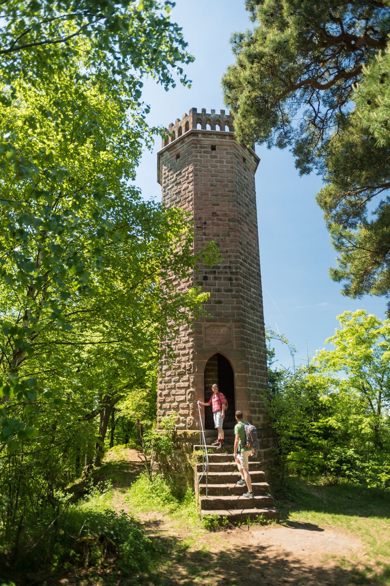
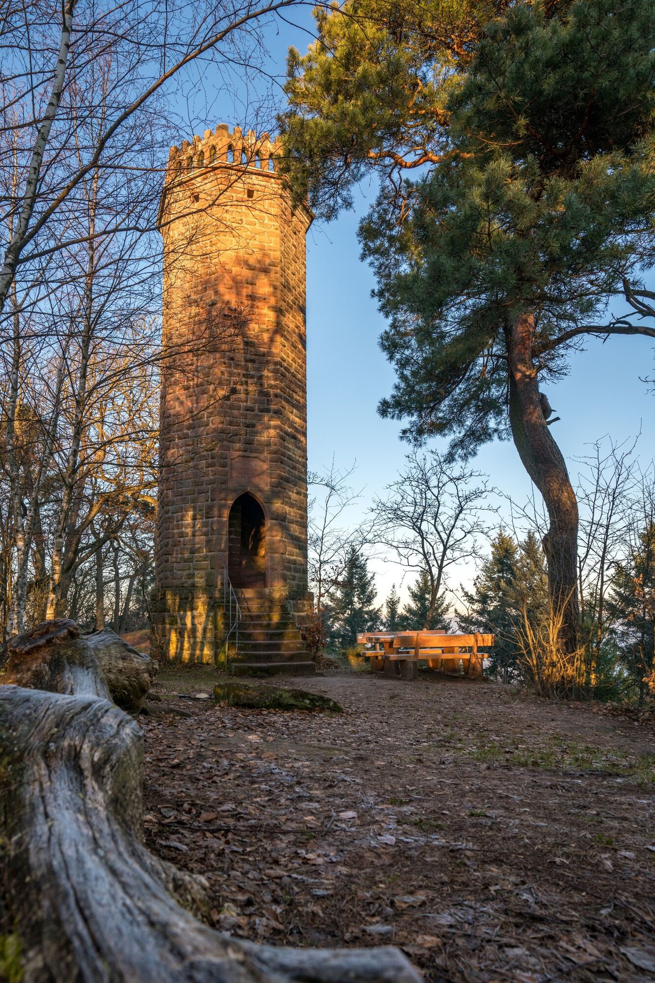
The challenging hike leads through meadows and forests to beautiful vantage points in Trifelsland. The highlight of the tour is the panoramic view from the Rehberg tower.
- Difficulty
-
difficult
- Rating
-
- Starting point
-
Rathausplatz in Annweiler am Trifels
- Route
-
Annweiler am Trifels (179 m)Stadtkirche0.0 kmAndachtsstätte Biotop2.9 kmAndachtsstätte Einsiedelei3.0 kmAndachtsstätte Arche3.2 kmWasgaublick3.8 kmKlettererhütte6.0 kmRehberg (577 m)8.2 kmRehbergquelle (505 m)9.0 kmBindersbach11.3 kmTrifels-Terrasse11.3 kmAnnweiler am Trifels (179 m)12.7 kmStadtkirche12.9 km
- Best season
-
JanFebMarAprMayJunJulAugSepOctNovDec
- Description
-
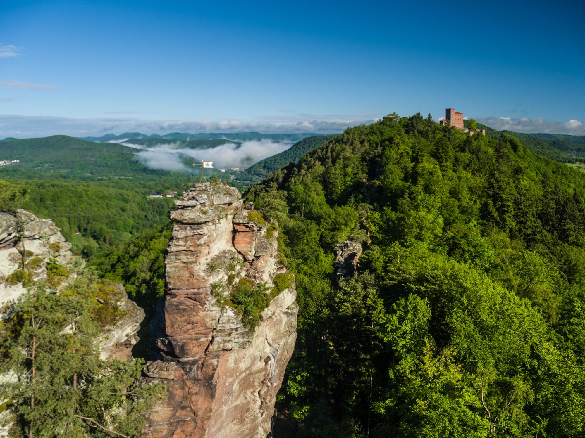
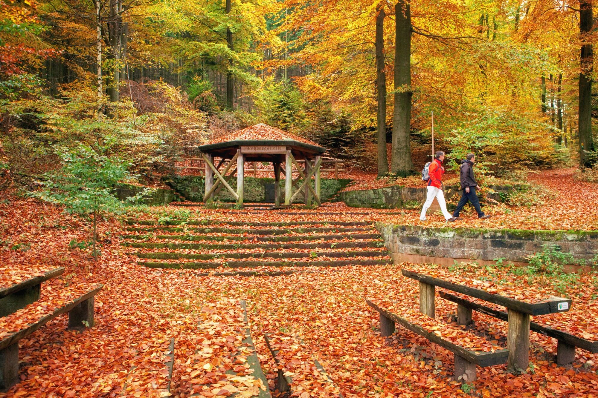
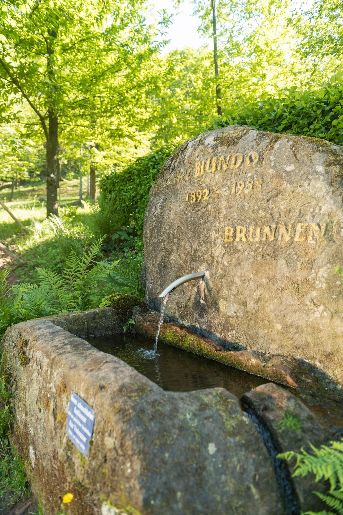
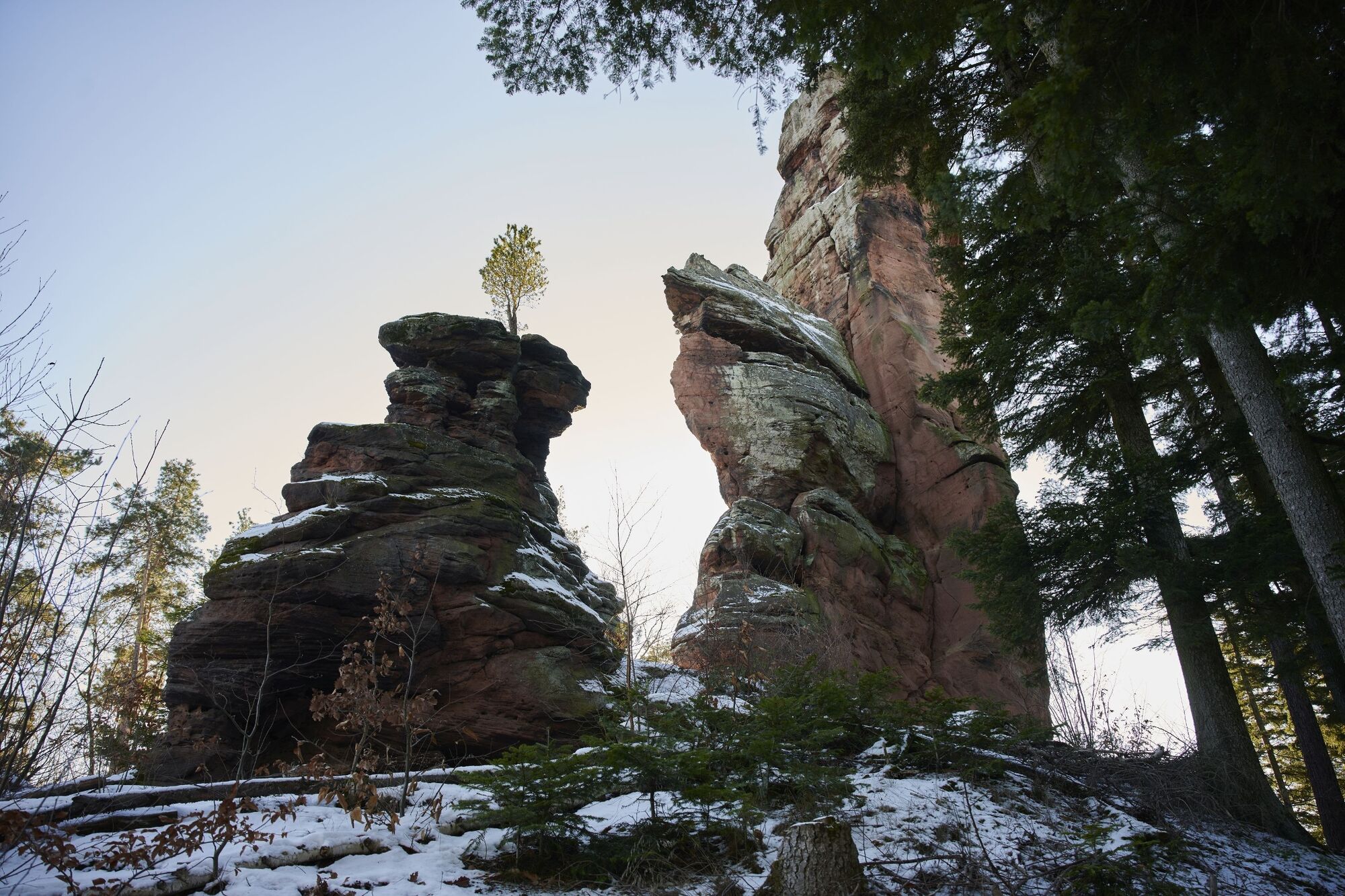
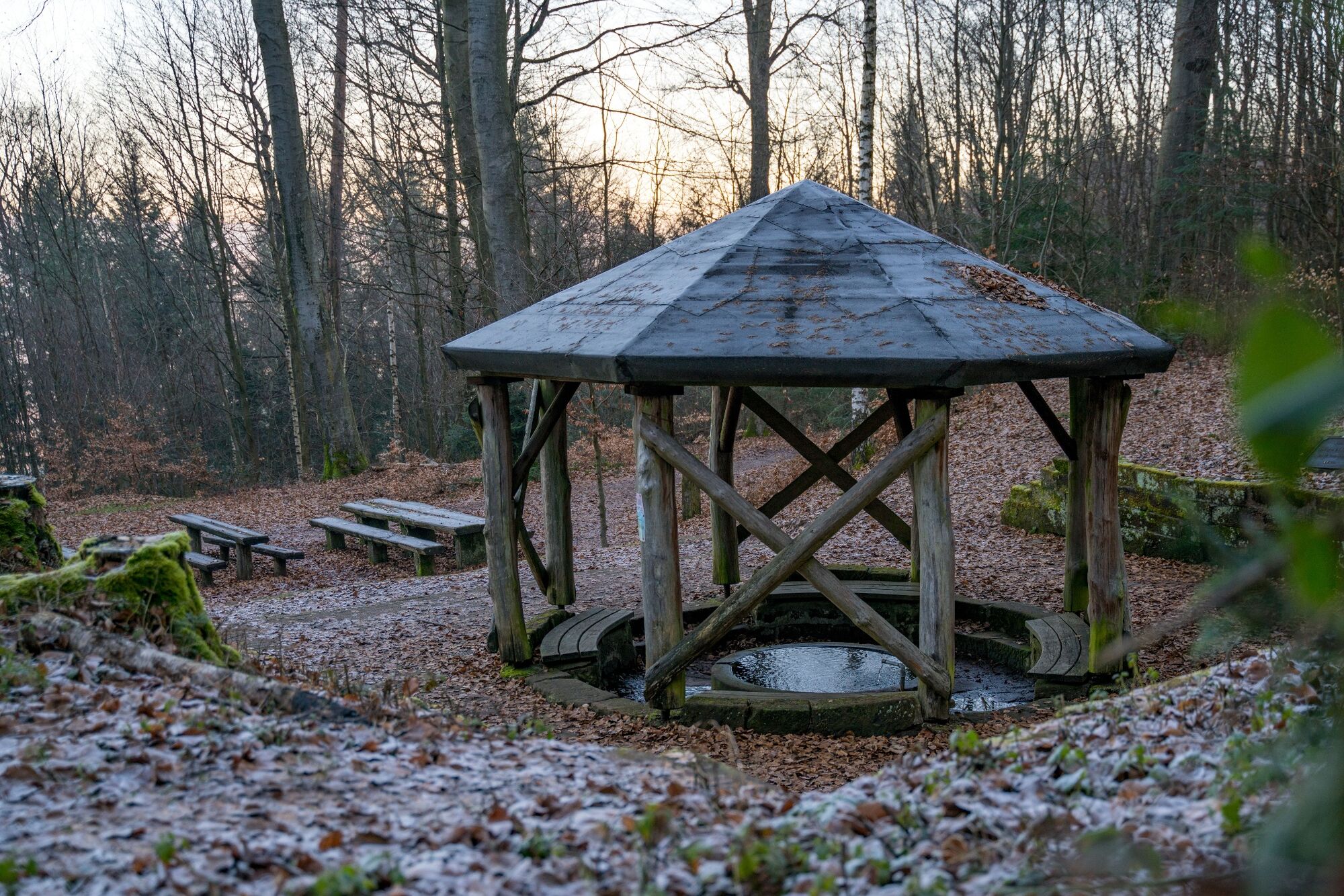
From the town hall square in Annweiler's town centre, the trail leads out of town through Gerbergasse via Südring. Past the Trifelsruhe and the Wasgaublick, the climbers' hut at the imposing rock massif Asselstein offers a rustic place to stop. Via the Rehberg car park, head up to the right to the lookout tower on the Rehberg. The climb is worth it, as the view over the Pfälzerwald-Nordvogesen Biosphere Reserve and the castles of Trifels, Anebos and Scharfenberg (Münz) is breathtaking. On the way down to the Rehberg car park, you pass the Rehbergquelle, an appealing resting place with a refuge. At the trail spider below the climbers' hut, the lion's heart marking leads to the right, down into the Bindersbach valley. At the Art Nouveau Hotel Trifels, the path turns left and leads along the Markwardanlage (park) via Burgstraße and Hauptstraße to the starting point of the hike at the town hall.
UFFBASSE! - Campaign for considerate coexistence in nature
Always act with foresight, kindness and consideration towards everyone you meet on the way. Respect nature, do not destroy plants and always stay on the paths. Try to avoid excessive noise and leave the forest before dusk. Remember to bring a rubbish bag for the road and take rubbish home with you. Please keep your dog on a lead at all times. Other visitors and animals will thank you. For your own safety, observe all road closures, even at weekends. Park only in designated parking areas. Leave space for emergency vehicles and agricultural machinery. P lease give priority to agricultural and forestry traffic.www.pfalz.de/uffbasse
- Directions
-
We start at the town hall in Annweiler am Trifels, first turn north and then turn into the picturesque Gerbergasse at the old water mill. Then we pass the Annweiler hospital on the left and continue along a footpath to the Südring. Cross this diagonally to the right and ascend via Brunnenring until you reach the street "Zum Honigsack". After a few metres, an easily overlooked meadow path branches off to the right, which turns into a forest path and leads us up the Klingelberg. Keeping to the right at the next two crossroads, we walk along the western flank of the ridge. Our path joins a wider hiking trail, which we follow to the right for a short while, only to leave it again to the left at the next opportunity. The path leads us steeply upwards in serpentines through the Annweiler municipal forest and the beautifully designed grounds of the Trifelsruhe natural burial site.
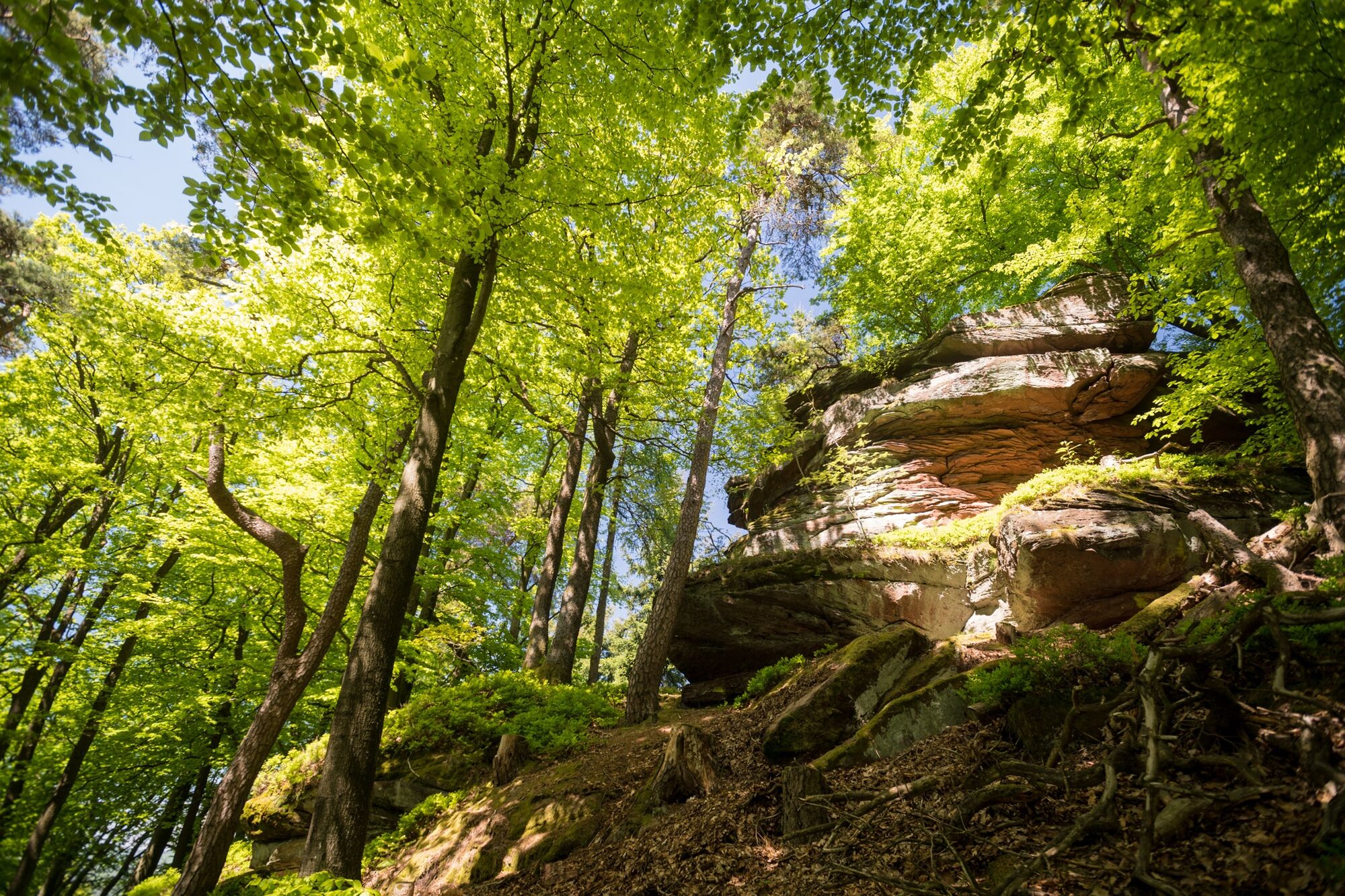
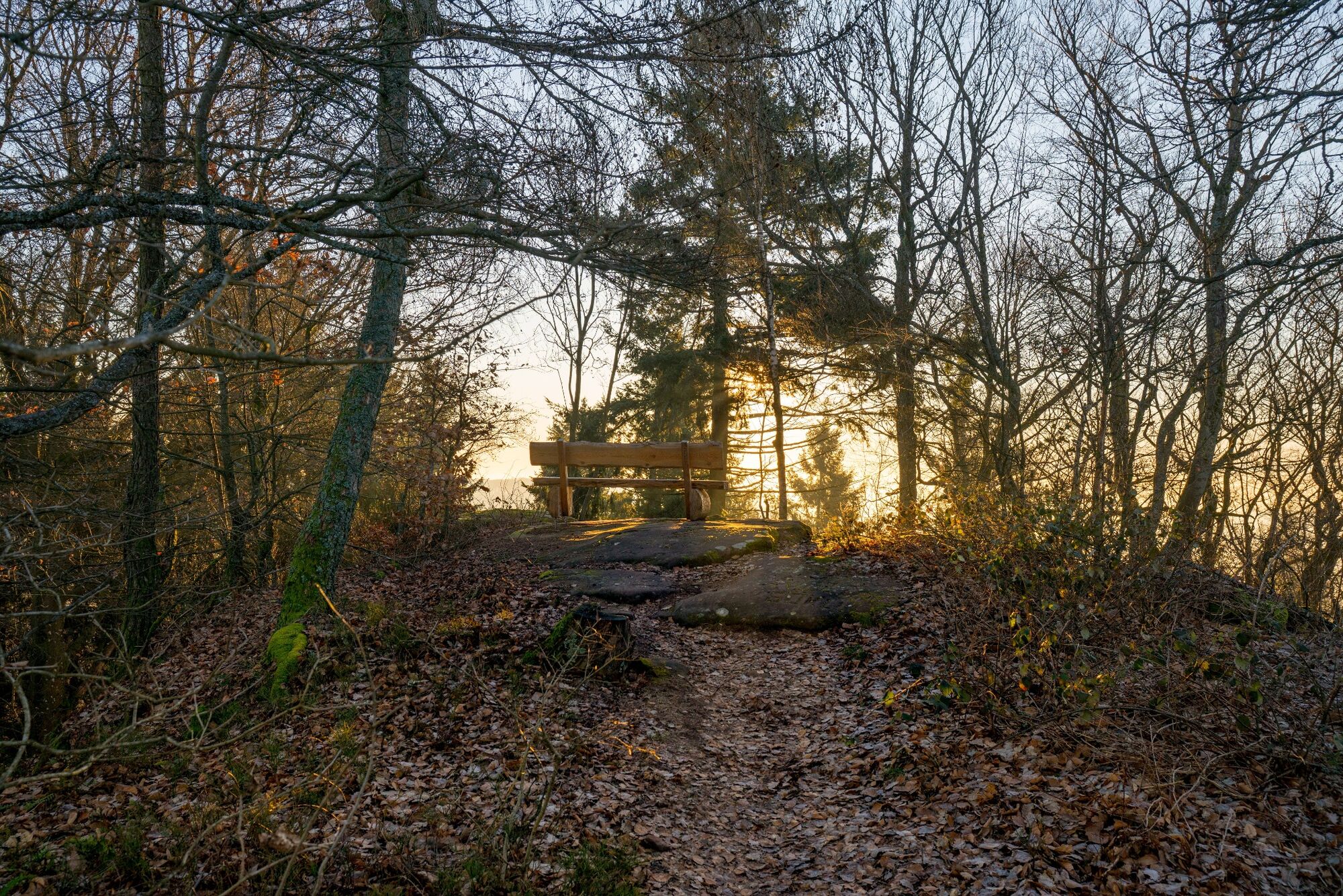
We pass the vantage point at the Willi-Achtermann-Hütte with a magnificent view of the Reichsfeste Trifels and continue along the hiking trail to the Wasgaublick vantage point. Here the name says it all and we enjoy the distant view over the green waves of the southern Pfälzerwald. We hike on a wider grassy path in a north-easterly direction. On a small forest path branching off to the right, we descend steeply to the road. The markings now guide us to the impressive Asselstein rock massif and on to the climbers' hut, a welcome place to stop for refreshments (closed on Mondays and Tuesdays).
From the nearby hikers' car park, we make a detour to the lookout tower on the Rehberg. The view from the Rehberg tower is breathtaking. In between, we discover the three castles Trifels, Anebos and Scharfenberg (Münz) as well as the Asselstein we just explored. After this detour, we follow the path downhill, past the Rehberg spring, back to the Rehberg hikers' car park. Here we keep to the right in a northerly direction, then turn right again at a large clearing with a magnificent view of Trifels Castle and zigzag down into Bindersbach Valley. There we finally reach Annweiler am Trifels through the idyllic valley and the Markwardanlage (park). At the end of the park, we turn left through Burgstraße and Hauptstraße back to Rathausplatz, our starting point.
If you want to shorten the tour a bit, you can also start at Trifelsruhe (there is a car park and a bus stop). Then follow the path up to Wasgaublick, on to Asselstein and the climbers' hut. If you like, you can still take the loop to the Rehbergturm. At the junction below the climbers' hut, however, you then leave the Richard Löwenherz Trail to hike back to Trifelsruhe (the connecting trail is signposted from the junction).
Distance round Löwenherzweg from Trifelsruhe without Rehberg 4.5 km, with Rehberg 8.5 km.
- Highest point
- 551 m
- Endpoint
-
Rathausplatz in Annweiler am Trifels
- Height profile
-
 © outdooractive.com
 - Equipment
-
For our hiking tours we recommend the following equipment as standard:
Sturdy shoes Clothing suitable for the weather Sun and rain protection Sufficient supplies of food and drinks, as there are not always refreshment stops or shops available or open everywhere. Even though the paths are very well marked throughout, for safety reasons it is always advisable to carry a suitable hiking map so that you can quickly find your way to a safe area in the event of a thunderstorm or emergency, for example. On Mondays and Tuesdays the climbers' hut is closed, so you should have backpack food with you. - Safety instructions
-
In general:
Especially in autumn, also be aware that leaves lying on the ground can hide bumps, roots, stones or holes in the path. After thunderstorms or rainstorms, trees can still fall or branches can fall down afterwards. Especially in adverse weather conditions, muddy and slippery passages can occur on natural paths. Not all rocks or precipices are secured with ropes or railings. Surefootedness is required in places. You have to expect this type of path impairment when you undertake a hike. If you are of the opinion that certain sections of the trail are not passable for you, you should avoid them.
NOTICE:
We endeavour to announce on this platform any closures that occur due to forestry work or hunting parties. Nevertheless, there are situations where hiking trails are closed and we may not have been informed. If you unexpectedly encounter a trail closure or diversion, please follow the instructions for your own safety.
- Tips
-
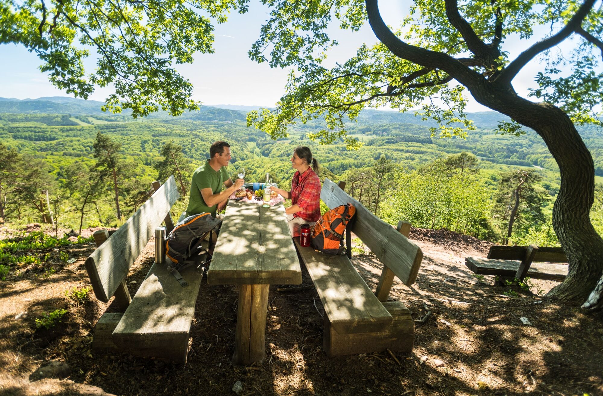
There are several nice resting places along the way: at Wasgaublick, on the way to Rehberg and at Rehbergquelle. Stop for a bite to eat: Climbers' hut at Asselstein
- Additional information
-
Annweiler am Trifels Tourism Office, Meßplatz 1, 76855 Annweiler, Tel. 0 63 46 / 22 00
Südliche Weinstrasse e.V., An der Kreuzmühle 2, 76829 Landau, Tel. 0 63 41 / 94 04 07
Help us to be a sustainable and environmentally friendly holiday region!
Climbers' Hut: Tel. 0 63 46 / 88 25 Opening hours: Monday and Tuesday day off, Wednesday - Friday: 11:00-19:00, Saturday, Sunday: 10:00-19:00; warm cuisine until 18:00.
- Directions
-
A65 to the Landau-Nord exit, continue on the B10 to Annweiler am Trifels
- Public transportation
-
Sustainable travel by public transport in Trifelsland.
Train stop Annweiler am Trifels on the Queichtal line Landau-Pirmasens, from the station to the town hall square it is about 10 minutes through the historic old town of Annweiler am Trifels. The line runs hourly.
- Parking
-
Car park Villa Gotthold P 10, Zweibrücker Straße, Annweiler am Trifels; directly on the Richard Löwenherz Weg; if you want to start at the starting point at Rathausplatz, walk approx. 5 minutes through the historic old town of Annweiler am Trifels.
Alternative parking/starting point:
Car park at the climbers' hut at Asselstein (Trifelsstraße)
Parking at the Trifelsruhe (Trifelsstraße)

- Author
-
The tour Annweiler Richard-Löwenherz-Weg is used by outdooractive.com provided.


General info
-
Pfalz
1512
-
Trifelsland
1061
-
Landau in der Pfalz
391