
- Brief description
-
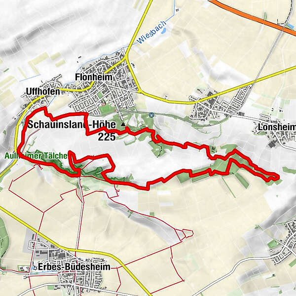
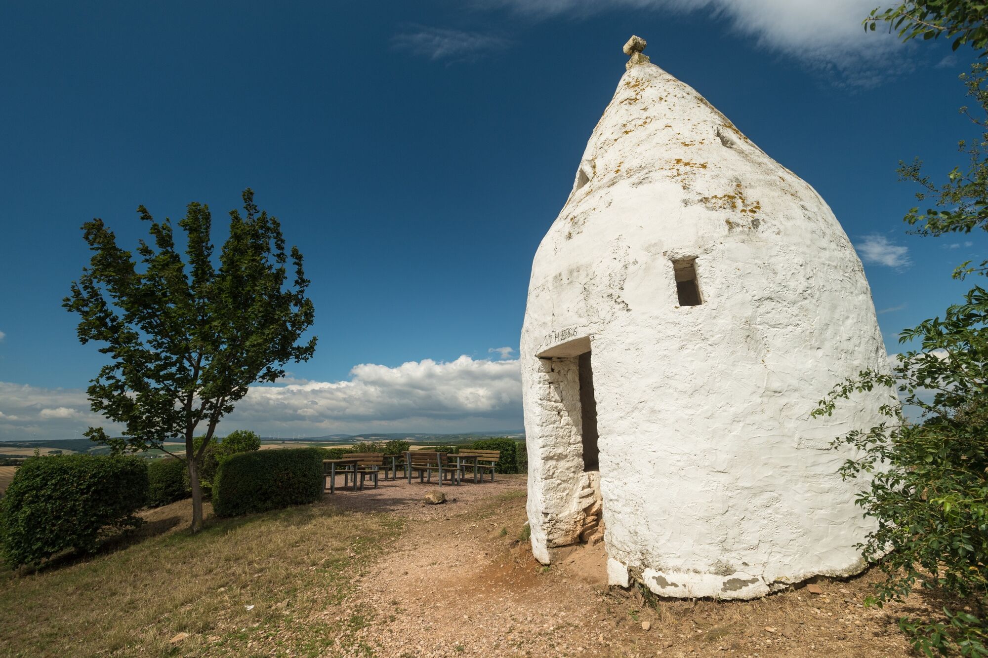
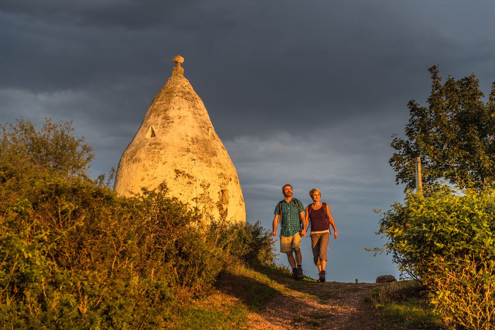
Wine, forest and meadows. On no other Hiwweltour is the trail profile as varied as on the Hiwweltour Aulheimer Tal and with the Flonheimer Trullo the hiking trail also has a very special sight.
- Difficulty
-
medium
- Rating
-
- Starting point
-
Flonheim - parking lot at the Adelberghalle (access road)
- Route
-
Uffhofen0.7 kmGutsschänke Aulheimer Mühle2.9 kmLonsheimer Türmchen7.8 kmSedanplatz11.4 kmRheinhessenblick11.5 kmIm Usinger11.7 kmSchauinsland-Höhe (225 m)12.0 km
- Best season
-
JanFebMarAprMayJunJulAugSepOctNovDec
- Description
-
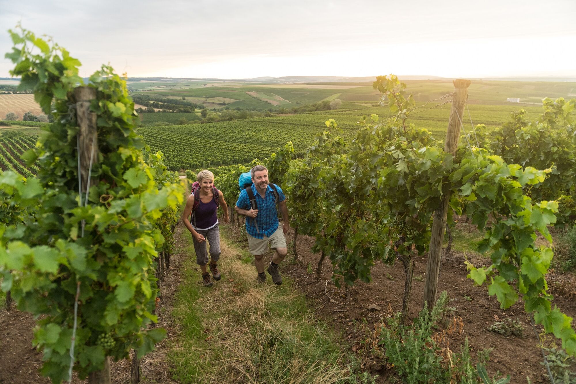
The Hiwweltour Aulheimer Tal in Rheinhessen is the longest of the Hiwweltours and offers great scenic variety. The attractive hiking trail leads through vineyards, meadows and through the forest. Various vantage points reward with great panoramic views over the Aulheim Valley and the region, which is not called "Rheinhessen Switzerland" for nothing. With the Flonheimer Trullo, a very special highlight and a great photo motif also awaits the hiker.
In 2022, the tour was awarded by Wandermagazin as the second most beautiful hiking trail in the category of day tours.
- Directions
-
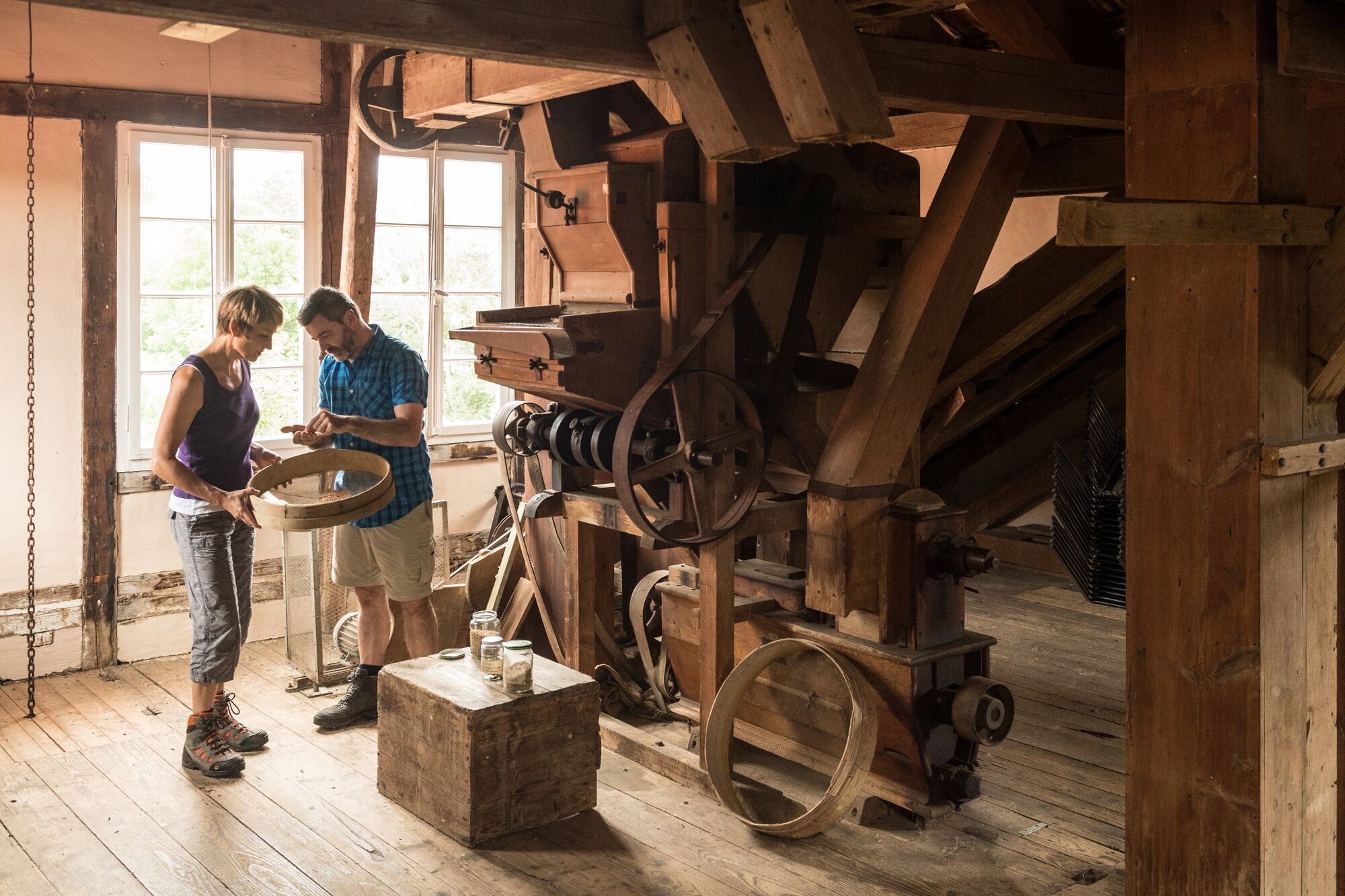
The Hiwweltour Aulheimer Tal starts in the Rhine-Hessian wine village of Flonheim. However, there are also other entry points at the Geistermühle and in the villages of Bornheim and Lonsheim.If you feel like it, you can explore the small village of Flonheim with its many historic buildings made of local sandstone and its excellent gastronomy before the actual hike,The first section of the hike follows the idyllic Wiesbach Valley to the Geistermühle, a historic mill homestead with beautiful half-timbering that is now a renowned winery.
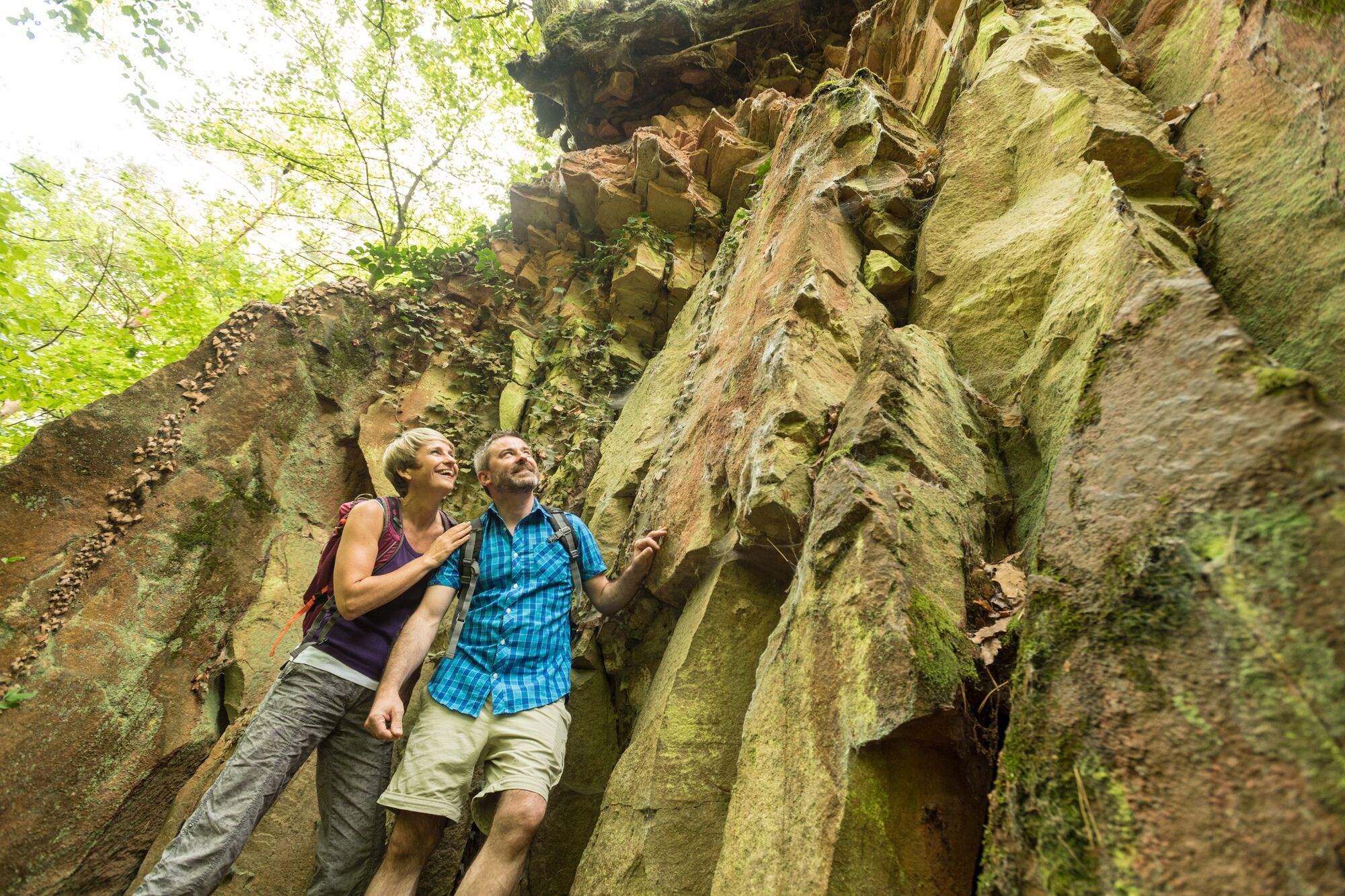
The Wiesbach valley slowly merges into the Aulheim valley. Below the Rabenkanzel, you pass old volcanic andesite quarries, while the Hiwweltour follows the Aulheimer Graben to the Aulheimer Mühle, an estate tavern between meadows and vineyards. Now the hiking trail leads up to the Adelberg. At the end of the climb through the vineyard, the Flonheimer Trullo awaits. The famous landmark of the region is a white round house with a pointed roof, which was built in 1756 (probably) by Apulian guest workers who worked in local quarries. Immediately next to the trullo, tables and benches invite you to have a relaxing picnic.The route continues to the flank of the Aulheim Valley. Here, vineyards, native hedges and grasses characterize the landscape. And again and again, beautiful views of the expanse of the valley await you.
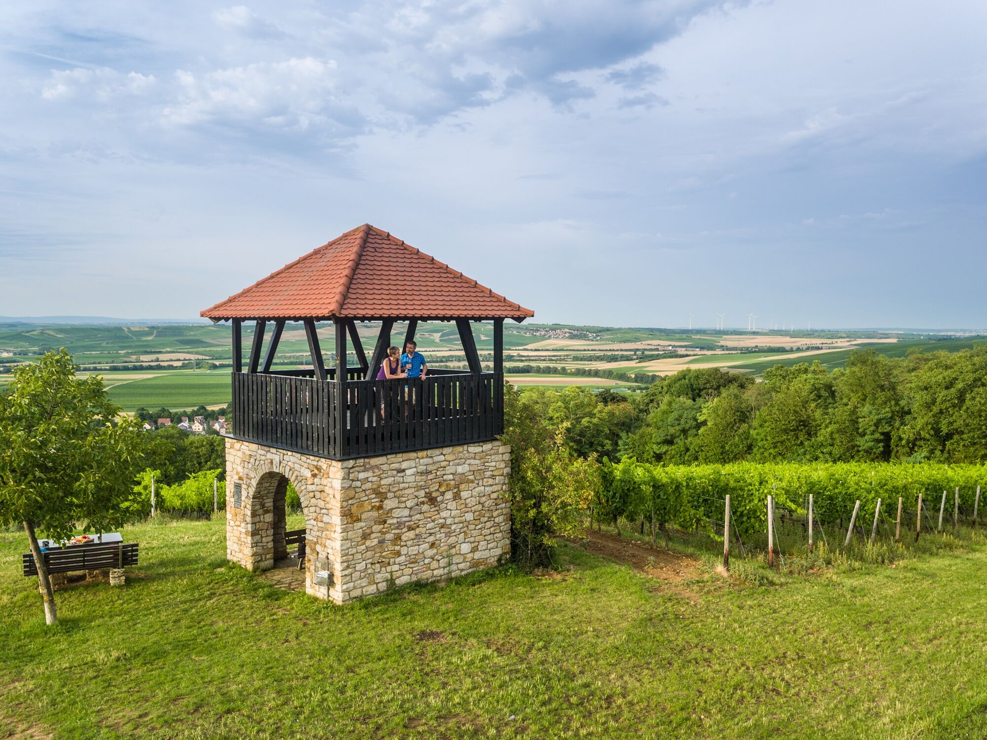
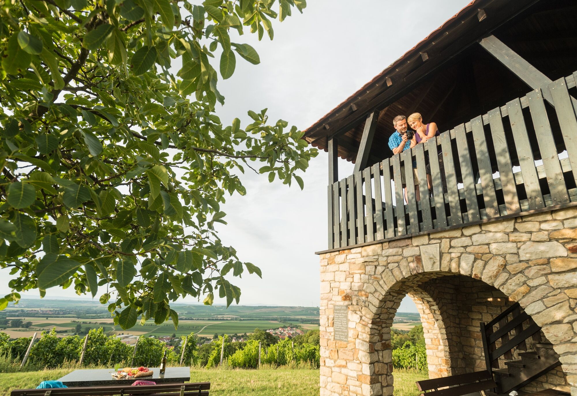
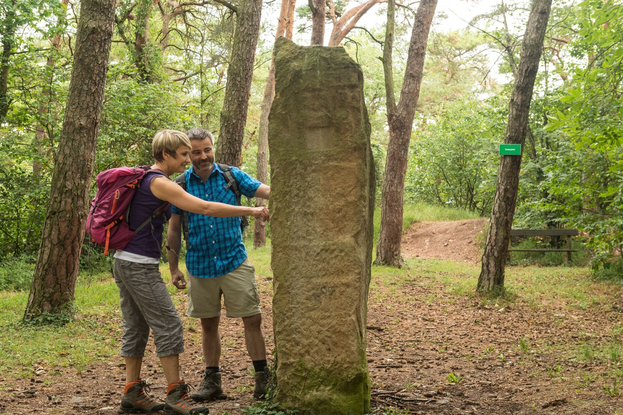
The next stage of this hike runs through the forest. Fresh air, pleasant forest floor and a very special silence accompany the hiker on the next kilometers. The Lonsheimer Turm towers out of the trees halfway through the forest. If you conquer the steep spiral staircase, you can enjoy a wonderful view over the tree tops into the surrounding nature.The hiking trail now leads between the edge of the forest and vines to the Oswaldhöhe. From the lookout point of the same name, you can let your gaze wander over the Rhine-Hessian village of Bornheim. A little later, the lookout tower in the Wingert offers another view over the sea of vines.The Hiwweltour leads again into the forest, past the Sedanplatz and impressive sandstone quarries, which are typical for the region around Flonheim. Finally, you reach the rustic Naturfreundehaus, which marks the last stage of this Hiwweltour.
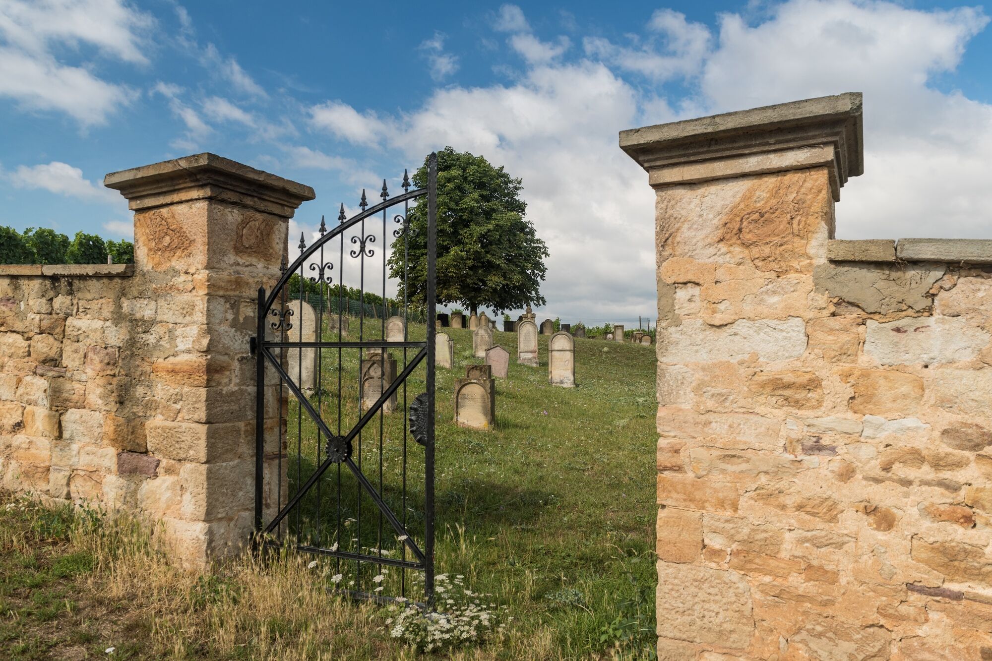
The last meters of the hike run through the middle of the vineyards to the Jewish cemetery in Flonheim, whose gravestones are mainly made of the aforementioned Flonheim sandstone. From here, a branch leads back to the charming center of the small wine village.
- Highest point
- 274 m
- Endpoint
-
Flonheim - parking lot at the Adelberghalle (access road)
- Height profile
-
 © outdooractive.com
 - Equipment
-
Sturdy shoes, hiking clothes, backpack food
- Safety instructions
-
Please refer to the current safety instructions of the Federal Ministry of Health regarding the handling of the COVID - 19 pandemic.
- Tips
-
Visit the tourist information center on the market square in Flonheim!
An exciting insight, into the history of the earth 30 million years ago.
- Additional information
- Directions
-
By car:
A61 or A63 exit Flonheim, on L408 direction Flonheim, turn left on Bornheimer Landstraße, left again into Bahnhofstraße, then right into Berliner Straße to the access road at the Adelberghalle in Flonheim.
Another direct access is at the parking lot for hikers at the Geistermühle. Alternatively, there are two other official access routes to the Hiwweltour Aulheimer Tal: one access route from the village of Bornheim and one access route from Lonsheim.
By public transport:
Arrival at Alzey train station, continue with bus 446 to the stop Flonheim, Marktplatz (Mon. - Fri.).
- Public transportation
-
Arrival at Alzey train station, continue with bus 446 to bus stop Flonheim, Marktplatz (Mon. - Fri.)
- Parking
-
Parking at the Adelberghalle
Address: Berliner Straße 16, 55237 Flonheim
Parking at the catholic church / cemetery
Address: Kirchgasse 10, 55237 Lonsheim
Parking at the community center Oswaldhöhe
Address: Bahnhofstraße 17, 55237 Bornheim
All parking lots are connected to the main road via access signs.


-

-
AuthorThe tour Hiwweltour Aulheimer Tal is used by outdooractive.com provided.


General info
-
Rheinhessen
866
-
Ferienregion Langenlonsheim
501
-
Alzey
45