
- Brief description
-
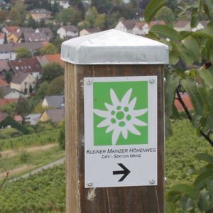
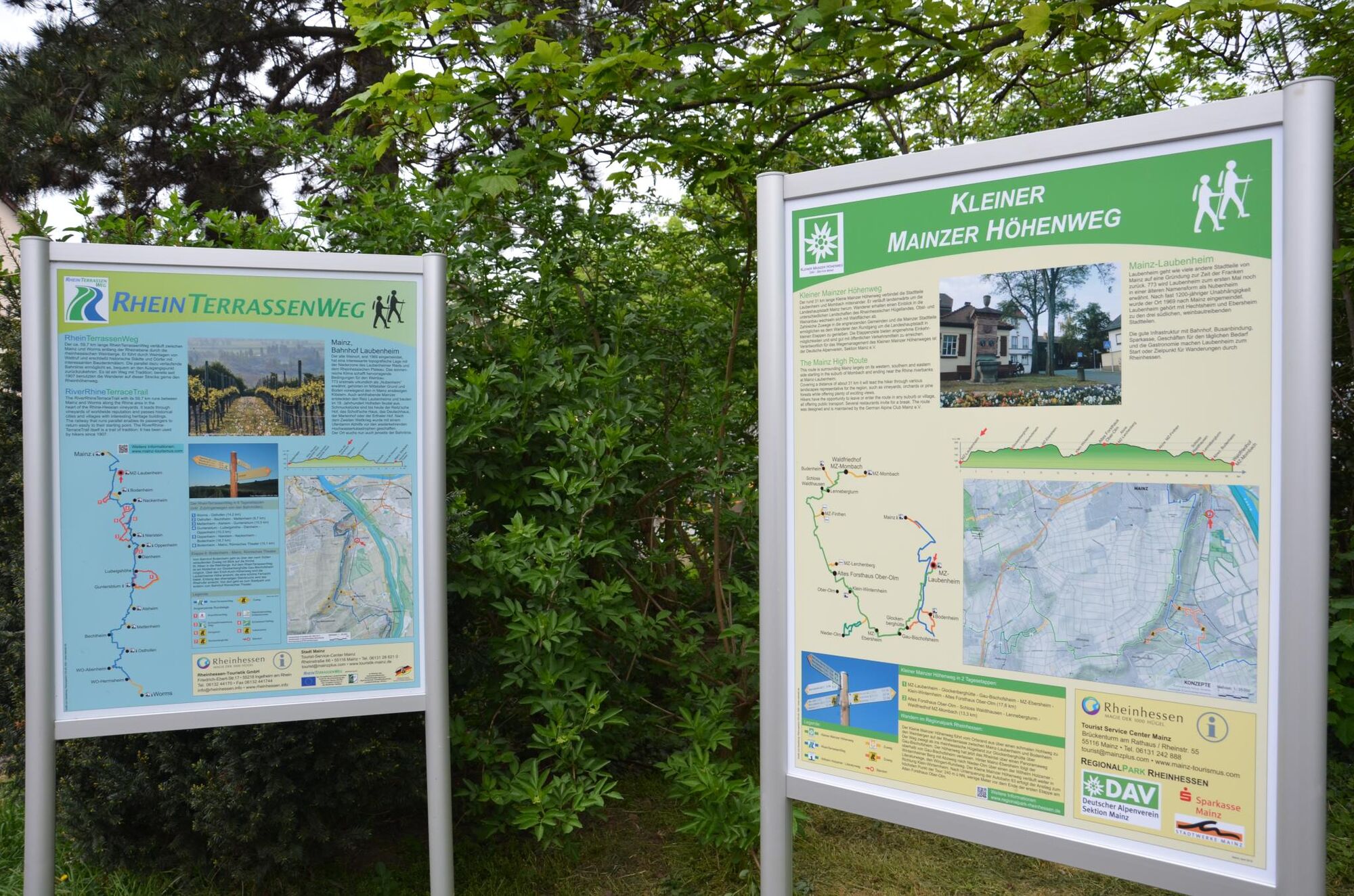
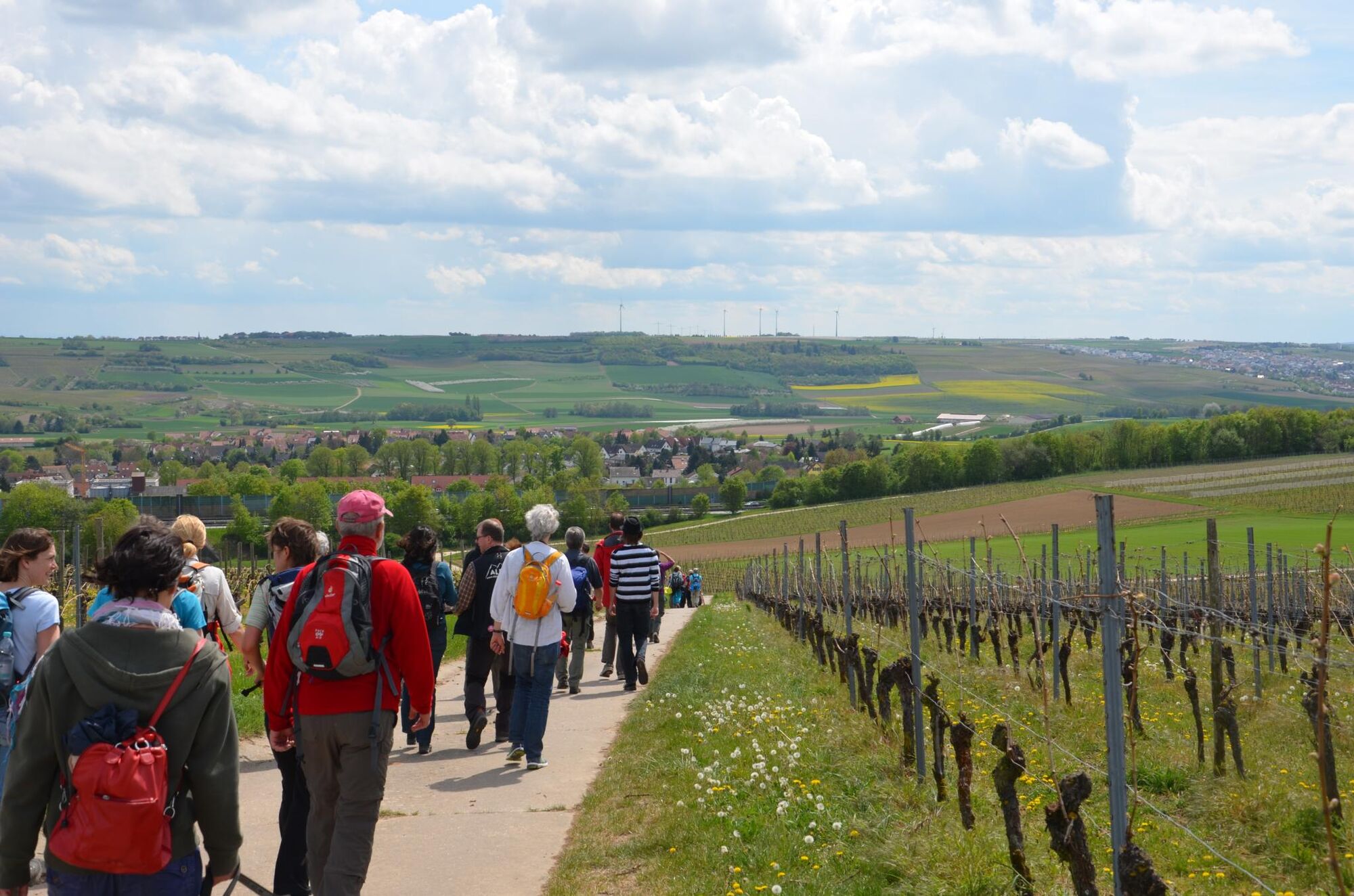
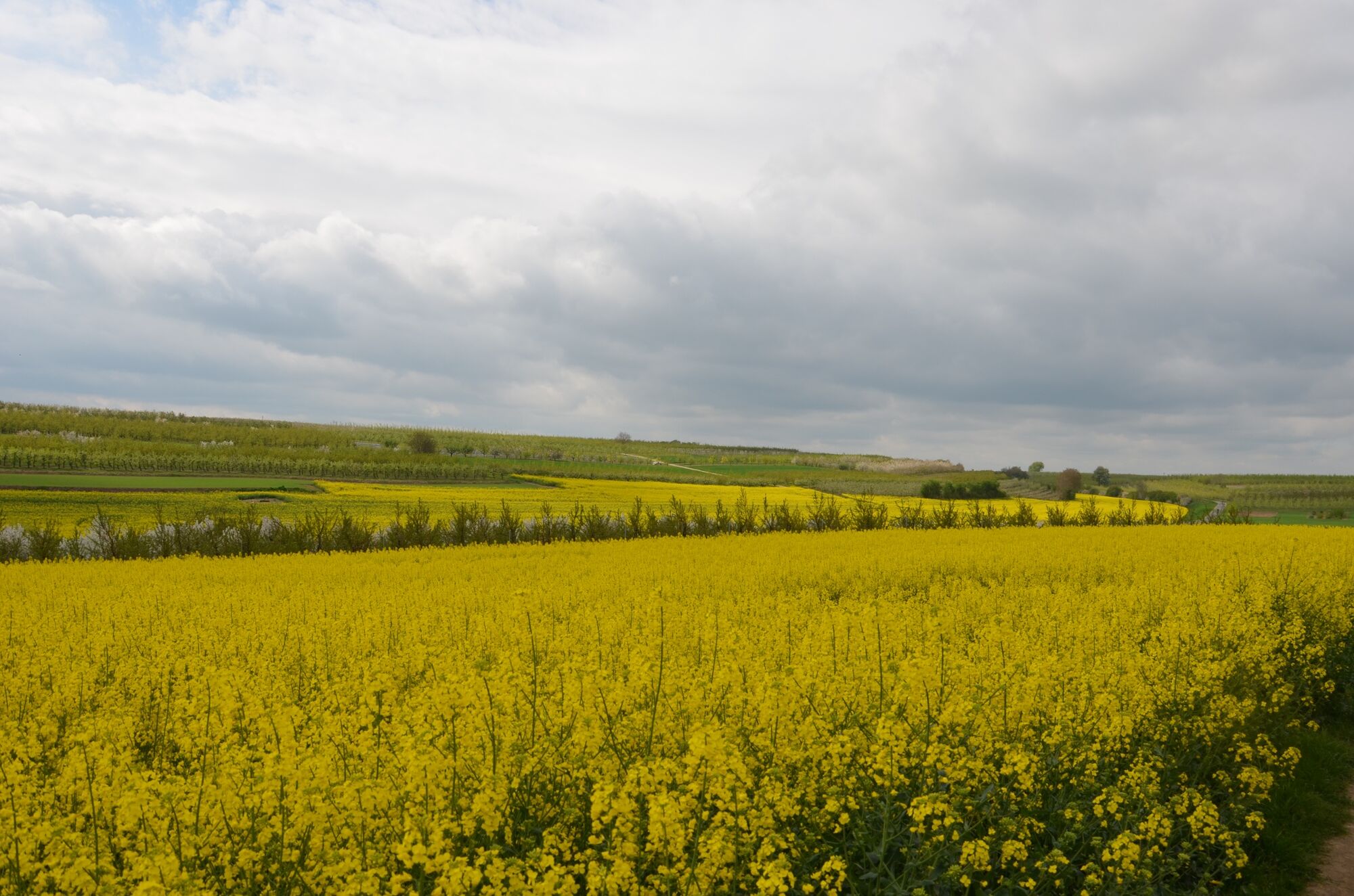
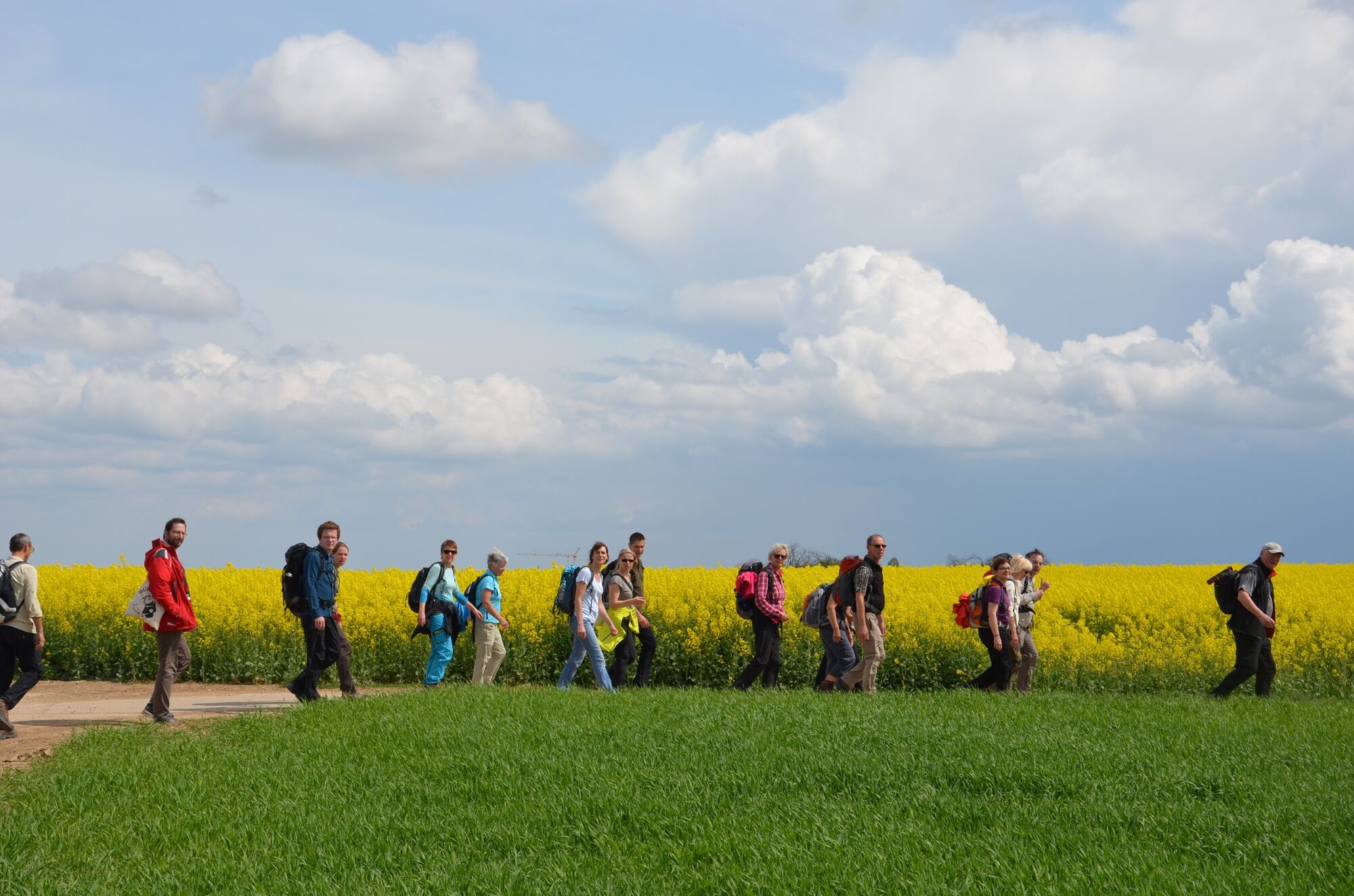
On this tour you will get to know the city Mainz and the region "Rheinhessen" with its fantastic views. There are a lot of information boards along the hiking route to find further information about the region, tour stages and sections as well as sights.
- Difficulty
-
medium
- Rating
-
- Starting point
-
Start: railway station / bus stop "im Brühl" in Mainz-Laubersheim
- Route
-
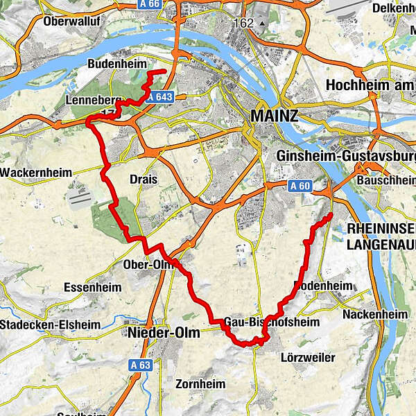
LaubenheimBodenheimer Hoch4.0 kmGauberg (212 m)5.9 kmGau-Bischofsheimer Fenster6.9 kmGau-Bischofsheim7.8 kmMarienkapelle7.8 kmWeinbergskapelle8.3 kmHarxheim8.6 kmSchlossbergturm9.3 kmEbersheim11.8 kmPizzeria Trattoria Da Rocco11.8 kmSankt Laurentius11.9 kmEvangelische Kirche16.3 kmKlein-Winternheim16.3 kmSt. Andreas16.3 kmPizzeria Bella Vista16.5 kmWaldgaststätte Ober-Olm18.7 kmDer Münchwald27.4 kmHinter dem Münchwald27.7 kmBernhardsborn28.6 kmCafé & Restaurant Am Turm30.1 kmLenneberg (176 m)30.3 km
- Best season
-
JanFebMarAprMayJunJulAugSepOctNovDec
- Description
-
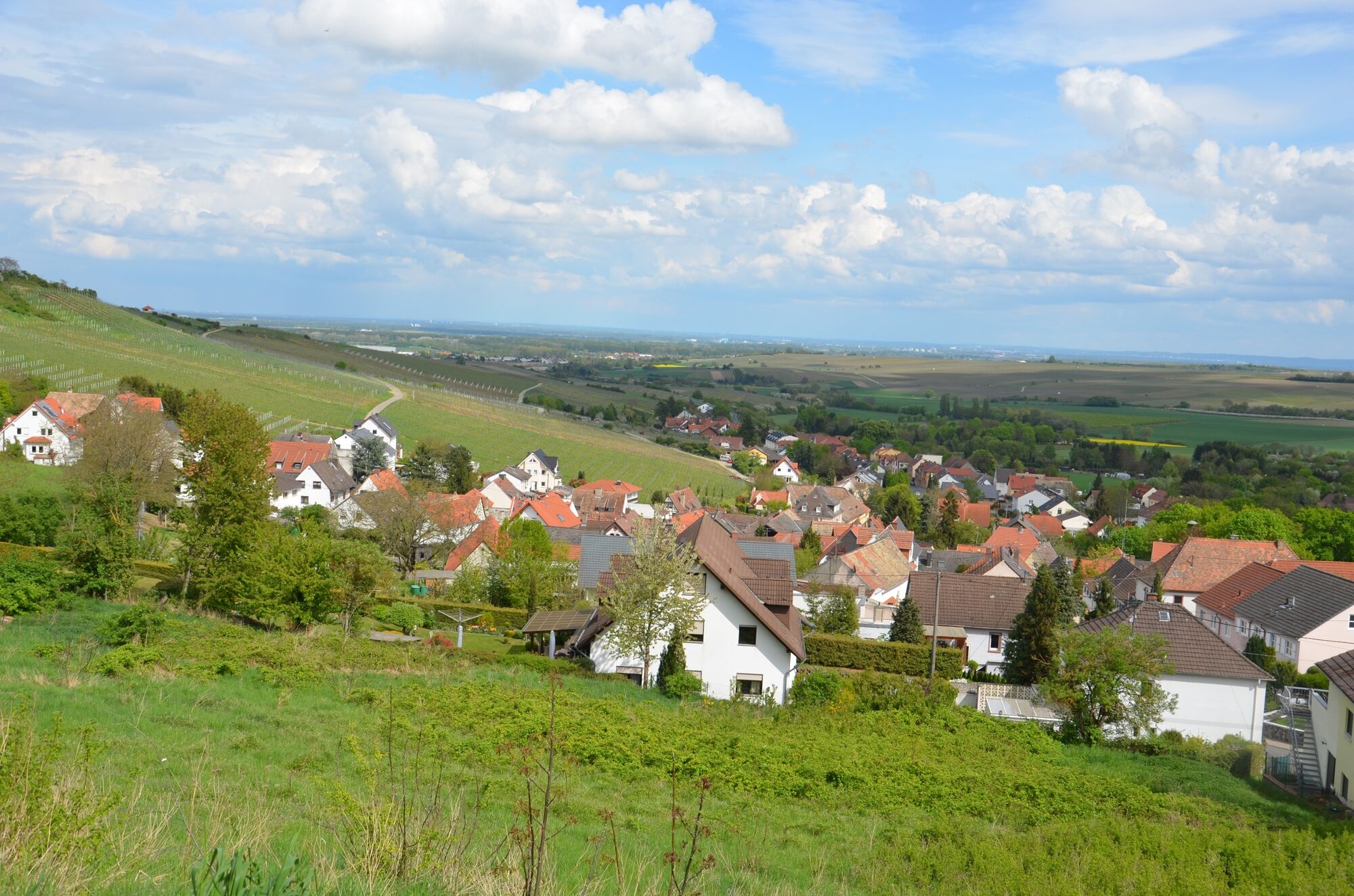
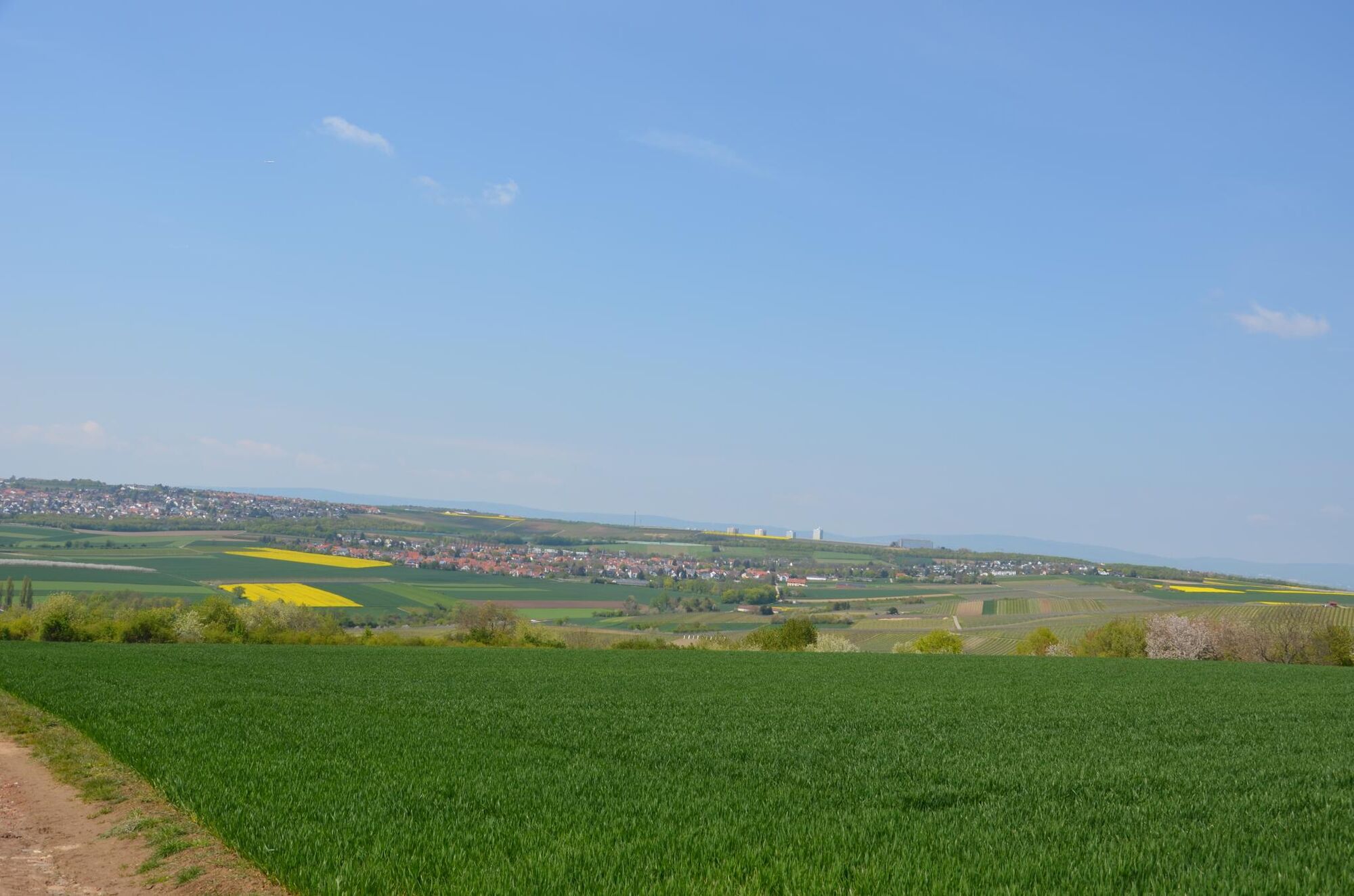
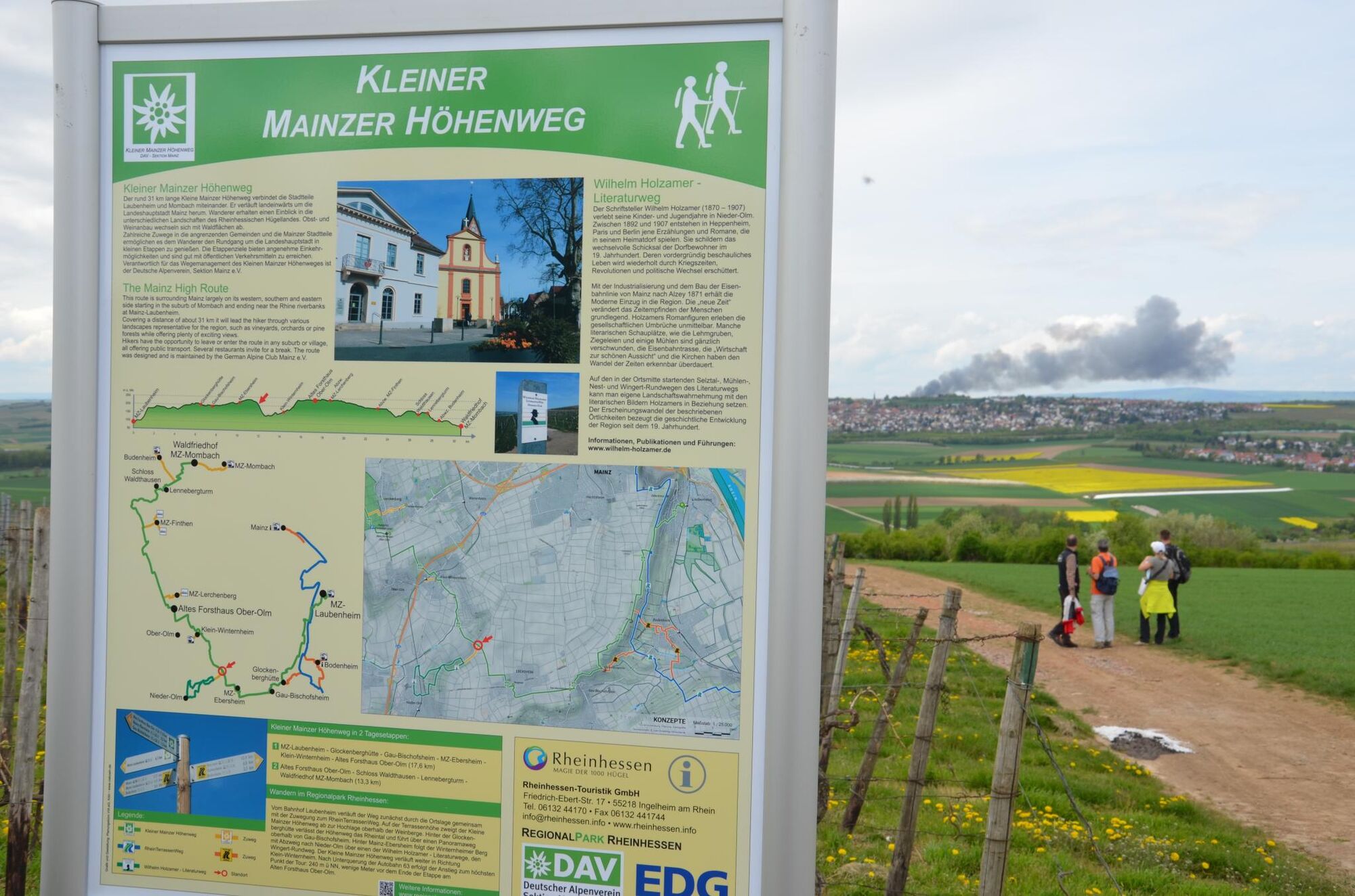
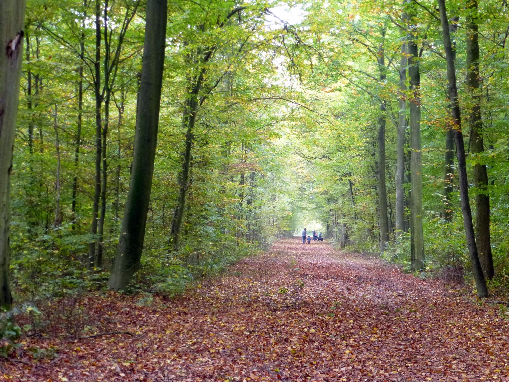
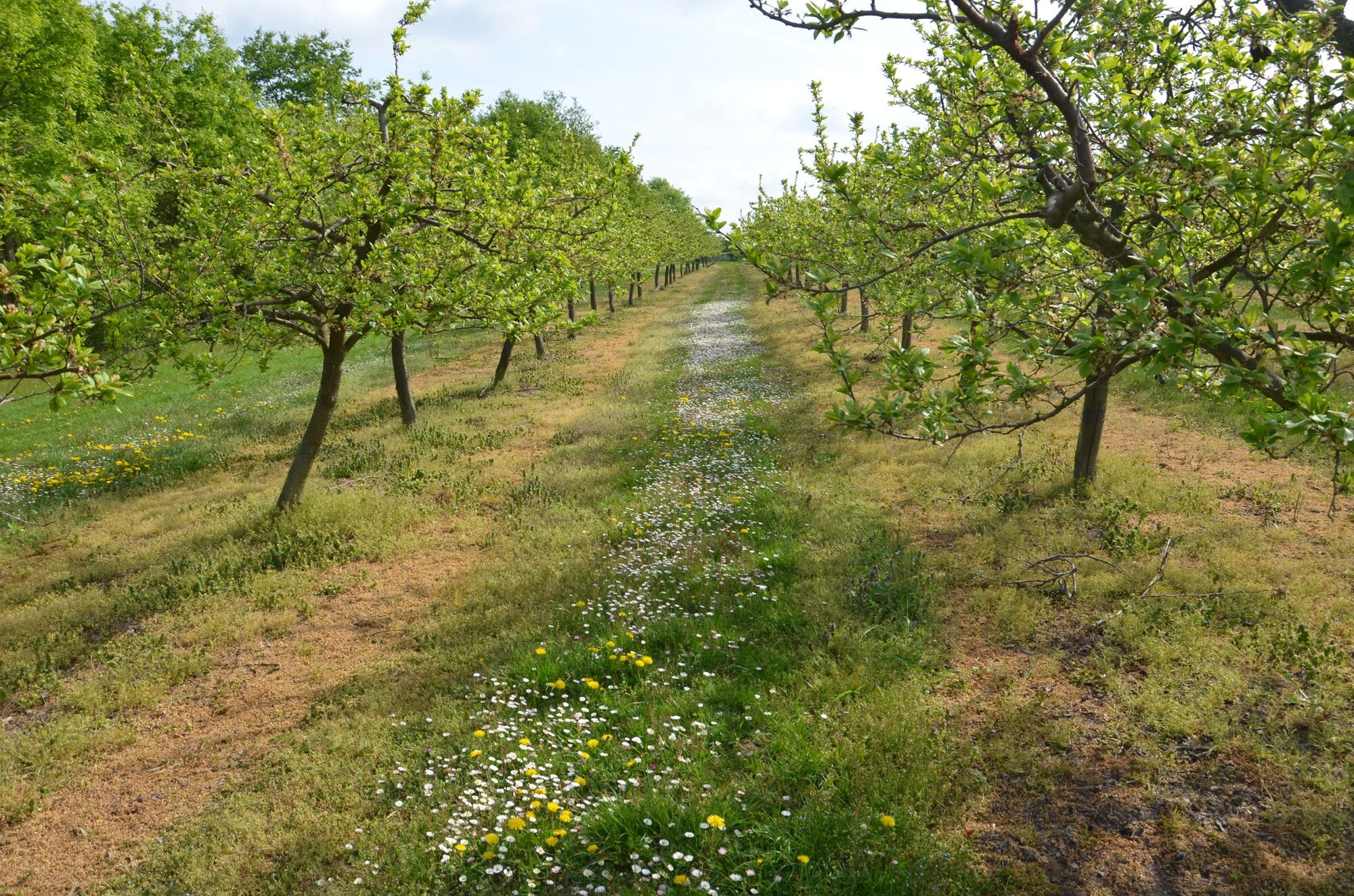
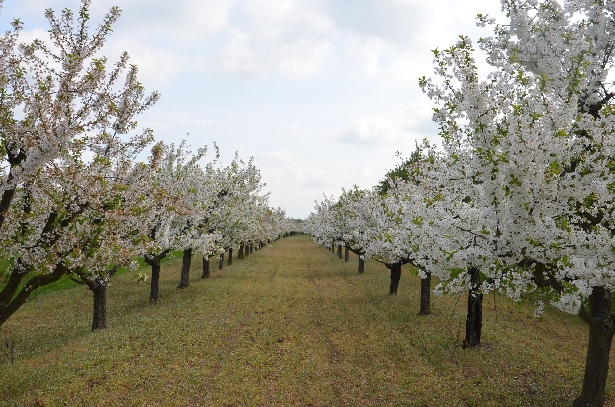
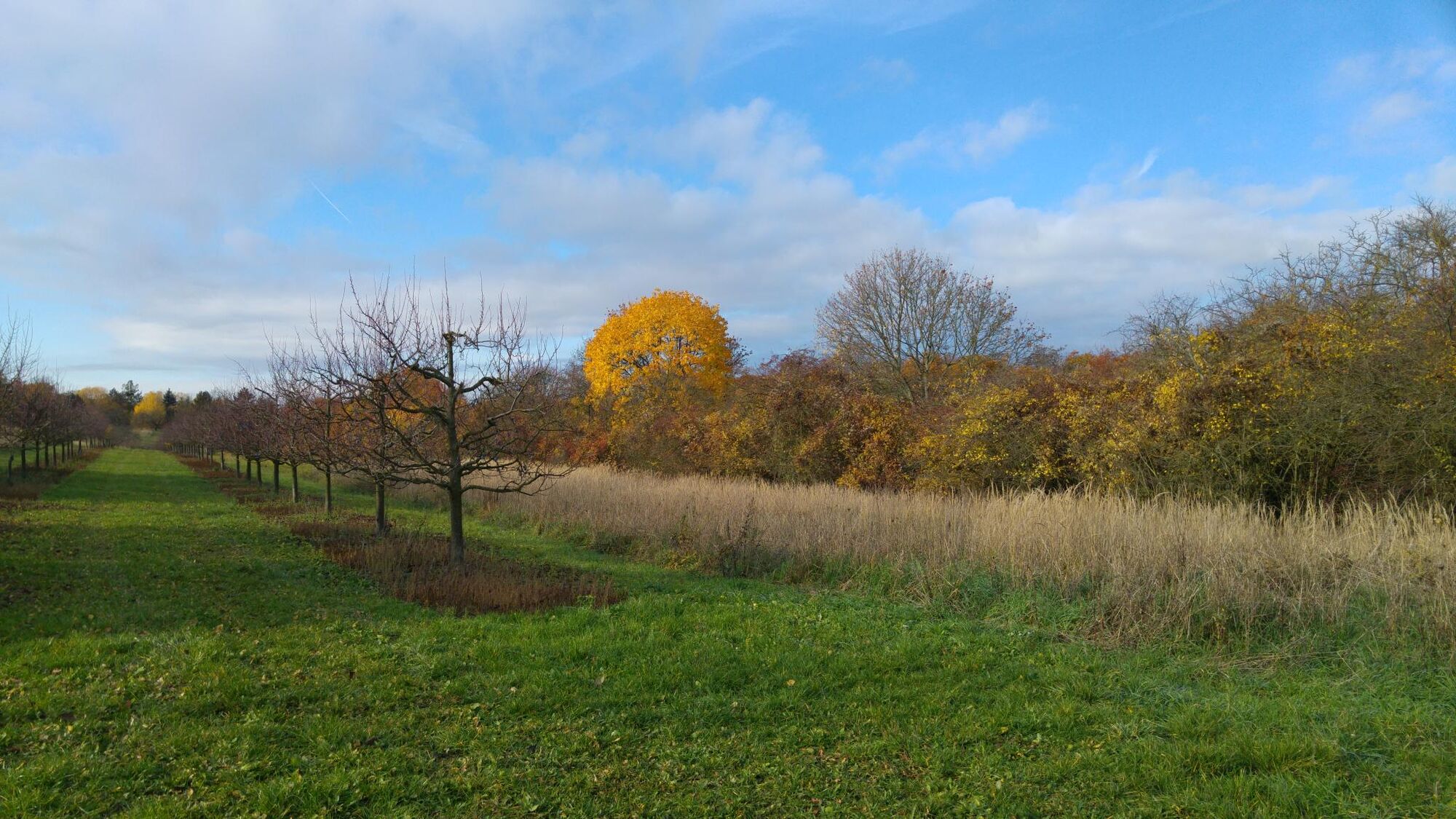
With its 31,7 km the tour "Kleine Mainzer Höhenweg" is the stripped down version of the "Mainzer Höhenweg in the Alps around Tyrol in Austria", and much more! This stage tour with its fantastic views is made for exploring the region Rheinhessen and the area around the city Mainz. It will lead you through vineyards, fields and forests. The tour starts in Mainz-Laubersheim, via the Glockenberghütte on Gauberg to Ebersheim. The second stage runs to Klein-Winternheim to "Alten Forsthaus" in Ober-Olm. It will then guide you through the forest "Ober-Olmer Wald", along to orchards in Finthen, again through a little forest called "Lennebergwald" and to the "Mainzer Sand", a nature reserve, and finally to "Waldfriedhof" in Mombach. All sections of this route as well as all sights are marked by information boards along the way.
- Directions
-
It is possible to hike the route "Kleiner Mainzer Höhenweg" in one step or to divide this route into individual stages:
1. stage from Laubenheim to Ebersheim, approx. 10.2 km
2. stage from Ebersheim to "Alten Forsthaus" in Ober-Olm, approx. 8.0 km
3. stage from "Alten Forsthaus" in Ober-Olm via Finthen to Mombach ("Waldfriedhof"), ca. 13.5 km
The path is well signposted, so it's easy to find access to individual stages and information on public transport.
Directions 1. stage:
Laubenheim - "Glockenberghütte am Gauberg" - Ebersheim
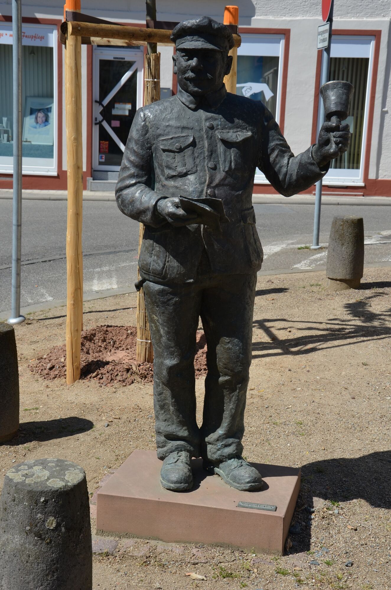
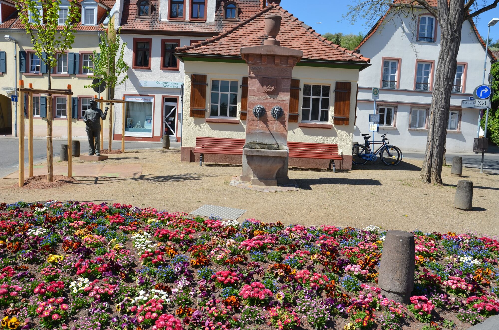
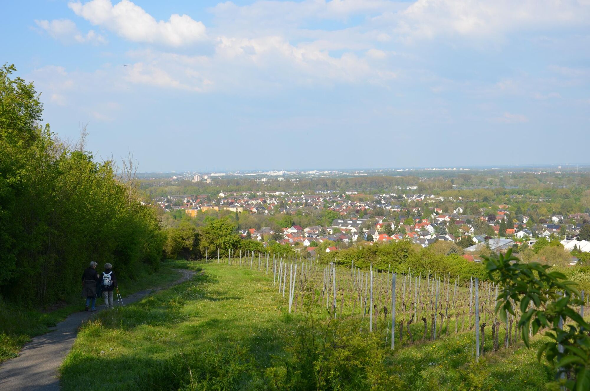
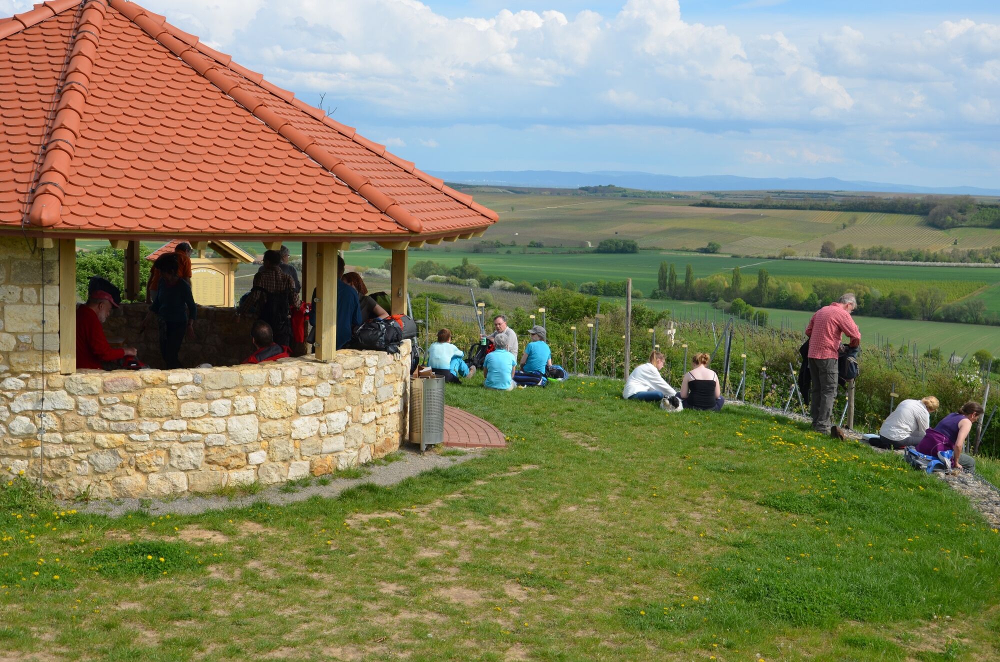
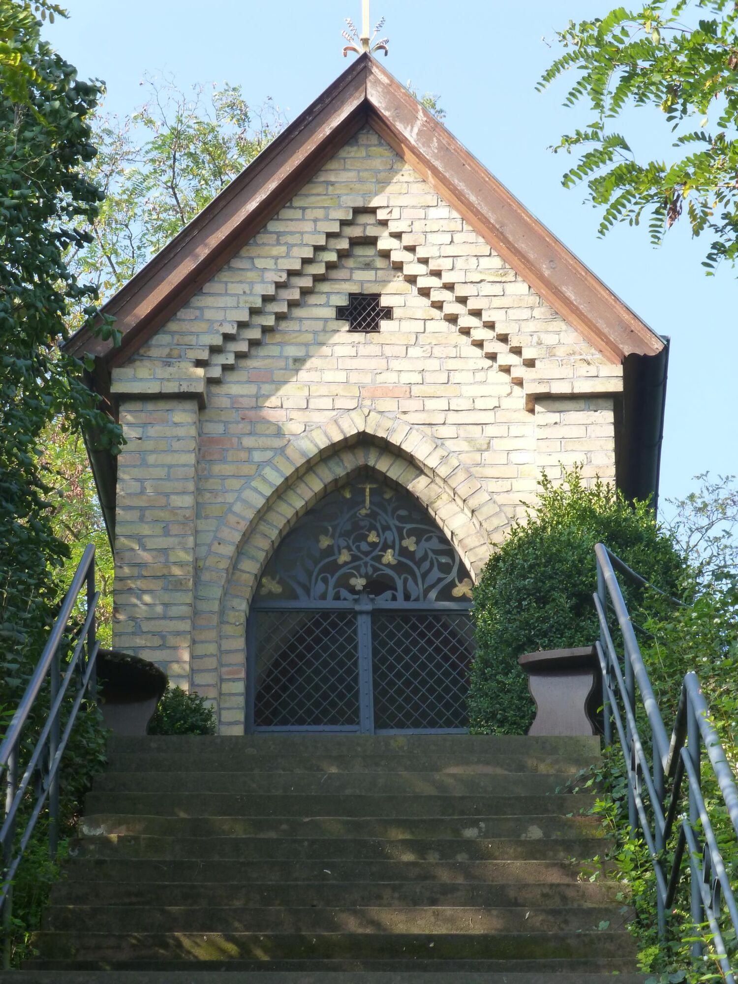
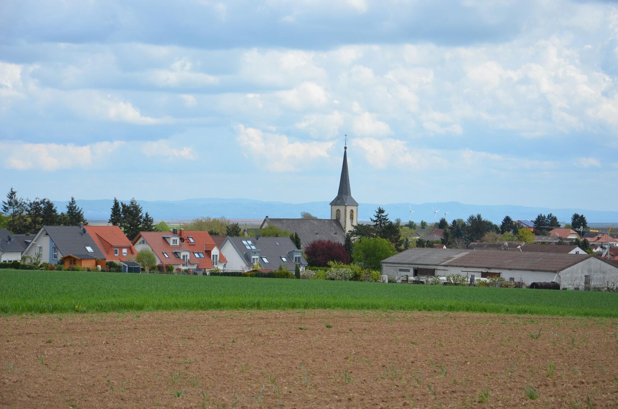
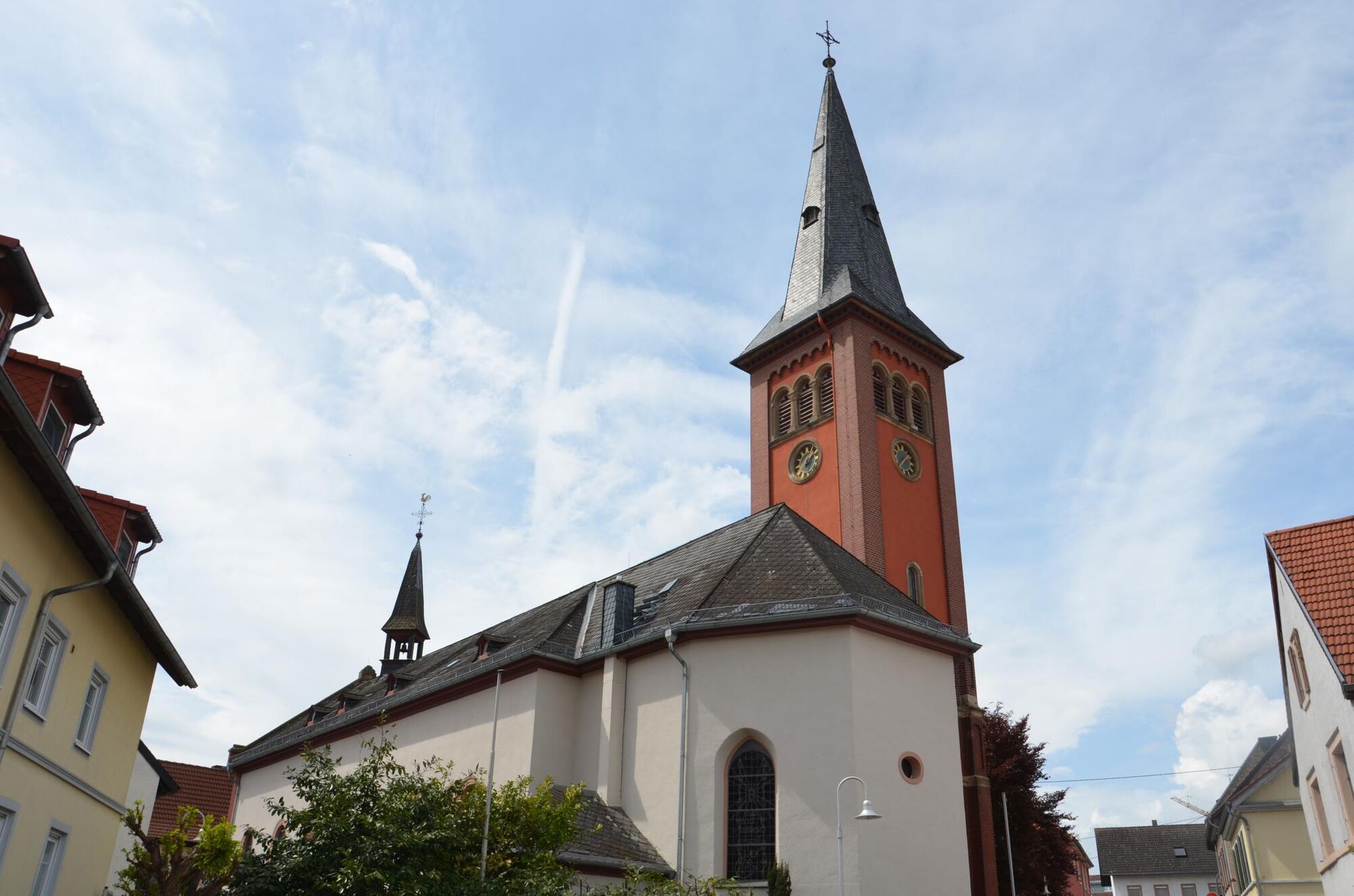
Start: train station/bus stop "Im Brühl" in Laubenheim. An information board will lead you directly to the route "Kleiner Mainzer Höhenweg". The path leads you through the old town centre and you will find there already some sights. There is a bronze statue called "Ausschellers und Polizeidieners" in front of "Wiegeheisje" and "Marienhof" (an old summer residence of former bishops of the city of Mainz). You will continue the route to go through the housing estate area, follow the path "Hohlweg am Heiligenhäuschen" until you reach the path "Erich-Koch-Höhenweg". Once at the top you will then pass "Laubenheimer Höhe" and "Bodenheimer Höhe" to reach the "Glockenbergschutzhütte am Gauberg". That is the place where you can have a break and enjoy the beautiful view. You can see the Rhine, "Laubenheimer Ried", "Taunus", the "Rhine-Main-Area" and even the skyline of Frankfurt as well as "Odenwald" and Rheinhessen's small hills. Rested it goes along a slope above Gau-Bischofsheim to the village boundary. A long staircase guide you to the chapel "Marienkappelle". Then you will follow L 425 next to fields, past a field cross from 1843 to Ebersheim. In the centre of Ebersheim you will find a Catholic church and finally the bus stop.
Directions 2. stage: Ebersheim- Klein-Winternheim - Altes Forsthaus Ober-Olm
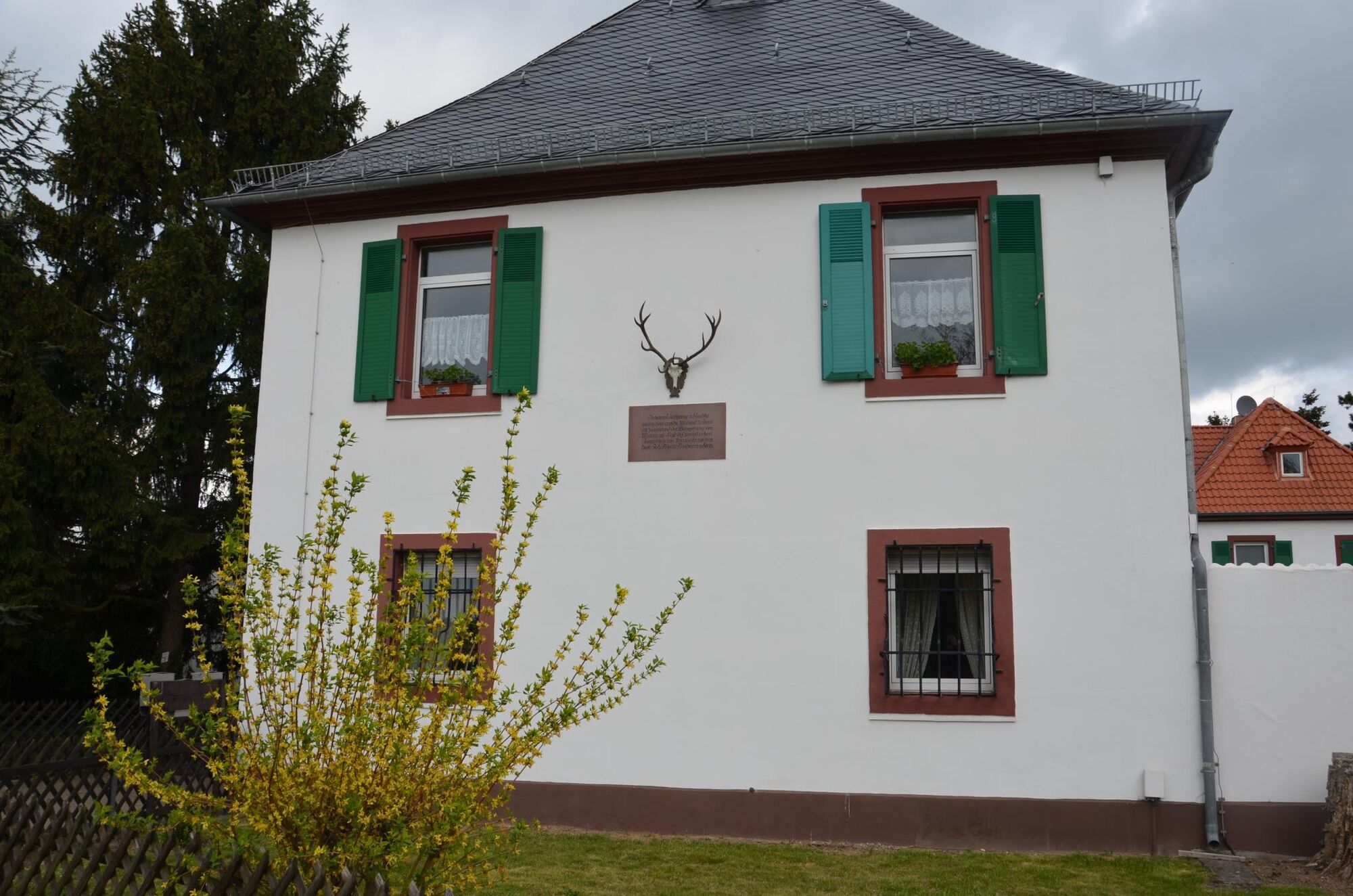
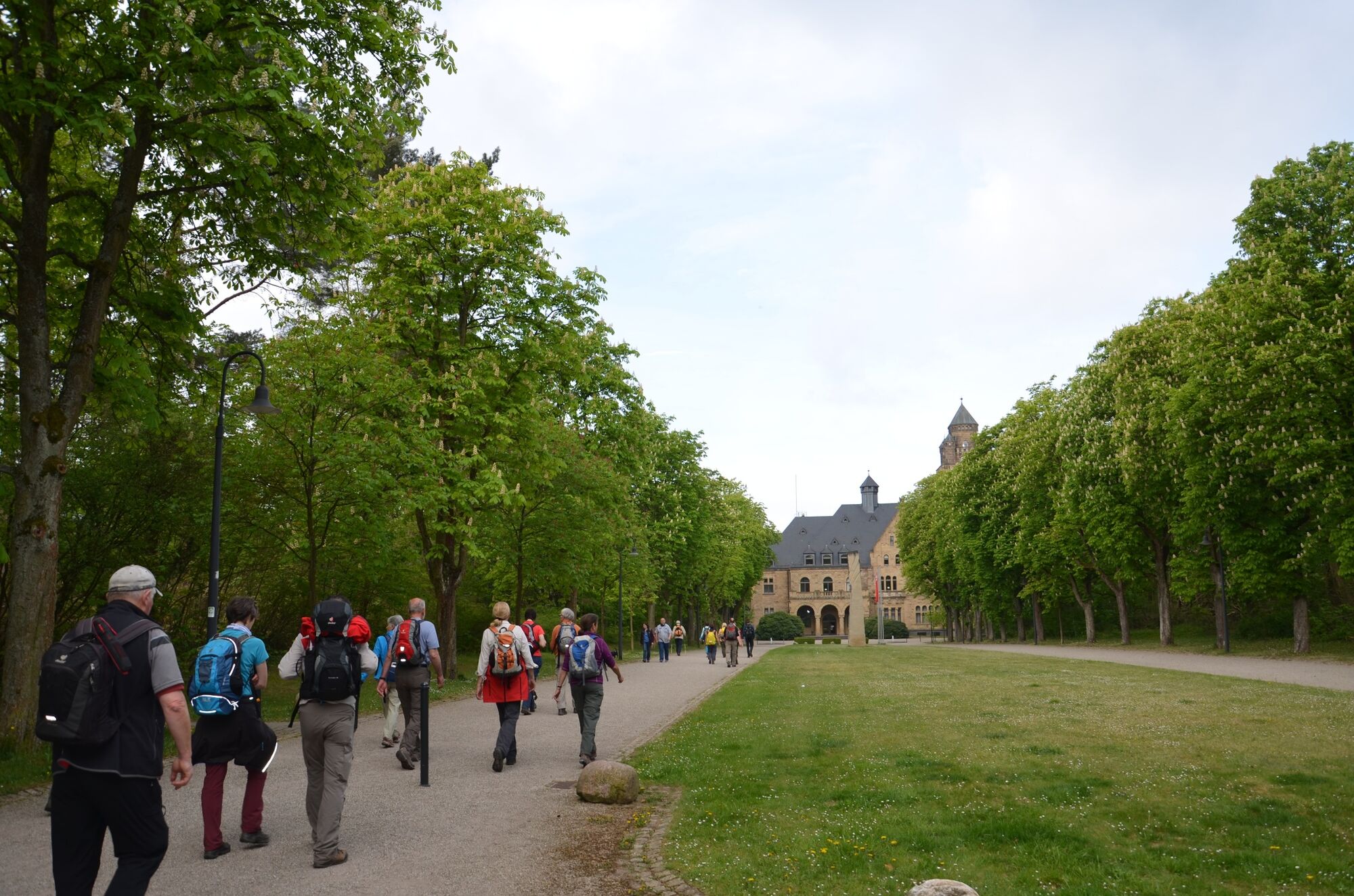
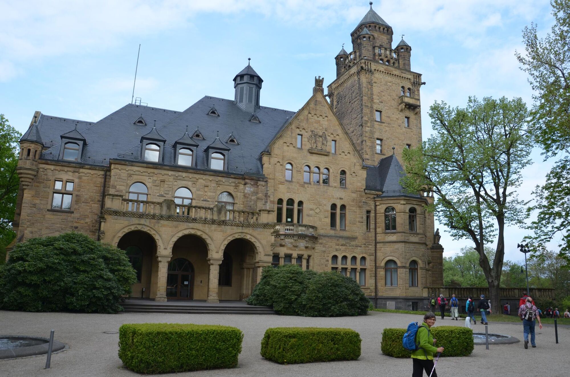
Start: Ebersheim church. You will walk now north to another field cross, the highest elevation of the Mainz city area. From here you will have a great view of the Donnersberg, the Soonwald, the Rheingau and Taunus as well as the skyline of Frankfurt. Passing a beautiful rest area with an information board, you first go through the Haybach valley and then along the stream to Klein-Winternheim to Andreasplatz. Here you will find the municipal administration and the Catholic church of St. Andreas, with the bronze statue "St. Andreas". Crossing the main road, under the railway and motorway underpass, it goes uphill through vineyards and fields past Ober-Olm to the Waldgasthaus Ober-Olm. From here you can see the skyscrapers on the Lerchenberg, the ZDF (German television broadcasting), the Mainz publishing house and the Rheingau Mountains with the "Hohe Wurzel". Nearby is the old forest house, our stage goal. Johann Wolfgang von Goethe spent several days there in 1793 during the siege of Mainz.
Directions 3. stage: "Altes Forsthaus" in Ober-Olm - Finthen - Waldthausen - Waldfriedhof Mombach
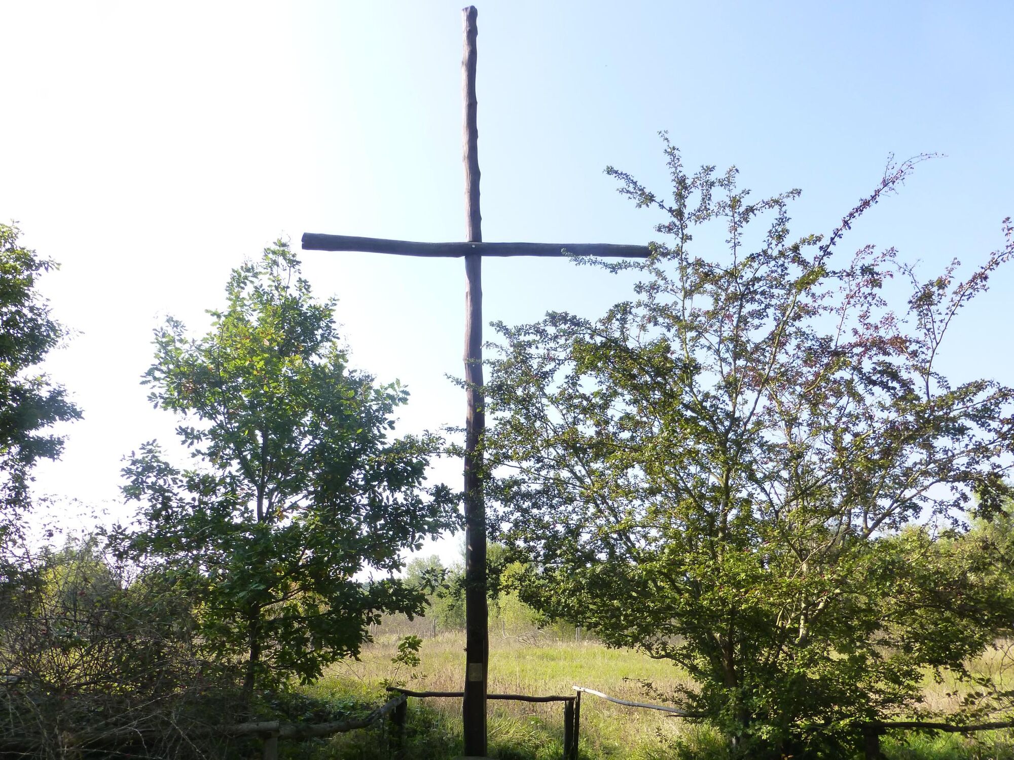
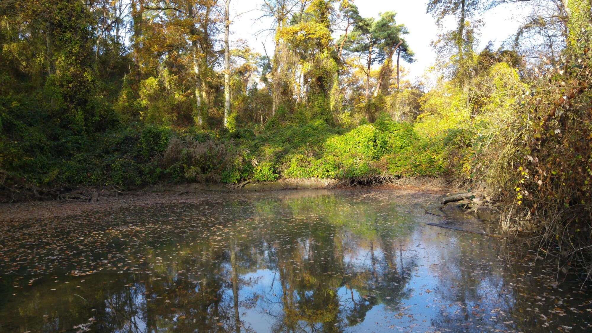
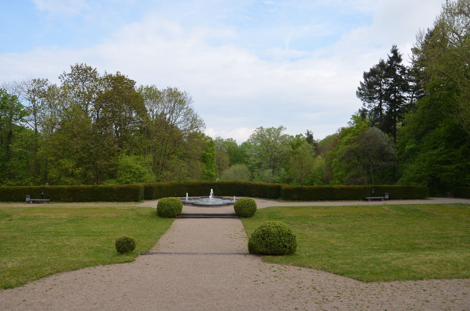
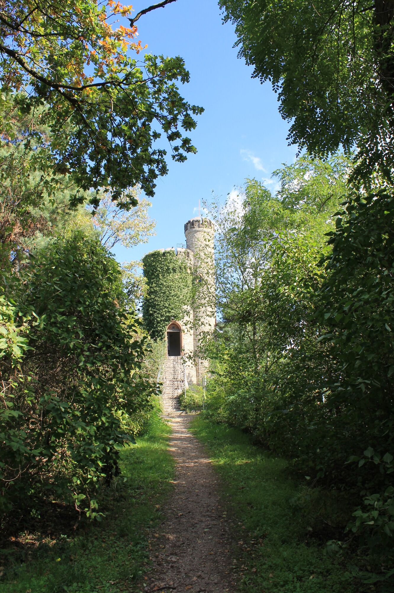
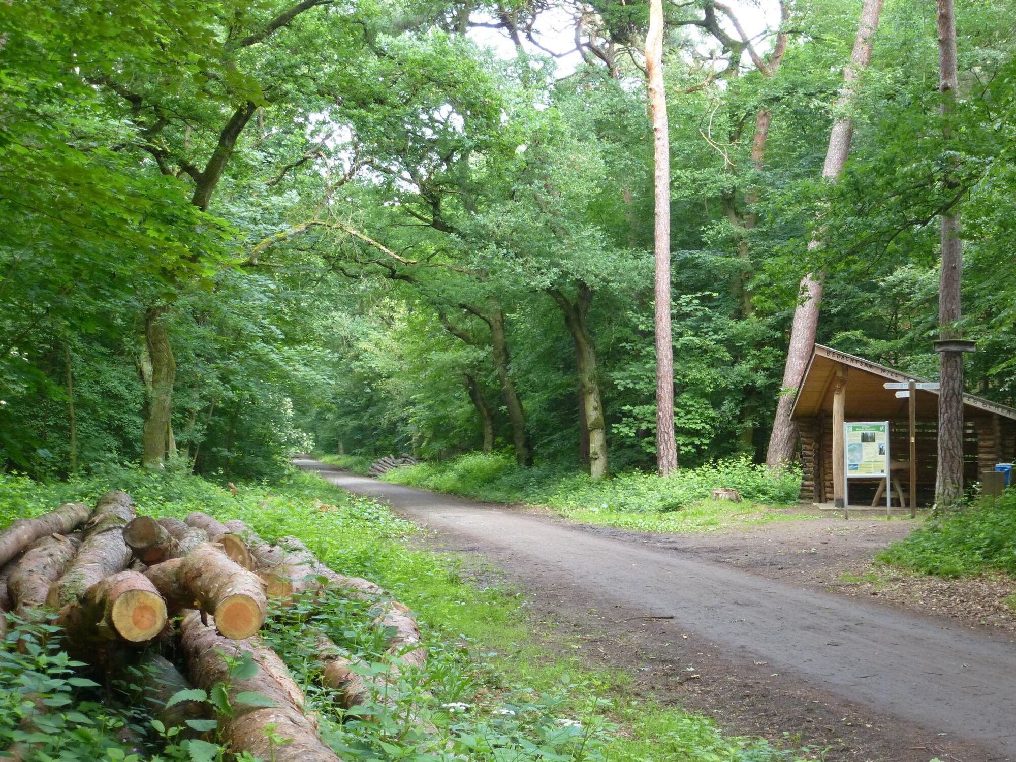
Start: old forest house "Altes Forsthaus". From here it goes through the Ober-Olmer forest, past the Friedenskreuz to the renatured areas with wooden walkways. Peat-like terrain crosses the path (a stop here is certainly worthwhile) and leads into the Finthen fruit fields, once over the airfield road in Finthen and further through the enchanting fruit fields into the Lenneberg Forest (also called Gonsenheimer or Budenheimer Wald). This very special forest has a sandy bottom and is one of the green lungs of Mainz with its 630 ha. The path goes past the seven ponds (today biotopes), near the "Rheingoldruhe", under the A 60 to the signpost to the "Green House" (exhibition of animal preparations and sale of game products), a bit uphill to the broadway "Allee", the former castle driveway from Heidesheim. Here you will find the next sight, the Waldthausen Castle, its park is open to the public. Once crossed, it goes past the gatehouse and out of the castle grounds. Cross the K 10 to Finthen and the L 422 to Gonsenheim at the crossings. Continue to the "Lennebergkuppe" with its Lenneberg tower, built in 1880, from its platform you have a magnificent view of the Rheingau and the Taunus to the Feldberg. Right next door there is the Lenneberg restaurant, which is ideal for a little refreshment. To the left past the Lennebergturm, there are many steps down to the new, beautiful refuge on the corner of the Wendelinus and Altmünsterschneise. Those who haven't had a break so far, can do a stop here at the latest. At the Mombacher forest cemetery it goes along the fence to the entrance, where you find another information board. A café and a bus stop are close. From here you have two options:
1. Walk past the "Fatzerbrünnchen" and the NSG Mainzer Sand (dune area) to the section's Alpine Club House
or
2. Return by bus (Waldfriedhof stop) without changing trains via the main train station to the starting point of the hike in Laubenheim.
- Highest point
- 239 m
- Endpoint
-
End: Bus station Mombach Waldfriedhof
- Height profile
-
 © outdooractive.com
 - Equipment
-
You will need hiking clothes, sturdy shoes, backpack catering, enough water to drink, head gear, sun protection.
- Safety instructions
-
no security advice
- Tips
-
Where to eat and drink:
First stage:
Steigerhof - winery in Harxheim
The are more wineries in along the way.
Second stage:
Eva Vollmer - winery in Ebersheim
Wollstädter - winery in Ober-Olm
"Hofcafé am Fortshaus" - a café in Ober-Olmer Wald
"Bergschön" - a restaurant at Lerchenberg
Third stage:
"Waldcafé Rheingoldruhe" - a café in Heidesheim
"Turmcafé" - a café at Lennebergturm
"Konditorei Café Müller" - a café at "Mombacher Friedhof"
- Additional information
-
Further information:
Deutscher Alpenverein (DAV) - Sektion Mainz e. V.
Turmstr. 85
55120 Mainz-Mombach
Tel.: 06131 688829
Fax: 06131 625890
mail: info(at)dav-mainz.de
Internet: www.dav-mainz.de/impressum.html
- Directions
-
First stage:
A 60 exit Mainz-Laubenheim, follow signs to the train station
Second stage:
A 60 exit Mainz-Hechtsheim West, follow Rheinhessenstraße to Ebersheim center (church)
Third stage:
A 60 exit Mainz-Finthen, turn right via Drais (L427), past Lerchenberg, until branch "Forsthaus Ober-Olm"
- Public transportation
-
The milestones are easy to reach by public transport.
Timetables: www.rnn.info
First stage:
To the starting point:
Train station "Mainz-Laubenheim" (RB) or bus stop "Im Brühl / Bahnhof" in Mainz-Laubenheim (line 61, 63, 64)
Back:
Bus stop "Neugasse" (line 66 with tram connection, line 67) to HBf Mainz
Second stage:
To the starting point:
Bus stop "Neugasse" (line 66, 67) in Ebersheim an der Kirche (first line 50 from Mainz, then change)
Back:
Bus stop "Forsthaus Ober-Olm" (line 650) or "Lerchenberg Hebbelsstraße" (line 54, 68), both to HBF Mainz
Back from Ebersheim (end of the third stage):
To the starting point:
Bus stop "Forstamt Ober-Olm" (line 650, 64, 68)
Back:
Bus stop "Mombach Waldfriedhof" (line 60, 61) to HBF Mainz
- Parking
-
First stage:
Large parking lot directly at the train station in Laubenheim
Second stage:
Few parking spaces on the roadside (Zornheimer Straße, Nieder-Olmer Straße), hardly any parking spaces available on weekends!
Third stage:
There is a large free parking lot at the Forsthaus in the Ober-Olmer Forest
-

-
AuthorThe tour Hiking Tour "Kleiner Mainzer Höhenweg" is used by outdooractive.com provided.


General info
-
Rheinhessen
866
-
Mainz
319
-
Walluf
142