
- Brief description
-
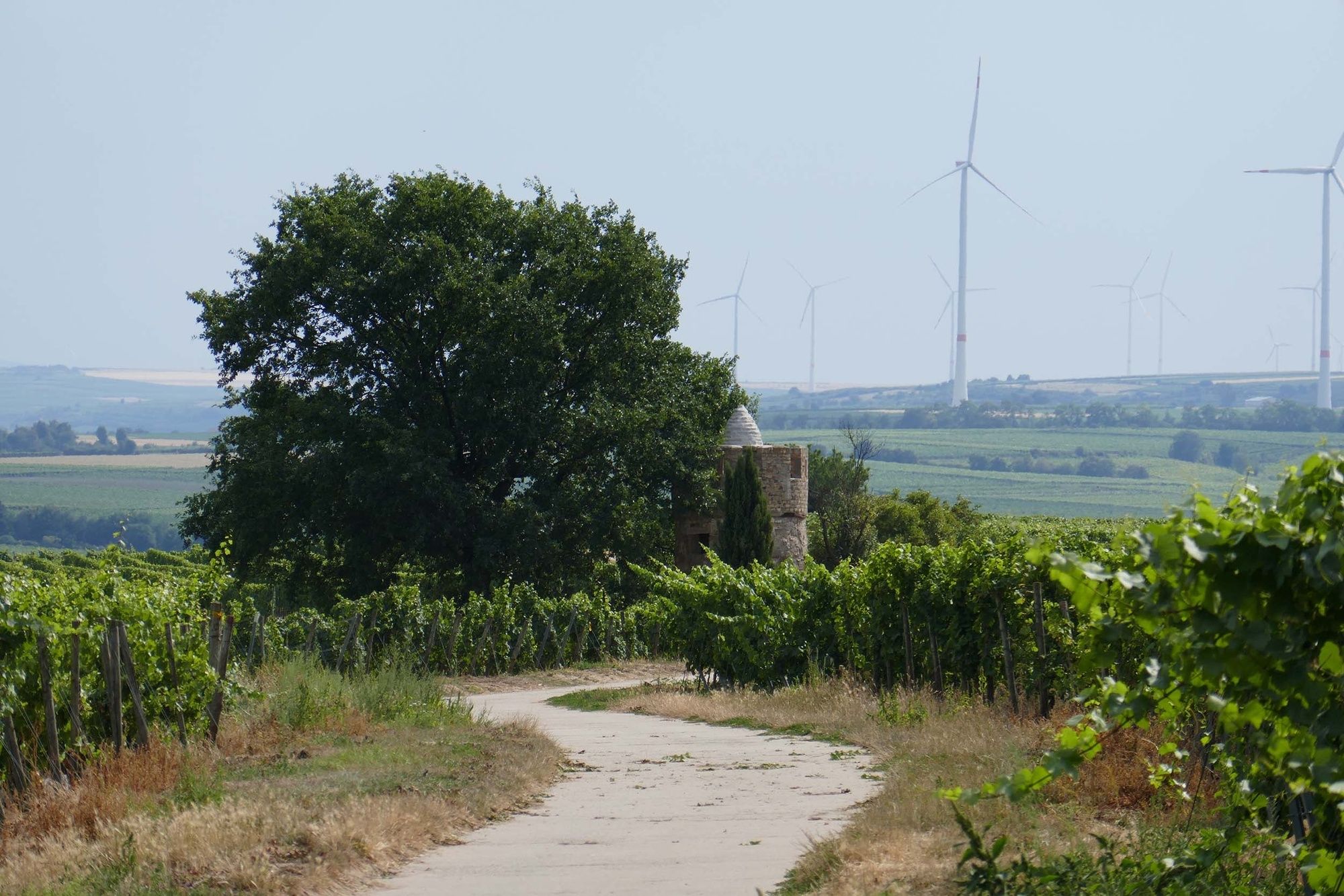
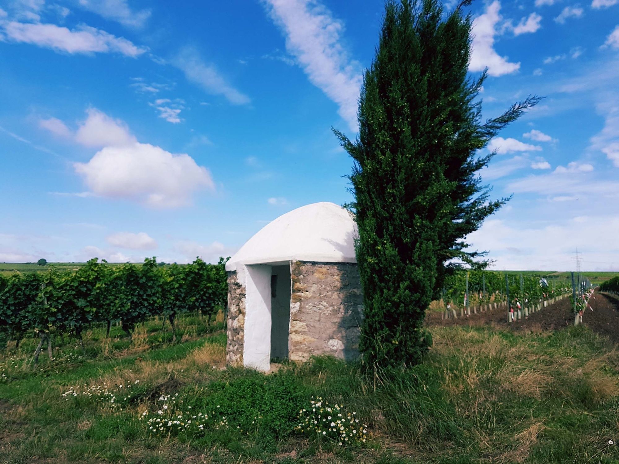
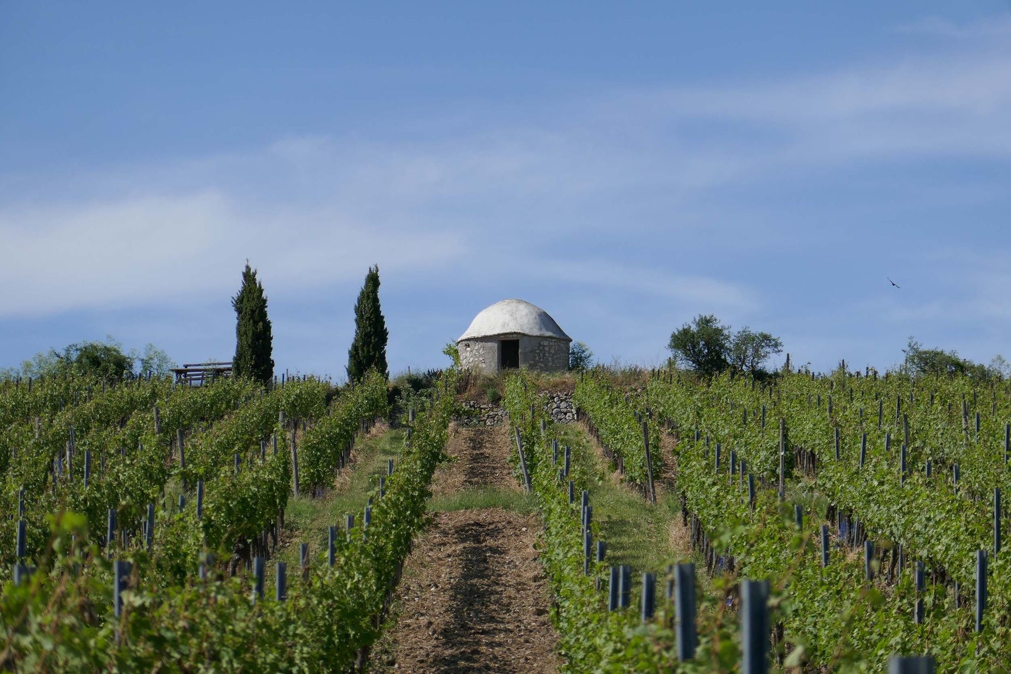
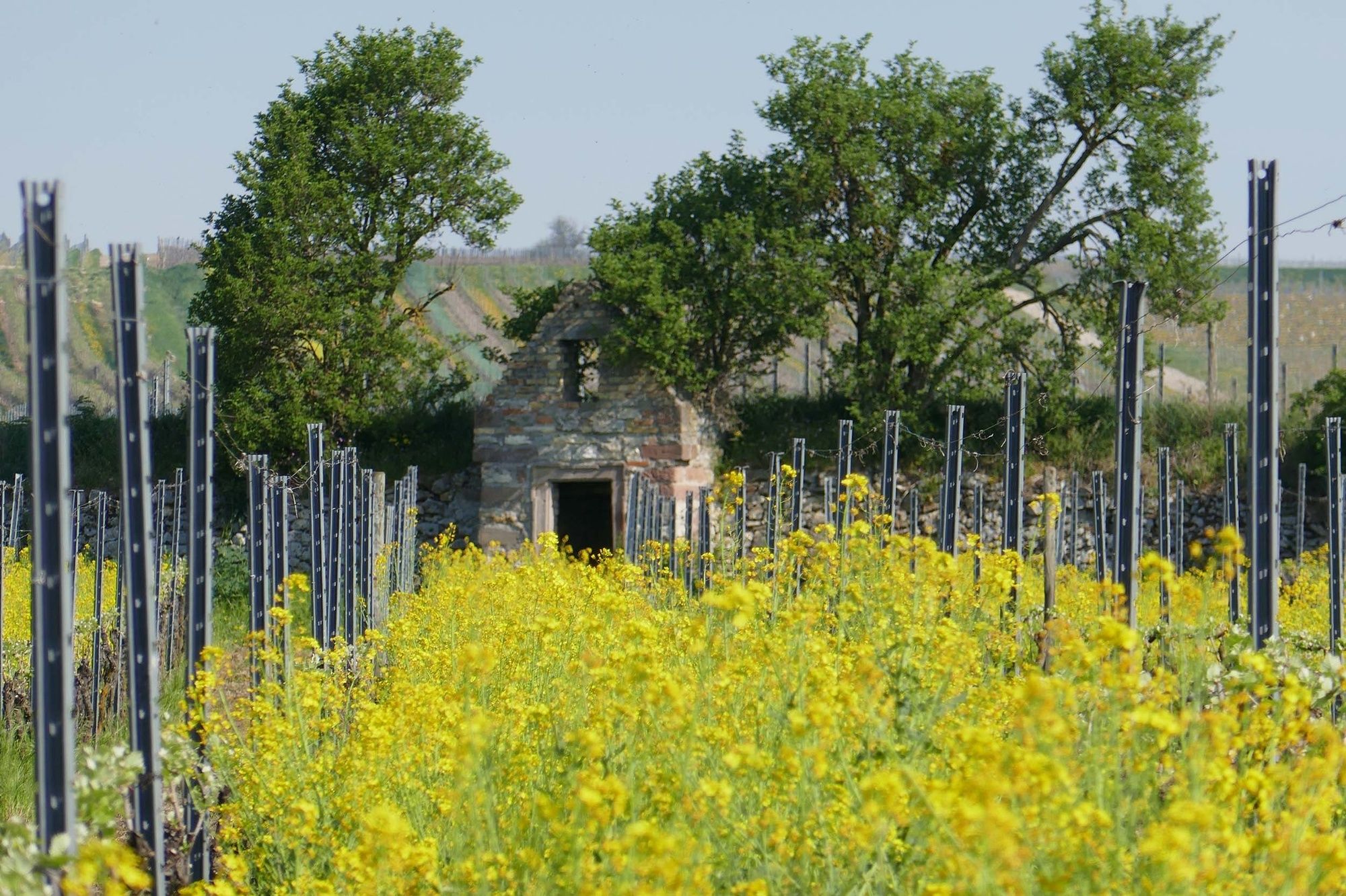
Historic "Wingertsheisjer" with many stories and anecdotes, as well as incomparable wide views and a beautiful old village center.
- Difficulty
-
medium
- Rating
-
- Starting point
-
Parking lot Am Nickelgarten in Westhofen
- Route
-
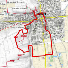
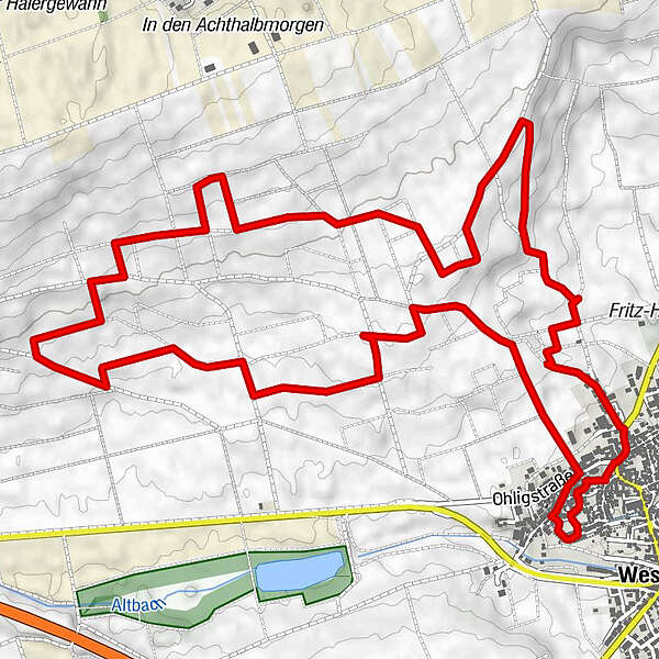
GUT LEBEN am MorsteinMollental0.6 kmAuf dem Staasbühl7.1 kmSeebachquelle8.0 kmWesthofen8.1 kmEvangelische Kirche8.5 kmSt. Petrus und Paulus8.5 kmGUT LEBEN am Morstein8.8 km
- Best season
-
JanFebMarAprMayJunJulAugSepOctNovDec
- Description
-
Start and end of the trail is the parking lot at Nickelgarten. From here you start directly into the vineyards and after a few hundred meters you reach the first historical Heisje from 1766. This is followed by the next stop, which offers you a beautiful panoramic view and at the same time allows you to marvel at 14 Heisje from a distance. And so you continue on your way through the vineyards around Westhofen. Discover a total of 14 Wingertsheisjer, the Westhofen cross and one of the typical hollow ways in the Wonnegau.
- Directions
-
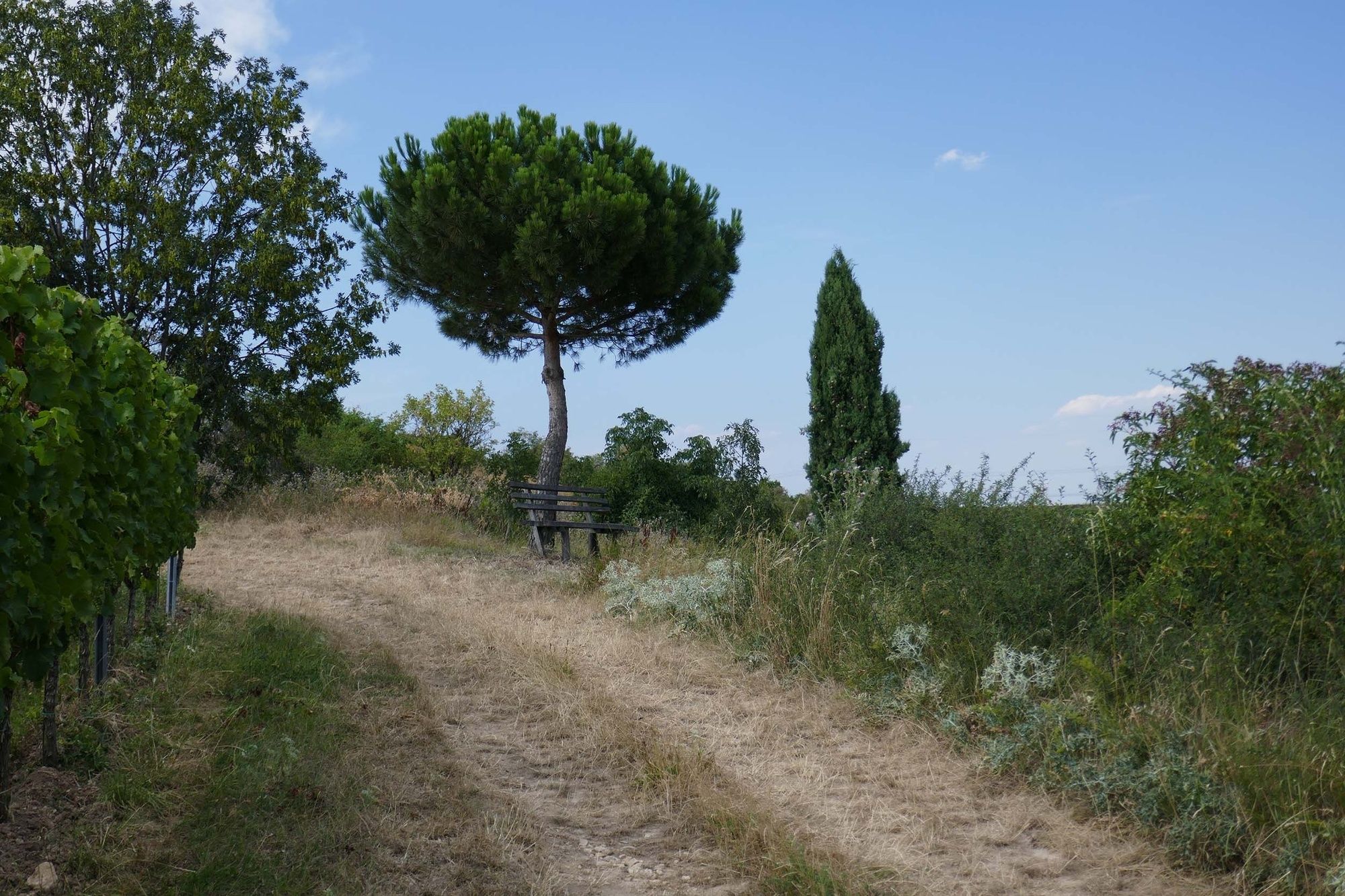
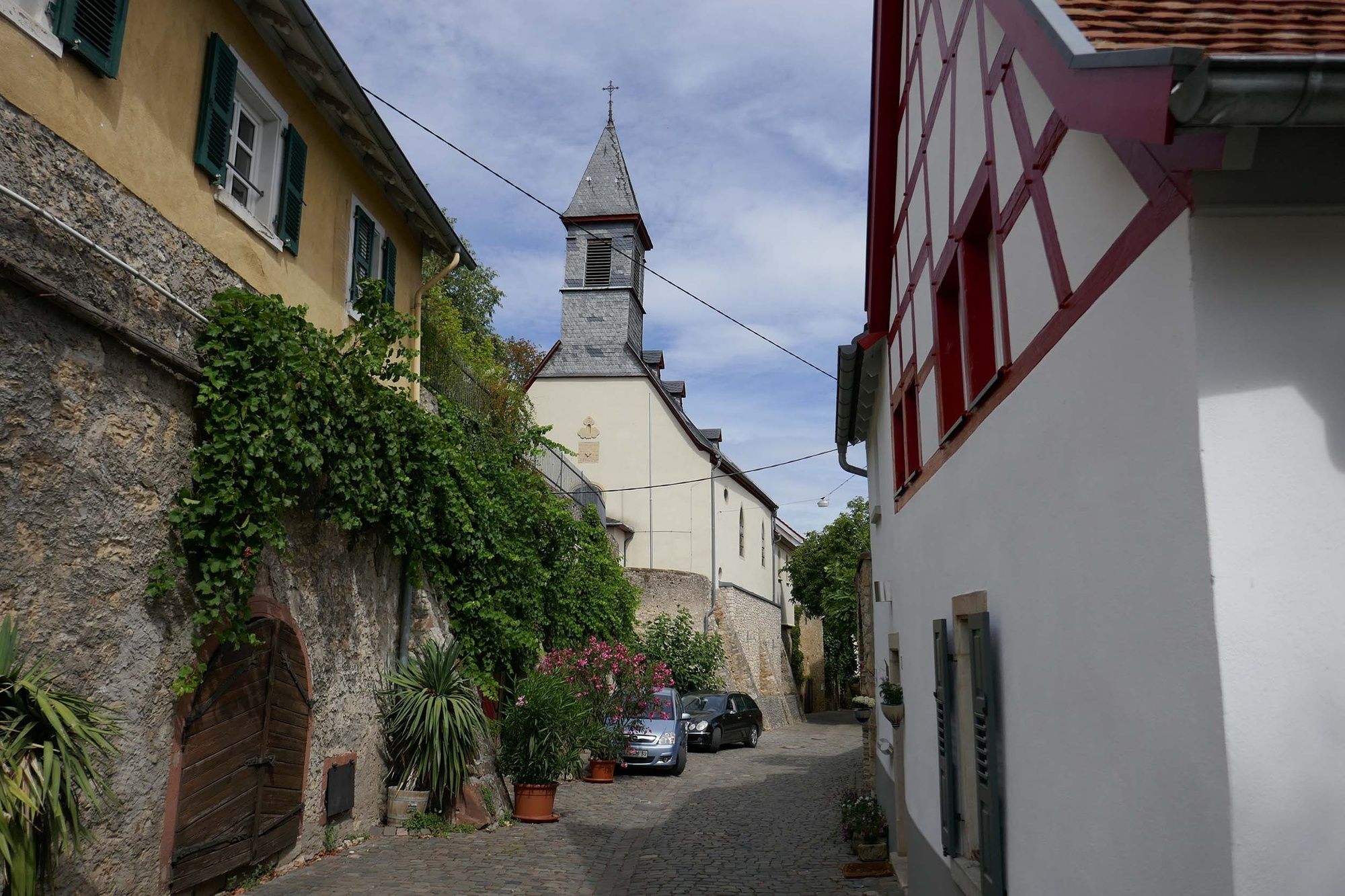
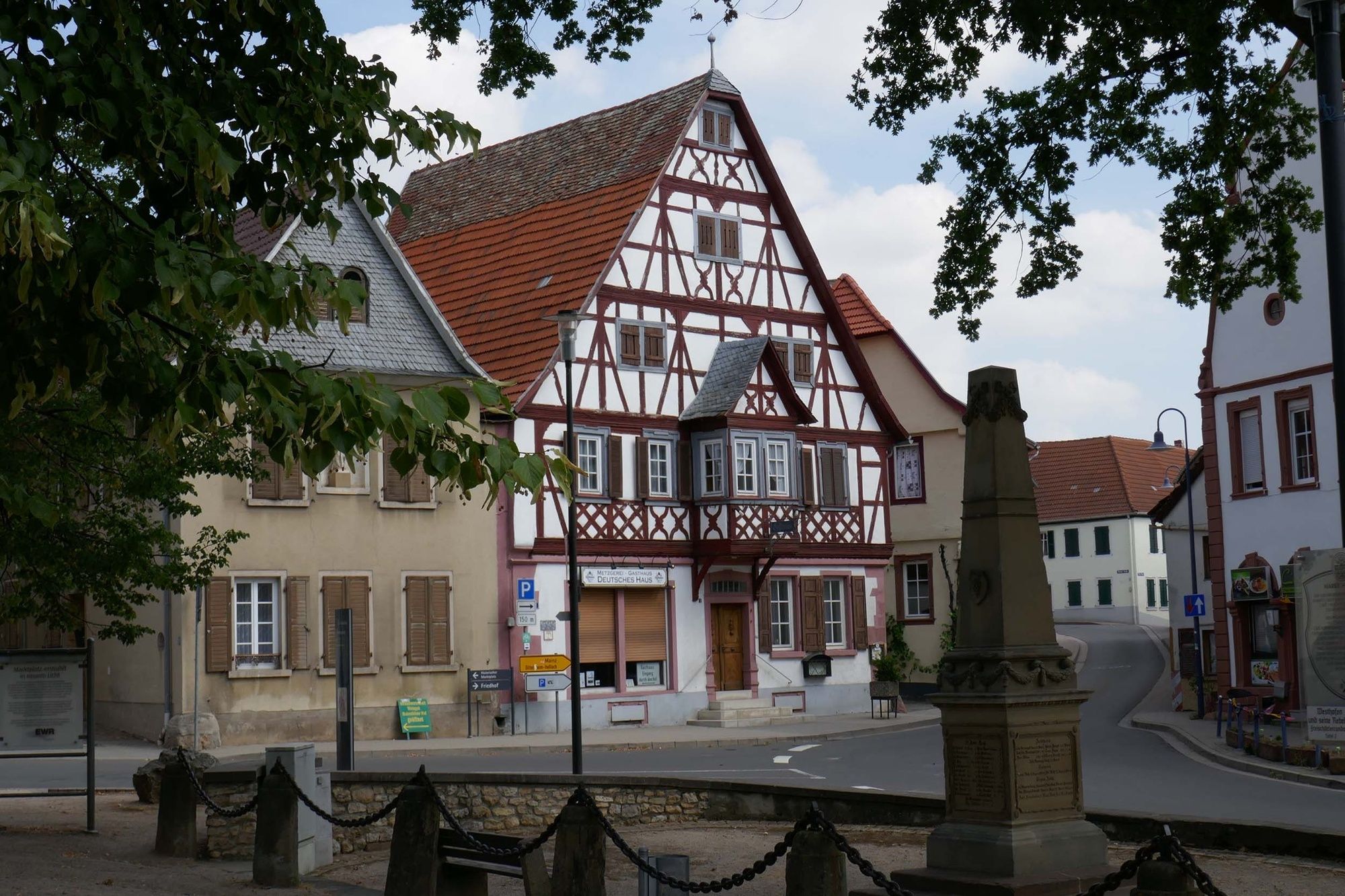
The circular hiking trail starts a, parking lot Nickelgarten in Westhofen. An information board with flyers directly at the entrance leads to the hiking trail. The path leads directly into the vineyards, where already after a few hundred meters the first Heisje can be explored. The second stop is the 14-Heisjer view, which reveals an incomparable distant view and also guarantees the view of 14 Wingertsheisjer. Further on, the hiking trail leads through one of the typical hollow ways in the Wonnegau. During the ascent you get a wonderful view as far as Frankfurt, Odenwald and along the Rhine valley. After the ascent, the Mission Heisje is reached. The hiker walks "around" the mountain without a name, to Juliusturm, then via Liebesnest, Petere's Heisje, Gallé-Blick, Westhofener Kreuz, the Hinkelstein to the Vierecks- and Zweiraum Heisje. Here you can take a rest and experience an unforgettable view from the Donnersberg over the Vosges, the northern Black Forest, Worms Speyer, Ludwigshafen, the Rhine plain and the Odenwald. After the Vierecks- and Brunnen-Heisje the hike goes almost downhill. Thereby 3 Heisjer from 1766 are on the way. From the "Ausgezeichneten Heisje" the hiker dives into a "sea of vines". View always in the direction of Westhofen and Odenwald. Finally, the route leads into the town center of Westhofen, which is well worth seeing. Through the "Reilche" one dives into the community. The hike leads through the origin of Westhofen with the Seehof, baroque houses, the Seebachquelle, Kneippanlage, winding old streets, the famous Kellergasse and one of the most beautiful marketplaces in Rheinhessen. From there via Mainzer Straße to the Nickelgarten.
- Highest point
- 230 m
- Endpoint
-
Parking lot Am Nickelgarten in Westhofen
- Height profile
-
 © outdooractive.com
 - Equipment
-
Sturdy shoes, hiking clothes, backpack provisions
- Safety instructions
-
No special safety instructions.
- Tips
-
The center of Westhofen.Seebach spring, Kneipp facility, winding alleys and one of the most beautiful marketplaces in Rheinhessen.
- Additional information
- Directions
-
By car
A61 exit Gundersheim / Westhofen on L386 direction Westhofen, turn left on Ohligstraße, at the market turn left into Mainzer Straße then at the traffic island turn left into the parking lot Nickelgarten.Please do not park on the excellent parking spaces for the mobile homes.
By public transport
Train station Osthofen or Alzey.Continue with bus 434 from Osthofen or 427 from Alzey to bus stop Westhofen "Verbandsgemeinde".
- Public transportation
-
Osthofen or Alzey train station.
Continue with bus 434 from Osthofen or 427 from Alzey to bus stop Westhofen "Verbandsgemeinde".
- Parking
-
Parking lot at Nickelgarten
Mainzer Str. 1067593 Westhofen
Other parking lots at the cemetery Mainzer Straße


-

-
AuthorThe tour Westhofener Wingertsheisjer hiking trail is used by outdooractive.com provided.


General info
-
Rheinhessen
867
-
Leiningerland
376
-
Alzey
46