
- Brief description
-
On the steep slopes of the Moselle, winemakers bustle about while working in the vineyard through so-called “Wangertspedcher”. It's hard to understand that grapes used to be transported down to the valley by donkeys on the 'Wangerstpedchen' (vineyard paths).
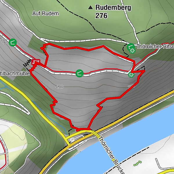
In the map below you will find further information about the location of the via ferrata.
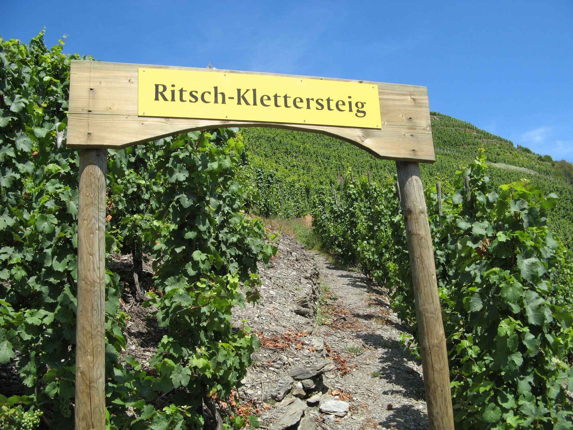
In 2004, the local community of Thörnich had the idea of paving part of these mostly very provisional paths and opening them up to tourists with a signposted system. Since 2006, it has been possible to climb through the vineyard to a beautiful viewpoint via the Thörnicher Ritsch via ferrata from the parking lot on the main road.
The path is around 1.4 kilometers long.
- Difficulty
-
mediumDifficulty level A/B
- Rating
-
- Starting point
-
Car park on the B 53/Thörnicher bridge
- Route
-
Thörnich1.4 km
- Best season
-
JanFebMarAprMayJunJulAugSepOctNovDec
- Highest point
- 252 m
- Endpoint
-
Car park on the B 53/Thörnicher bridge
- Height profile
-
 © outdooractive.com
 - Equipment
-
Sturdy shoes required.
- Safety instructions
-
The footpath leads through steep, rocky terrain in places. Hikers should be sure-footed and have a head for heights.
- Tips
-
Rest area & meeting place Thörnicher Ritsch:
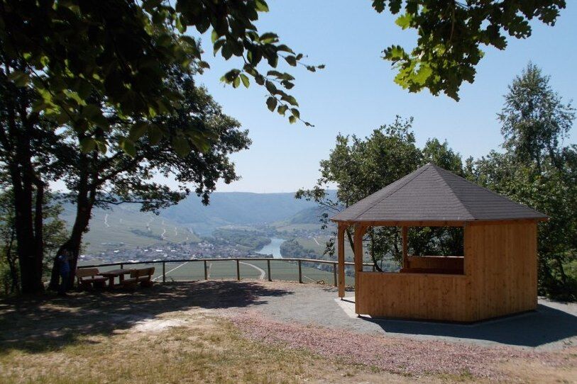
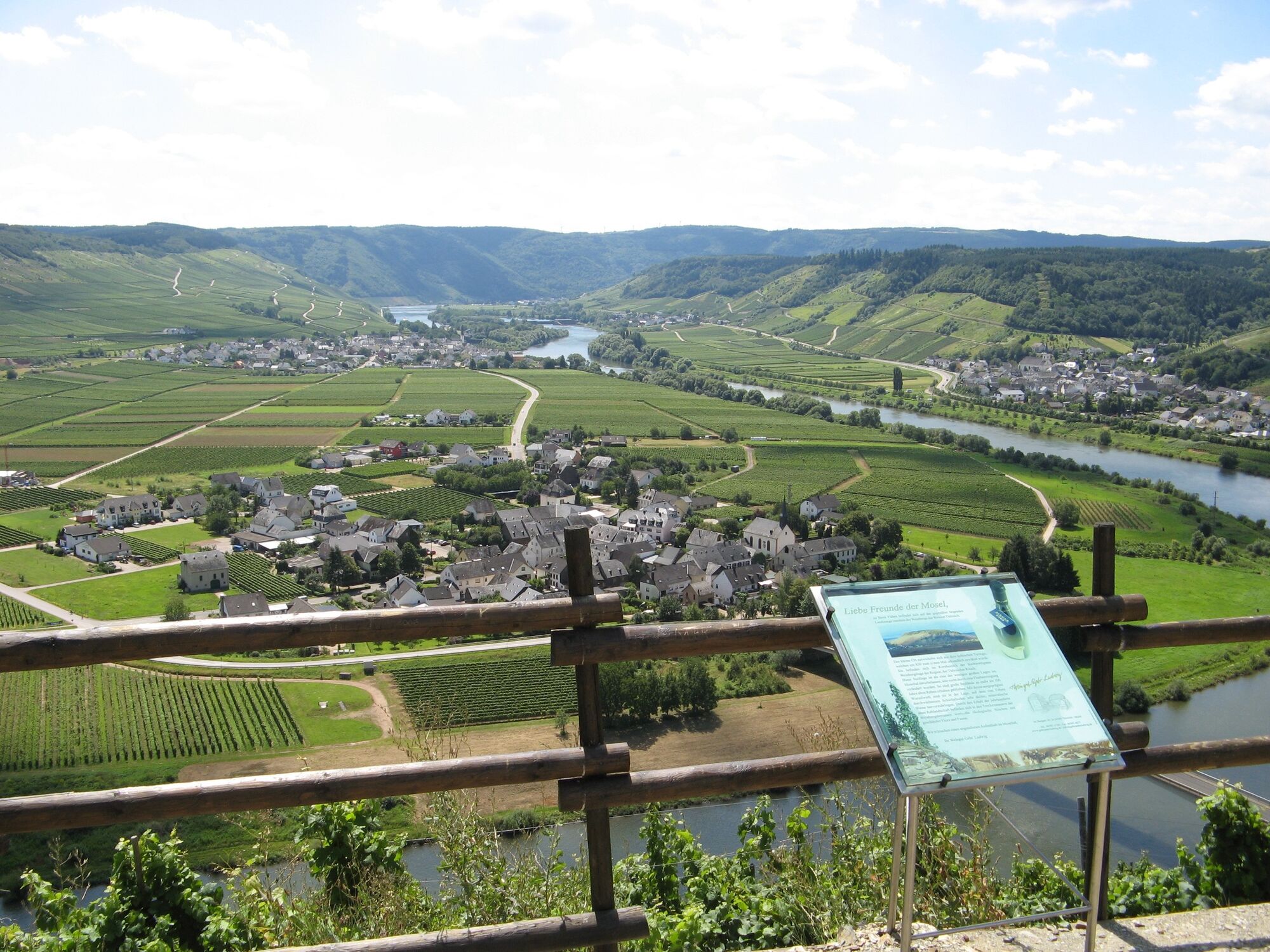
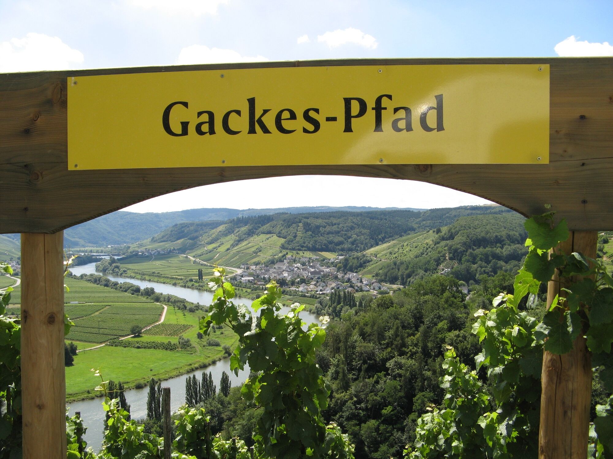
After hiking the most difficult part of the via ferrata, a beautiful rest area including an information board welcomes the exhausted hiker. From there you have a unique view of the Moselle valley from Leiwen via Thörnich to Pölich. A little above this rest stop, the Thörnicher Ritsch meeting place has been located since 2015 with a large refuge and other rest areas.
Thörnicher Ritsch:
The name of the world-famous Thörnicher Ritsch wine region is derived from the location's brittle gray slate; rocks repeatedly slide into the valley. Due to the brittle rocks, land consolidation and path construction cannot be carried out in the Ritsch; the paths would slip in the steep terrain.
- Additional information
- Directions
-
To get there, take the B 53 to Thörnicher Brücke. There are some parking spaces available there. Alternatively, we drive over the Thörnicher Bridge to the other side of the Moselle and then turn sharp right to Thörnich. Additional parking spaces are available there.
- Public transportation
- Parking
-
The parking lot on the B 53 can be used. There are also sufficient parking spaces available in the center of Thörnich.
-

-
AuthorThe tour Via ferrata "Thörnicher Ritsch" is used by outdooractive.com provided.