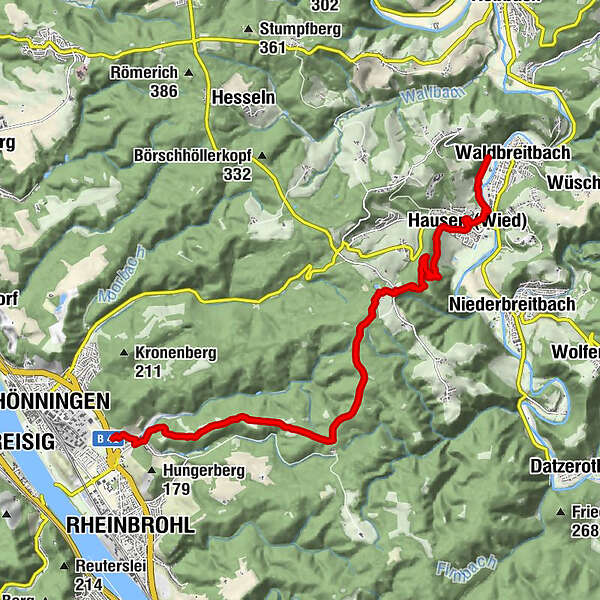
Westerwald-Steig Stage 16: Waldbreitbach - Bad Hönningen (East - West)


- Brief description
-
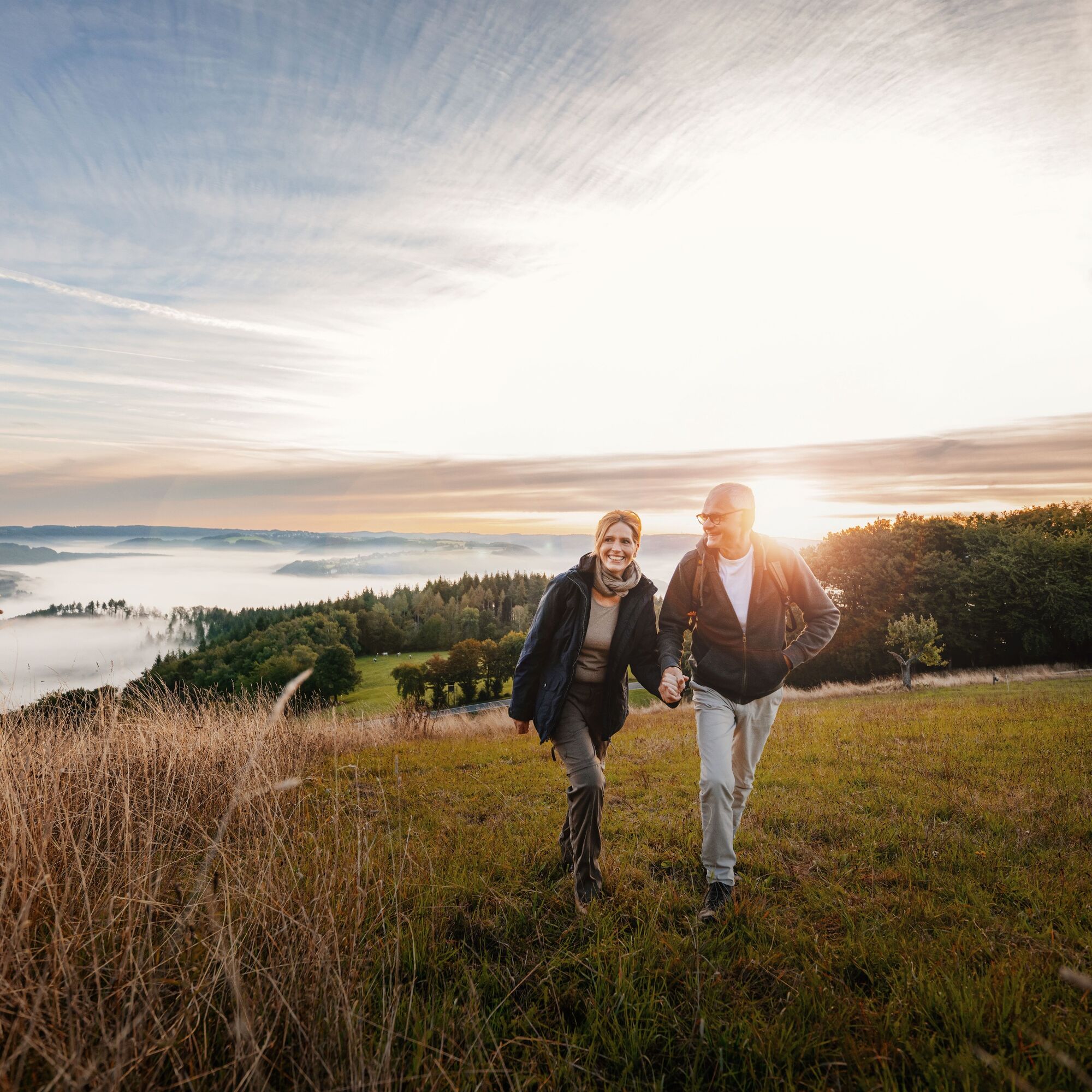
This stage of the trail passes through the grounds of the St Joseph House in Hausen, continues to the 'three abbey view' and leads up to the hikers'/ski hut on the Malberg mountain. We then pass some Roman watchtowers before descending into the Middle Rhine Valley to the RömerWelt, a living Roman history museum.
- Difficulty
-
difficult
- Rating
-
- Starting point
-
Waldbreitbach
- Route
-
WaldbreitbachMariengrotte1.0 kmHausen (Wied)1.7 kmMalberg-Hütte5.4 kmHähnen5.5 kmMalberg (373 m)5.5 kmGebildeichshäuschen7.9 kmBeulenberg (321 m)8.8 kmNaturpark-Weitblick Dielsberg10.4 kmArienheller11.8 km
- Best season
-
JanFebMarAprMayJunJulAugSepOctNovDec
- Description
-
The Westerwald-Steig trail passes the St Joseph House in Hausen and heads over the Malberg mountain to the Rhine. The 373m high Malberg looks like a crater, but its lake is not volcanic – it was created by the former basalt mine here. You can ski here in the winter, but the ski hut is open all year round to cater for hikers. The Westerwald-Steig trail ends in Rheinbrohl with one more highlight – the RömerWelt living Roman history museum.
- Directions
-
The last stage of the Westerwald-Steig trail takes us into the Rhine Valley to Bad Hönningen. At 13km, the stage isn't too long and leaves you enough time to visit St Marienhaus, above Waldbreitbach, before you begin your hike. The monastery, with its neo-gothic church and its herb garden with plants from the Biblical times which is looked after by the Franciscan nuns, can be reached via the Klosterweg path and should not be missed.
Immediately after the start of the stage, we walk right past the St Joseph House, the main house of the Franciscan monks in Hausen. We climb on narrow paths to the Malberg, where a ski hut (open all year round) with a magnificent view of the Wied Valley tempts us to stay for a while. The trail soon comes to the first Roman watchtower and offers a view across the Rhine Valley and the Eifel region. In Arienheller, between Rheinbrohl and Bad Hönningen, the Westerwald-Steig trail meets the Rheinsteig trail (which runs for 320 kilometres from Wiesbaden to Bonn). Here, you can also visit the RömerWelt, a living Roman history museum. The Roman limes, 550 kilometre-long defence walls between the Rhine and the Danube, begin in Rheinbrohl. The Upper Germanic Limes has been a UNESCO World Heritage site since 2005 and is an outstanding archaeological monument. The Roman historian Tacitus called the beginning of the Limes Romanus 'Caput limitis' – head of the limes.
Access paths (marking: green W on a yellow background) - Highest point
- 362 m
- Endpoint
-
Bad Hönningen
- Height profile
-
 © outdooractive.com
 - Equipment
-
Hiking boots/shoes
Suitable weatherproof clothing - Safety instructions
-
Wear sturdy shoes and appropriate, weatherproof clothing that protects you from cold and wet or heat and sun.Take enough liquid with you. There are not always places to stop for refreshments.Please wear walking shoes appropriate for the trail, which will give you sufficient grip even on slippery and steep or rocky and uneven paths.If you are of the opinion that certain sections of the trail are not passable for you, then you should avoid them. Especially in adverse weather conditions, muddy and slippery passages can occur on natural paths.Especially in autumn, you should also be aware that leaves lying on the ground can hide uneven surfaces, roots, stones or holes in the path. You must expect path impairments of this kind when you undertake a hike.Although the trail is very well marked throughout, you should always have a suitable hiking map with you for safety reasons.
- Tips
-
For families with children: visit the RömerWelt (living Roman history museum)
- Additional information
-
www.wiedtal.de
www.bad-hoenningen.de - Directions
-
A3 to the Neustadt (Wied) exit (35), then take the L270 towards Asbach/Neustadt/Obersteinebach/Niedersteinebach/Hümmerich/Krunkel, and continue on the K88 and K90 towards Waldbreitbach
From Neuwied or Neustadt: L255 to Waldbreitbach - Public transportation
-
Train to Neuwied, continue with bus no. 131 to Waldbreitbach town centre
Return journey from Bad Hönningen/Arienheller to Hausen/Waldbreitbach: bus no. 137
www.bahn.de
www.vrminfo.de - Parking
-
Waldbreitbach, market square (Marktstraße)

- Author
-
The tour Westerwald-Steig Stage 16: Waldbreitbach - Bad Hönningen (East - West) is used by outdooractive.com provided.


General info
-
Ahrtal
1260
-
Siebengebirge
708
-
Rheinbrohl
244