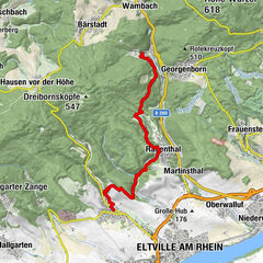
Rheinsteig Stage 19: Johannisberg–Kiedrich (north–south)


- Brief description
-
Right through the Riesling paradise
- Difficulty
-
medium
- Rating
-
- Route
-
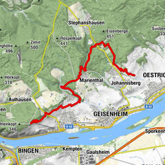
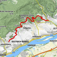
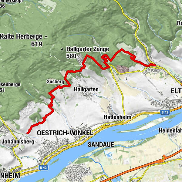
Oestrich-Winkel1.3 kmKühn's Mühle2.6 kmSusberg (331 m)5.5 kmAm Unkenbaum7.9 kmBernharduskapelle9.5 kmBistro im Pfortenhaus9.9 kmKiedrich14.6 kmSankt Michaelskapelle14.8 kmSankt Valentinus14.8 km
- Best season
-
JanFebMarAprMayJunJulAugSepOctNovDec
- Description
-
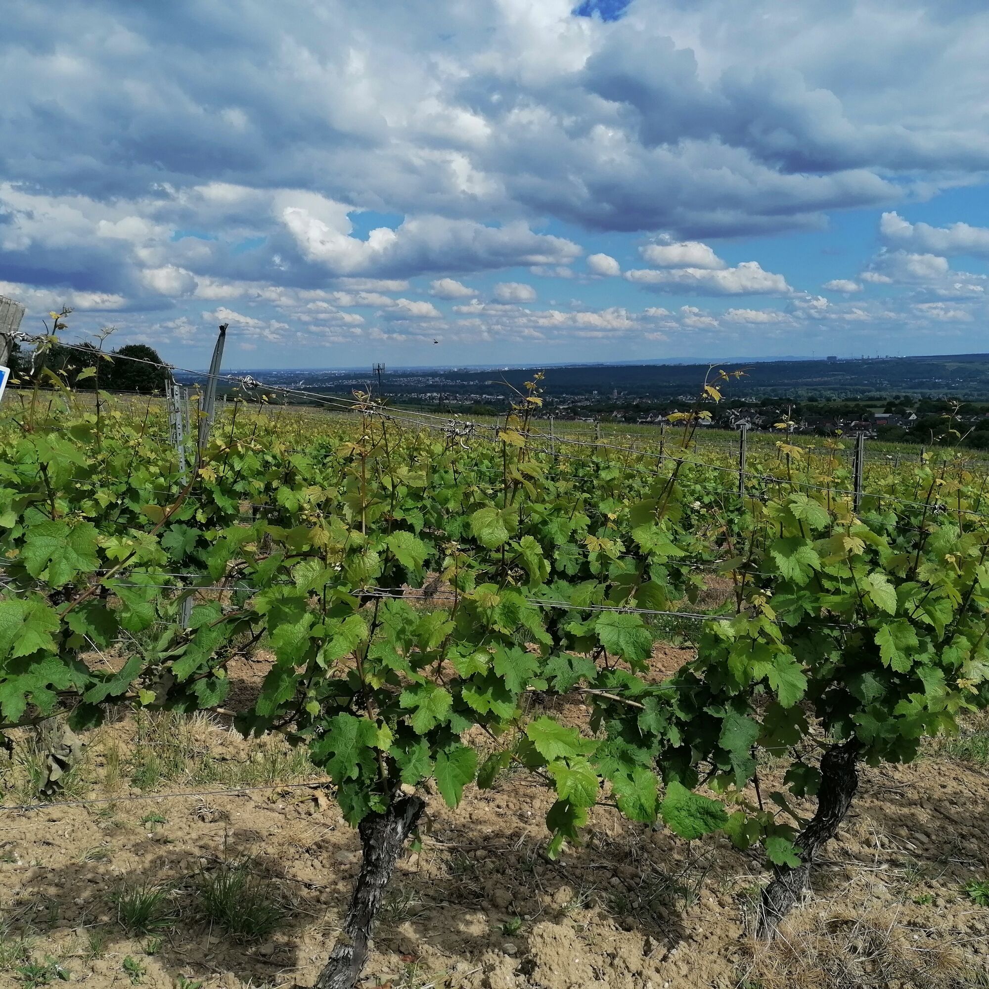
Today's hike through the Riesling paradise begins near Johannisberg Castle, the cradle of the late harvest. Long stretches of the stage lead through a landscape shaped by winegrowing. The wonderful distant views inspire as well as the impressive walls of Schloss Vollrads. The cultural highlight, however, is Eberbach Abbey, where you should definitely take the time for a tour before heading over the mountain to the day's destination, Kiedrich.
- Directions
-
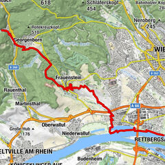
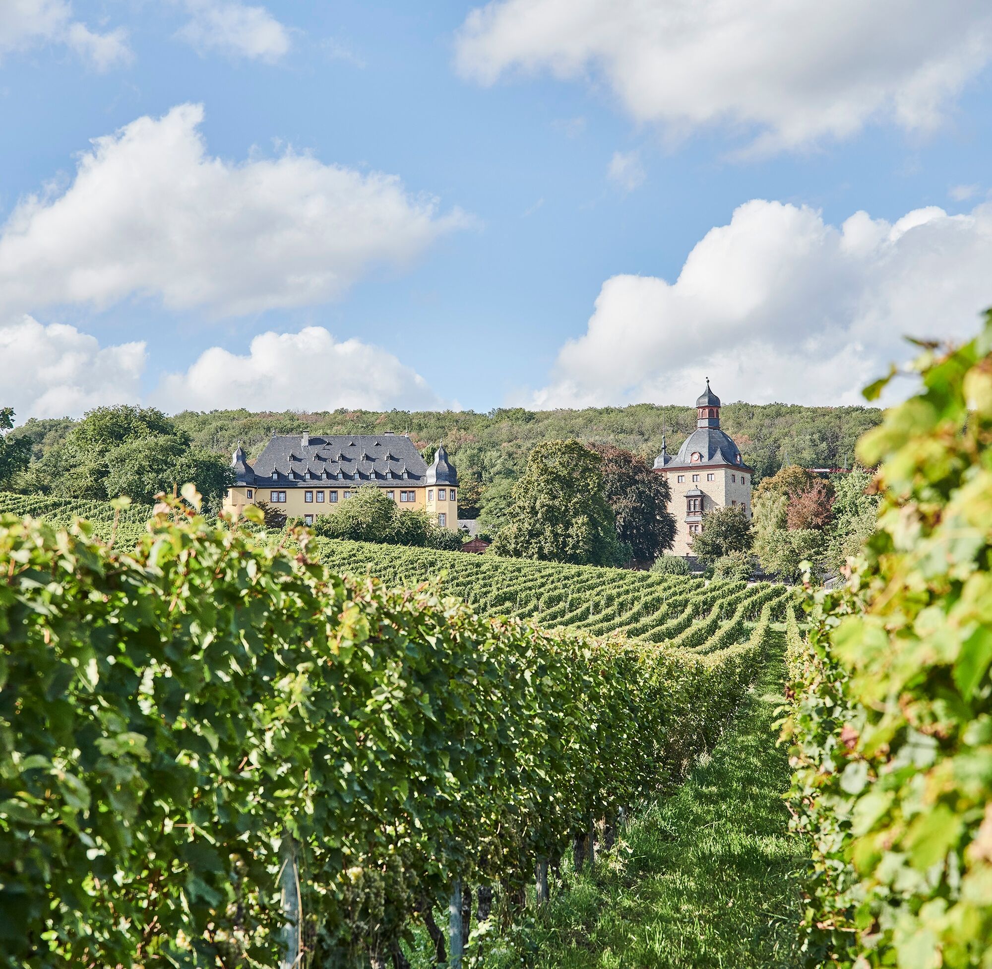
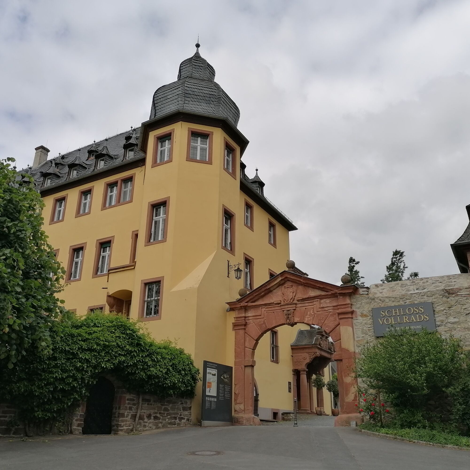
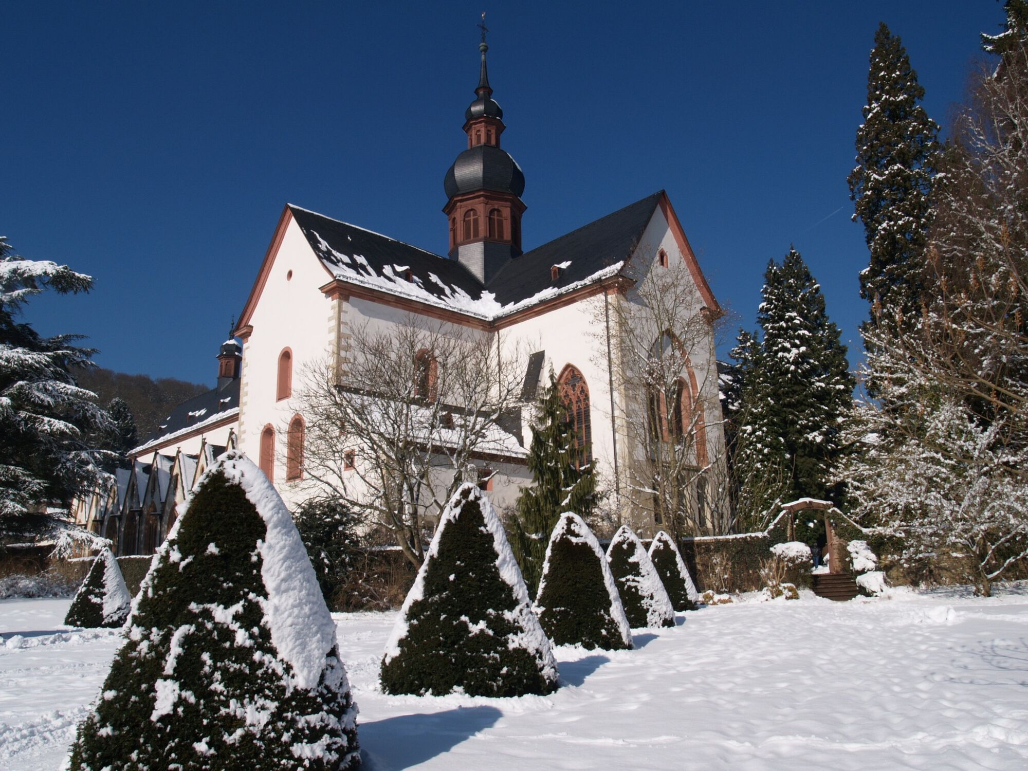
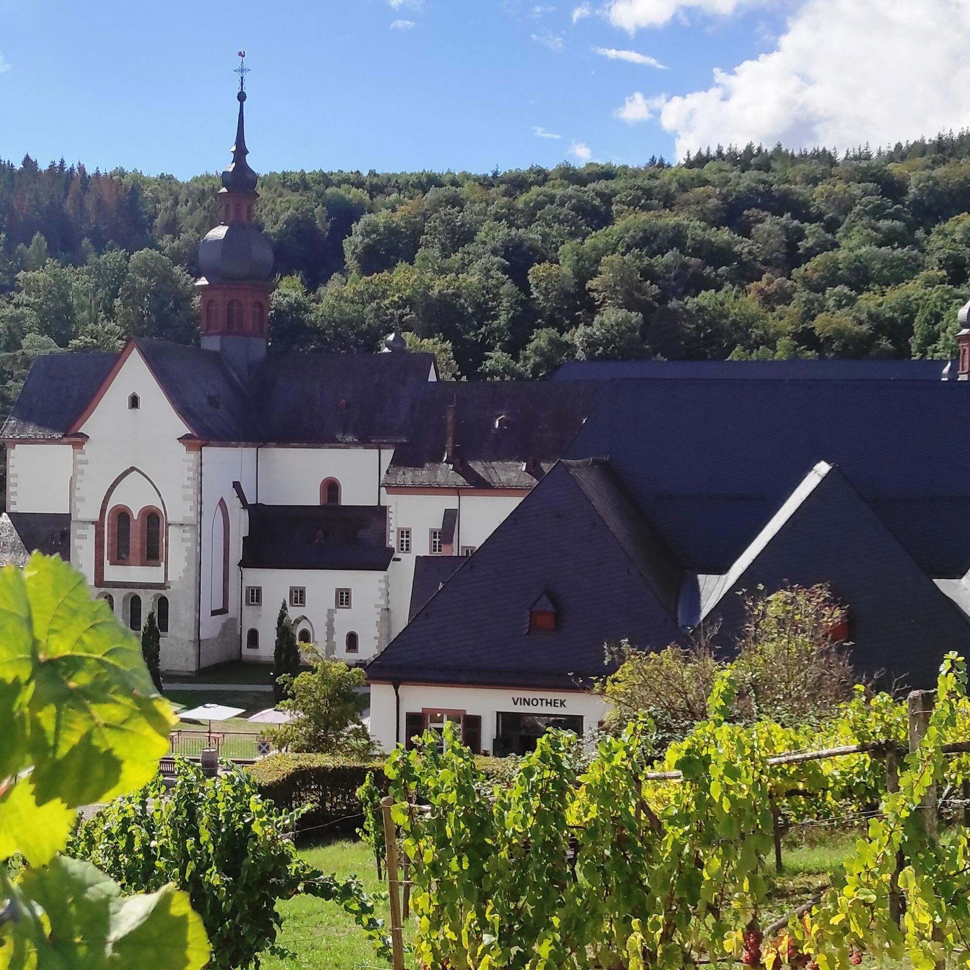
Access: From the Oestrich-Winkel train station, an access path leads through the vineyards up to the Rheinsteig (RS). Alternatively, you can get to the RS from Johannisberg (bus connection). In the middle of the sea of vines, you pick up the trail of the RS again. With a gentle gradient, the RS leads through the vineyards and soon you are in front of Vollrads Castle, famous for its wines. The RS continues the vineyard route with a few detours and soon passes the Gottesthal mill. With a prominent left turn, it goes slightly uphill to Kühns Mühle. Again and again, there are places to rest at the edge of the vineyards to linger and enjoy the view. After crossing the Dornbach, a meadow provides variety, but watch out: some aircraft can whizz around your ears here, because this is the airfield of a model club. A few meters further up, the RS reaches the edge of the forest and now leads east between the forest and the sea of vines with great views. Walk past the Philippsburg hunting lodge to the refuge on the Susberg and, after a short rest, climb the mountain through the woods. Now you leave the vines behind and can hike through the forest and across open fields for a change. You arrive at Rebhangstraße, cross it and turn left until you reach the Rebenhang settlement. You quickly walk back into the forest via the Unkenbaumweg and come across an inviting rest area at the multiple crossing "Am Unkenbaum". However, the eponymous toad tree, an ancient oak, fell victim to a storm a long time ago. The RS now turns right and on the following, quiet forest passage you can let your thoughts wander until the forest recedes and you reach the "Steinberg" vineyard surrounded by a venerable wall. The view is once again magnificent as you hike down along the famous vineyard. Finally there is a steep descent through the forest and then the time has come: you are standing on the edge of the extensive complex of Eberbach Abbey! The RS leads through the middle of the monastery area, which is definitely worth a detailed visit. After all, it was Bernhard von Clairevaux who founded this venerable Cistercian monastery in 1136.
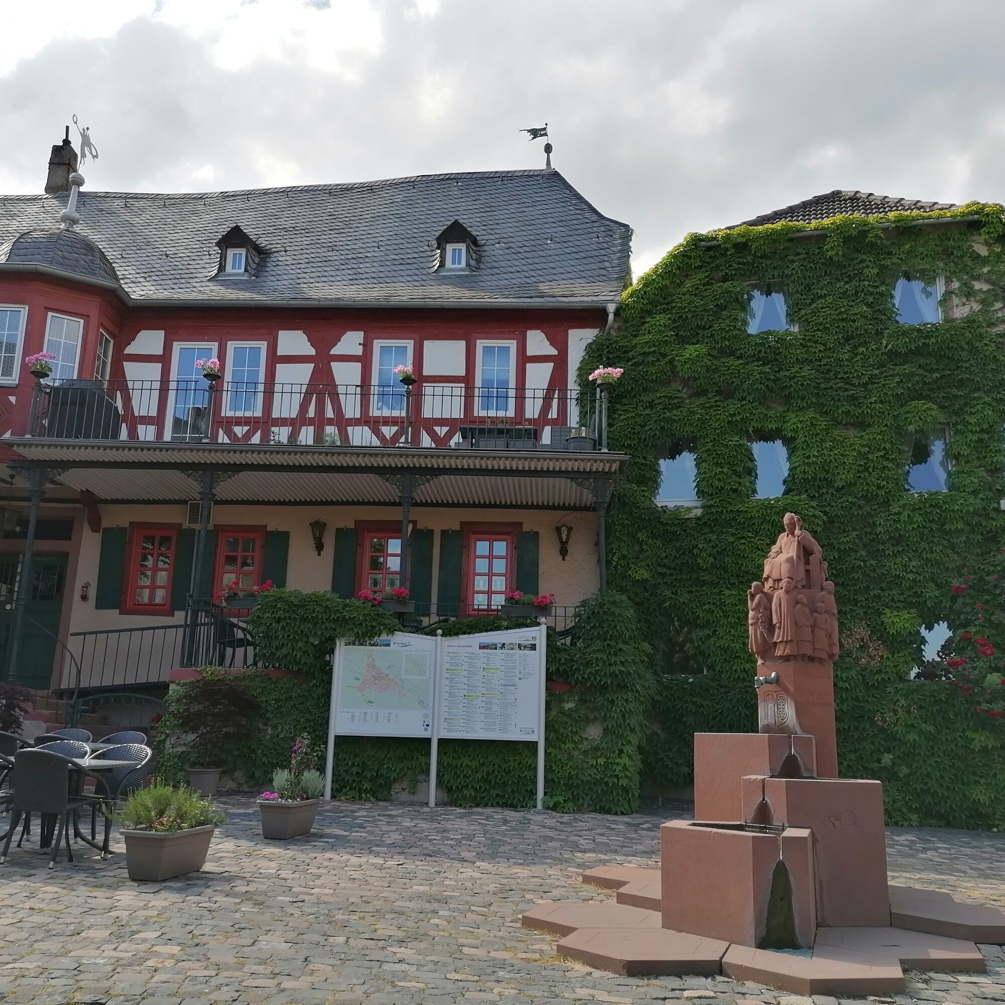
After the tour, you return to the RS, which leaves the monastery behind at the Kisselbach and dives into the forest. After a short, steep ascent, you switch to a path parallel to the slope and can admire the monastery from a new perspective. Then there is the long ascent to the Honigberg. After a significant increase in altitude, you cross the crest in the middle of the forest and are happy when the RS leads out of the forest into the open field a little later. Soon the meadows give way to loose woods and finally you reach the vineyards again, which characterize today's stage. Now it won't be long before the first houses in Kiedrich are reached. At the end of the hike, on Marktstraße, in the heart of Kiedrich, there are picturesque half-timbered houses and rustic places to stop for refreshments to bring this exciting tour to a fitting end.
- Highest point
- 358 m
- Endpoint
-
Kiedrich
- Height profile
-
 © outdooractive.com
 - Safety instructions
-
Health and safety
Wear suitable weatherproof clothing that will protect you from cold, wet, heat and sunshine. Make sure you take regular breaks and don't overexert yourself. Take enough fluids with you as there are sections without rest stops. Wear suitable hiking boots/shoes which give you enough grip on slippery, steep, rocky and uneven surfaces. Avoid any sections of the route which you feel are too difficult for you. Natural trails can quickly become wet and slippery in adverse weather conditions. Particularly in autumn, you should be careful of uneven ground, roots, stones or holes that have been covered by leaves. You need to take these kinds of adverse conditions into account every time you go on a hike. Particularly steep and dangerous places are made safer with handrails or ropes. Please use these as safety aids. Handrails are not to be climbed on or used to get a better view! - Tips
-
Eberbach Monastery is famous as the place where The Name of the Rose starring Sean Connery was filmed. It’s well worth a visit.
- Directions
-
Follow the B42 until you get to Geisenheim or Oestrich-Winkel. From here, follow the signs to Johannisberg.
- Public transportation
-
Take the regional train to the station in Geisenheim. From here you can catch a 183 bus to Johannisberg (5 minutes’ ride). There is a bus once an hour from Monday to Saturday and every two hours on Sundays and public holidays.
From Kiedrich you can catch a 172 bus to the train station in Eltville (13 minutes’ ride). There is at least one bus an hour every day. Alternatively, you can continue on the Rheinsteig for a further 2.5 kilometres until you come to the access path marked with yellow signs to the train station in Eltville (three kilometres). This makes your hike 5.5 kilometres longer.
- Parking
-
Park on Schlossallee or at the sports ground on Hansenbergallee.

- Author
-
The tour Rheinsteig Stage 19: Johannisberg–Kiedrich (north–south) is used by outdooractive.com provided.


General info
-
Rheingau
998
-
Ferienregion Rhein-Nahe
537
-
Oestrich-Winkel
169