

- Starting point
-
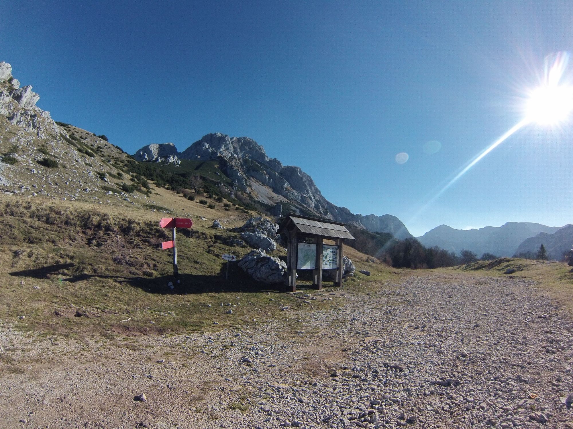
Parking spot Suha (650 masl)
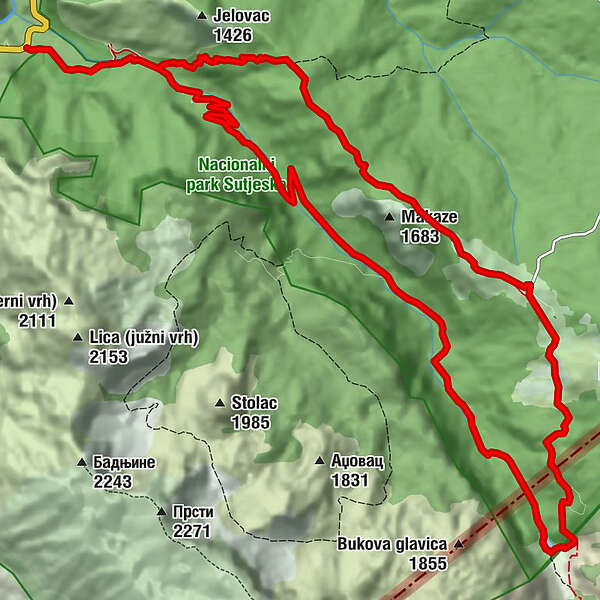
- Route
-
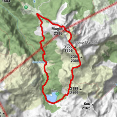
Susi Potok1.4 kmPrijevor6.1 kmSusi Potok17.4 km
- Description
-
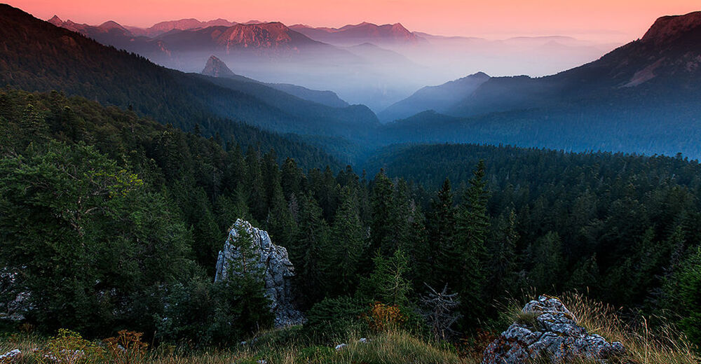
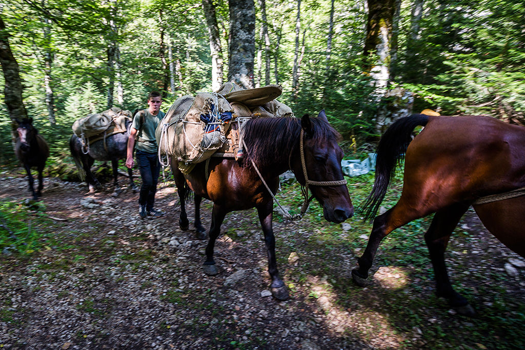
The hike starts from the paved parking area at Suha (650 m) and finishes after a day-long tour, returning back to the same place. From the parking lot, follow the dirt road that goes up the valley. Very soon where the road turns sharply left, you should continue straight off the gravel onto grassy road, following the white and red signs leading you straight, making the shortcut through the forest. In the forest there is a national park watchtower near which you should pass, before getting on the road again. From that moment, only about twenty meters away, you will encounter a sign on your left, showing you a junction and hiking path towards a ridge up above. This point is only 20 minutes from the starting point.
After you take this left turn, the path is marked by white-and-red trail marker circles and goes steep uphill all the way to the ridge. Approximately one hour after, you should reach a ridge and a new junction. The left path leads down into Perućica primeval forest and should be ignored, because it is forbidden to enter the forest without a guide. You should take the path on the right, which follows the ridge (south-east direction). From this point, there’s no more white and red signs on trees, but the orientation shouldn’t be difficult as the path is very visible and all time goes along the ridge until you reach the Prijevor pass. At one point, the path comes to the flat part of the ridge and is harder to notice, but looking to the right, should direct you towards the last parts of the ridge where the path is more overgrown by young trees and shrubs.
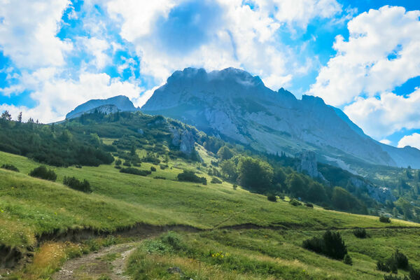
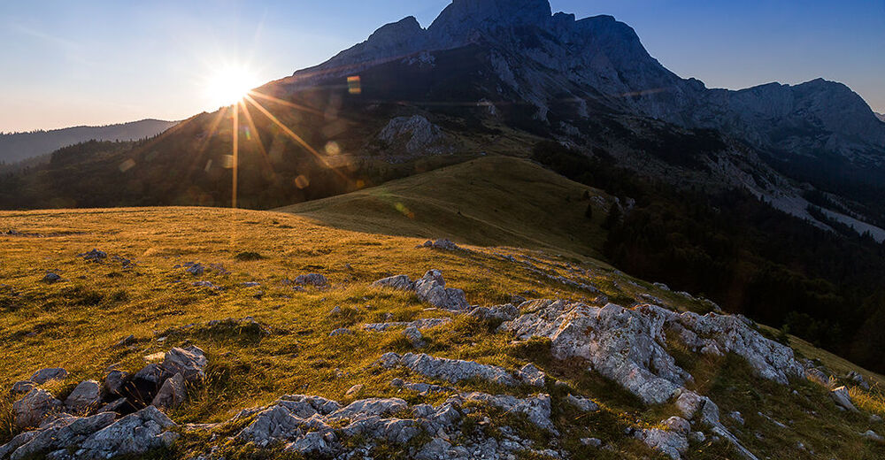
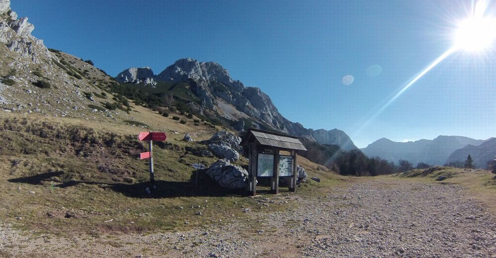
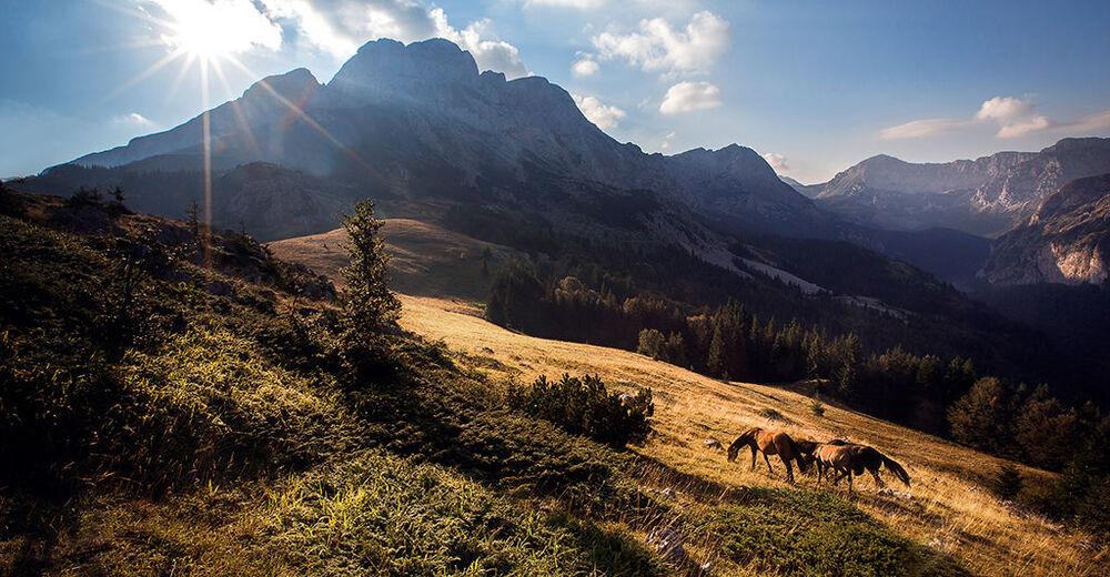
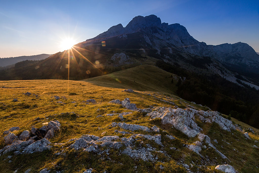
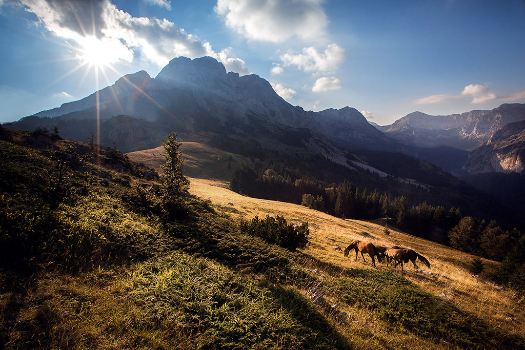
After approximately 1 hour and 40 minutes you should reach a meadow with the dominant peak of Maglić (2386 m) in the background and, approaching the watchtower, should reach the road and parking spot at Prijevor pass.
Just beneath the parking in it’s westernmost spot, you can refill your water as there is a source of fresh water lasting all year long.
From here, your trail goes towards the south, following the dirt road where some shepherd’s huts can be seen above and later on, below the road. At a few spots, the road is taken away by the rockslides and some 30 minutes away from Prijevor, the road is dividing in two paths. In the end, both paths will get you down to the Suva Jezerina, but the one on the right that goes steeply downhill will get you to the crossing sign where you should turn right, towards north-western direction, toward Suha. From now on, the path follows the natural gorge in between high rocks and later it turn in to a dirt road going downwards all the way to the place where you parked your car. This is reachable in three hours from Suva Jezerina.
- Directions
-
After 20 minutes from start, the first turning is on a left (east), towards a ridge.
Second turning is on the right following the ridge all the way up to Prijevor pass.
Once on Prijevor, follow the road (south direction).
The next turning is on the right, steep down to the Suva Jezerina.
Last turning is on right (north-west) at crossing sign at Suva Jezerina.
- Highest point
- 1,656 m
- Endpoint
-
Parking spot Suha ( round tour )
- Height profile
-
 © outdooractive.com
 - Safety instructions
-
Going down to Perućica valley is allowed only with announcement to the officials of National Park Sutjeska and with their guides. This is due to the strict level of protection and nature preservation of Perućica primeval forest.
- Additional information
-
Author: Dado Delić, Mountain Club Željezničar, Sarajevo, BiH
- Directions
-
From a Tjentiste towards Gacko drive for 6.5 km and turn left once you see a big parking place and old stone abandoned house. Park your car there, since passing through ramp is impossible and start hiking.
- Public transportation
-
Up to Suha from Sarajevo, Foča, Trebinje or Dubrovnik, yet there is no direct public transport to the location.
- Parking
-
You can park at a big parking spot with a signs pointing directions of hike.

-

-
AuthorThe tour Suha – Prijevor – Suva Jezerina – Suha is used by outdooractive.com provided.