- Brief description
-
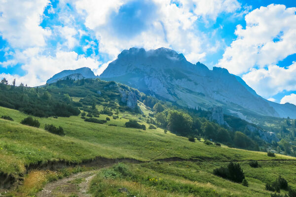
Challenging mountain hike to the highest summit of Bosnia and Herzegovina. Includes scrambling all the way up to Maglić ridge, but it's worth the view!
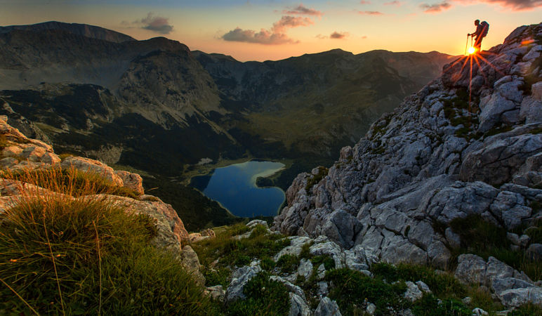
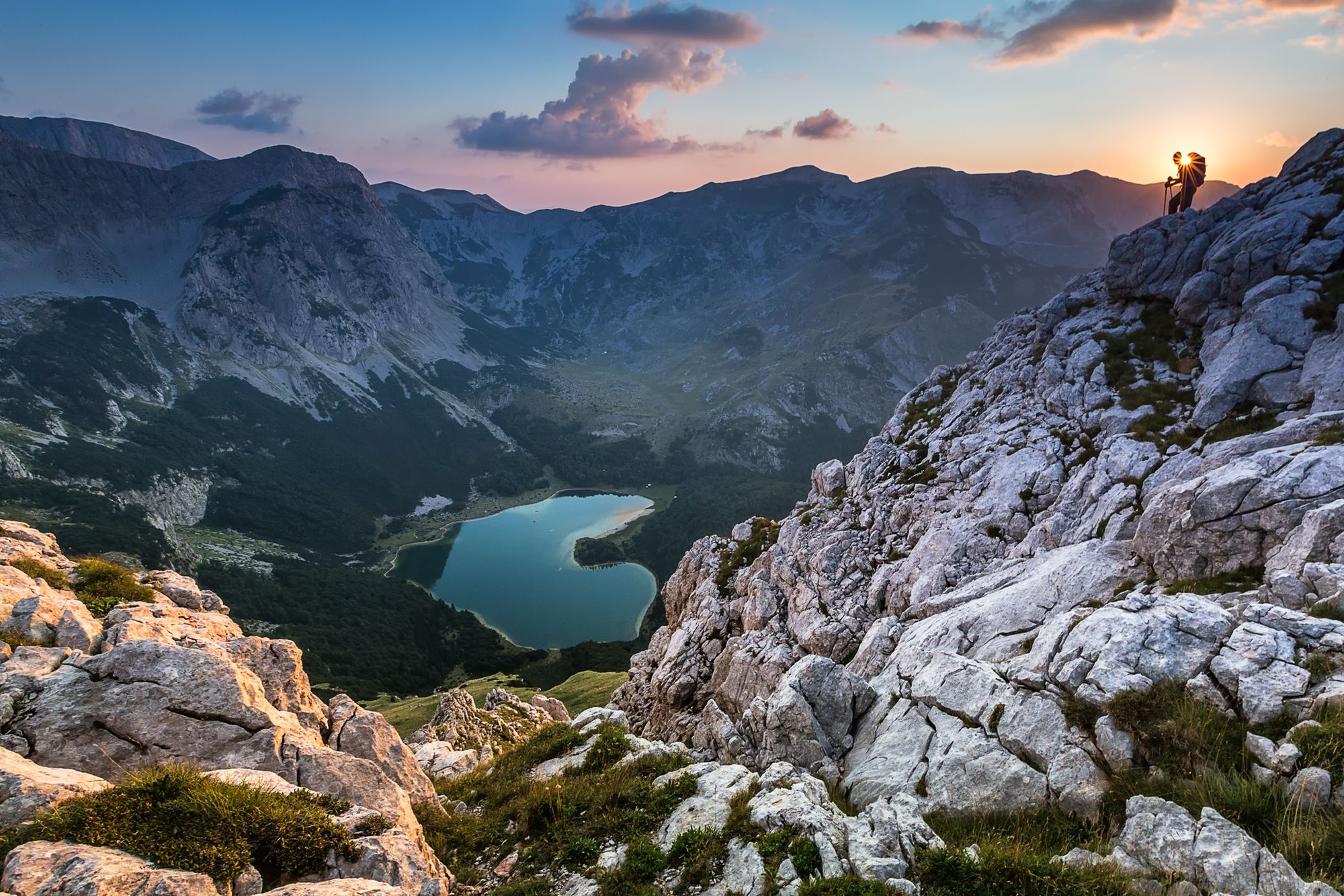
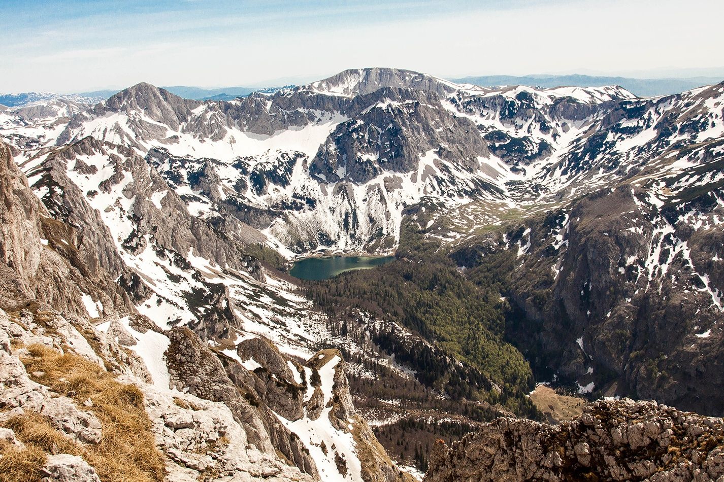
There are spectacular views of Volujak, Bioč, Zelengora, Trnovački Durmitor and the heart-shaped Trnovačko lake.
- Difficulty
-
difficult
- Rating
-
- Starting point
-
Prijevor
- Route
-
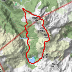
Maglić (2,386 m)2.0 kmVeliki Maglić (2,389 m)2.7 km2356 (2,356 m)3.1 km2232 (2,232 m)4.9 kmCarev Do5.3 km
- Best season
-
JanFebMarAprMayJunJulAugSepOctNovDec
- Description
-
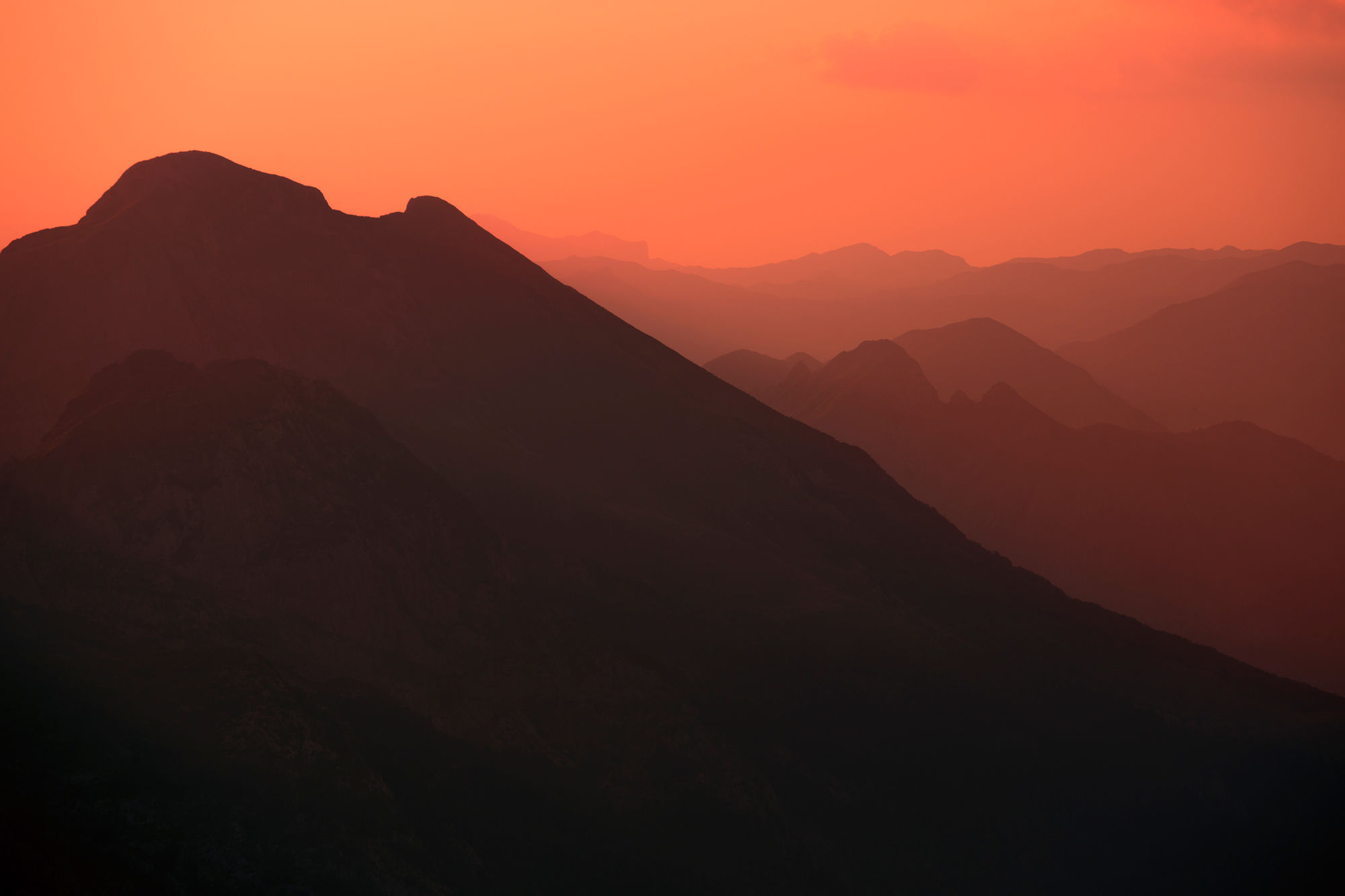
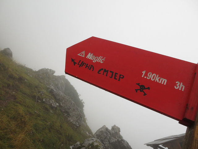
Even in summer, Mt Maglić often lives up to its name (Misty Mount), so you can expect fog even at Prijevor, which is the starting point (at 1659 MASL) where the ascent begins. It is a meadow and is filled with flowers in the summer, but soon gives way to scree, a slope covered with small and large rock debris that is very difficult to walk on. You have to be careful as it's easy to sprain your ankle. It's not recommended to walk on such terrain without mountaineering boots which will provide a measure of protection. In addition, when moving up the slope in sinlge file, you must mind the rockfall set off by the person in front of you. Still, all of this is the easier part of the walk. We're going from the direction of Banja Luka, the most difficult and demanding direction for ascent. The trail is semi-alpine and extremely demanding. It requires basic knowledge and experience in Alpine mountaineering, and is not recommended to those who are afraid of heights. You reach the rock where a cable is installed to make the climb easier and safer for mountaineers. However, it is in such a condition that it can only give you a false sense of safety.
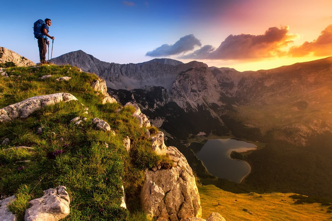
After some two and a half hours you reach the summit (2386 MASL). When there is no fog, the view is fantastic, but when it's foggy you see nothing but a sea of white as far as the eye can see. From the summit the walk continues towards the Montenegrin peak of Maglić. The biggest and most dangerous part of the route is behind you, and now everything seems a walk in the park. Again beautiful meadows full of flowers. The Montenegrin peak of Maglić (2388 MASL) is soon reached. There are no symbols typically found on summits in Bosnia and Herzegovina, no flags, no seal box, just a little cairn.
- Directions
-
From Prijevor, follow the road to the huts built in the traditional style. The road ends there, and you should look for the marks that will bring you to the forest. There are some short sticks placed as marking points. The red-white circles might be difficult to spot. However, from the forest the marking is quite good. The path winds up over steeper grass and scree slopes. About an hour from the huts, you will reach steeper rocky faces, right off the gully at the northwest side of the Maglic massif. From here, you scramble up following the red-white marks. There are actually two ways up. One is the "Via Ferrate" which is secured with steel cables that eventually lead up to an overhang that requires some more climbing skills. The other way goes more to the left and is well marked, but somewhat exposed. “Ferrate” is the shorter way, but you should be aware of the conditions prior to climbing.
Both ways will bring you to the north ridge of Maglic, which shortly takes you to the summit of Maglic (2386 m).
From here, you descend to the other side – towards the south. Follow the marked path and continue straight south at the first crossing below the pass. The path will go slightly southeast, and after approximately 30 minutes you will reach another crossing. From there, go west (right) down over the pass and south again.
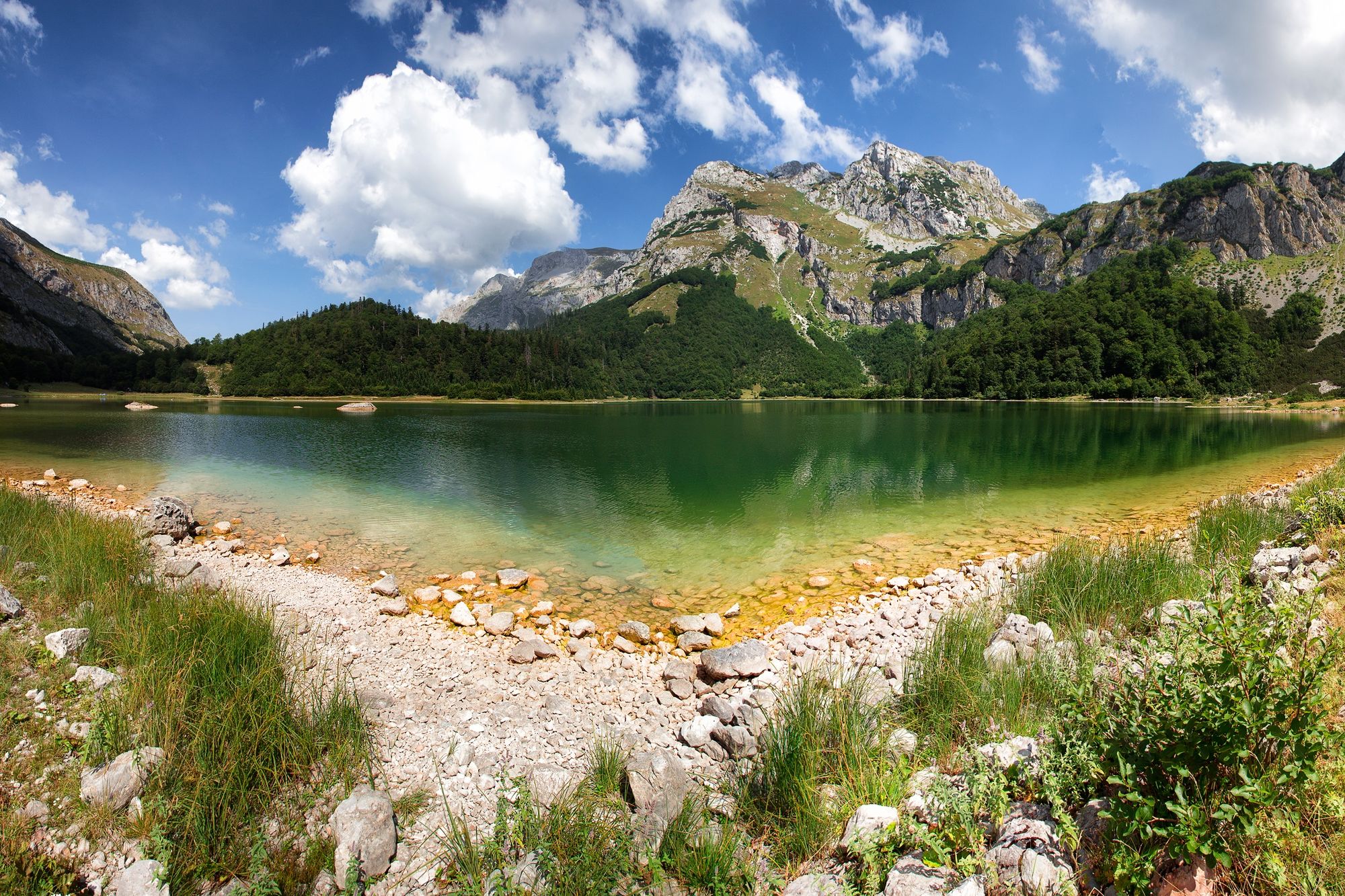
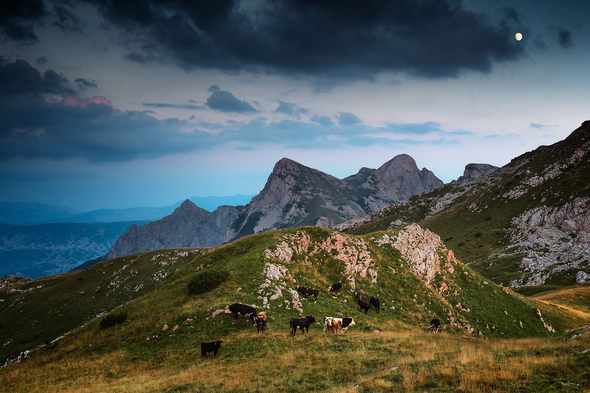
Now you will be on very a steep section considered challenging by many hikers. You will be descending towards Trnovacko lake, enjoying the view all the way. You will end up at the southern shore of the lake, and you should continue to walk around the lake. There you will see some huts, and you will meet a ranger who will charge you a tourist tax and camping fee (if you decide to stay there overnight). Further down the path, you will see a pole with the Montenegrin flag and a board with the inscription “goodbye and come again.”
From here, follow the marked path through the forest that brings you down to Suva Jezerina (meadow). There will be a crossing sign where you should turn east (right). That path goes uphill and north. You may notice that there once used to be a forest road there. Your trail goes on that road, and cuts on its curves uphill until it comes to the better sections of the road. Soon the road will pass over rocky scree slopes on the western side of Maglic, and then it is about 30 minutes more to Prijevor where you left your car. Closer to the Prijevor pass, you will see shepherd huts below -- and 50 m later -- above the road.
- Highest point
- 2,353 m
- Endpoint
-
Prijevor
- Height profile
-
 © outdooractive.com
 - Equipment
-
Standard hiking gear + helmet. Some might need a rope as well.
- Safety instructions
-
Be aware of loose rocks and hikers above you. Avoid climbing if a thunderstorm is likely.
If inexperienced, take a guide!
The Via Ferata cable is well-managed.
Inform the mountain rescue team about your plans:
+38765467043 Rescue Club Wolf
- Tips
-
Not recommmended to those scared of heights. Make sure that you have good hiking boots.
- Additional information
-
www.zone-2000.net
- Directions
-
From the regional road in Tjentiste, turn east at the sign. Follow the road and you will pass the entrance gate to the national park. Drive for about 10 km, and turn right at the junction (there is a signpost pointing to Prijevor). Soon you will reach an open area where you can see the mountain ridge of Volujak. (Just before the end, there is a water pipe below the road).
- Public transportation
-
Available to Tjentiste from Sarajevo, Foca, Trebinje or Dubrovnik.
- Parking
-
You can park at the obvious parking spot close to the information board. Next to the information board, there is a sign that points toward Maglic, which says ''Black Trail."


-

-
AuthorThe tour Maglić from Prijevor to Trnovačko Lake is used by outdooractive.com provided.