
- Brief description
-
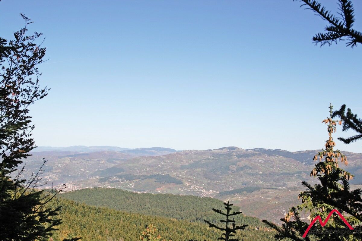
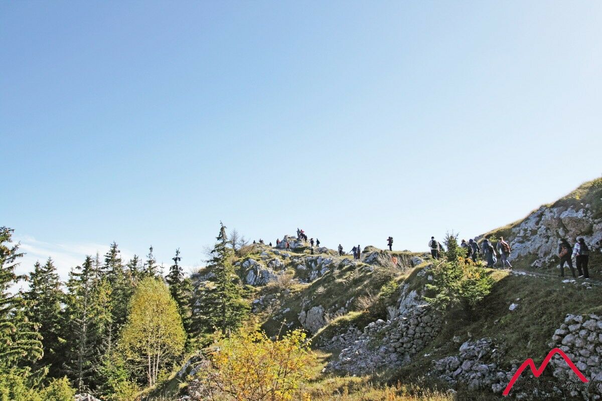
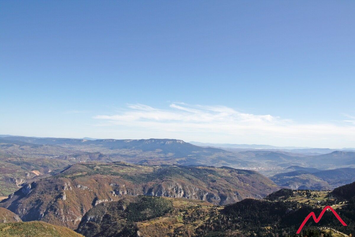
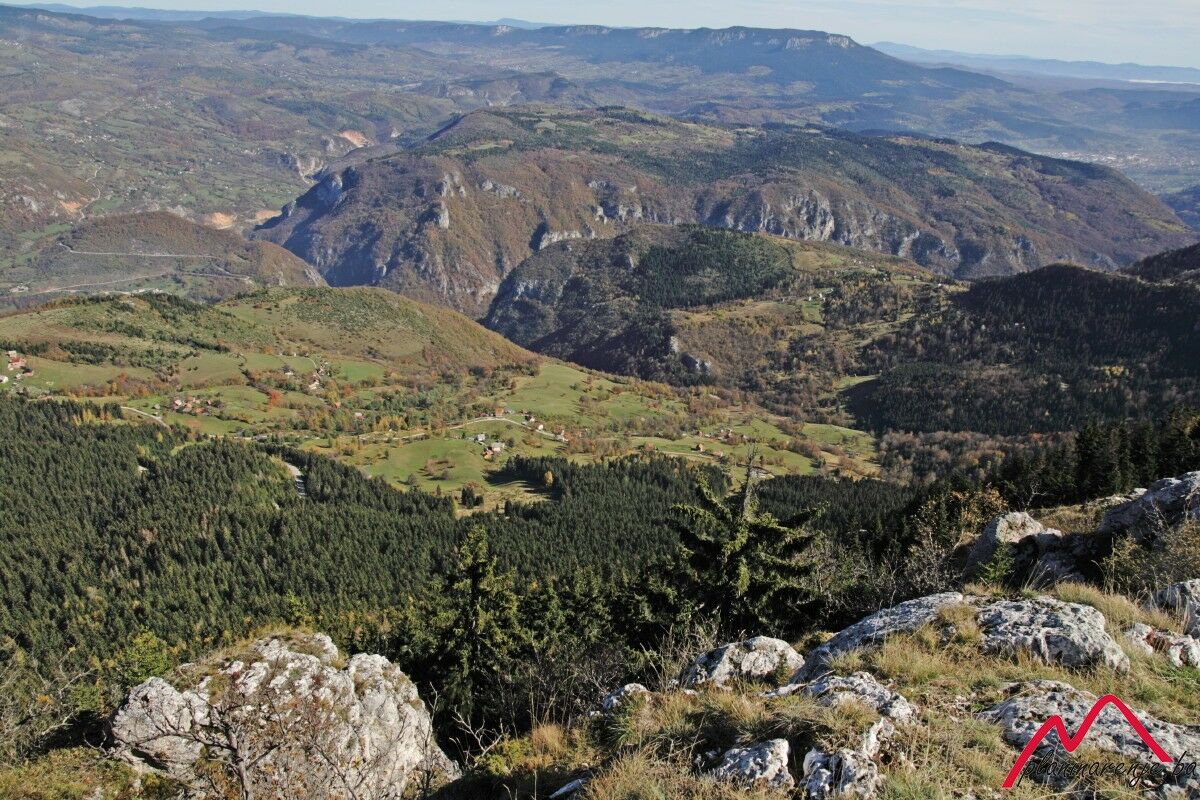
It is a pleasant walk on an easily traversable trail which goes through evergreen forest and allows you to conquer a moderate altitude via a gradual ascend up the long meandering trails. The pay-off comes in the form of an attractive ridge on the summit of Sofe, offering a view of most of the area of Bosnia and Herzegovina.
- Starting point
-
Brus
- Route
-
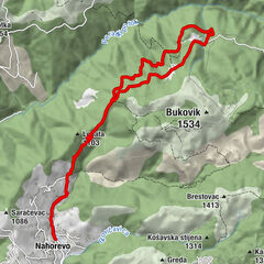
Brus0.1 kmTrebević-Sofe (1,627 m)4.6 kmPD Dobre vode8.4 kmPrvi Šumar10.0 km
- Description
-
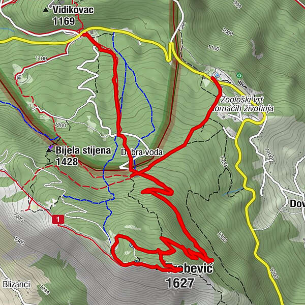
The path to the summit of Trebević begins at picnic area of Brus in form of a wide marked trail which starts from the parking lot behind the water supply facility. The trail passes through coniferous forest and the soft soil intersected with roots and streams is excellent for walking and running. One can quickly reach the destroyed Dobre Vode lodge where the path turns slightly to the left and runs all the way to the summit via serpentine trails. Along one of them one can find a lookout which is adequately marked by signposts. The path runs past former botanical garden to the abandoned Vaso Miskin Crni lodge which is located just under the summit.
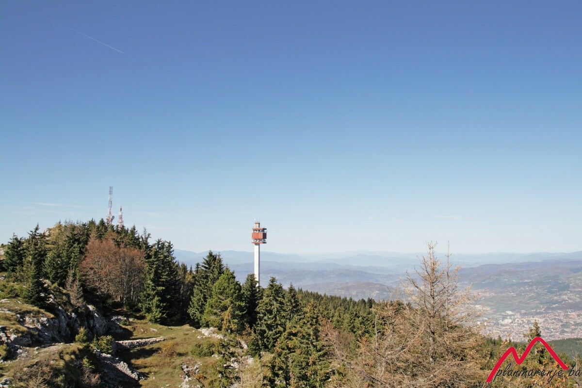
From the summit, the path descends along the western ridge at a short distance and ends at the heliport, while a macadam road leads back to an area beneath the broadcast relay station, in the direction of the Vaso Miskin Crni lodge, and the same path leads back to Dobre Vode. There, it does not turn leftward towards the area of Brus but rather continues to descend all the way to Pino Nature Hotel.
- Directions
-
Take the marked trail leading to the ruins of the postal workers' mountain resort and the Dobra voda spring (1300 MASL). From Dobra voda onwards follow the markers along the forest road to the left which subsequently narrows down into a trail. The summit can be reached via the ridge. From the summit, follow the ridge next to the telecommunications aerial, descend to the road by the old helipad, and continue to the large tower. Continue towards the well-preserved but abandoned PD Željezničar lodge, then back to Dobra Voda and Brus via the path you came on.
- Highest point
- 1,599 m
- Endpoint
-
summit of Trebević Sofe
- Height profile
-
 © outdooractive.com
 - Safety instructions
-
The trail is technically undemanding and there is no risk of landmines.
- Additional information
- Directions
-
By car, taxi or van to Vrace via Grbavica, then to the Ravne car park ("Pino Nature Hotel") and Brus.
- Public transportation
-
Taxi or van from Latinska ćuprija to the Brus picnic area.
- Parking
-
Parking at the Brus picnic area, free of charge.
-

-
AuthorThe tour Trebević via Brus is used by outdooractive.com provided.