
- Brief description
-
If you like walks in isolated out-of-the-way areas this is the right walk for you. One stretch of the route leads through a dense forest, is not marked and is extremely difficult to find your way.
- Starting point
-
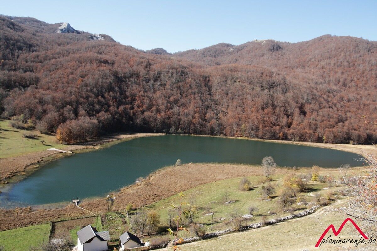
Uloško Lake
- Route
-
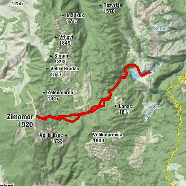
Zimomor (1,920 m)9.1 km
- Description
-
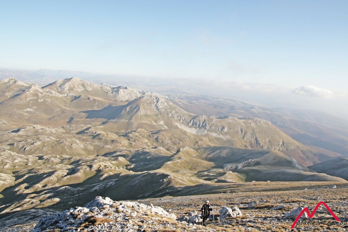
Mt Crvanj can be reached from lake Uloško (also known as Crvanjsko) via the peak Zimomor.
The road to lake Uloško goes from Sarajevo via Trnovo, Kalinovik and Ulog. The road from Kalinovik to Gacko is macadam, so it takes a while to get to the fork where the road to the lake branches off. The last 6km of the road to the lake are macadam as well, in a very bad condition, and it takes over half an hour to cover.
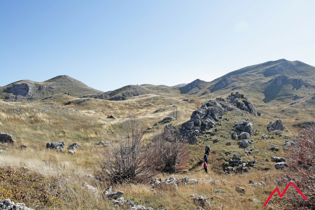
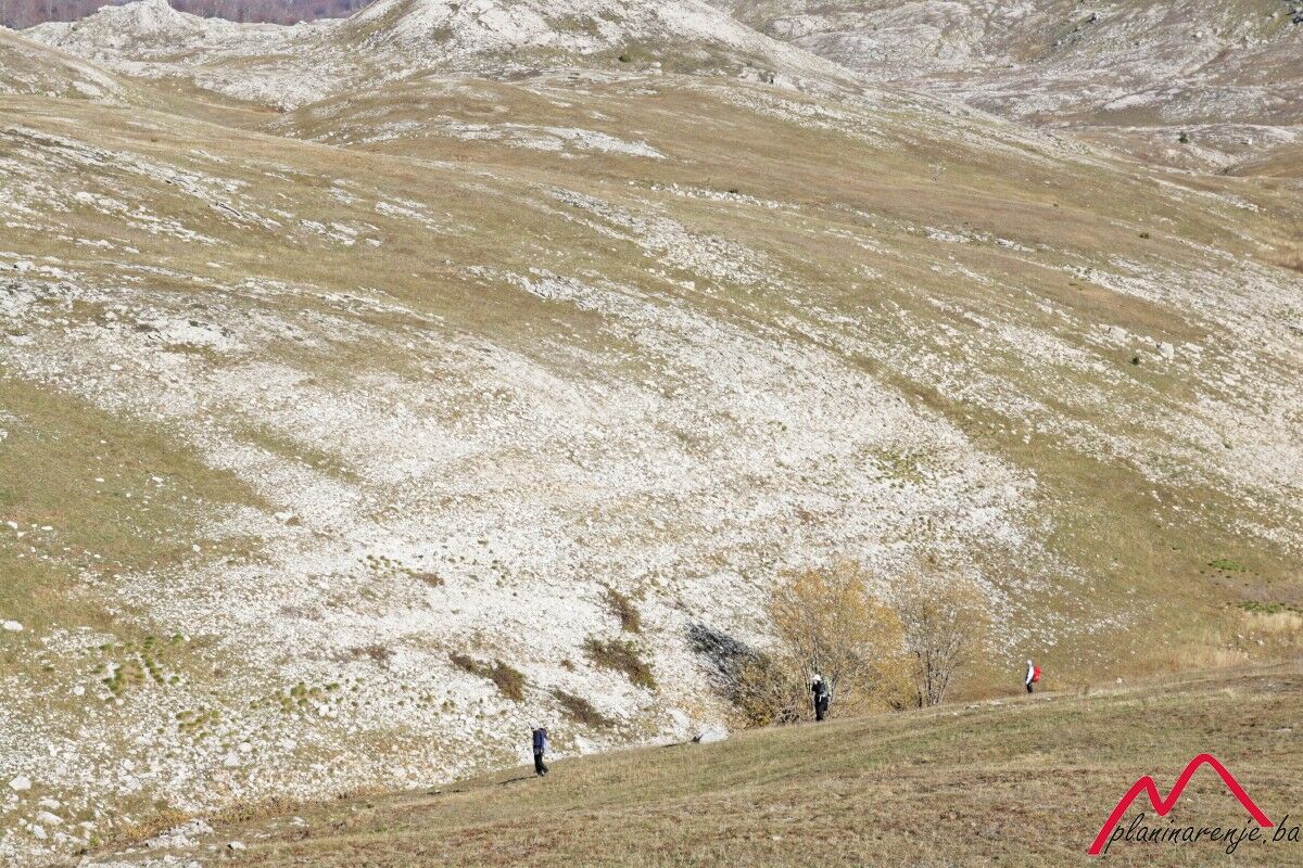
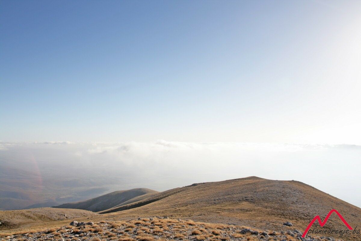
The first part of the track is a forest trail, the first part of which is marked, then after a while the markers stop. After an hour's walk you'll have to make your way through a thicket of arm-thick trees, growing less than half a metre from each other with densely entwined branches. You have to cover around 600-700 metres of the trail through the copse, which takes almost an hour, to come out to the clearing which leads to the peak Zimomor, by a concrete well. The way across the clearing is demanding as it's full of tiny hillocks and hollows which make walking difficult and take up a lot of time. The final ascent is neither short nor gentle, but the view from the top is mesmerising, and it encompasses a stretch from the plain of Nevesinjsko polje to Mt Prenj. On your way back you will see the markers taking you to the right of the above-mentioned trail. This part of the route is easier, as there are no hollows and hillocks. After a while the markers point to the right. If you choose not to follow the markers you can descent into a valley, shorten the way by 200 metres and reach the copse earlier. After that it takes three more hours through the forest.
It is advised that you do not take this route without a GPS, as it's almost impossible to orient without it in the dense forest. In addition, because it takes a long time to cover it, it is best left for long summer days.
- Directions
-
Skirt the lake from the right and head southwest on the forest road. The first part of the road is marked with affixed markers, then with cairns, and finally the markers disappear completely and the forest becomes so dense that it's almost impossible to walk with a rucksack on your back. Go southwest until you leave the forest, then west across the clearing full of hollows towards the peak Zimomor. The road to the peak is marked. Go back the same way you came.
- Highest point
- 1,895 m
- Endpoint
-
Zimomor
- Height profile
-
 © outdooractive.com
 - Equipment
-
Standard mountaineering equipment, in accordance with the weather.
- Safety instructions
-
The trail is technically undemanding, though it is demanding in terms of orientation, and there is no risk of landmines.
- Additional information
- Directions
-
Take M18 from Sarajevo leading to Trnovo. In Dobro polje turn right to R433 leading to Kalinovik. From Kalinovik drive on to Nevesinje. Drive all the way to Ulog, then turn right and drive 6 km more to lake Uloško on the bad macadam road.
- Public transportation
-
Public transport: N/A
- Parking
-
Park on the lay-by.
-

-
AuthorThe tour Lake Uloško - Zimomor is used by outdooractive.com provided.