Route des Grandes Alpes - From Valberg to Saint-Martin-Vésubie (12)


- Brief description
-
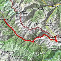
A long stage in the Mercantour that will take you from Valberg to the valley of Vésubie. On the menu: grandiose landscapes, perched villages and roads generally not very busy!
- Difficulty
-
difficult
- Rating
-
- Route
-
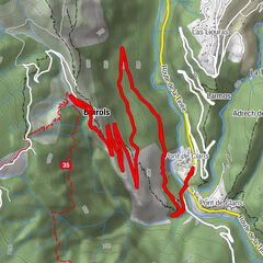
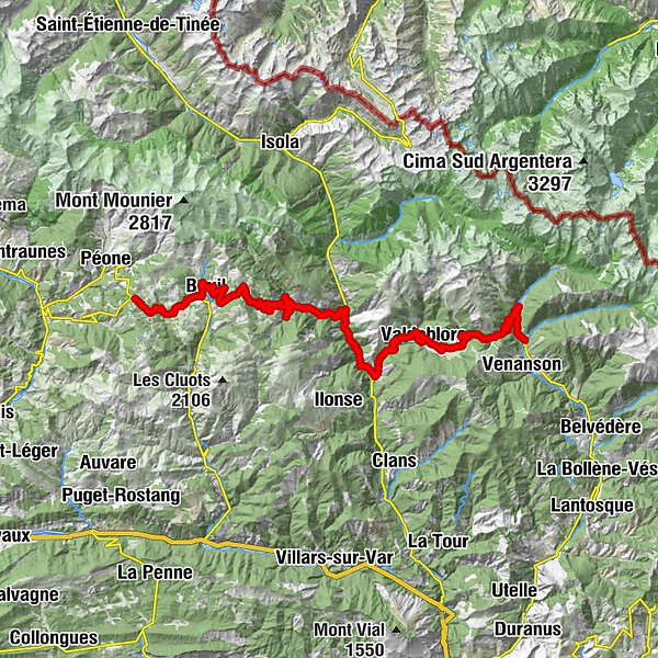
ValbergCombarionne0.8 kmAdrech de Lagas0.9 kmLaune-Inférieure4.0 kmLes Launes4.2 kmLaune-Supérieure4.3 kmChapelle Sainte-Anne4.5 kmBoglio6.2 kmLe Relais du Mercantour6.2 kmAuberge Quintessence13.5 kmLes Vautes16.2 kmVillars16.3 kmChapelle Saint-Sébastien18.7 kmRobione19.2 kmWaterfall22.1 kmRorà26.5 kmÉglise Saint-Michel30.0 kmChapelle des Pénitents Blancs30.0 kmSan Salvatore30.1 kmSnack chez coco30.3 kmBollina42.8 kmÉglise Saint-Jacques-de-la-Bolline43.7 kmValdiblora43.7 kmChapelle de la Miséricorde44.7 kmL'alternative44.7 kmLa Rocca44.7 kmAuberge de la Roche44.7 kmLe Millefonds47.3 kmSan Dalmazzo di Valdiblora47.5 kmÉglise de l'Invention-de-la-Sainte-Croix47.7 kmJardin d'Enfants (ESF)50.9 kmColmiana50.9 kmChez Frankie50.9 kmLa Barquette51.0 kmBelvédère de la Pausa54.3 kmSan Martino Lantosca59.1 km
- Best season
-
JanFebMarAprMayJunJulAugSepOctNovDec
- Description
-
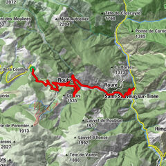
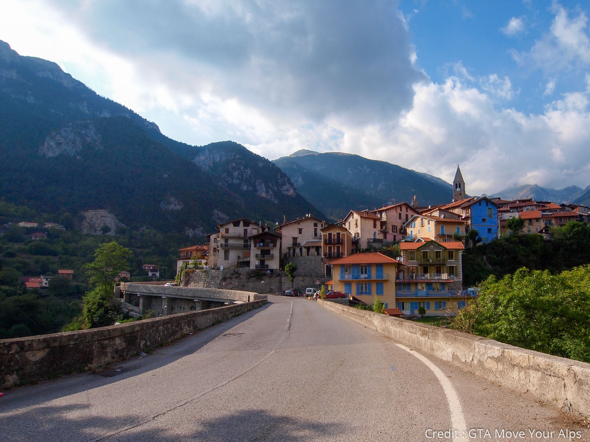
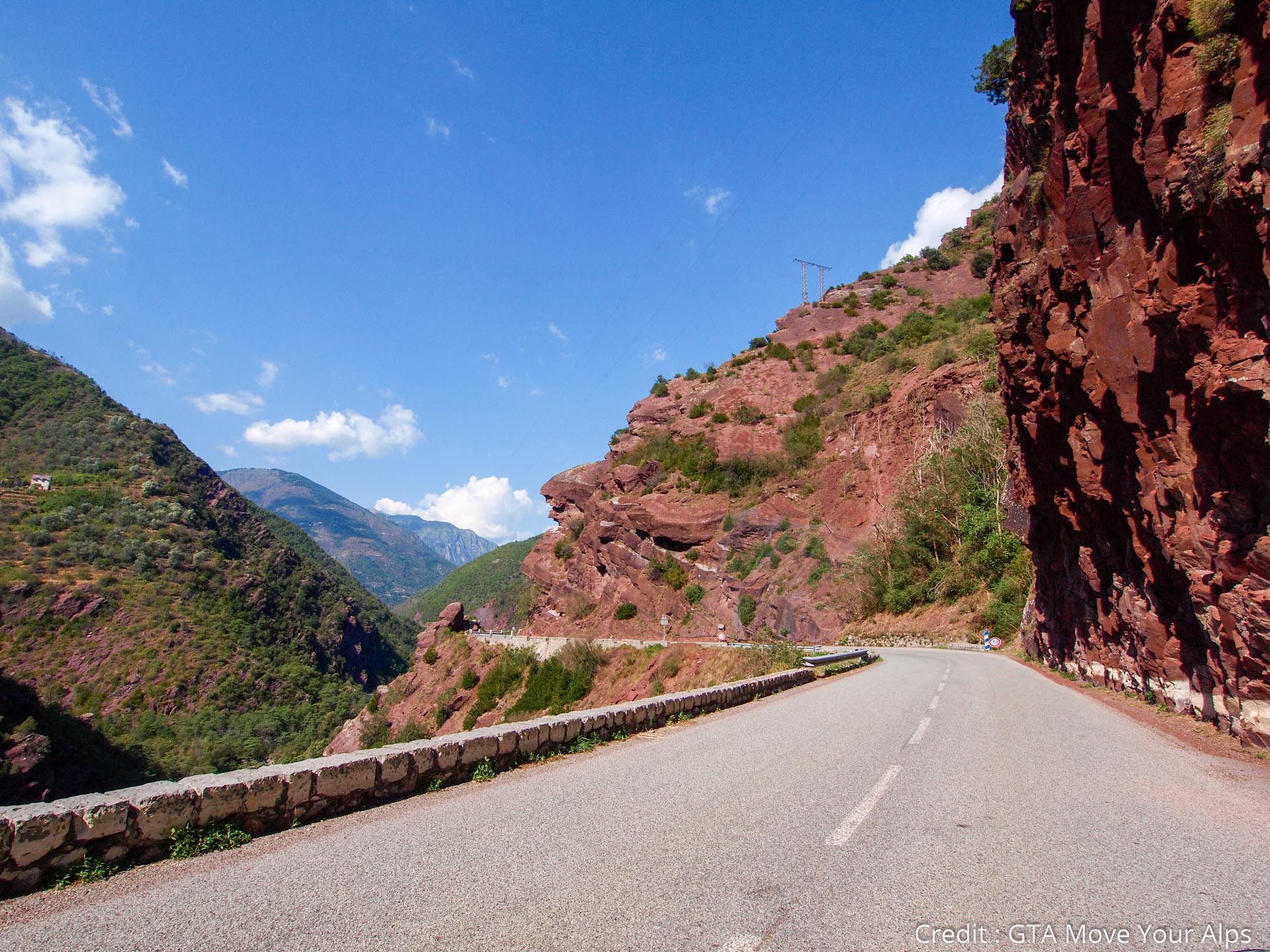
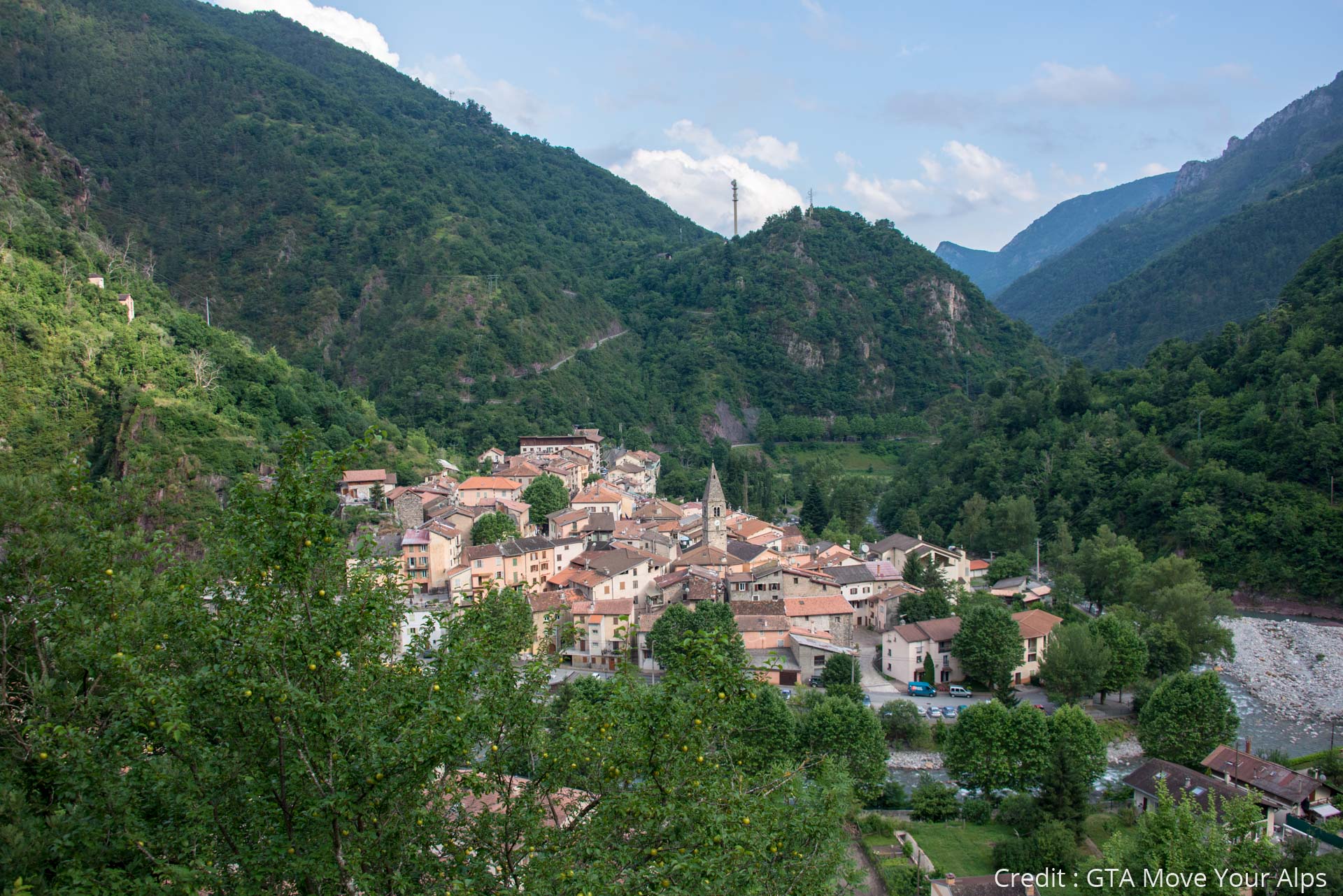
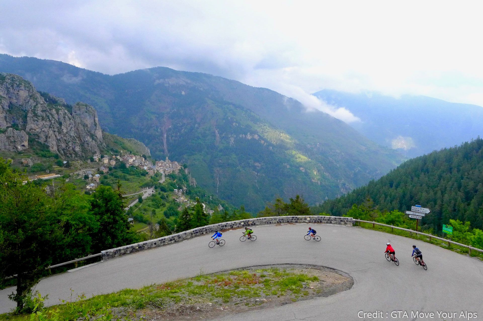
In a Mediterranean atmosphere, in the middle of wild spaces, this stage is composed by the ascent of two passes, Col de la Couillole and Col Saint-Martin. From Valberg, you will easily pass Col de la Couillole (1678 m) before embarking on a long descent into the heart of the Tinée Valley. The landscapes are grandiose: views of the Mercantour peaks, huge red cliffs and villages nestled in the heart of the valleys or perched on the cliffs. Roubion, a pretty medieval village with narrow streets is worth a visit.
The final climb of the Col Saint Martin (1503 m) with its 1000m ascent and some passages up to 9% will give you all the reasons to have well deserved the break. And after a short descent, you will finally discover the beautiful colorful village of Saint Martin Vésubie and its small central square where we find of course the traditional petanque field: welcome to the South!
NB: the climb to Valberg can also be done by the village of Péone.
- Directions
-
The route follows the D28 road between Valberg and Beuil, then the D30 to Saint-Sauveur sur Tinée and finally the D2205 and D2565 to Saint Martin Vésubie. It is very well indicated by large signs "Route des Grandes Alpes".
- Highest point
- 1,677 m
- Endpoint
-
Saint-Martin-Vésubie
- Height profile
-
 © outdooractive.com
 - Tips
-
Vesubia Mountain Park, take the time to discover this indoor temple of mountain activities in Saint-Martin-Vésubie!
- Additional information
-
On E-bike, the largest electricity consumption is around 35 km for the climb of Saint-Dalmas. A recharge is possible in Valdeblore. The battery level needed to complete the stage must be higher than 40% at this point.
- Author
-
TILT COM’SEILThe tour Route des Grandes Alpes - From Valberg to Saint-Martin-Vésubie (12) is used by outdooractive.com provided.


-
Alpes-Maritimes
71
-
Alpes d'Azur
33