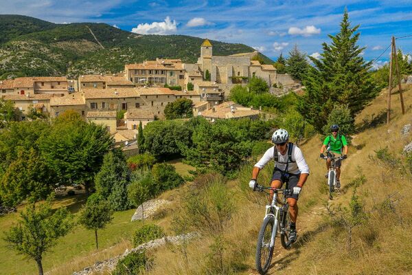
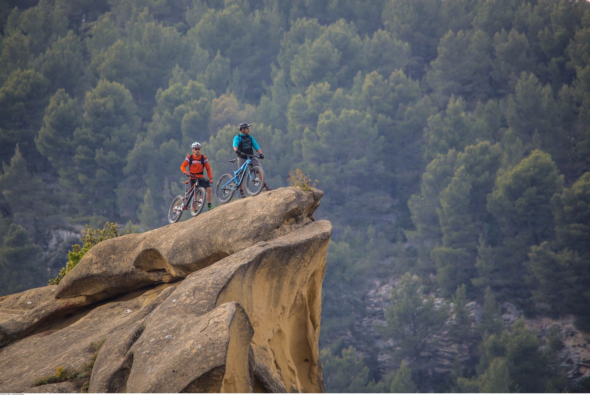
© Vaucluse Provence - HOCQUEL Alain

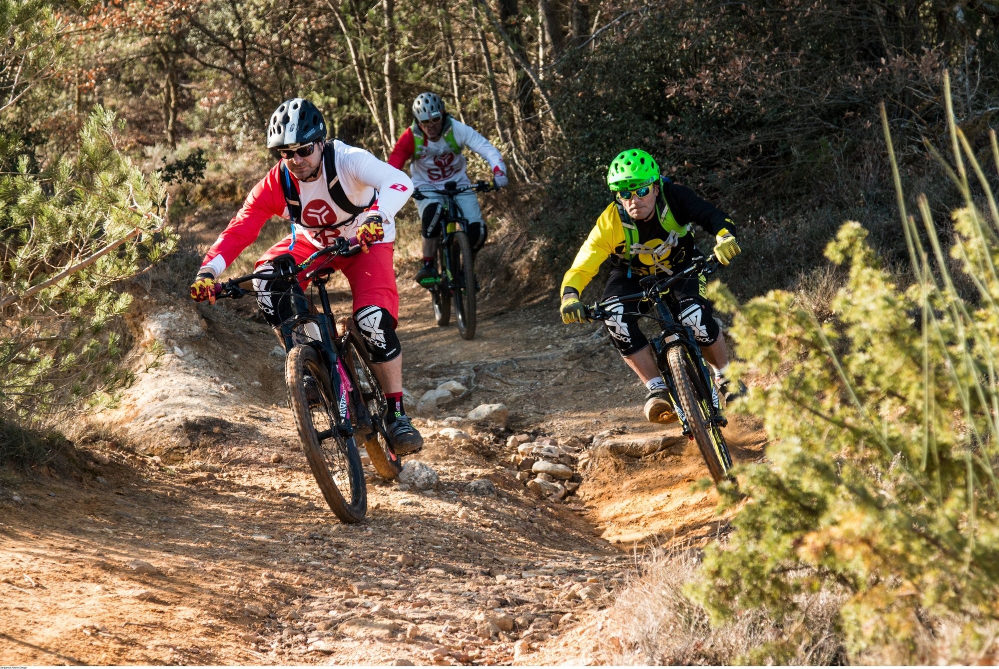
© Vaucluse Provence - Dangerous Momo Design

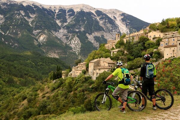
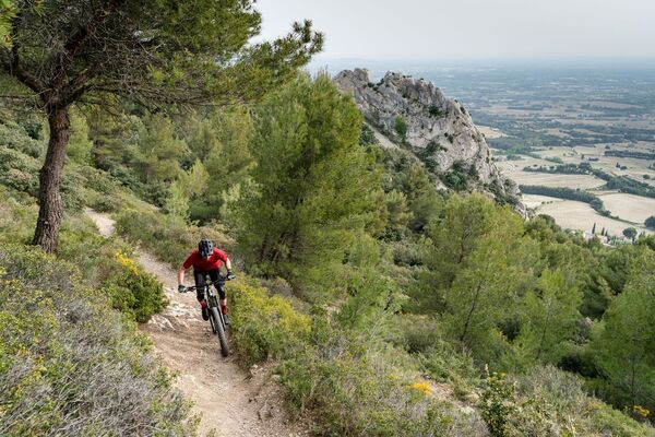
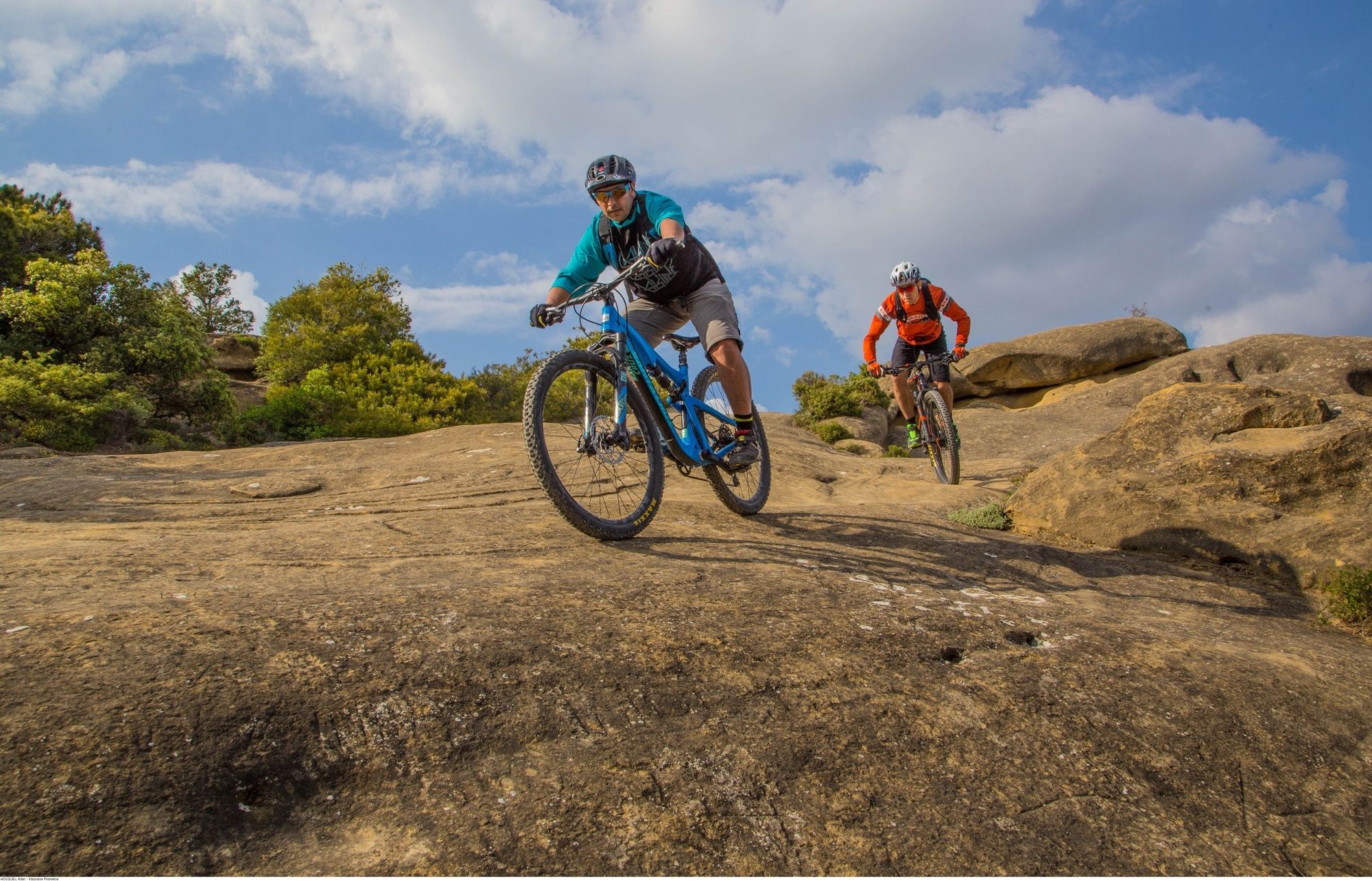
© Vaucluse Provence - HOCQUEL Alain

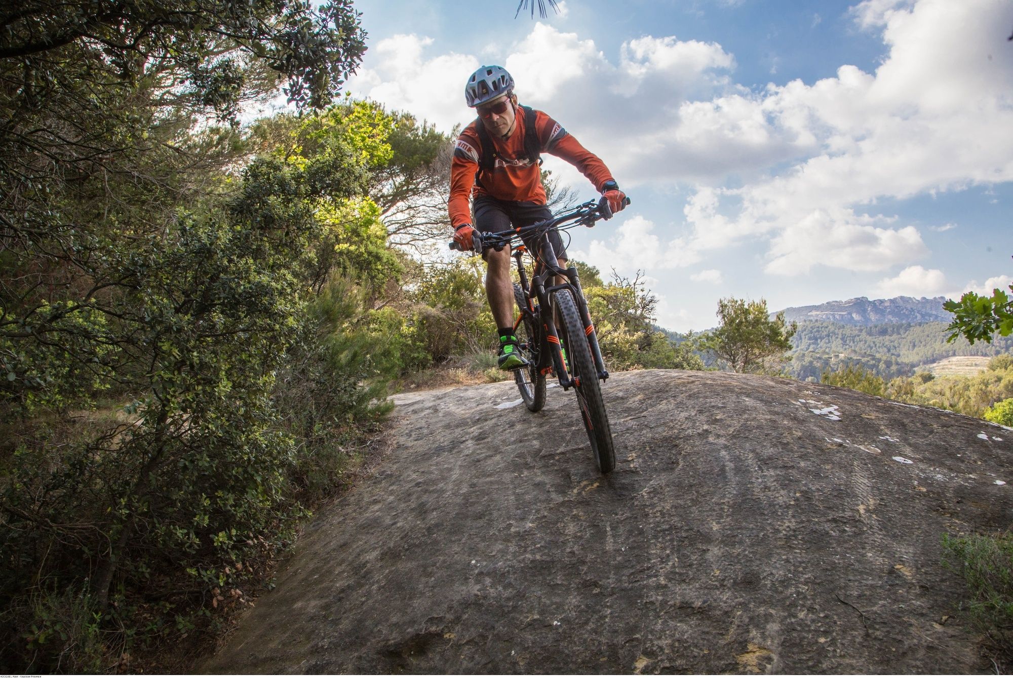
© Vaucluse Provence - HOCQUEL Alain

- Brief description
-
-
- Difficulty
-
difficult
- Rating
-
- Starting point
-
Savoillan
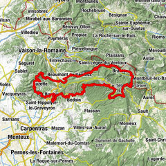
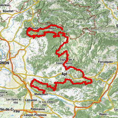
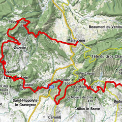
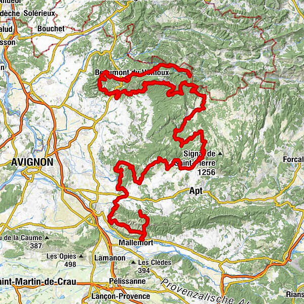
- Route
-
Église Saint-AgricolSavoillan0.0 kmBrantes5.6 kmSaint-Léger-du-Ventoux12.2 kmCol du Comte (995 m)18.5 kmLes Alazards23.8 kmSainte-Marguerite24.4 kmLes Cabanes27.0 kmBeaumont du Ventoux27.1 kmVallat de la Beaume29.1 kmVallon de la Beaume30.0 kmLa source du Grozeau31.2 kmLe Groseau31.2 kmChapelle Notre-Dame-du-Groseau31.5 kmMalaucène32.6 kmÉglise paroissiale Saint-Michel32.8 kmCol de la Chaine (472 m)36.3 kmPas du Loup (578 m)40.4 kmSuzette45.4 kmLe Bistrot de Lafare51.4 kmLafare51.4 kmÉglise Saint-Sixte51.4 kmLa Roque-Alric52.6 kmPlace Saint-Denis58.4 kmÉglise Saint-Jean-Baptiste58.4 kmLe Barroux58.5 kmGajulea58.6 kmLes Chalons72.9 kmChalet Reynard97.2 kmFont d'Angiéu (1,159 m)103.5 kmCol de La Frache (1,319 m)110.4 kmAurel124.3 kmRelais du Ventoux124.3 kmÉglise Saint-Aurèle124.4 kmAven du Deffends126.6 kmPicnic130.1 kmSault130.5 kmLa Loge132.0 kmLe Grand Vallat134.6 kmMonieux137.0 kmÉglise Saint-Pierre137.1 kmLes Lavandes137.1 kmAyguier de Travignon (950 m)168.2 kmTravignon168.5 kmÉglise Saint-Étienne178.6 kmSaint-Saturnin-lès-Apt178.8 kmLes Voyageurs179.0 kmL'Estrade179.0 kmLes Blanchards180.6 kmLa Garrussière (332 m)182.3 kmCombe de Font Jouvale183.8 kmCombe de Font Jouvale184.5 kmFont-Jouvale185.9 kmLioux189.5 kmLa Combe191.9 kmMurs200.6 kmLe Crillon200.6 kmGordes207.4 kmSaumane-de-Vaucluse225.3 kmBistrot de Saumane225.6 kmFontaine-de-Vaucluse232.1 kmBondelon233.7 kmLagnes236.4 kmChapelle Sainte-Antoine236.4 kmAuberge de Lagnes236.6 kmChapelle Saint-Eusèbe240.8 kmCoustellet243.4 kmRobion248.8 kmTaillades251.2 kmMérindol278.2 kmÉglise Sainte-Anne278.2 km
- Best season
-
JanFebMarAprMayJunJulAugSepOctNovDec
- Description
-
The Vaucluse long distance mountain bike trail with a French Cycling Federation label is a technical and physical tour composed of the most beautiful trails from Ventoux to Luberon, where you can discoverlandscapes of vineyards, lavender, ochre, climb cliffs and enjoy exceptional panoramic views.
- Highest point
- 1,531 m
- Endpoint
-
Mérindol
- Height profile
-
 © outdooractive.com
 - Equipment
-
Repair kit contents:
1 spare inner tube and patches 1 spoke wrench and pair of tire levers 1 back derailleur cable 1 back brake cable1 chain tool 1 set of open-ended spanners 1 set of hex-head keys - Safety instructions
-
-
- Tips
-
If you prefer to cycle the route with a professional, please contact a guide and discover the most beautiful stretches of the route with him!
- Additional information
- Parking
-
Parking available for one or more day(s) from Savoillans or at Fontaine-de-Vaucluse:
- Parking Savoillans : 44°10’45.1»N 5°22’29.4»E
- Parking Groseau (Malaucène) : 44°10’04.6»N 5°08’56.2»E
- Parking Sault : 44°05’33.6»N 5°24’32.4»E
- Parking Saint-Saturnin-Lès-Apt : 43°56’32.7»N 5°23’02.3»E
- Parking Fontaine-de-Vaucluse : 43°55’21.0»N 5°07’37.3»E
- Parking Mérindol : 43°45’15.0»N 5°12’09.2»E
- Author
-
The tour Great mountain bike crossing of the Vaucluse - West is used by outdooractive.com provided.
GPS Downloads


General info
A lot of view
Other tours in the regions