Cammini delle alte colline ombrose e delle colline chiare: Tappa 11: Scurzolengo - Calliano


- Difficulty
-
easy
- Rating
-
- Route
-
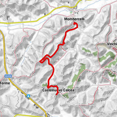
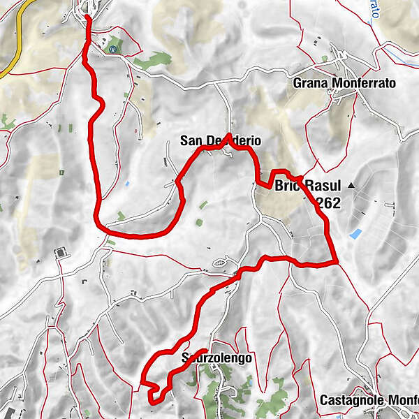
ScurzolengoSan Desiderio7.9 kmSan Desiderio8.4 kmSan Rocco13.0 kmSan Rocco13.3 kmSan Michele13.3 kmCalliano Monferrato13.3 kmPiazza13.4 km
- Description
-
The route that unites the towns of Scurzolengo and Calliano extends over a length of almost 13 kilometers and lasts 3 hours, with a height difference of 4 metres.
Scurzolengo is one of the cities decorated for military valor for the War of Liberation, awarded the bronze medal for military valor for its activity in the partisan struggle during the Second World War.
The route starts from the center of the town, in via Marconi, and then continues to the right in via Martiri della Libertà, finding the Chapel of San Giuseppe on the right. You will continue along the road for about 800 metres, until you reach the town of San Defendente with the Chapel, after which you will turn right to take a path in a wooded area for about 800 metres, until you come across
From here you descend into the Pissapola Valley and then head north along the valley until you reach the Torre Region, crossing provincial road 37. You will then cross Viale Dusio Piero, named after the entrepreneur, sports manager and racing driver who was president of the Juventus football club from 1942 to 1947, and which was born in Scurzolengo in 1899. You will leave a clearing on the left and head onto a dirt road on the right which, after approximately 750 meters of travel between meadows and fields, will lead to cross provincial road 94. You will then turn right and after a very short stretch, before a solitary farmhouse, you will flank the building continuing the itinerary on the dirt road between cultivated fields, meadows and woods. After about 600 meters you will come across another road on which you turn left and continue for about 800 metres, before entering a stretch of route between cultivated fields and meadows, until you cross, after about 1200 metres, via Scurzolengo (provincial road 38) which you can enter by turning right and going up the slope towards the hamlet of San Desiderio di Calliano. After about 500 meters the first houses of the hamlet will appear and you will continue until you cross Via Vittorio Emanuele II where you turn left. The itinerary then continues along the main street of the hamlet, crossing the town center and continuing for about a kilometre.
After a stretch of approximately 500 meters you will see the Church of San Desiderio on the left and continue until the intersection with Via Valle Riti, near the Santisè restaurant which offers typical Piedmontese cuisine. Here you will turn left and continue for about 400 metres, reaching a fork at which you will have to continue to the right crossing the Rio Valley up to the Sassia area, between fields and meadows, forests at times, for about a kilometre, until you come to Strada Castelletto to cross it and leave it on the right, continuing straight along the route that runs through the Gorgo Valley with notable landscape views of the surrounding vineyards, the summit centers and the agricultural landscape of the valley bottom. You then reach Calliano, passing over the Cemetery and entering the town known and renowned for its typical donkey-based dishes, such as the delicious agnolotti and tasty salami.
- Highest point
- 287 m
- Endpoint
-
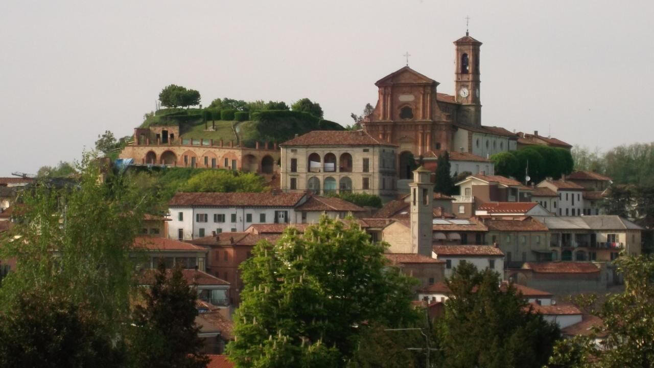
Calliano
- Height profile
-
 © outdooractive.com
 - Safety instructions
-
Present
- Tips
-
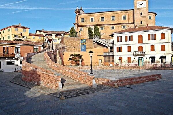
Historic centers of Scurzolengo and Calliano
- Directions
-
Scurzolengo: reachable by own means, located 10 km from the Asti-Est toll booth in the direction of Alessandria/Scurzolengo Calliano: reachable by own means of transport, located 10 km from the Asti-Est toll booth in the direction of Casale Monf.
- Public transportation
-
Scurzolengo: Scurzolengo Arfea Bus Stop Line 48 to Asti Calliano: Calliano Arfea Bus Stop Line 46 to Asti
- Author
-
The tour Cammini delle alte colline ombrose e delle colline chiare: Tappa 11: Scurzolengo - Calliano is used by outdooractive.com provided.


-
Asti und Umgebung
78
-
Asti
23