Cammini delle alte colline ombrose e delle colline chiare: Tappa 2 Chiusano d'Asti - Soglio


- Difficulty
-
easy
- Rating
-
- Route
-
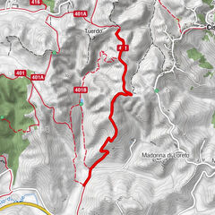
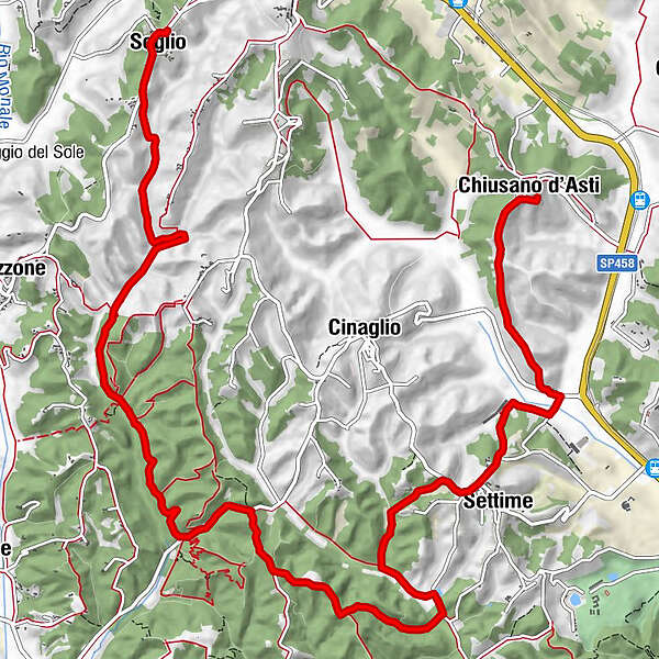
Madonna Del Carmine0.1 kmChiusano d'Asti0.1 kmSan Rocco0.6 kmSettime3.3 kmPeschiera5.2 kmSoglio13.6 kmIl chicco di cafè13.8 km
- Description
-
Perched among the dense woods, Chiusano extends to the edges of the special natural reserve Valle Andona, Valle Botto and Valle Grande. The Valle Andona, Valle Botto and Valle Grande Special Nature Reserve is one of the best known, even at an international level, for its paleontological value which is due to the wealth of fossil finds of marine organisms that populated the waters which, in the Pliocene (from 5 million to 1.8 million years ago), covered the entire Po Valley.
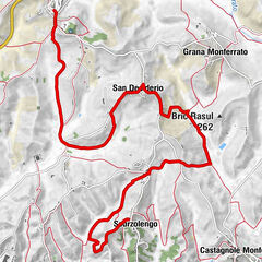
The Chiusano-Soglio route is approximately 10.8 kilometers long and requires a travel time of 2 hours and 35 minutes.
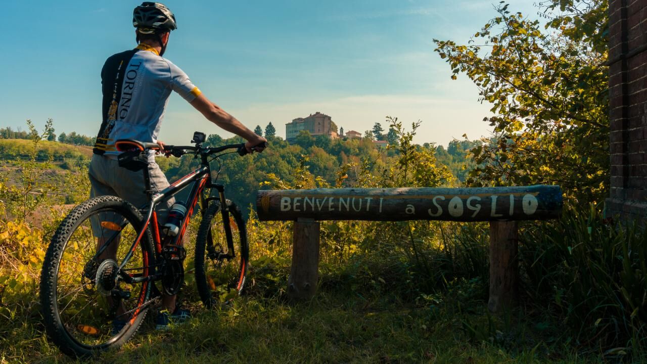
Near the Town Hall of Chiusano, take Via San Martino which descends and joins Via San Sebastiano. After 500m you reach the chapel of S. Rocco. The dirt road forks here and the itinerary continues keeping to the right to descend along the wooded slope for just over 1 kilometer until arriving near two farmhouses where the dirt road merges with Provincial Road 35. After about 90 minutes it continues follow the path on the right and you will cross the fields. After 200 meters you will turn right again and continue until the next crossroads which you will encounter after 400 metres. Here the route continues following the right near three large blocks of flats. At this point the route winds through fields for about 500 meters at the end of which it opens onto Provincial Road 35. Here the itinerary continues descending to the right and after a few minutes you find yourself near Settime, where the road forks with Via Roma. Continue on Provincial Road 35, keeping to the right, for approximately 400 metres. Once you reach a tree-lined area, you will leave the road to follow the path on the left. Through the woods, the path continues for just over 1 kilometre, then it becomes a dirt road. The route continues on the dirt road that descends on the left. After 500 metres, continue left again for another 500 metres, until you reach a crossroads which you pass by keeping to the right. What you travel through is a landscape of cultivated fields that coexist with dense chestnut woods, typical of these hills. After 200 meters you find yourself near a new crossroads, here the route continues keeping to the right. Continue through thick woods for about 2 kilometers and arriving in Montegrosso the path meets the asphalt road which you follow keeping to the left. After 600 meters the route leaves the asphalt road for the dirt road which, on the right, enters the dense woods. Continue for 5 kilometers until you cross provincial road 2, following it on the right and going up until you reach Soglio. The symbol of the Municipality is the medieval castle, located in the center of the town, modernized in the mid-eighteenth century. The building, with a lunette plan, still has remains of the original structure and is supported by an imposing wall which retains traces of large pointed windows.
- Highest point
- 277 m
- Endpoint
-
Soglio
- Height profile
-
 © outdooractive.com
 - Safety instructions
-
Present
- Tips
-
Woods of the Valleandona, Valle Botto and Val Grande Nature Reserve
- Directions
-
Chiusano: reachable by own means of transport, 12 km from the Asti Ovest motorway toll booth in the direction of Ivrea/Chivasso Soglio: reachable by own means of transport, 20 km from the Asti Ovest motorway toll booth in the direction of Ivrea/Chivasso
- Public transportation
-
Chiusano: Chiusano Stazione stop - GTT bus line 3105 Asti-Chivasso Soglio: Soglio stop - Giachino bus line 50AT
- Author
-
The tour Cammini delle alte colline ombrose e delle colline chiare: Tappa 2 Chiusano d'Asti - Soglio is used by outdooractive.com provided.


-
Asti und Umgebung
78
-
Asti
23