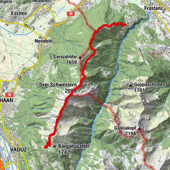
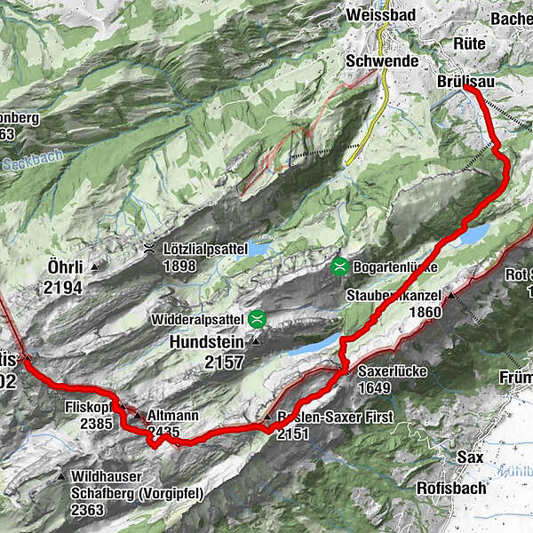
Säntis - Rotsteinpass – Altmannsattel – Zwinglipass – Mutschen – Saxer Lücke – Bollenwees – Plattenbödeli – Brüllisau

Hiking

© Appenzellerland Tourismus AR - Säntis Schwebebahn
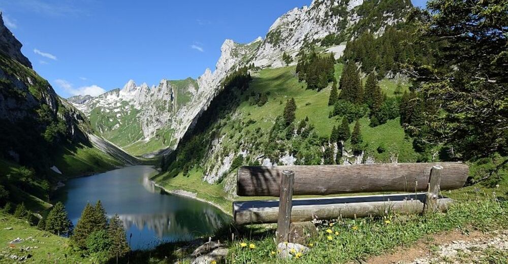
© Appenzellerland Tourismus AR - Säntis Schwebebahn
- Brief description
-
Diese Route eignet sich auch als 2-Tages-Tour und ist für gut trainierte und geübte Berggänger ein Vergnügen.
- Difficulty
-
difficult
- Rating
-
- Route
-
Chalbersäntis0.3 kmWisswand1.0 kmBerggasthaus Rotsteinpass2.1 kmRotsteinpass2.2 kmFliskopf (2,385 m)2.8 kmChreialpfirst (2,126 m)6.2 kmMutschensattel6.7 kmRoslenalphütte8.3 kmSaxerlücke (1,649 m)9.0 kmBerggasthaus Bollenwees10.0 kmBollenwees10.0 kmTannhütte NFS (1,231 m)12.4 kmPlattenbödeli13.9 kmBerggasthaus Plattenbödeli13.9 kmRompeli14.7 kmPfannenstiel16.1 kmAlp Sigel-Bahn Talstation16.1 kmBrülisau (922 m)17.2 kmKatholische Kirche St. Sebastian17.3 km
- Best season
-
JanFebMarAprMayJunJulAugSepOctNovDec
- Highest point
- 2,445 m
- Endpoint
-
Brülisau
- Height profile
-
 © outdooractive.com


- Author
GPS Downloads


General info
Refreshment stop
A lot of view
Other tours in the regions
-
Appenzellerland
1956
-
Ebenalp
1094
-
Gams
343