© Appenzellerland Tourismus AR - Jolanda Spengler, Appenzeller Verlag

© Appenzellerland Tourismus AR - Jolanda Spengler, Appenzeller Verlag

© Appenzellerland Tourismus AR - Jolanda Spengler, Appenzeller Verlag
- Brief description
-
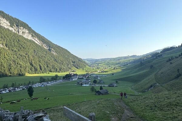
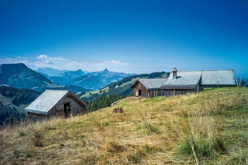
You don’t always have to be atop the mighty Alpstein massif for wonderful views far into the distance and deep into valleys and ravines.
- Difficulty
-
medium
- Rating
-
- Starting point
-
Former Rossfall inn
- Route
-
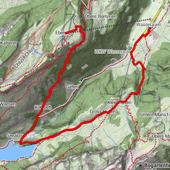
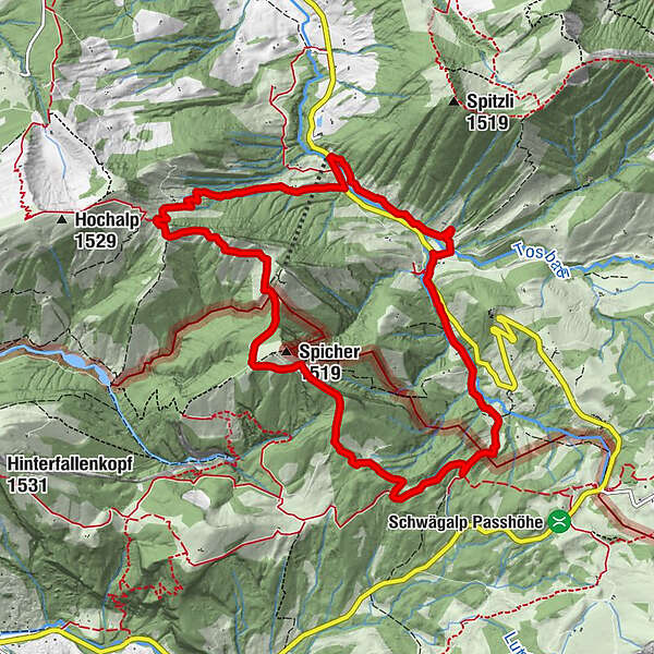
RossfallAelpli (1,360 m)3.3 kmAlp Spicher (1,510 m)4.5 kmChräzerli7.8 kmRossfall11.1 km
- Best season
-
JanFebMarAprMayJunJulAugSepOctNovDec
- Description
-
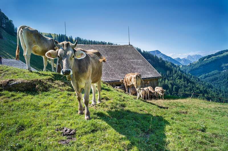
The hike from Rossfall up to Spicher and then back into the Urnäsch valley across the Chräzerenpass is proof of that. Up on the ridge is where Toggenburg and the Appenzellerland meet. Here, it is easy to see what the two regions have in common: pristine nature with forests, reed lands, deep ravines and wild streams – and lush green mountain pastures, where our cattle graze during the summer.
*Regarding parking at the Rossfall inn, please note that the inn is currently closed.
- Directions
-
Former Rossfall inn – Faltig – Oberer Chenner – Oberer Hirzen – Spicher – Chräzerenwald – Chräzerenpass – Chräzerli – Grosschräzeren – Steinfluh – former Rossfall inn
- Highest point
- 1,478 m
- Endpoint
-
Former Rossfall inn
- Height profile
-
 © outdooractive.com
 - Equipment
-
Good footwear, hiking or trekking shoes
- Additional information
- Public transportation
-
Take the post bus from Urnäsch in the direction of Schwägalp to the Rossfall stop (every hour).
- Parking
-
Parking is available at the Rossfall inn.

- Author
-
The tour On the ridge between Urnäsch and Necker is used by outdooractive.com provided.
GPS Downloads


General info
Refreshment stop
A lot of view
Other tours in the regions
-
Toggenburg
1771
-
Ferienregion Toggenburg
897
-
Urnäsch
291