© Peter Straub - VISIT Glarnerland
- Brief description
-
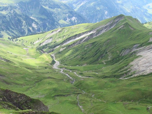
Auf dieser Wanderung sind Ruhe und Stille garantiert.
- Difficulty
-
difficult
- Rating
-
- Route
-
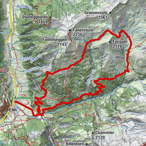
Elm (977 m)Untertal0.4 kmTöniberg1.2 kmStulz1.4 kmOberer Töniberg1.5 kmSchwamm2.6 kmChratzegg3.7 kmRiet4.1 kmRaminer Matt7.6 kmSääss7.7 kmChamm10.1 kmSpilboden10.9 kmGamperdun Mittelstafel11.6 kmOber Windegg12.6 kmGamperdun13.7 kmChnollenboden13.9 kmGrossweid14.6 kmChnollen14.9 kmOberer Töniberg15.4 kmAlpegli15.6 kmTöniberg15.8 kmUntertal16.5 kmElm (977 m)16.9 km
- Best season
-
JanFebMarAprMayJunJulAugSepOctNovDec
- Highest point
- 2,108 m
- Endpoint
-
Busstation Elm Station
- Height profile
-
 © outdooractive.com
- Author
-
The tour Rundwanderung Gamperdun - Ramin is used by outdooractive.com provided.
GPS Downloads


General info
Insider tip
Flora
A lot of view
Other tours in the regions
-
Glarnerland
1972
-
Elm
773
-
Elm
206