


- Brief description
-
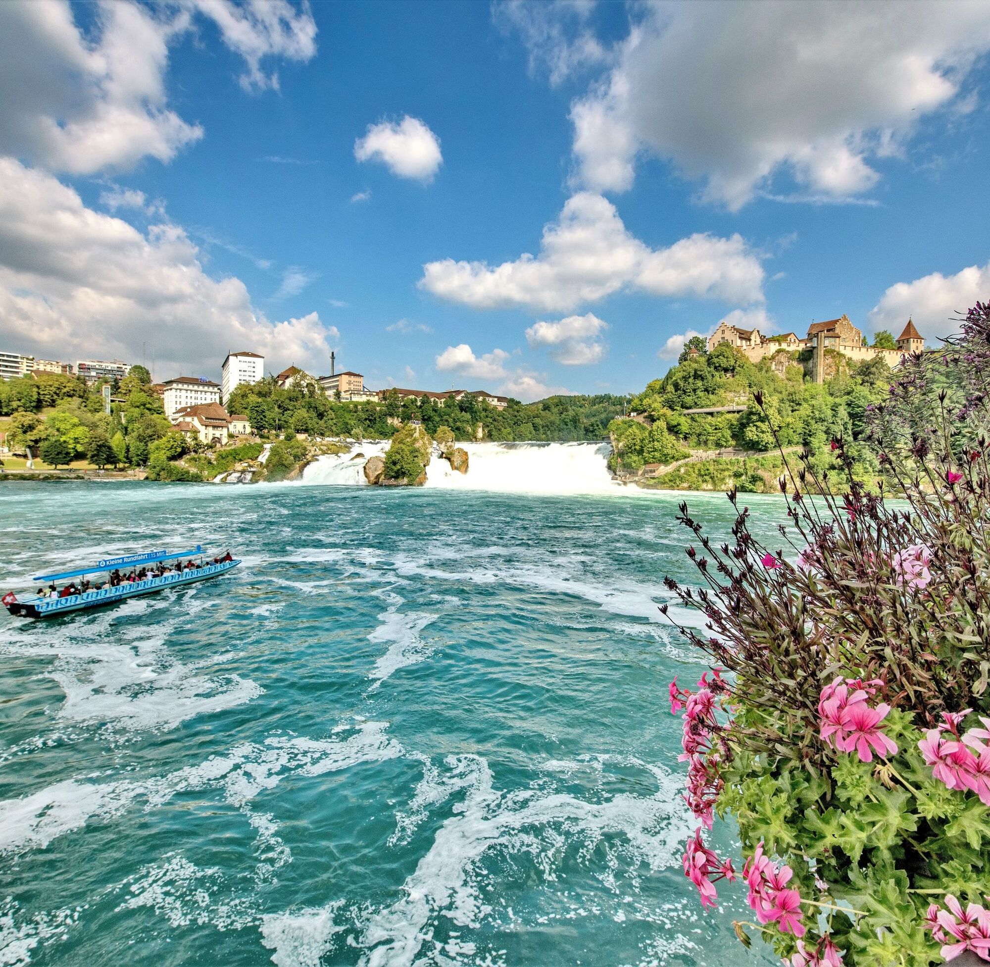
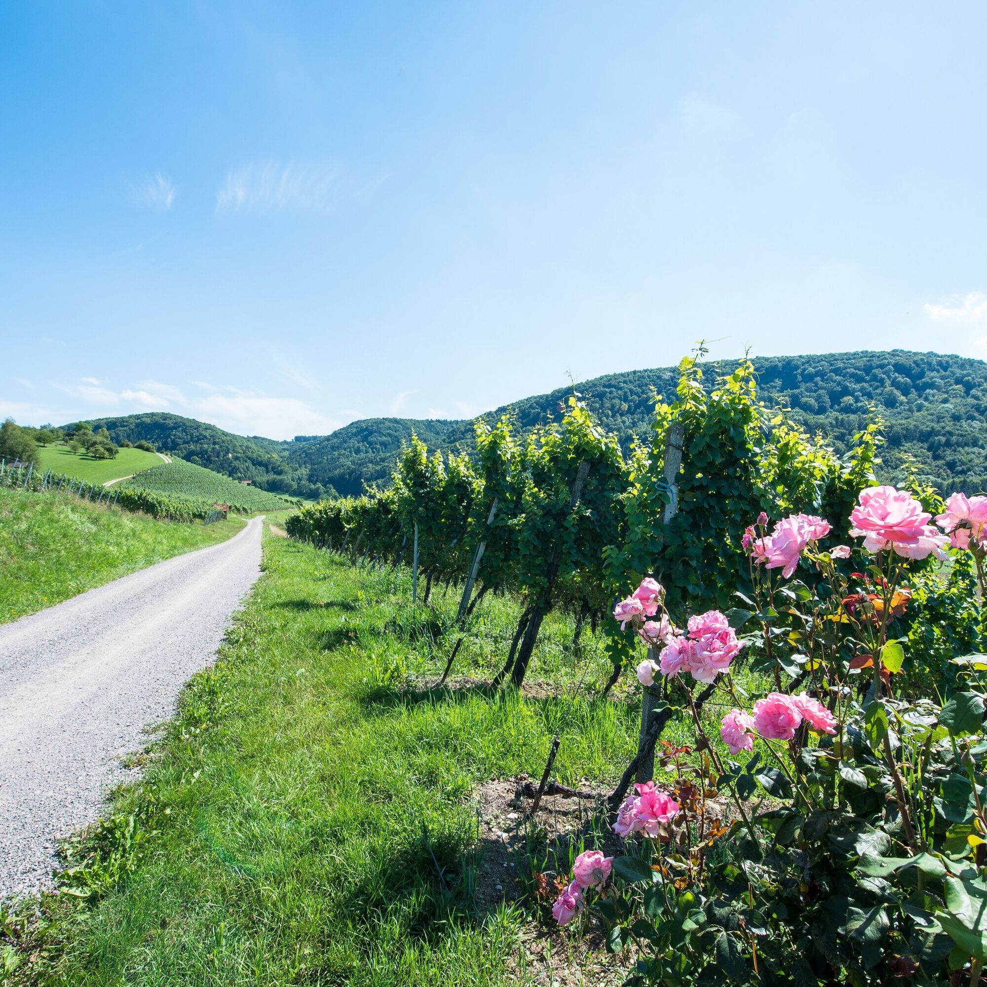
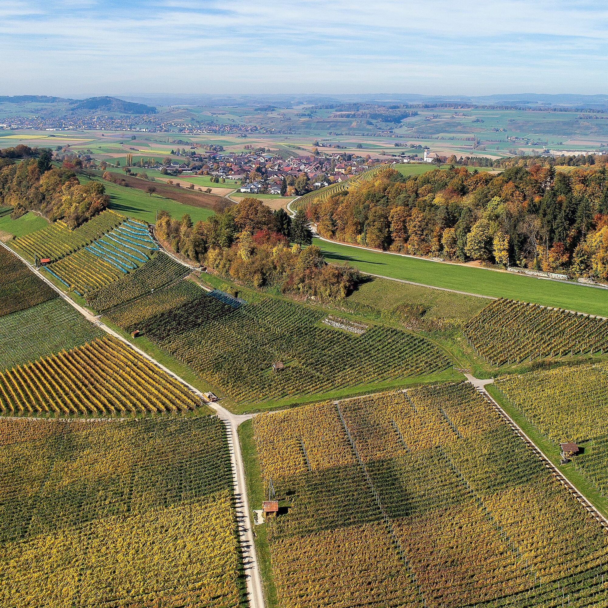
The Schaffhausen Border Trail connects the Rhine Falls with the largest contiguous vineyard area in German-speaking Switzerland and leads right into the heart of Schaffhausen's Pinot Noir country.
- Difficulty
-
medium
- Rating
-
- Starting point
-
Neuhausen am Rheinfall
- Route
-
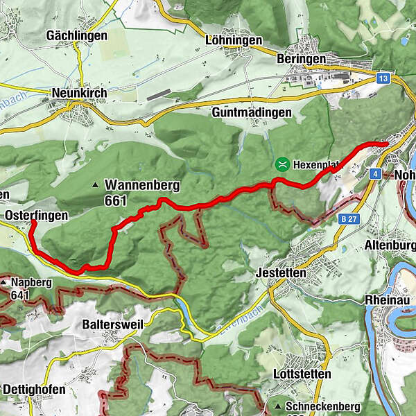
Schaffhausen (403 m)Neuhausen (410 m)Schneeschmelzi4.6 kmRossberg7.9 kmBad Osterfingen11.5 kmOsterfingen12.1 km
- Best season
-
JanFebMarAprMayJunJulAugSepOctNovDec
- Description
-
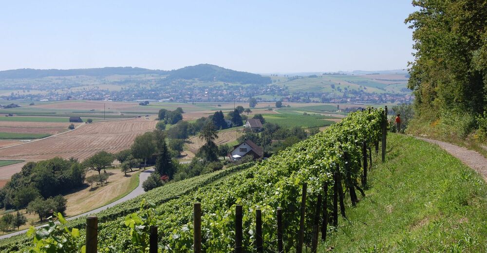
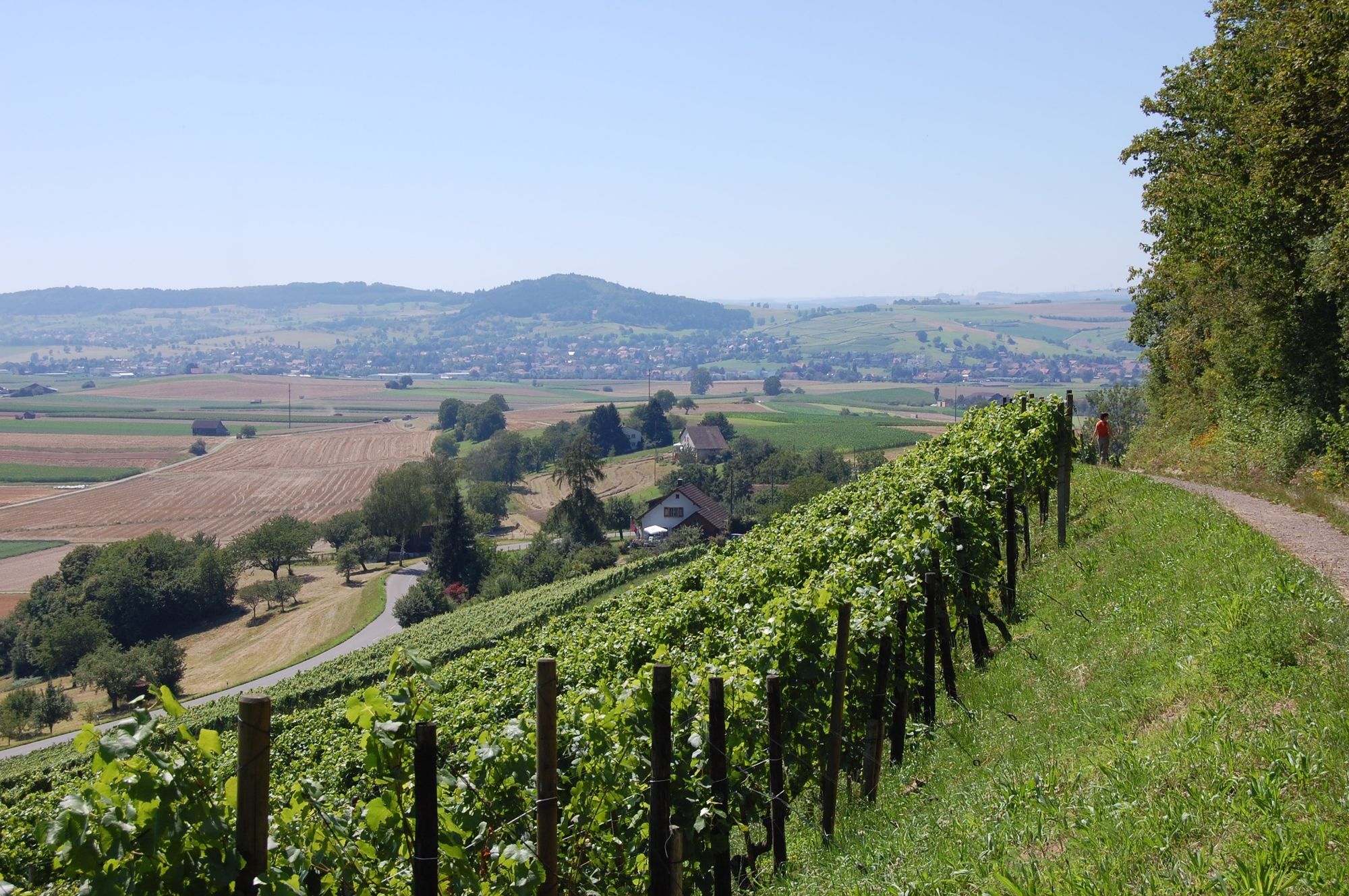
This route connects the largest waterfall in Europe with the largest contiguous vineyard area in German-speaking Switzerland in the Klettgau region of Schaffhausen. Geology and botany are at the centre of this hike, which takes you from boundary stone to boundary stone.
- Directions
-
Starting from Neuhausen am Rheinfall, Herbstäcker, the sound of the thundering falls fades into the peaceful silence of the forests of Schaffhausen's southern edge.
This area has been mined since Roman times and there is evidence of it from the 16th century. Even today, you can still see the ore pits that have since been renaturalised.
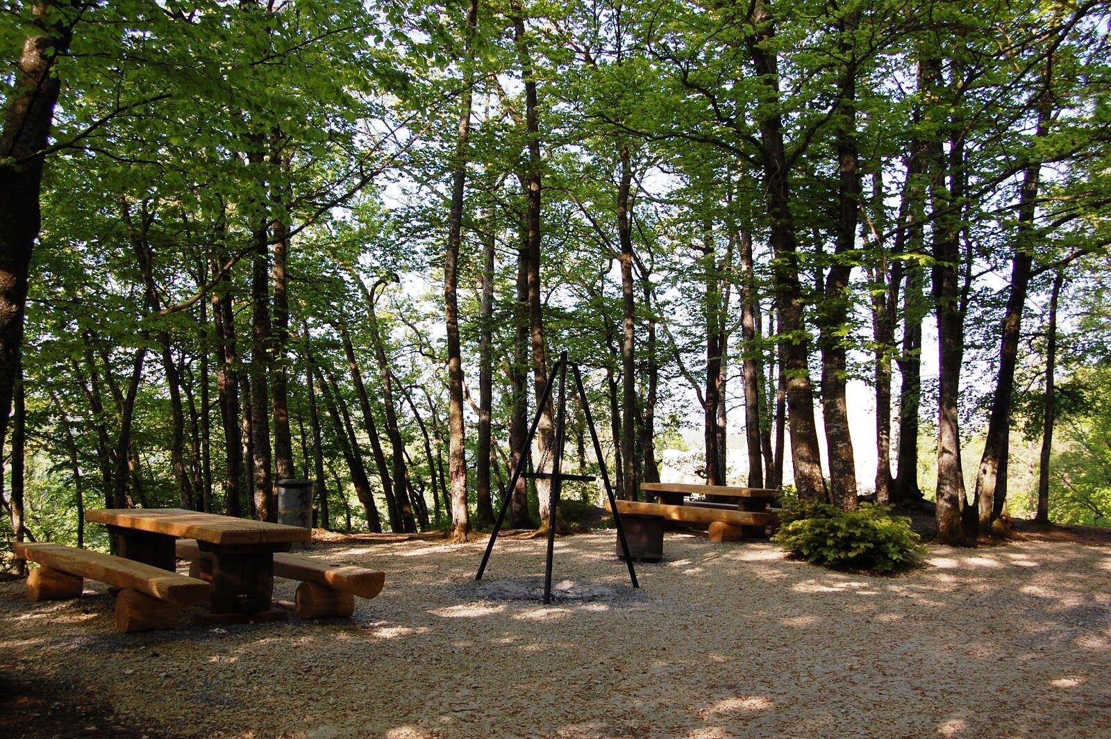
The ruins of Radegg Castle are located on the southern slope of the Rossberg above Osterfingen. It was first mentioned in 1200 and was owned by the Lords of Rossberg. The castle was probably destroyed in battles with the neighbouring nobility.
The walls of the castle can still be seen today and the spacious barbecue area invites you to take a break.
"Come as a guest, leave as a friend" is the motto of the Wilchingen, Osterfingen, Trasadingen gourmet region at the end of this route. These three communities have dedicated themselves entirely to enjoyment.
The destination is the wine-growing community of Osterfingen with its unmistakable village image. Don't miss the opportunity to savour an exquisite Schaffhausen Pinot Noir in the historic and newly renovated mountain grotto
- Highest point
- 622 m
- Endpoint
-
Wilchingen-Osterfingen
- Height profile
-
 © outdooractive.com
 - Equipment
-
Good shoes, drinks and snacks for in between.
- Tips
-
Visit one of the wineries at your destination or convince yourself of the quality of Schaffhausen wine in the historic mountain grotto.
- Additional information
- Directions
- Public transportation
- Parking
-
Car parking is available in Neuhausen am Rheinfall.

- Author
-
The tour SwitzerlandMobility 898: Schaffhausen border trail is used by outdooractive.com provided.


General info
-
SchaffhauserLand
1023
-
Klettgau
624
-
Guntmadingen
156