- Brief description
-
This route is particularly family-friendly and can also be walked with a pushchair (bikes suitable for field paths are an advantage).
One of three routes on the Stone Age Trail.
- Difficulty
-
easy
- Rating
-
- Starting point
-
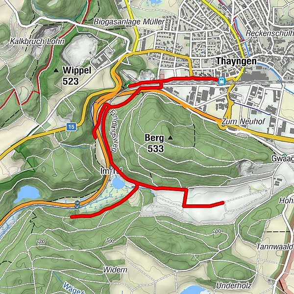
Thayngen, railway station
- Route
-
ThayngenKesslerloch (Eingang Ost)0.8 kmKesslerloch (Eingang Süd)0.8 kmThayngen8.1 km
- Best season
-
JanFebMarAprMayJunJulAugSepOctNovDec
- Description
-
Kleine Runde (blau)
Auf drei verschiedenen Wanderrouten führt der Steinzeitpfad vorbei an bedeutenden Fundstellen der Schaffhauser Archäologie. Infotafeln geben spannende und kurzweilige Einblicke in die Urgeschichte.
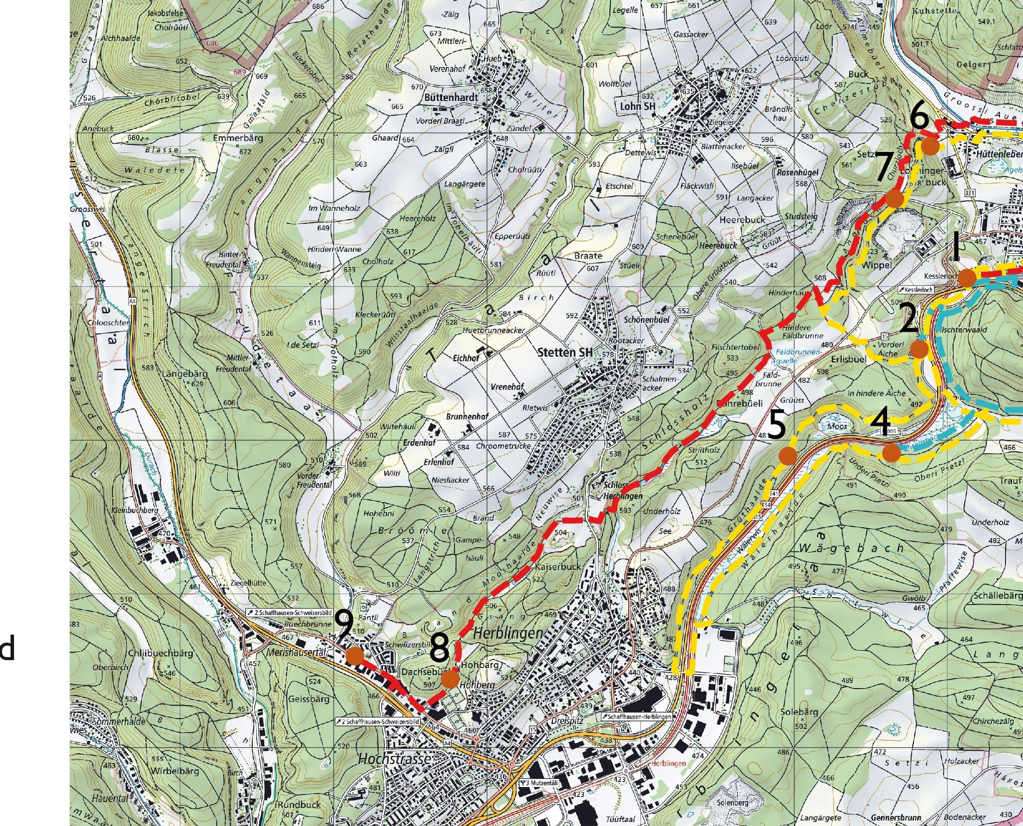
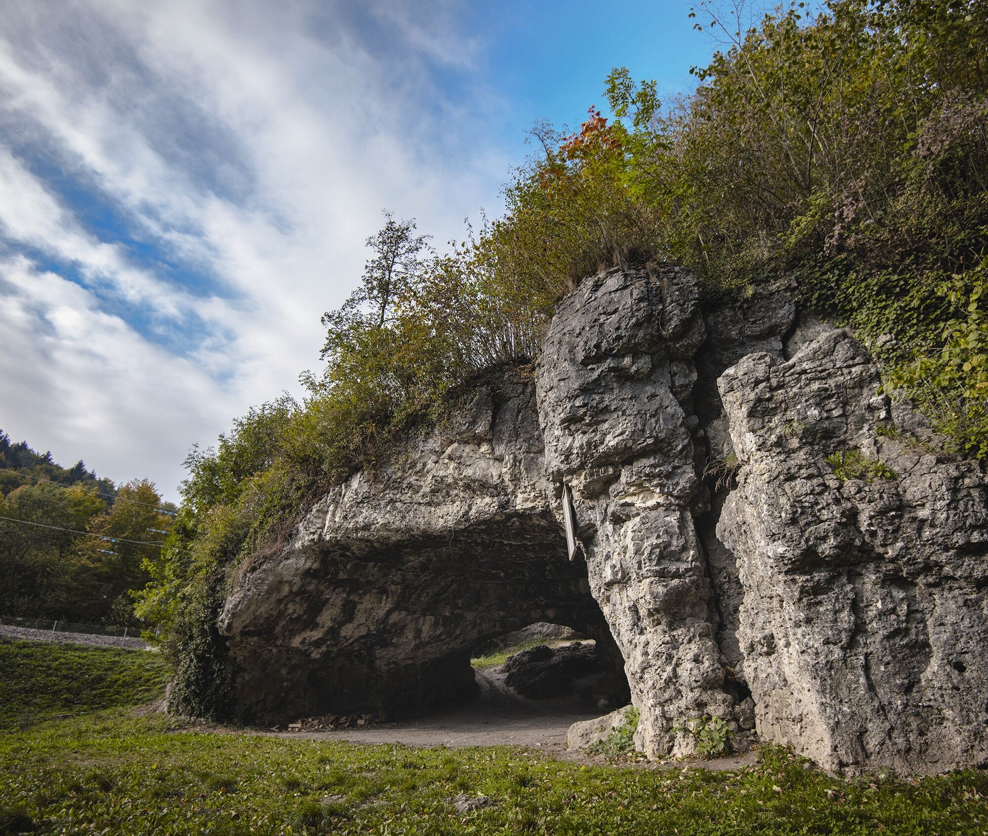
Alle drei Routen starten beim Bahnhof Thayngen. In wenigen Gehminuten erreicht man die erste Station, das Kesslerloch (1). Die Höhle war einst Lagerplatz von späteiszeitlichen Rentierjägern. Hier wurde nicht nur Ur-, sondern sogar Weltgeschichte geschrieben. Kunstvoll verzierte Gegenstände aus Rentiergeweih sorgten bei ihrer Auffindung am Ende des 19. Jahrhunderts international für Aufsehen.
Ab hier folgt man den altsteinzeitlichen Jägernomaden zur nächsten Station, der kleinen Höhle Vordere Eichen (2). Auch hier schlugen sie einst ihre Lager auf. Viele tausend Jahre später, in der Jungsteinzeit, wurde an dieser Stelle ein Kind bestattet.
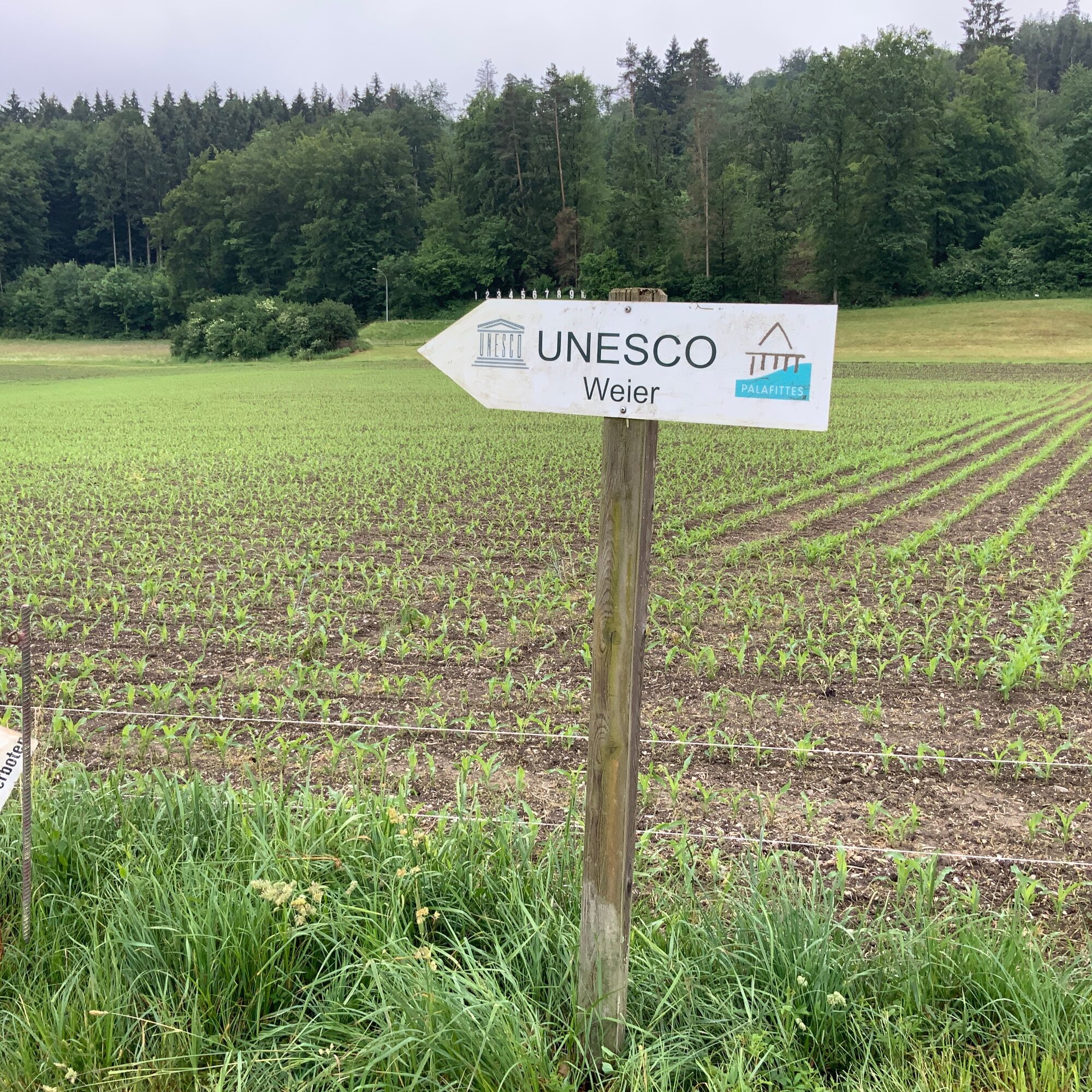
Eine erste Abzweigung führt nun zur Station Thayngen-Weier. Das einstige Moorgebiet wurde in der Jungsteinzeit von Pfahlbauern besiedelt. Ein Teil des Dorfes ist immer noch gut geschützt im Boden und gehört heute zum Unesco-Weltkulturerbe "Prähstorische Pfahlbauten um die Alpen".
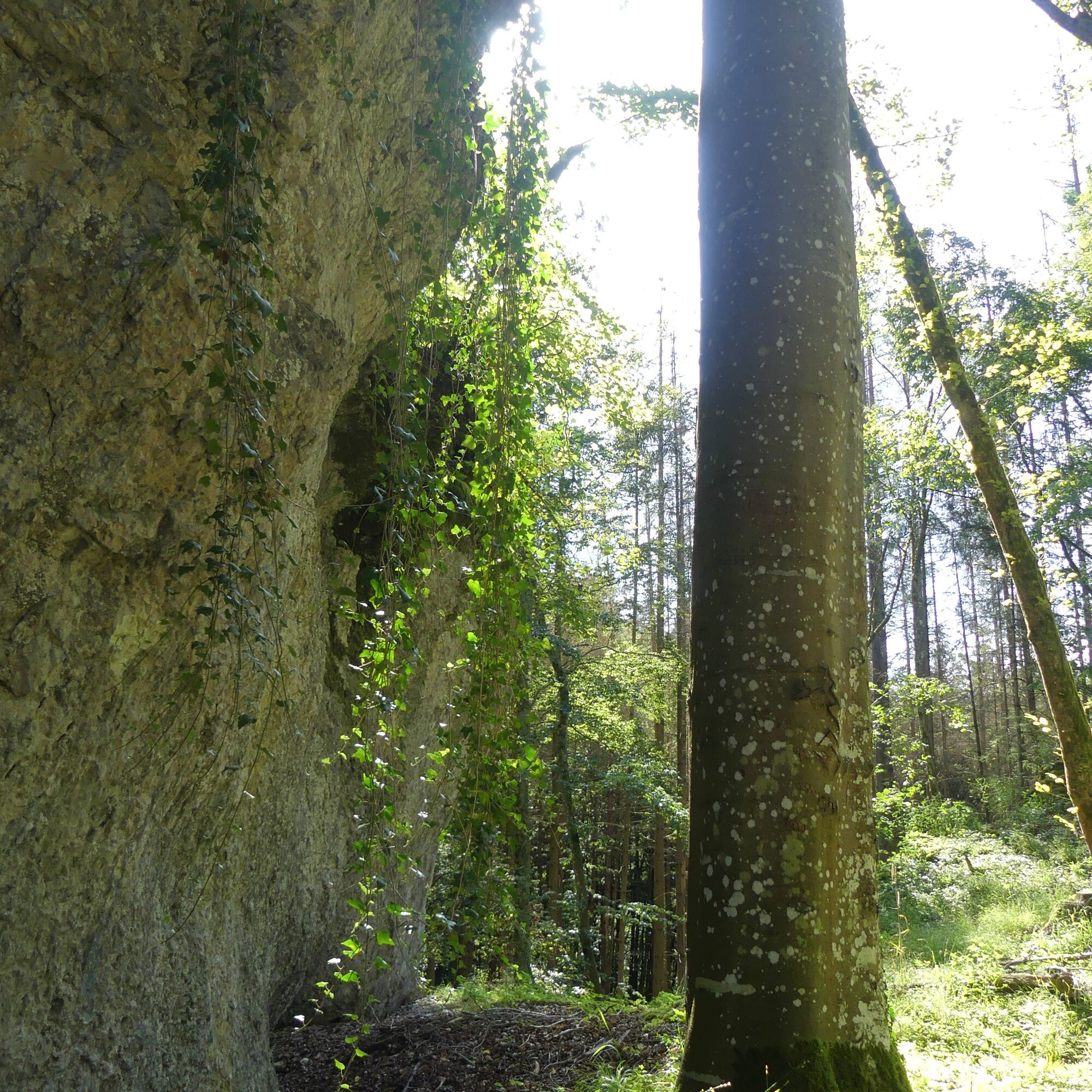
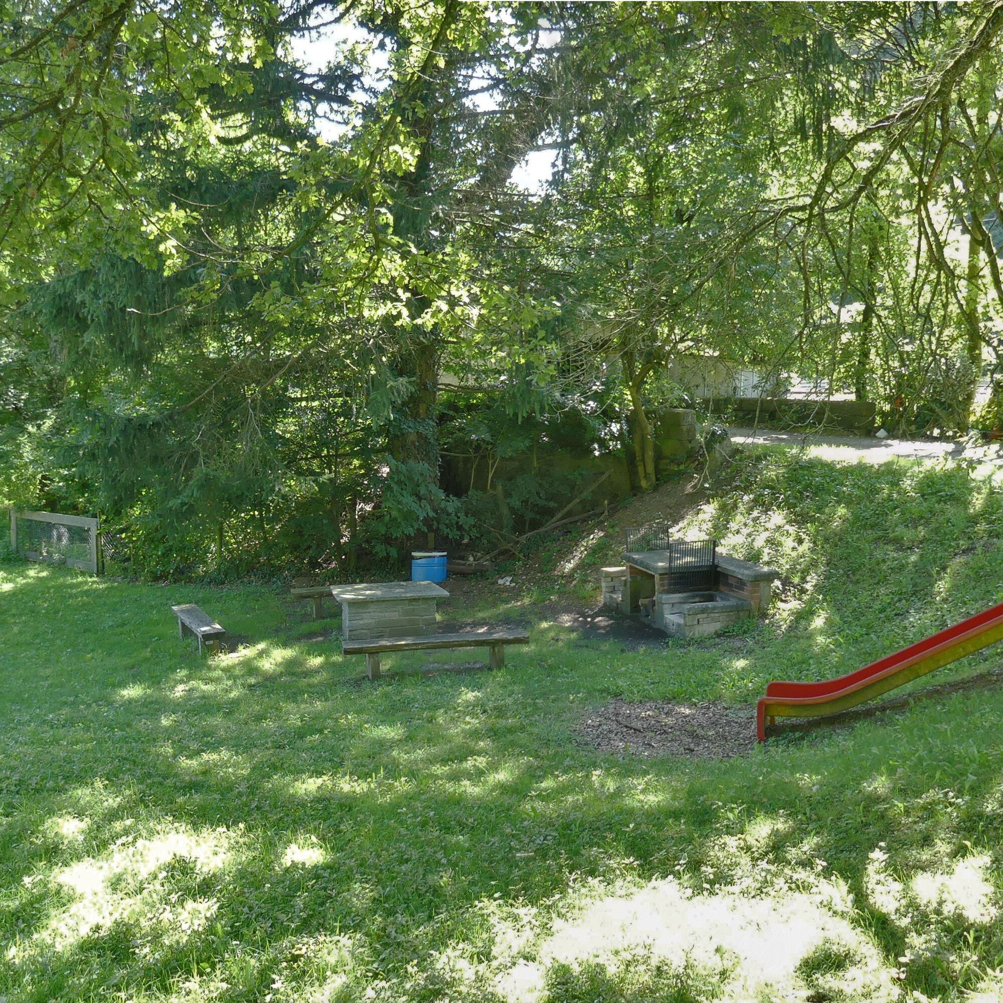
Vom Moordorf geht es ein Stück zurück zur zweiten Abzweigung. Diese führt uns zur letzten Station der kurzen Route. Der mächtige Felsblock bei der Unteren Bsetzi (4) bot ebenfalls vorbeiziehenden Jägern am Ende der letzten Eiszeit Schutz. In der Jungsteinzeit wurde der Ort zum Begräbnisplatz.
Autorentipp
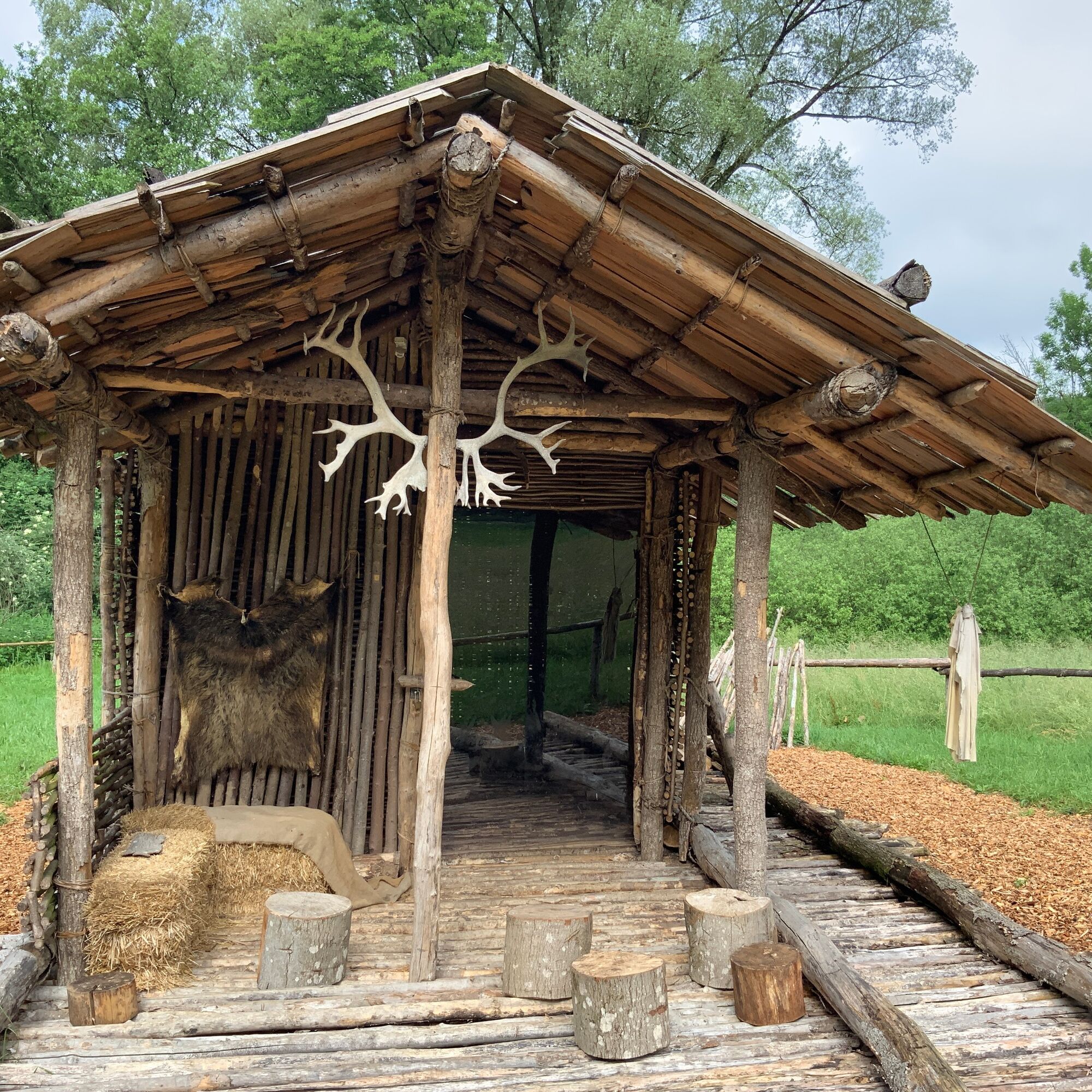
Auf dem Weg zur Pfahlbaufundstelle Thayngen-Weier treffen Sie auf eine Holzhütte. Es ist der Nachbau eines Hauses, wie es im Moordorf Weier vor über 5000 Jahren stand. Wie ist es wohl, in so einem Haus zu leben?
- Directions
-
All three routes start at Thayngen railway station. The first stop, the Kesslerloch (1), is just a few minutes' walk away. The cave was once a camp site for late ice age reindeer hunters. Not only prehistory, but also world history was written here. Artfully decorated artefacts made from reindeer antlers caused an international sensation when they were discovered at the end of the 19th century.
From here, you follow the Palaeolithic hunter nomads to the next stop, the small Vordere Eichen cave (2). They once set up camp here too. Many thousands of years later, in the Neolithic period, a child was buried here.
A first turn-off now leads to the Thayngen-Weier station (3). The former moorland area was colonised by pile dwellers in the Neolithic period. Part of the village is still well protected in the ground and is now part of the UNESCO World Heritage Site "Prehistoric Pile Dwellings around the Alps".
From the moorland village, we return a little way to the second junction. This leads us to the last stop on the short route. The mighty boulder at Untere Bsetzi (4) also provided shelter for passing hunters at the end of the last Ice Age. In the Neolithic period, the site was used as a burial ground.
- Highest point
- 456 m
- Endpoint
-
Thayngen, railway station
- Height profile
-
 © outdooractive.com
 - Equipment
-
Comfortable shoes, drinks and snacks for in between.
- Safety instructions
- Tips
-
- Thayngen-Weier pile-dwelling site, Thayngen
- Kesslerloch, Thayngen
- Additional information
- Directions
- Public transportation
- Parking
-
Car parks near the Kesslerloch and Thayngen railway station are marked on the map. Please note that you may have to pay a parking fee.
- Author
-
The tour Steinzeitpfad- small tour (blue) is used by outdooractive.com provided.


General info
-
SchaffhauserLand
1029
-
Reiat
476
-
Thayngen
169