- Brief description
-
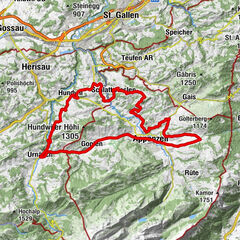
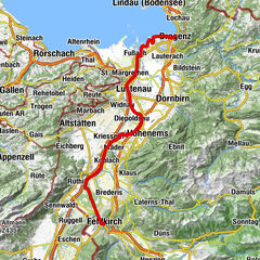
The cycle route for families winds through the green hills of the Appenzell region, past the crystal cave to Altstätten, the historic town in the St.Gallen Rhine Valley.
- Difficulty
-
easy
- Rating
-
- Starting point
-
Appenzell
- Route
-
Eggerstanden (892 m)3.0 kmNeues Bild3.4 kmRestaurant Hölzlisberg9.7 kmHölzlisberg (670 m)9.8 kmIm Fuhracker10.5 kmSüesswinkel10.7 kmSüsswinkel10.9 kmEichberg (500 m)11.3 kmDorf11.4 kmHinterforst13.1 kmMattenhof13.4 kmAltstätten Stadt (469 m)16.5 kmAltstätten16.7 km
- Best season
-
JanFebMarAprMayJunJulAugSepOctNovDec
- Description
-
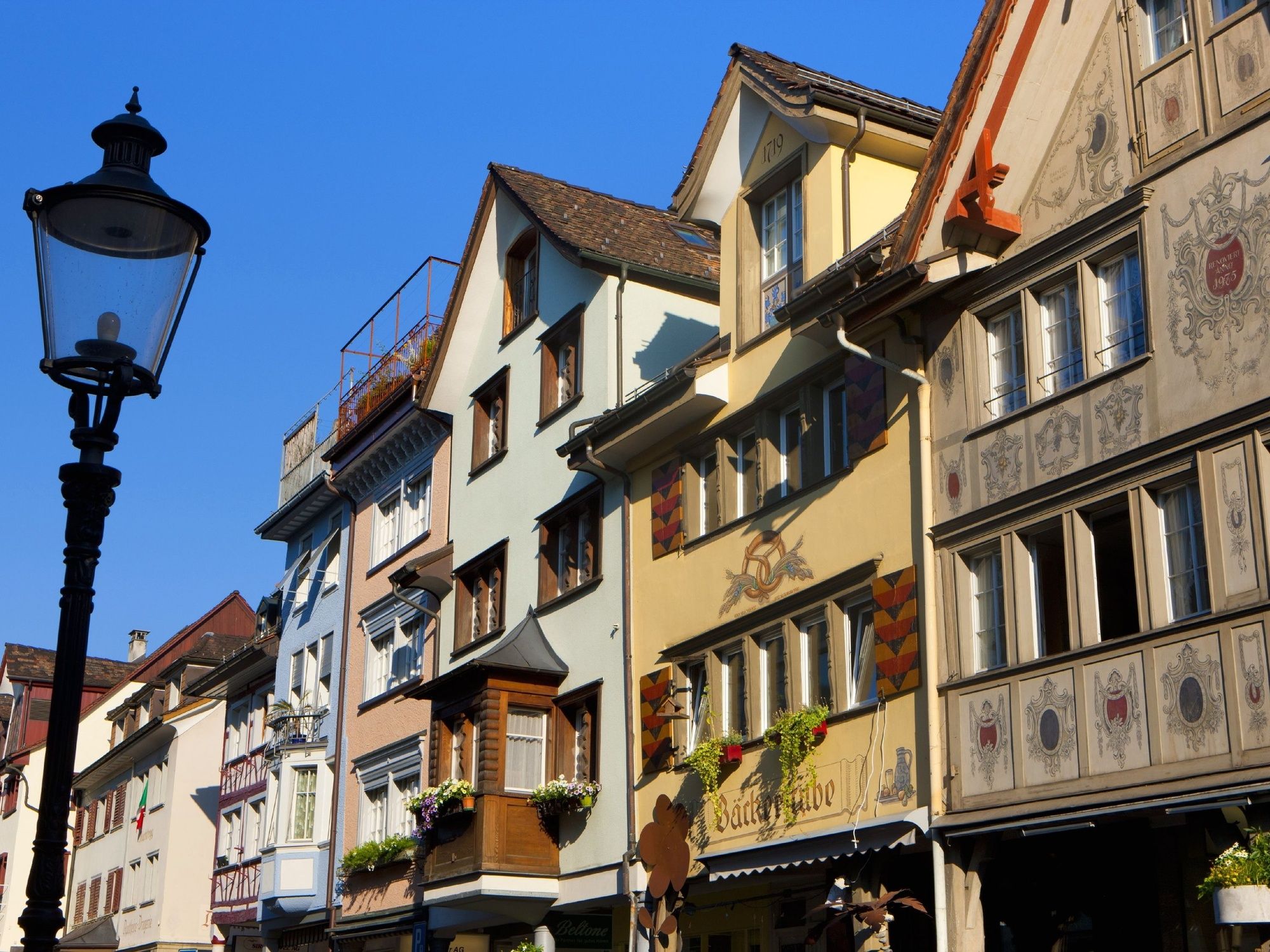
A small ascent takes you from Appenzell through the rolling hills, past traditional farms to Eggerstanden. The magnificent view of the entire Alpstein, a sub-group of the Appenzell Alps whose three mountain ridges meet at the Säntis peak, makes the effort worthwhile. The pale green hills overlooking the Appenzell region reveal the beauty of the scattered village from a special vantage point. Now follow the signs to Oberriet. The approaching descent through the Kobel Forest offers a view of the vastness of the Rhine Valley. An information board about halfway down points the way to the crystal cave which is certainly worth making a short detour. Once you have reached the bottom of the valley, follow the cycle path that runs along the main road to Eichberg. The historic market town of Altstätten with its quaint winding streets and beautiful houses is the centre of the region. The Appenzell mountain railways make the ascent back to Appenzell a breeze.
- Directions
-
Appenzell - Eggerstanden - Eichberg - Altstätten
- Highest point
- 914 m
- Endpoint
-
Altstätten
- Height profile
-
 © outdooractive.com
 - Tips
-
A visit to the crystal cave is a wonderful experience with its glimmering crystals, stunning stalactites and reflections of light on water inside the cave.
- Directions
-
From St.Gallen in the direction of Teufen/Stein to Appenzell.
- Public transportation
-
Train connection from St.Gallen to Appenzell four times an hour.
- Parking
-
Various parking areas in Appenzell (near train station and Landsgemeindeplatz).
- Author
-
The tour Appenzell Rhine Valley Route is used by outdooractive.com provided.