- Brief description
-
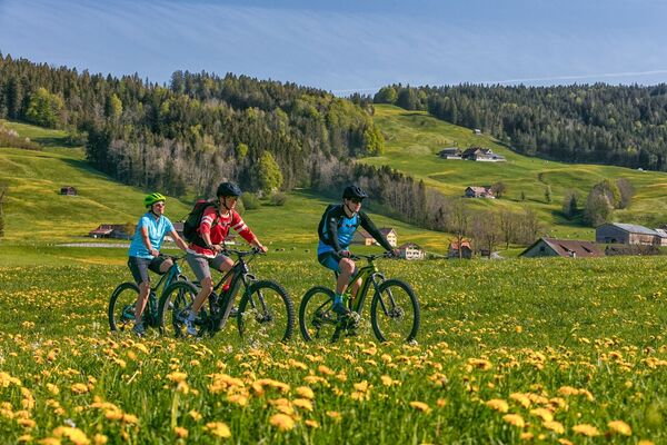
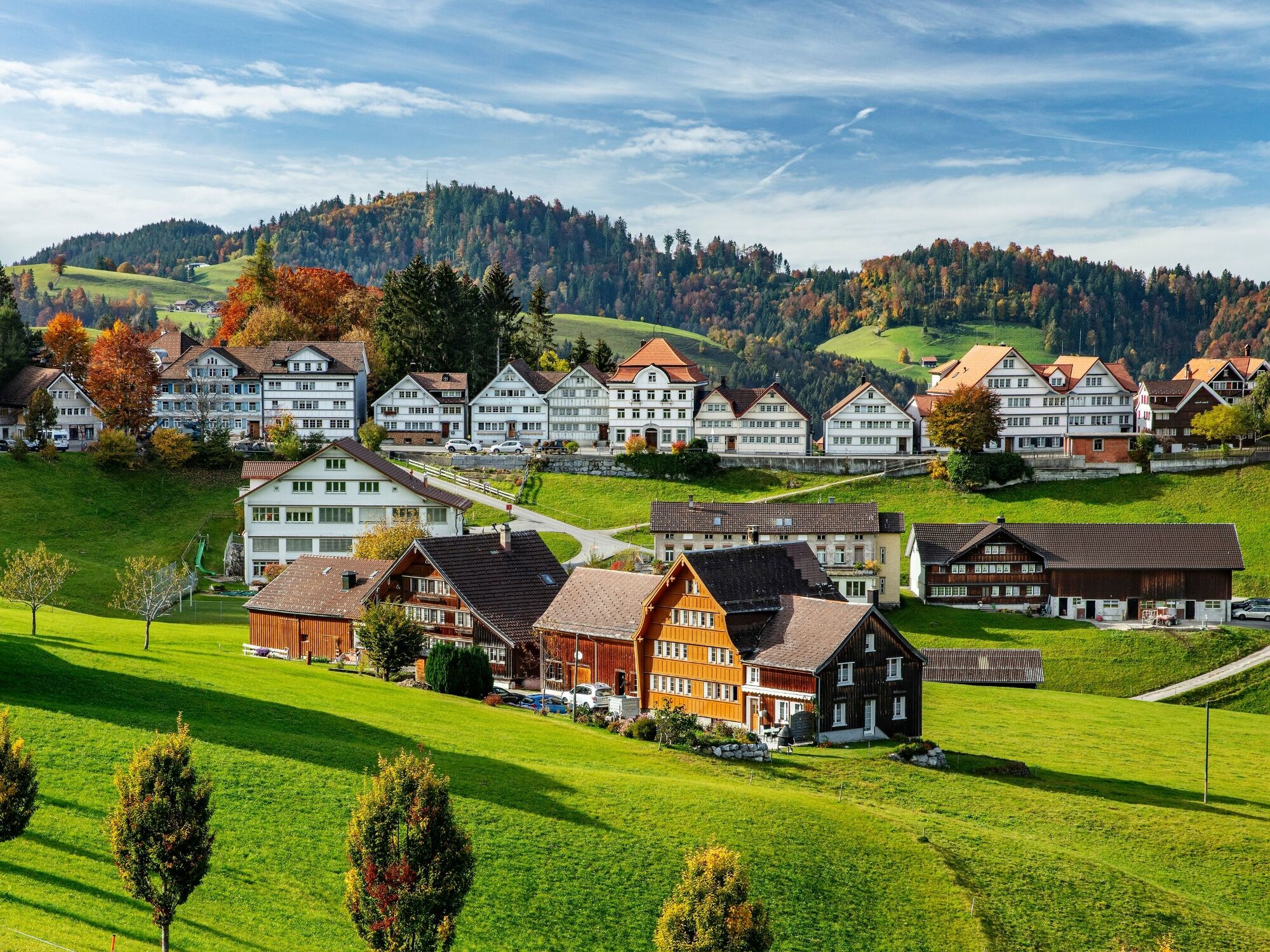
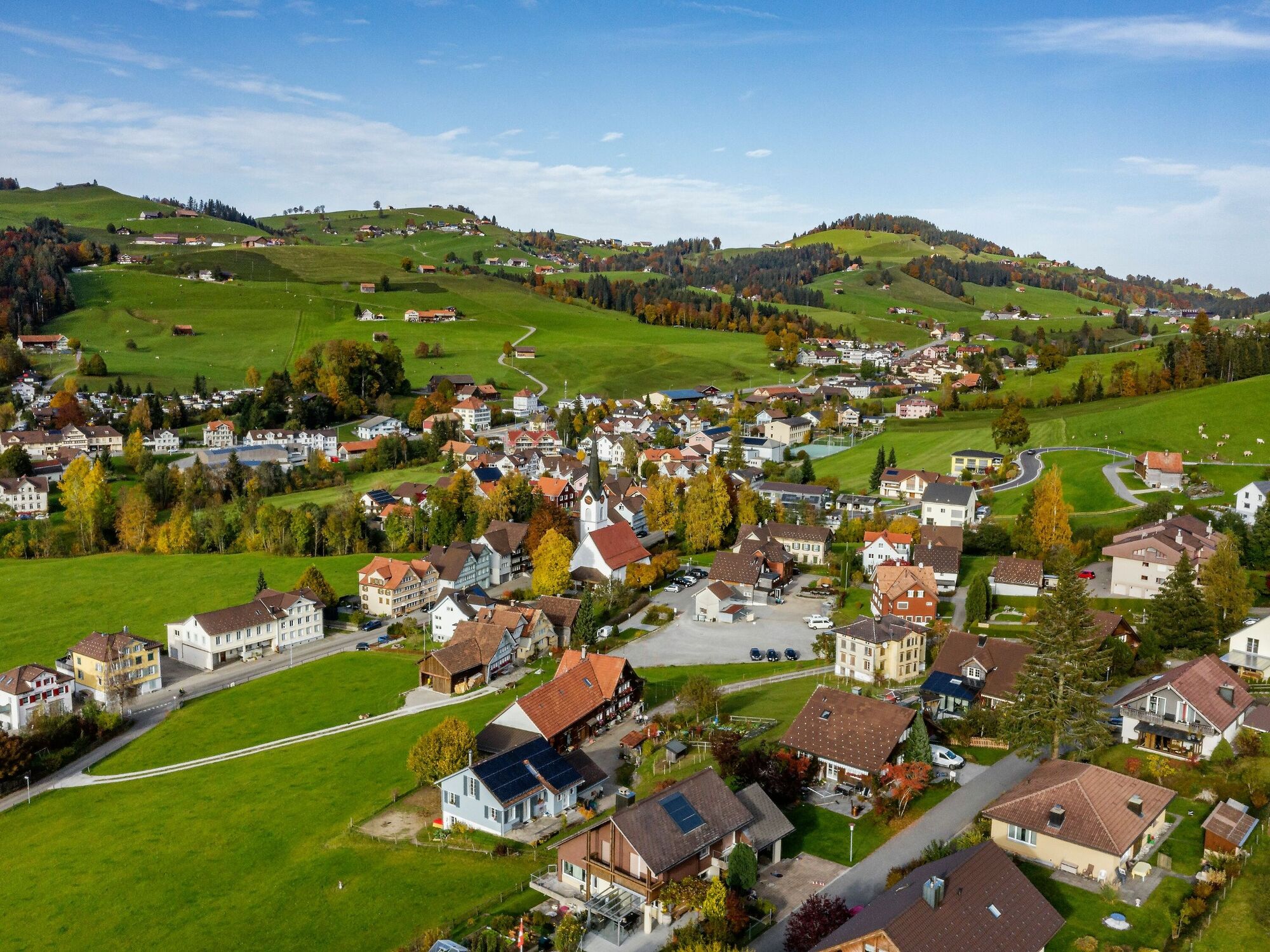
Past apple and pear trees on undulating roads
- Difficulty
-
medium
- Rating
-
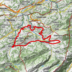
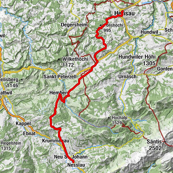
- Route
-
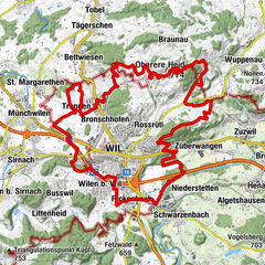
Katholische Kirche St. Peter und Paul0.0 kmHerisau (771 m)0.4 kmOpenhous Herisau1.1 kmStuel2.5 kmLehn3.2 kmBergli3.7 kmSchwellbrunn7.7 kmEvangelisch-reformierte Kirche Schwellbrunn7.8 kmDorf-Beizli7.8 kmRestaurant Metzgerei Ochsen7.8 kmk u k haus für kultur8.1 kmRisi8.9 kmTüfi10.5 kmWald11.5 kmSchönengrund11.6 kmRestaurant Ochsen11.8 kmReformierte Kirche11.9 kmRestaurant Schäfli11.9 kmBächli15.2 kmZum Rössli15.4 kmSchwandsbrugg16.6 kmHörnli Hemberg18.8 kmHemberg (935 m)18.9 kmEvangelische Kirche18.9 kmGasthaus Löwen18.9 kmKatholische Kirche St. Johannes der Täufer19.2 kmOberdorf19.4 kmEggli19.8 kmScherb21.9 kmBendel23.4 kmSternen23.5 kmPlatten-Guggenloch24.0 kmGuggenloch24.1 kmBrüssel25.3 kmDreibrunnen25.4 kmHof-Aemelsberg25.5 kmSibold26.1 kmUnderstein26.2 kmGäuer28.2 kmRutzenbach28.4 kmNeu St. Johann28.8 km
- Best season
-
JanFebMarAprMayJunJulAugSepOctNovDec
- Description
-
From Herisau, the hilly foothills of the Säntis are to be conquered, a green, sharply delineated landscape with scattered farmhouses. Dairy and fruit farming predominate here, and the route features apple and pear trees everywhere, be they standard trees, habitats for the many birds or high-yielding low trunk cultures. After reaching Schwellbrunn at around 1000 metres above sea level, you descend into the deep, craggy trench of the Necker (750m), only to sweatily climb to the thousand-metre mark again without rest. The reward for your pedalling efforts is a quiet upland moor, the Chellenmoor, where you’ll find heather, bog bilberry, pines and birches. You may hear a grass frog croaking or a dragonfly buzzing by. Far away are the ridges of the Churfirsten as you take the lively descent into the Thur valley, with its beautiful, centuries-old timber-framed building of the ‘Haus zur Mauer’ in Neu-St.Johann.
- Highest point
- 1,108 m
- Endpoint
-
Nesslau
- Height profile
-
 © outdooractive.com
 - Public transportation
-
Herisau is easily accessible by train.

- Author
-
The tour Orchard Route is used by outdooractive.com provided.


General info
-
Toggenburg
184
-
Ferienregion Toggenburg
54
-
Schönengrund
10