- Brief description
-
A route peppered with beautiful paths and great views.
- Route
-
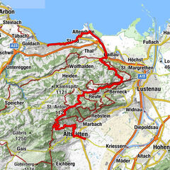
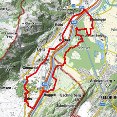
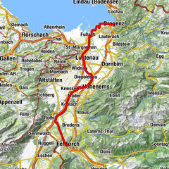
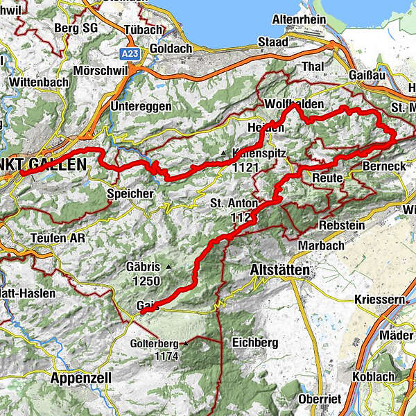
Gais (915 m)0.0 kmPfarrei St. Michael0.1 kmHotel zur Krone0.2 kmGais (933 m)0.3 kmFalken0.3 kmReformierte Kirche Gais0.3 kmLandmark7.2 kmGasthaus Landmark7.2 kmzum Wilden Mann9.2 kmSt. Anton (1,123 m)9.8 kmSt. Anton10.0 kmKapelle St. Anton10.1 kmSt.Anton10.3 kmOberegg (870 m)13.2 kmSchachen (815 m)14.2 kmBüriswilen18.7 kmSternen18.9 kmWilen19.8 kmEvangelische Kirche22.0 kmWalzenhausen22.2 kmCafé Restaurant Bahnhof22.2 kmHarmonie25.0 kmReformierte Kirche27.6 kmWolfhalden27.7 kmHeiden (794 m)29.3 kmHeiden30.1 kmRössli33.0 kmKaien33.2 kmSäntis34.3 kmDorf 535.1 kmPost35.1 kmRehetobel35.2 kmLinde36.6 kmSonne40.4 kmSpeicherschwendi41.1 kmBären41.2 kmSchaugenhof43.1 kmReformierte Linsebühlkirche46.2 kmLinsebühl-Dreilinden46.4 kmSankt Gallen (675 m)47.1 km
- Best season
-
JanFebMarAprMayJunJulAugSepOctNovDec
- Description
-
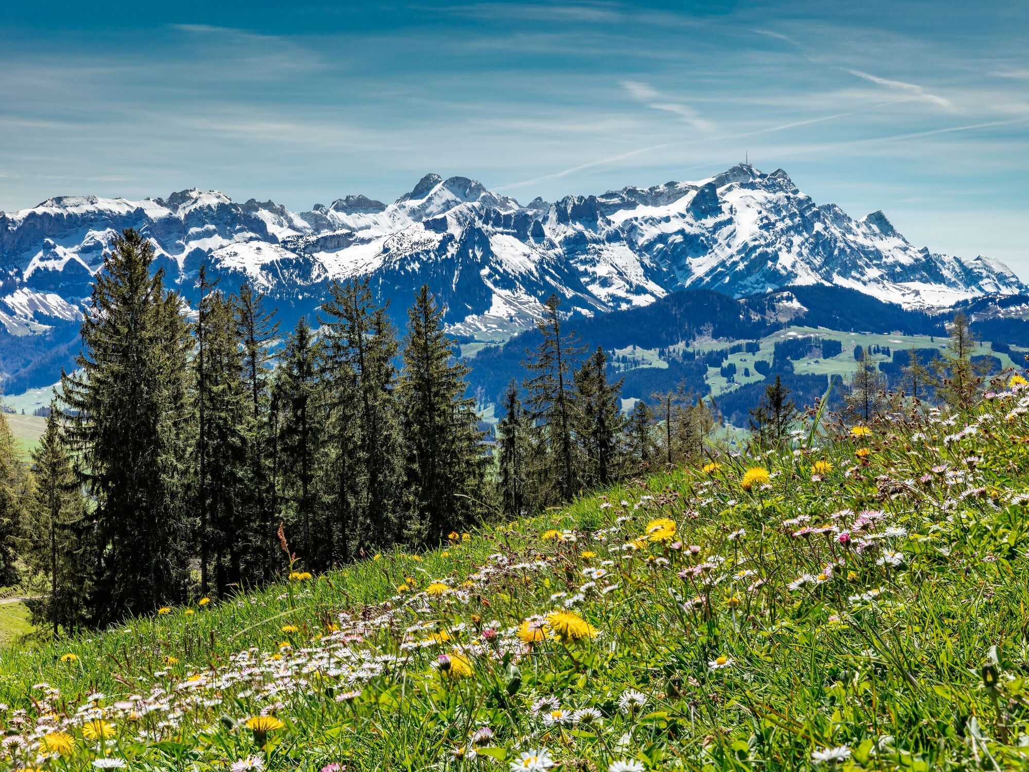
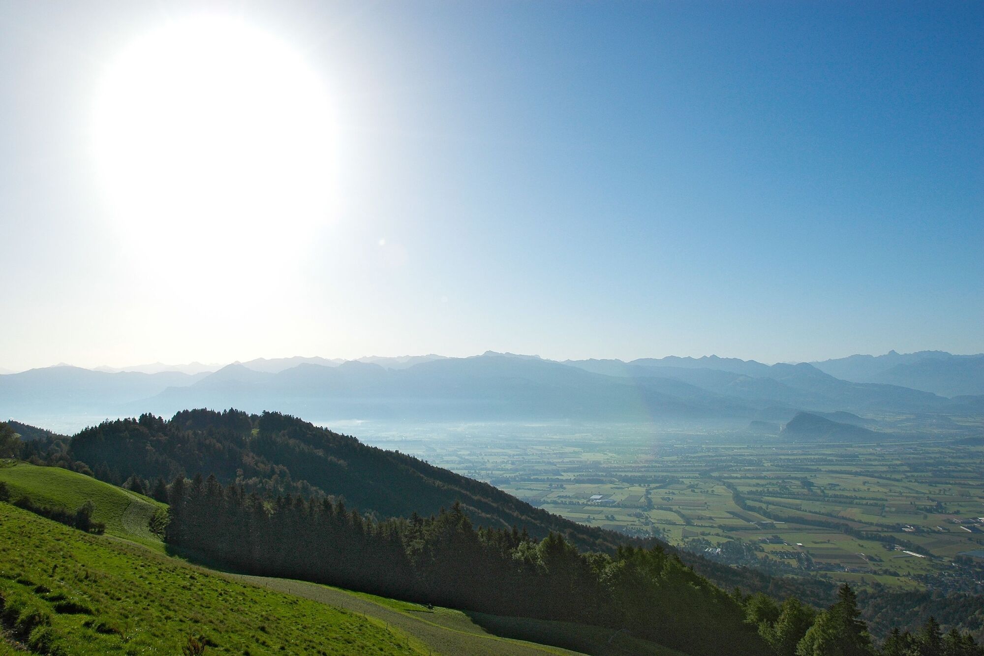
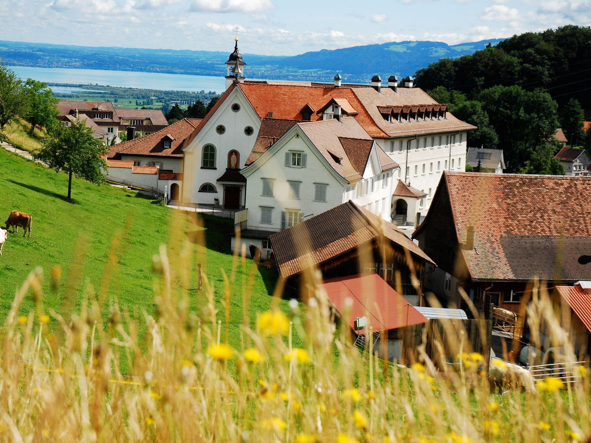
Across the picturesque village square of Gais, then past the well-proportioned brown cattle and flower-adorned farmhouses, the road winds its way into the hills. Looking back, the Alpstein once again shows its impressive side. The dirt road becomes ever narrower. The now single-track path leads through a small area of woodland. Afterwards, you cross a pasture with a steep downhill slope; it’s advisable to get off your bike at this point.The adventure is soon over, however, and at Landmark the view opens out down into the Rhine Valley and across to the Vorarlberg Alps. A break is recommended at St. Anton at least, either because of the spectacular view or because of the pubs that invite you to stop for refreshments. We continue with many ups and downs along the left flank of the Rhine Valley until we finally find ourselves above Lake Constance and the view extends far into neighbouring Germany. In the spa town of Heiden, there are once again numerous possibilities for dining and overnight accommodation before the route turns back towards St. Gallen.
- Highest point
- 1,179 m
- Endpoint
-
St. Gallen
- Height profile
-
 © outdooractive.com
 - Public transportation
-
Gais is easily accessible by the Appenzell railways.
- Author
-
The tour Appenzeller route stage 2 is used by outdooractive.com provided.


General info
-
St. Gallen - Bodensee
288
-
St. Gallen und Umgebung
139
-
Grub
56