- Brief description
-
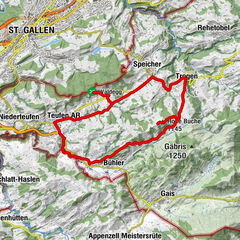
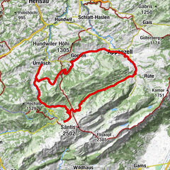
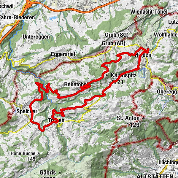
Discover the Appenzeller Vorderland on a beautiful circular route.
- Difficulty
-
difficult
- Rating
-
- Route
-
Heiden (794 m)Heiden0.7 kmRössli3.4 kmKaien3.4 kmWald AR (962 m)6.0 kmRechberg6.7 kmKrone9.9 kmTrogen (903 m)10.0 kmGasthaus zum Schäfli10.1 kmTrogen10.3 kmBendlehn (932 m)11.7 kmSpeicher (924 m)12.6 kmSankt Gallen (675 m)13.0 kmLinde18.4 kmRehetobel20.0 kmPost20.0 kmDorf 520.0 kmGupf (1,089 m)21.7 kmSchwarzenegg25.4 kmBenzenrüti25.7 kmEvangelisch-reformierte Kirche27.0 kmHeiden27.2 kmHeiden (794 m)27.4 km
- Best season
-
JanFebMarAprMayJunJulAugSepOctNovDec
- Description
-
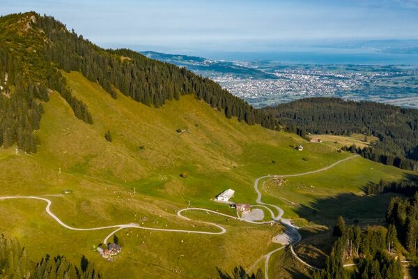
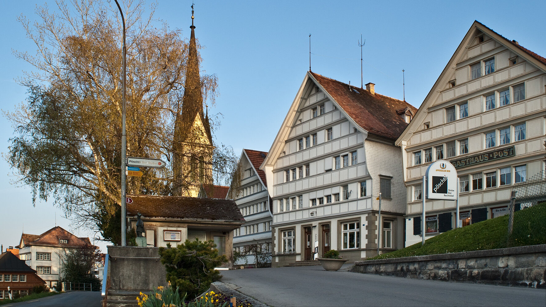
The Vorderland circuit begins with a steady but pleasant climb towards the forest. Shortly before Wald, you leave the main road, which is somewhat busier, and enter a breathtaking landscape full of lush meadows, green forests and traditional Appenzell farms. You’ll soon come to the historically important town of Trogen. Here, the cantonal assembly square with its baroque Grubenmann church, the Zellweger palaces and the Pestalozzi Children’s Village should all feature on your travel itinerary. You can now take it easy for the next few kilometres. A longer descent awaits you from Speicher to Zweibrücken. During the subsequent ascent, you can enjoy a meal at one of the inviting restaurants in Rehetobel and marvel at the expanse of the Appenzeller region. From Rehetobel it’s only a short distance to the Kaienspitz, the highest point of the Vorderland circular route. Linger for a moment on the Kaienspitz and enjoy the panorama, which offers a view over Lake Constance, the Säntis massif and all the way to the city of St. Gallen. The circuit finishes with another descent to Heiden.
- Highest point
- 1,070 m
- Endpoint
-
Heiden
- Height profile
-
 © outdooractive.com
 - Tips
-
A visit to the Landsgemeindeplatz or the Zellweger's century is not to be missed.
- Additional information
-
You can find more information here


- Author
-
The tour Appenzeller Vorderland-Route is used by outdooractive.com provided.