
- Brief description
-
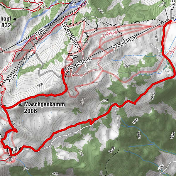
The trail for ambitious runners. The biggest challenge of the Panüöl Trail follows at the end: The ascent from Alp Panüol to Maschgelugge. But the magnificent panorama is compensation enough!
- Difficulty
-
medium
- Rating
-
- Route
-
Panüöl3.9 kmAlprestaurant Panüöl4.1 kmMaschgenlücke5.0 kmMaschgalugge (1,955 m)5.1 kmMaschgenkamm (2,006 m)5.3 kmProdkamm6.4 km
- Best season
-
JanFebMarAprMayJunJulAugSepOctNovDec
- Highest point
- 1,969 m
- Endpoint
-
Prodkamm, Flumserberg
- Height profile
-
 © outdooractive.com


-

-
AuthorThe tour Panüöl trail 465 is used by outdooractive.com provided.
GPS Downloads


General info
Refreshment stop
A lot of view
Other tours in the regions
-
Heidiland
49
-
Flumserberg und Umgebung
40
-
Flumserberg
16